

You are here
Avalanche Advisory for 2013-03-01 06:55:20
- EXPIRED ON March 2, 2013 @ 6:55 amPublished on March 1, 2013 @ 6:55 am
- Issued by Nick Meyers - Shasta-Trinity National Forest
Bottom Line
For today, the overall avalanche danger remains LOW. We received no new snow over this past week with predominantly moderate northwest winds. Instabilities are unlikely and will be limited to areas of wind loading near ridgetops, bowls, rock outcrops, chutes and gullies on all aspects and on slopes steeper than 35 degrees. Most other areas have been scoured down to the old, firm snow surface and/or entered a melt/freeze cycle.


Avalanche Problem 1: Wind Slab
-
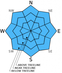
Character ?

-
Aspect/Elevation ?
-
Likelihood ?CertainVery LikelyLikelyPossible
 Unlikely
 -
Size ?HistoricVery LargeLargeSmall

In general, a lot of variability exists out there concerning the depth, location and sensitivity to triggering of the wind slabs. Wind slabs are showing a strengthening trend and while triggering a wind slab will be unlikely to trigger by a single person, it will not be impossible for very isolated pockets of wind loaded snow to be unstable...potentially with the weight of multiple skiers and/or snowmobile. These areas will be limited to extreme terrain like chutes, gullies, ridgelines and generally above treeline. Normal caution advised.
Recent Observations
No new recent avalanches observed or reported since last Sunday and observations over the week were limited, 2-24-13.
2-23-13 North side of Mt. Shasta, 4-8 inches new snow, wind affected. Traveled only to the trailhead, not in avalanche terrain. Several feet of snow at the trailhead and no recent tracks. Snowmobiles necessary for approx. 5 miles of road to access the trailhead. Very cold, poor visibility, snowing lightly at the time.
2-22-13 Mt Eddy area, NW aspect, 35 degree slope... ECTP 2 / Q1 - Failures on same layers as seen at Castle Lake...small, faceted snow crystals above and below buried crust layer, 30-40 cm deep in wind loaded area. Weakest layer has been below this crust layer. No recent nature/human triggered avys observed.
2-21-13 - Castle Lake area, NW aspect, 30 degree slope on Middle Peak... CT-6 / ECTP - 4 - Q1/2 - Failures near buried crust on layer of facets, above old snow, about 30-40 cm down from surface, wind deposited snow, full propagation hard slab. No recent nature/human triggered avys observed.
2-20/2-21 - Numerous reports of "whoomfing" and shooting cracks near and above treeline on Mt. Shasta: Giddy Giddy gulch, Anaconda, The Promise Land areas.
2-20-13 - Avalanche Gulch, Spring Hill area, small wind slab avalanche (R1-D2), unknown trigger
Below: ECTP-4 / Q2 at Castle Lake on 2-21. Received same results (ECT-2) in Mt. Eddy area, wind loaded NW aspect.
Weather and Current Conditions
Weather Summary
Warm air is in the area this morning and will remain through Saturday. We'll havea areas of fog and clouds this morning, but otherwise it should be mostly sunny today with light winds above and below treeline. While the climate predication center is indicating below normal temperatures and precipitation for the rest of the winter, a few disturbances should occur in the next week or so. The first wave of weather will enter the area Saturday night as rain with snow levels upwards of 7-8,000 feet. Cold air will drop snow levels by Sunday, though showers will be diminishing by then. Up to .25" of water is expected by Sunday morning. We should see a few more moments of "winter" like weather next week, but nothing to get excited about at this point.
WEATHER STATIONS - (last 24 hours):
In Mt. Shasta City at 0500, we have partly cloudy skies and a current temperature of 35 F.
On Mt. Shasta: In the Old Ski Bowl (7,600') on the south side of Mt. Shasta, we have a current temperature of 32 F. Snow on the ground totals 95" inches with no new snow and 5" settlement since last Sunday. Temperatures have ranged from 28 F to 39F. At Grey Butte (8,000') on the south side of Mt. Shasta winds averaged 12 mph from the NW with a max gust of 21 mph from the NW. The current temperature is 34 F and temps have ranged 28 F to 37 F.
Castle/Mt. Eddy: Castle Lake - Castle Lake is hosting a current temp of 37 F. In the last 24 hours temperatures have ranged from 33 F to 48 F. Snow depth measures 44" inches with no new snow and 3" settlement since last Sunday. On Mt Eddy, we have 62" inches of snow on the ground with no new snow and 2" settlement since last Sunday. The current temperature reads 37 F with temps ranging from 36 F to 41 F. Winds have been SW, averaging 2 mph and gusting to 5 mph from the SW.
THIS SEASON: A brief re-cap of the snow season thus far in Mt. Shasta... Leading up until now, September and October were warm and dry with September recording exactly zero precipitation. November remained warmer than normal with precipitation almost double normal values, 9.16" vs. 5.08". A local weather COOP observed the 2nd wettest November on record. December started out wet and warm, but temperatures cooled and brought snow to very low elevations. Since our avalanche cycle near Christmas, we've had a few small storms that brought some amounts of snow to the area, but did not produced any notable avalanches. January was below normal for precipitation with a long period of high pressure and sun that kept skiing conditions somewhat meager. We've had a few storms lately that has brought a pittance of wintery weather, but nothing to write home about! The area has been under siege by high pressure overall giving us blue bird days for the most part. Feb 7/8 gave us up to 11" of new snow followed by moderate NE winds. Most recently, on 2-22 a trace to and inch of snow fell in the area. High and dry weather is expected for the next week and potentially the rest of the month. Our neighbors, the Sierra Nevada, has recorded the driest winter on record. We currently have 6-10 feet of snow above 6,500 ft. Since September 1st, Mt Shasta sits at 74% of normal, 22.55" recorded; normal 30.17". For 2013, we sit at 12% of normal with 1.85" recorded and 14.29" normal.
| 0600 temperature: | 28 |
| Max. temperature in the last 24 hours: | 40 |
| Average wind direction during the last 24 hours: | NW |
| Average wind speed during the last 24 hours: | 0-10 mi/hr |
| Maximum wind gust in the last 24 hours: | 21 mi/hr |
| New snowfall in the last 24 hours: | 0 inches |
| Total snow depth: | 59-95 inches |
Two Day Mountain Weather Forecast
Produced in partnership with the Medford NWS
| For 7000 ft to 9000 ft | |||
|---|---|---|---|
|
Friday (4 a.m. to 10 p.m.) |
Friday Night (10 p.m. to 4 a.m.) |
Saturday (4 a.m. to 10 p.m.) |
|
| Weather | Fog and clouds this morning, otherwise mostly clear | Partly cloudy | Increasing clouds in the morning, Rain/Snow in the afternoon, snow levels 7-8000 feet and dropping by Sunday. |
| Temperature (°F) | 52 | 32 | 47 |
| Wind (mi/hr) | SE Light | NE 5-10 mph | S 5-10 mph |
| Precipitation SWE / Snowfall (in) | / 0 | / 0 | / .5-1 |
| For 9000 ft to 11000 ft | |||
| Friday | Friday Night | Saturday | |
| Weather | Mostly clear, windy | Partly cloudy | Snow, mainly after 4pm |
| Temperature (°F) | 40 | 23 | 34 |
| Wind (mi/hr) | N 15-25 mph with gusts higher | S/SW 0 | SW 30-40 mph with gusts higher |
| Precipitation SWE / Snowfall (in) | / 0 | / 0 | / 1-2 |

