

You are here
Avalanche Advisory for 2013-03-07 07:18:48
- EXPIRED ON March 8, 2013 @ 7:18 amPublished on March 7, 2013 @ 7:18 am
- Issued by Adam Teel - Mt. Shasta Avalanche Center
Bottom Line
For today, the avalanche danger remains LOW for lower aspects and elevations and has increased to MODERATE on the mid and upper elevations. Our storm totals are approaching 2 feet in the deepest places heightening our avalanche conditions and making human triggered avalanches possible. The existing snowpack looks to be handleing the new snow well but with the accompanying winds we should expect some wind slabs, storm slabs, and crossloading. Yesterday weak interfaces were observed in the new storm snow 30-35 cm below the surface. They didn't have much energy or a high quality shear but were failing easliy with comprssion tests (ct4&5, Q2).


Avalanche Problem 1: Wind Slab
-
Character ?

-
Aspect/Elevation ?
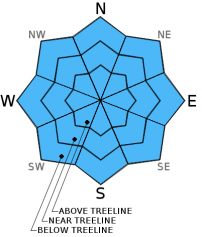
-
Likelihood ?CertainVery LikelyLikelyPossible
 Unlikely
 -
Size ?HistoricVery LargeLargeSmall

Avalanche Problem 2: Storm Slab
-
Character ?

-
Aspect/Elevation ?

-
Likelihood ?CertainVery LikelyLikelyPossible
Unlikely
-
Size ?HistoricVery LargeLargeSmall
Where the wind hasn't had as much effect the new snow 'sluff' could accumulate and pose a threat. We have had about two new feet in the last 48hrs. Sluff managment may be necessary on steeper slopes.
Recent Observations
The new snow fell on a warm old snow surface in mid elevations which should help it bond and adjust to the recently added weight. The wind with the new snow caused wind slabs and crossloading in the more exposed areas, while the skiing remained creamy and consistant in any sheltered terrain. There is some weakness in the upper snowpack within the new snow (top 35cm) which will likely heal with time and warming but may become an issue while the temps remain cool and the new snow settles.
Weather and Current Conditions
Weather Summary
Today it will remain cloudy and cold but the snow has likely come and gone. We can expect a slight warming trend for the next couple days with a slight chance of more snow accumulation. Winds will be moderate from the Southeast early in the day then shifting to the Northeast.
WEATHER STATIONS - (last 24 hours):
In Mt. Shasta City at 0500, we have cloudy skies and a current temperature of 29 F.
On Mt. Shasta: In the Old Ski Bowl (7,600') on the south side of Mt. Shasta, we have a current temperature of 15 F. Snow on the ground totals 121" inches with 24" of new since Tuesday evening. Temperatures have ranged from 15 F to 21F. At Grey Butte (8,000') on the south side of Mt. Shasta winds averaged 15 mph from the W with a max gust of 42 mph from the WSW. The current temperature is 15 F and temps have ranged 15 F to 20 F.
Castle/Mt. Eddy: Castle Lake - Castle Lake is hosting a current temp of 23 F. In the last 24 hours temperatures have ranged from 20 F to 34 F. Snow depth measures 61" inches with over 17 inches since Tuesday evening. On Mt Eddy, we have 74 inches of snow on the ground with about 15 inches of new storm snow. The current temperature reads 16 F with temps ranging from 16 F to 26 F. Winds have been S, averaging 2 mph and gusting to 14 mph from the SE.
THIS SEASON: September and October were warm and dry with September recording exactly zero precipitation. November remained warmer than normal with precipitation almost double normal values, 9.16" vs. 5.08". A local weather COOP observed the 2nd wettest November on record. December started out wet and warm, but temperatures cooled and brought snow to very low elevations. Since our avalanche cycle near Christmas, we've had a few small storms that brought some amounts of snow to the area, but did not produced any notable avalanches. January was below normal for precipitation with a long period of high pressure and sun that kept skiing conditions somewhat meager. We've had a few storms in the past few weeks that have brought a pittance of wintery weather, but nothing to write home about! The area has been under siege by high pressure overall and giving us blue bird days for the most part. California and the Sierra Nevada have recorded the driest January and February on record. We currently have 6-10 feet of snow above 6,500 ft. Since September 1st, Mt Shasta sits at 77% of normal, 24.36" recorded; normal 31.67". For 2013, we sit at 23% of normal with 3.66" recorded and 15.79" normal. Since Tuesday we have received 1.7 inches of water which helped boost our percent of normal for the year over ten points.
| 0600 temperature: | 18 |
| Max. temperature in the last 24 hours: | 28 |
| Average wind direction during the last 24 hours: | W |
| Average wind speed during the last 24 hours: | 17 mi/hr |
| Maximum wind gust in the last 24 hours: | 42 mi/hr |
| New snowfall in the last 24 hours: | 5 inches |
| Total snow depth: | 79-121 inches |
Two Day Mountain Weather Forecast
Produced in partnership with the Medford NWS
| For 7000 ft to 9000 ft | |||
|---|---|---|---|
|
Thursday (4 a.m. to 10 p.m.) |
Thursday Night (10 p.m. to 4 a.m.) |
Friday (4 a.m. to 10 p.m.) |
|
| Weather | Mostly cloudy. Chance of snow in the morning then diminishing through the day. | Partly Cloudy | Partly cloudy |
| Temperature (°F) | 30 | 14 | 34 |
| Wind (mi/hr) | SE 5-10 | NE 5-10 | NE 5-10 |
| Precipitation SWE / Snowfall (in) | / trace to none | / 0 | / 0 |
| For 9000 ft to 11000 ft | |||
| Thursday | Thursday Night | Friday | |
| Weather | Slight chance of snow before 10am, clearing otherwise. | Partly cloudy | Partly cloudy |
| Temperature (°F) | 13 | 3 | 20 |
| Wind (mi/hr) | SE 10-20 mph with gusts higher | NE Trace | NE 15-25 mph with gusts higher |
| Precipitation SWE / Snowfall (in) | / Trace | / 0 | / 0 |

