

You are here
Avalanche Advisory for 2013-03-22 07:09:36
- EXPIRED ON March 23, 2013 @ 7:09 amPublished on March 22, 2013 @ 7:09 am
- Issued by Nick Meyers - Shasta-Trinity National Forest
Bottom Line
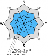
The avalanche danger for today is low for all aspects and elevations. This past week we received a warm storm that brought 4"-8" inches of snow to elevations above 6,500 ft. Snow levels fluctuated and most of the snowpack below 6,500 feet took a hit from rain on snow. Overall, the recent storm snow was wet and deposited itself in a very cohesive manner on the mountain. The North winds blew yesterday on the upper mountain at a steady 20-30 mph with gusts higher. This morning, winds out of the north have increased and currently Gray Butte is showing average wind speeds of 40-50 mph with gusts to 78 mph. Most of the new snow is well pasted on the old snowpack or has simply blown away. That being said, one's primary concern for today should be for freshly formed wind slabs in isolated areas, below and above treeline, all aspects.


Avalanche Problem 1: Wind Slab
-
Character ?

-
Aspect/Elevation ?
-
Likelihood ?CertainVery LikelyLikelyPossible
 Unlikely
 -
Size ?HistoricVery LargeLargeSmall

Small wind slabs will be found in isolated areas on Mt. Shasta near rock outcrops, chutes, gullies and near ridgetops. These wind slabs are 6"-12" deep, small in size, and while they could be easy to trigger, they likely will not be of consequence. It will still be prudent to keep your eye out for potentially larger wind slabs as you travel on the mountain. The Castle Lake area probably will not host any wind slabs as that area was right at the snow/rain level this past weeks storm.
Recent Observations
Overall, conditions are in transition and a wide variety of skiing conditions will be found out in the backcountry! Four to six inches of new snow fell this past work week over Tuesday night and Wednesday. Snow levels were high, above 6,500 feet mostly for that storm. Any elevations lower than that reveived rain on snow and took a hit. The Castle Lake area has reported grim snow coverage and the lake is looking quite slushy. On the mountain, pack powder and "cardboard" like snow exist with erosional wind features mixed in. Isolated areas near rock features, chutes and gullies hosted small wind slabs 6-12" deep that were easily triggered by skis yesterday...however these wind slabs are very small and hard to find. Most areas are scoured or have well pasted new snow on top of our old snowpack.
No recent avalanche activity has been witnessed or reported.
While loose-wet avalanches are not a concern at this time, as Spring approaches and temperatures begin to warm, spring skiers and climbers should keep these type of avalanches in mind. Sunny days and spring time can cause folks to forget their "avalanche mind". Loose-wet slides occur every year on Mt. Shasta and can be very large and harmful to human life! This is a great video from the Gallatin Avalanche Center, Bozeman, MT demonstrating a loose-wet slide: http://www.youtube.com/watch?v=zWpRQzgtL3o&feature=share&list=PLXu5151nmAvT7gHqdNajDBGfGY4u5XMSL
Weather and Current Conditions
Weather Summary
The cold temperatures and wind of the past few days are a far cry from the balmy weather of not to long ago...however a warming trend should be in order for the weekend. Not much of note for the near future on the storm front though. Cold air will continue today and then temps will warm through Sunday. Winds are cranking this morning out of the north/northwest with the jet stream overhead. They look to continue through at least Saturday on the mid to upper mountain levels. While the skies will be clear this weekend, winds can make climbing conditions very difficult.
More low pressure arrives next week near Tuesday or Wednesday, though does not apprear to be particularly stormy. More to come on that as it approaches.
WEATHER STATIONS - (last 24 hours):
In Mt. Shasta City at 0500, we have clear skies and breezy north winds with and a current temperature of 30 F.
On Mt. Shasta: In the Old Ski Bowl (7,600') on the south side of Mt. Shasta, we have a current temperature of 28F. Snow on the ground totals 106" inches with no setttlement. Five inches of new snow was recorded this past Tuesday/Wednesday. Temperatures have ranged from 14F to 32F. At Grey Butte (8,000') on the south side of Mt. Shasta winds averaged 6 mph from the ESE up to 1500, then switched and turned on out of the north again, averaging 40-50 mph and with a max gust of 78 mph. The current temperature is 28 F and temps have ranged 14F to 30F.
Castle/Mt. Eddy: Castle Lake - Castle Lake is hosting a current temp of 17F. Temperatures have ranged from 14F to 34F. Snow depth measures 44" inches with little settlement. Castle Lake received mixed rain and snow this past week. On Mt Eddy, we have 60" inches of snow on the ground with little settlement. The current temperature reads 17 F with temps ranging from 15F to 27F. Winds have been averaging 5 mph from the SE and gusting to 24 mph - SE.
THIS SEASON: September and October were warm and dry with September recording exactly zero precipitation. November remained warmer than normal with precipitation almost double normal values, 9.16" vs. 5.08". A local weather COOP observed the 2nd wettest November on record. December started out wet and warm, but temperatures cooled and brought snow to very low elevations. Since our avalanche cycle near Christmas, we've had a few small storms that brought some amounts of snow to the area, but did not produced any notable avalanches. January was below normal for precipitation with a long period of high pressure and sun that kept skiing conditions somewhat meager. We've had a few storms for 2013 that have brought us glimpses of wintery weather, but nothing to write home about! California and the Sierra Nevada have recorded the driest January and February on record. We currently have 5'-8.5' feet of snow above 6,500 ft. Since September 1st, Mt Shasta sits at 70% of normal, 24.60" recorded; normal 34.71". For 2013, we sit at 20% of normal with 3.90" recorded and 18.83" normal.
| 0600 temperature: | 26 |
| Max. temperature in the last 24 hours: | 32 |
| Average wind direction during the last 24 hours: | ESE, switching to N at 1500 |
| Average wind speed during the last 24 hours: | 5-10mph/ESE to 1500, increasing to 40-50 mph/NNW mi/hr |
| Maximum wind gust in the last 24 hours: | 78/Gray Butte mi/hr |
| New snowfall in the last 24 hours: | 0 inches |
| Total snow depth: | 60-106 inches |
Two Day Mountain Weather Forecast
Produced in partnership with the Medford NWS
| For 7000 ft to 9000 ft | |||
|---|---|---|---|
|
Friday (4 a.m. to 10 p.m.) |
Friday Night (10 p.m. to 4 a.m.) |
Saturday (4 a.m. to 10 p.m.) |
|
| Weather | Partly cloudy, then becoming sunny | Clear | Clear |
| Temperature (°F) | mid 30's - lower 40's | 15-20 | Not as cool, mid 40's to lower 50's |
| Wind (mi/hr) | North 10-15 with gusts to 35 | North 10-15 mph with gusts higher | North 5-10 with gusts higher |
| Precipitation SWE / Snowfall (in) | / 0 | / 0 | / 0 |
| For 9000 ft to 11000 ft | |||
| Friday | Friday Night | Saturday | |
| Weather | Clear and Windy! | Clear and Windy! | Clear and Windy! |
| Temperature (°F) | 23 | 12 | 30 |
| Wind (mi/hr) | NW 40-50 with gusts to 70-80 mph | NW 0 | NW 40-50 decreasing to 30-40 with gusts to 60-70 mph |
| Precipitation SWE / Snowfall (in) | / 0 | / 0 | / 0 |

