

You are here
Avalanche Advisory for 2013-03-31 06:54:00
- EXPIRED ON April 1, 2013 @ 6:54 amPublished on March 31, 2013 @ 6:54 am
- Issued by Nick Meyers - Shasta-Trinity National Forest
Bottom Line
The avalanche danger today is low with pockets of moderate.Timing of the storm this weekend has been slowed, however significant precipitation in the form of rain and snow is expected. Elevations below 8,000 feet will see mostly rain and/or wet snow. On the upper mountain, one or more feet of new snow is possible. Any instability due to rain will likely be seen within the first few hours of precipitation and/or during the warmest portions of the day. Storm slabs and wind slabs will be most sensitive to trigger today and tomorrow as new snow accumulates on the upper mountain. Tuesday and Wednesday, temperatures are expected to be 10F degrees above normal. Wet-loose activity will still be our primary concern. Wind/Storm slabs could also linger on the upper mountain in isolated areas. Climbers be aware and carry a beacon, shovel and probe!


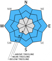
Avalanche Problem 1: Wet Slab
-
Character ?

-
Aspect/Elevation ?
-
Likelihood ?CertainVery LikelyLikelyPossible
 Unlikely
 -
Size ?HistoricVery LargeLargeSmall

Wet-Loose avalanches will be possible today and with the greatest chance during the first few hours of precipitation that arrives and/or the warmest portions of the day. Our main concern for wet-loose slides will lie within the top couple inches of the snowpack. Slopes steeper than 38 degrees will be most susceptible to these type of slides. Wet Loose slides involve the release of wet, unconsolidated snow or slush. These slides typically occur within layers of wet snow near the surface of the snowpack, though can gouge into lower snowpack layers. They usually start at a point and entrain more snow as they move downhill, forming a fan-shaped avalanche. Wet loose slides generally move slowly, but can contain enough mass to easily cause damage to trees, etc., not to meniton human life and limbs.
As temperatures warm above normal on Tuesday and Wednesday, our primary concern will continue to be wet-loose avalanches on southerly slopes steeper than 35 degrees.
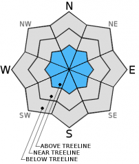
Avalanche Problem 2: Storm Slab
-
Character ?

-
Aspect/Elevation ?
-
Likelihood ?CertainVery LikelyLikelyPossible
Unlikely
-
Size ?HistoricVery LargeLargeSmall
For upper elevations, above 10,000 feet, new snow accumulation with the incoming storm could be upwards of one or more feet at best. The chance for storm slab avalanches will increase as new snow accumulates. Today and tomorrow (Sunday/Monday) will likely host the highest chance for storm slab avalanches, however climbers/upper elevation skiers should be on the lookout for slabs into the week.
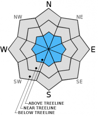
Avalanche Problem 3: Wind Slab
-
Character ?

-
Aspect/Elevation ?
-
Likelihood ?CertainVery LikelyLikelyPossible
Unlikely
-
Size ?HistoricVery LargeLargeSmall
Isolated wind slabs will likely be found later today and into the work week. Winds do not look strong with this storm, but will be just enough to move snow onto leeward slopes. Often high winds are present on the upper mountain and usually blow snow available for transport away. However, with this storm, wind speeds look moderate and we could see wind loading in isolated areas around chutes, gullies, rock outcrops, etc.Winds have been primarily blowing from the bottom 180 degrees of the compass, (southerly).
Recent Observations
Smooth and very good skiing conditions were found yesterday above 8,300 feet on the south side of Mt. Shasta...however below that, while the snow was supportable, very sticky snow kept skis pointed in only one direction - down! Get your spring tune and proper wax to combat the lower slopes back to your vehicle. Northerly, upper elevation aspects may still hold some dryer snow, but warmer temps and rain as of late has the snow settling out and working towards a melt/freeze cycle. An isothermic and stable snowpack exists overall.
Temperatures yesterday reached a balmy 76F out at Ash Creek, east of McCloud/Mt. Shasta and 71F in Mt. Shasta City. At Castle Lake we saw a high of 64F and 50F on Gray Butte.
One could still ski at Castle Lake currently, however it's getting pretty thin. Rock and manzanita slalom is the name of the game up there now. The lake is still frozen and supportable of weight. Use caution near the edges.
Yesterday, 3-30-13, insignificant wet-loose slides were easily triggered off of "Criblets Ridge", the east/west facing, north/south running ridgeline that separates Powder Bowl and Sun Bowl. The slides were within the top 1" to 2" of snow and on slopes steeper than 38-40 degrees and ran only 10-20 feet. A larger, shallow wet-loose slide was viewed in Sun Bowl and is suspected to have released on 3-29-13. My guess is it was skier triggered... Sun Bowl is south facing, 35-38 degrees... The slide ran several hundred feet, though was of little consequence. Roller balls were plentiful on top end of Powder Bowl.
{Wet-Loose slide in Sun Bowl, picture taken 3-30-31, slide estimated to have occured on 3-29-13. Photo: Meyers}
As spring approaches and temperatures begin to warm, spring skiers and climbers should keep WET-LOOSE AVALANCHES in mind. Sunny days and spring time can cause folks to forget their "avalanche awareness". Loose-wet slides occur every year on Mt. Shasta and can be very large and harmful to human life! Even though the avalanche danger may be low, this means that avalanches are still possible. A BEACON, SHOVEL & PROBE are STILL A GREAT IDEA in spring time!
Significant rain can also cause WET-LOOSE AVALANCHES. Use caution this weekend.
This is a great video from the Gallatin Avalanche Center, Bozeman, MT demonstrating small loose-wet slides: http://www.youtube.com/watch?v=zWpRQzgtL3o&feature=share&list=PLXu5151nmAvT7gHqdNajDBGfGY4u5XMSL
Weather and Current Conditions
Weather Summary
The cutoff low is taking its sweet time delivering the weighty precipitation totals that were expected this weekend. Models show that the area should still get a good bit of rain and snow, albeit a bit delayed. The QPF expects .58" of water for Mt. Shasta today so we should see the brunt of the wet weather in the next 12-24 hours. Showers will continue through Monday and we could see upwards of .75" of water by the end of the storm, if were lucky... A drying and clearing trend will ensue Tuesday and temperatures are expected to be 10F degrees above normal for a couple days. Thursday brings another cold front and more precipitation. Moderate winds were the case yesterday above treeline, and while we'll likely see gusty, breezy conditions continue today, it appears the southerly winds will diminish as the weekend comes to a close. The 700mb wind charts show low wind speeds for the begining of the week and picking back up out of the south late Wednesday/Thursday.
WEATHER STATIONS - (last 24 hours):
In Mt. Shasta City at 0500, we have cloudy skies, light rain and a current temperature of 48 F.
On Mt. Shasta: In the Old Ski Bowl (7,600') on the south side of Mt. Shasta, we have a current temperature of 33F. Snow on the ground totals 103" inches with 2" of settlement due to rain and no new snow. Temperatures have ranged from 33 F to 50 F. At Grey Butte (8,000') on the south side of Mt. Shasta winds averaged 15 mph and southerly in direction with a max gust to 35 mph from the ENE. The current temperature is 33F and temps have ranged 33F to 50F.
Castle/Mt. Eddy: Castle Lake - Castle Lake is hosting a current temp of 38F. Temperatures have ranged from 38F to 64F. Snow depth measures 36" inches with 2" settlement due to rain and no new snow. On Mt Eddy, we have 54" inches of snow on the ground with 4" settlement due to rain and no new snow. The current temperature reads 37F with temps ranging from 36F to 53F. Winds have been averaging 2 mph from the SW and gusting to 11 mph - SE.
THIS SEASON: September and October were warm and dry with September recording exactly zero precipitation. November remained warmer than normal with precipitation almost double normal values, 9.16" vs. 5.08". A local weather COOP observed the 2nd wettest November on record. December started out wet and warm, but temperatures cooled and brought snow to very low elevations. Since our avalanche cycle near Christmas, we've had a few small storms that brought some small amounts of snow to the area, but did not produced any notable avalanches. January was below normal for precipitation with a long period of high pressure and sun that kept skiing conditions somewhat meager. We've had a few storms for 2013 that have brought us glimpses of wintery weather, but nothing to write home about! California and the Sierra Nevada have recorded the driest January and February on record. We currently have 4.5'-8.5' feet of snow above 6,500 ft. Since September 1st, Mt Shasta sits at 69% of normal, 24.93" recorded; normal 36.00". For 2013, we sit at 21% of normal with 4.23" recorded and 20.12" normal.
| 0600 temperature: | 35 |
| Max. temperature in the last 24 hours: | 55 |
| Average wind direction during the last 24 hours: | Southerly |
| Average wind speed during the last 24 hours: | 10-15 mi/hr |
| Maximum wind gust in the last 24 hours: | 35 - ENE mi/hr |
| New snowfall in the last 24 hours: | .6" rain/a couple inches upper elevation snow inches |
| Total snow depth: | 54-103 inches |
Two Day Mountain Weather Forecast
Produced in partnership with the Medford NWS
| For 7000 ft to 9000 ft | |||
|---|---|---|---|
|
Sunday (4 a.m. to 10 p.m.) |
Sunday Night (10 p.m. to 4 a.m.) |
Monday (4 a.m. to 10 p.m.) |
|
| Weather | Rain and snow showers, though mostly rain. Snow levels near 8-9,000 feet and lowering to 6,800 feet | Rain and snow showers, becoming snow after midnight. Some thunder possible. | Rain and snow showers, snow levels rising to 8,000 feet. Mostly cloudy in the afternoon. |
| Temperature (°F) | 43 | 30 | 44 |
| Wind (mi/hr) | East this morning, shifting to southwest this afteroon 0-10mph | West 0-10 mph | West 0-10 mph |
| Precipitation SWE / Snowfall (in) | / trace | / trace | / trace |
| For 9000 ft to 11000 ft | |||
| Sunday | Sunday Night | Monday | |
| Weather | Rain and snow | Rain and snow | Rain and snow |
| Temperature (°F) | 29 | 20 | 29 |
| Wind (mi/hr) | Southeast 5-15 mph with gusts into the 20's | North/northwest 4-8 | North 5-15 mph with gusts into the 20's |
| Precipitation SWE / Snowfall (in) | / 4-8 | / 4-8 | / 1-3 |

