

You are here
Avalanche Advisory for 2016-04-02 06:54:17
- EXPIRED ON April 3, 2016 @ 6:54 amPublished on April 2, 2016 @ 6:54 am
- Issued by Jon Dove - Shasta-Trinity National Forest
Bottom Line
LOW avalanche danger will exist for all elevations and aspects this morning. MODERATE danger will form for loose-wet related instabilities on sun exposed slopes 35 degrees and steeper on E-SE-S-SW aspects below 10,000 feet. Poor overnight refreeze and continued warm temperatures will encourage surface snow to remain soft and potentially unstable. Distribution of loose wet snow avalanche activity may be limited today by cloud cover and light winds. Look for clues such as roller balls, pinwheels, and small point releases.


Avalanche Problem 1: Loose Wet
-
Character ?

-
Aspect/Elevation ?
-
Likelihood ?CertainVery LikelyLikelyPossible
 Unlikely
 -
Size ?HistoricVery LargeLargeSmall

Overnight temperatures remained warm at most locations near and below treeline within the forecast area, barely dipping into the thirty's. The coldest temperatures were recorded at Sand Flat weather station which reported a low this morning of 33 degrees. Old Ski Bowl and Gray Butte weather stations revealed that temperatures never even made it below 40 degrees at those locations. Poor overnight re-freeze will allow for snow to soften more readily today. That being said, the increase in atmospheric moisture and the associated cloud buildup will limit sun exposure on southerly facing aspects. Light winds with stronger gusts will aid in cooling the snow's surface, as well. This in turn could limit the distribution of loose wet snow instabilities on E-SE-S-SW facing aspects below 10,000 feet. Higher elevations will remain too cold for loose wet snow to develop. Look for clues mother nature will give like the presence of roller balls, or recent point release loose wet snow slides. These could be early warning signs of the potential for larger, more hazardous loose wet snow avalanches. Take these types of avalanches seriously as they may push you off of your feet and carry you over a cliff band, through tight trees, or into a terrain trap where enough snow may collect to fully bury a person. Continue to play it safe out there!
Forecast Discussion
Today we begin a slight shift away from the spring time bliss that has enveloped Mount Shasta over the past few days. A weak front pushes on shore this morning bringing only some high clouds to start off. As the day warms up instability within the atmosphere and an increase in moisture will lead to lots of cumulus build up along the cascade crest and to the east. This could spell out a chance for some isolated thunderstorm activity during the mid to late afternoon. Winds will generally be southerly and light, but any thunder storm activity could cause locally gusty winds. There will be a slight chance for some precipitation late this afternoon into the evening, then becoming partly cloudy. Tomorrow will see clouds building back up by the afternoon with a chance for some precipitation in the early evening until Monday morning. Precipitation amounts look to be light with models showing only 0.05 inches of water potential with this afternoon's buildup. The forecast for some clouds and the associated atmospheric moisture will surely cause a cloud cap around Mount Shasta. Climbing into a white-out is never a safe or good idea and we do not recommend it. Even experienced guides have become lost in poor visibility conditions on the upper mountain. Once you gain the upper mountain, above approximately 12,500 feet, it is very easy to accidentally descend off the wrong side of the mountain. This has happened many times before and is easily prevented. Should that happen, one will find themselves in potentially steep, glaciated terrain and it makes for a very long and potentially hazardous day (and night perhaps) for climber, fellow party members, and rescue resources. Not to mention the stress on family members and friends. Play it safe and do not climb into a white-out.
CLIMBERS & SKIERS:
We are on the edge of climbing season for Mount Shasta. As April and May roll around, this is when we typically get the most climber and skier traffic, AND it is when we get most of our accidents. Conditions right now are fantastic, but with that comes risk. The mountain is completely covered in snow and rime ice. While the rockfall potential is low, other hazards exist.
In no particular order...
First, weather... Late Winter and Spring can offer the full gamut of weather conditions - winter blizzards, howling wind, freezing cold to beautiful sunny days with flip flops and brews in the parking lot. You need to bring the appropriate attire to accommodate all these weather conditions.
Avalanche danger can also rise and fall quickly with passing storms resulting in wind slabs on top of firm, melt/freeze snow and also loose wet related instabilities on those warm days. An avalanche beacon, shovel and probe are essential.
As for the climbing, the snow surface conditions are currently very smooth and very firm. If you slip and fall, you WILL take a long slide for life if you do not immediately self-arrest. A helmet, ice axe and crampons essential! (A hiker slipped and fell on Spring Hill a few days ago, sliding into a tree, breaking a leg/hip... yes, the snow is smooth and firm!)
Lastly, exposed rocks are currently plastered in rime ice. This rime ice will break off and tumble downhill onto climbers and skiers on warm days, sometimes taking rock with it. The rime ice chunks can be just as hard as rock and cause serious injury.
Thus, full winter mountaineering conditions exist and a climb of Mt Shasta should not be taken lightly. Our goal is not scare tactics here, but to provide accurate, up to date and factual information so you can plan and prepare for a safe adventure on Mt Shasta, returning home in one piece. For your best chances at a safe climb, be sure you have the proper equipment (ice axe, crampons, helmet, avalanche transceiver, shovel, and probe) and know how to use all of it. Check the weather. Make sound decisions. Keep your group together. Know how to self-arrest. Please call us if you have further questions. 530-926-4511
THIS SEASON PRECIPITATION for MT SHASTA CITY: Since October 1st (the wet season), we have received 36.73 inches of water, normal is 35.57 inches, putting us at 103% of normal. For the month of April we've received 0.00 inches of water, normal is 0.11 inches, putting us at 0% of normal, and finally... for the year of 2016 we've received 27.24 inches of water, normal is 20.36 inches, putting us at 133% of normal.
Recent Observations
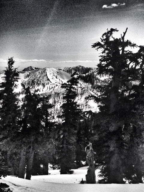
Observations were made yesterday on the West side of our forecast area on multiple aspects below and near treeline. No signs of loose wet snow instabilities were witnessed which is surprising when one considers the warm temperatures we had. The snow was soft, however, and corn conditions were widespread. Temperatures remained warm overnight with all weather stations recording temperatures above freezing. Both Old Ski Bowl and Gray Butte reported temperatures that never dipped below 40 degrees. Sand Flat was the coldest with a low of 33 degrees this morning. The poor overnight re-freeze will keep snow soft near and below treeline and elevate the potential for loose-wet activity. There are some factors that may counter that influence today. Increasing clouds may limit daytime warming on southerly facing aspects due to lack of solar gain from the sun. This, in turn, may limit distribution of loose wet snow instabilities. Continue to practice safe back country travel techniques, and keep an eye out for signs of loose wet snow activity such as roller balls, and point release loose wet snow slides. These are freebies that mother nature will give, so pay close attention.
Snow conditions at 10,000 feet and above will be quite different. Upper elevations and shadier aspects where colder temperatures exist will hold smooth, scoured snow with scabs of sastrugi and wind effected, packed powder. Where corn snow is present, riding conditions have been fantastic.
Enjoy the backcountry as the melt/freeze cycle begins! Be sure to stay on your "A" game this Spring... larger loose-wet slides happen every year on Shasta and can become large enough to cause serious harm. Along with this, falling rime ice and rocks necessitate the need for a helmet. Last, a slide for life on firm, smooth snow in the AM hours is possible....thus an ice axe and self arrest skills are absolutely required. These are some hazards not typically associated with winter conditions. Take note, be prepared, have fun!
West side of the forecast area above the North Fork of the Sacramento River:
-----------------------------------------------------------------------------------------------------------------------------------------------------------
LOCAL AREA ROAD, NORDIC, AND SNOWMOBILE PARK STATUS:
The Sand Flat cross country ski trails are in good shape still and ready for your cross country skis and snow shoes. These are backcountry routes marked with blue diamonds on trees. Trails are not groomed. Snow shoers, please blaze a parallel trail to cross country skiers staying out of the skin track. These trails can be accessed via the Everett Memorial Highway. Thank you, and enjoy!
The Mt. Shasta Nordic Center is CLOSED for the season. http://www.mtshastanordic.org
The Pilgrim Creek & Deer Mountain Snowmobile Parks are open, however snow is dwindling fast at these locations. One had to drive down the 19 road (Military Pass) a mile or so to get to consistent snow before unloading just a few days ago. Head to our "Education" tab on our website and find the snowmobile section for trail information, grooming status, and other sledder resources.
The Castle Lake Road is OPEN. The Everett Memorial Highway is OPEN. The Castle Lake and Everett Hwy are plowed year round to the trailheads. The roads are not always first priority, so your dawn patrol powder mission might be ceased if the plow has not made it up yet. Siskiyou County does a great job keeping the roads clear. Be respectful of the plow drivers if you encounter them. If you get to Bunny Flat before or during when the plow is there, please park on the uphill, LEFT side of the parking lot as you drive in. This is uphill and lookers right of the bathrooms. Thank You!
The Five Red Flags of Avalanche Danger any time of year include: 1) Recent/current avalanche activity 2) Whumphing sounds or shooting cracks 3) Recent/current heavy snowfall 4) Strong winds transporting snow 5) Rapid warming or rain on snow.
Weather and Current Conditions
Weather Summary
Good Morning! In Mt Shasta City at 0500, we have a current temperature of 48 F, nine degrees warmer than yesterday at this time. Skies are overcast with calm wind.
On Mt Shasta (South Side) in the last 24 hours...
Old Ski Bowl - 7,600 feet, the current temperature is 42 degrees F. Snow on the ground totals 147 inches with no new snow and 2 inches of settlement. Temperatures have ranged from 35 F to 51 F.
Gray Butte - 8,000 feet, the current temperature is 43 degrees F. Temperatures have ranged from 39 F to 51 F. Wind speeds are not available for Gray Butte at this time. The anemometer was taken down due to the need for repairs. Thank you for your understanding.
Mt Eddy Range (West side of Interstate-5)...
Castle Lake - 5,600 feet, the current temperature is 42 degrees F. Temperatures have ranged from 42 F to 67 F. Snow on the ground totals 69 inches with no new snow and 1 inch of settlement.
Mt Eddy - 6,500 feet, the current temperature is 37 degrees F. Temperatures have ranged from 35 F to 57 F. Snow on the ground measures 80 inches with no new snow and 1 inch of settlement. Winds have been variable in nature with an average of 3 mph, and a maximum gust of 8 mph, SE.
Always check the weather before you attempt to climb Mt Shasta. Further, monitor the weather as you climb. Becoming caught on the mountain in any type of weather can compromise life and limb. Be prepared.
| 0600 temperature: | 33 |
| Max. temperature in the last 24 hours: | 58 |
| Average wind direction during the last 24 hours: | N/A |
| Average wind speed during the last 24 hours: | N/A mi/hr |
| Maximum wind gust in the last 24 hours: | N/A mi/hr |
| New snowfall in the last 24 hours: | 0 inches |
| Total snow depth: | 91 inches |
Two Day Mountain Weather Forecast
Produced in partnership with the Medford NWS
| For 7000 ft to 9000 ft | |||
|---|---|---|---|
|
Saturday (4 a.m. to 10 p.m.) |
Saturday Night (10 p.m. to 4 a.m.) |
Sunday (4 a.m. to 10 p.m.) |
|
| Weather | Mostly cloudy this morning then partly cloudy with a 20% chance of thunderstorms this afternoon. | Mostly cloudy with a 30% chance of showers and thunderstorms before 11 pm. | Partly cloudy in the morning then mostly cloudy with a 20% chance of rain showers in the afternoon. |
| Temperature (°F) | 53 | 37 | 52 |
| Wind (mi/hr) | South 5-10 mph | South 5-10 mph | South 10-15 mph |
| Precipitation SWE / Snowfall (in) | / 0 | / 0 | / 0 |
| For 9000 ft to 11000 ft | |||
| Saturday | Saturday Night | Sunday | |
| Weather | Mostly cloudy this morning then partly cloudy with a 30% chance of snow showers after 2 pm. Some thunder is also possible. | Mostly cloudy with a 30% chance of snow showers before 11 pm. Some thunder is also possible. | Partly cloudy in the morning then mostly cloudy with a 20% chance of snow showers after 11 am. |
| Temperature (°F) | 32 | 29 | 29 |
| Wind (mi/hr) | Southwest 5-10 mph with gusts to 20 mph | Southwest 0-..5 | Southwest 10-15 mph with gusts to 20 mph |
| Precipitation SWE / Snowfall (in) | / 0-..5 | / 0-.5 | / 0 |

