

You are here
Avalanche Advisory for 2016-04-09 06:37:44
- EXPIRED ON April 10, 2016 @ 6:37 amPublished on April 9, 2016 @ 6:37 am
- Issued by Jon Dove - Shasta-Trinity National Forest
Bottom Line
Warm overnight temperatures contributed to poor re-freeze once again. However, mostly cloudy skies with locally blustery winds and some light precipitation will keep avalanche danger LOW for all elevations and aspects today. If any loose wet snow instabilities occur, though unlikely, it will be during the afternoon on south to southeast aspects on slopes 35 degrees and steeper. Roller balls and loose, heavy, wet snow is the best clue indicating larger loose wet slides are possible.


Avalanche Problem 1: Loose Wet
-
Character ?

-
Aspect/Elevation ?
-
Likelihood ?CertainVery LikelyLikelyPossible
 Unlikely
 -
Size ?HistoricVery LargeLargeSmall

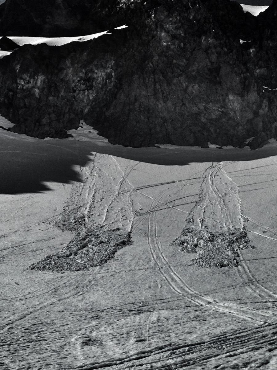
No reports or observations are available from the field for yesterday, but Thursday saw some loose wet activity, mostly on southeast facing slopes from treeline to just over 9,000 feet on Mt Shasta. These slides occurred in areas that are mostly protected from the wind and get plenty of solar gain during the day. Overnight temperatures remained well above freezing once again last night. For today, however there are a couple factors to consider. Overall temperatures will be slightly cooler than yesterday. Clouds have already started to obscure the sky this morning, and there is a chance for some precipitation. Isolated to scattered thunderstorm activity will raise the chance for locally gusty winds, as well. This will help to keep a lid on the chance for loose wet snow instabilities. Areas to pay attention to today will continue to be south to southeast aspects during the warmest parts of the day. Natural indicators for any instability are roller balls, pinwheels, and small point release slides. If you see any of theses signs while out on a ski tour it might be a good idea to steer clear of similar aspects, or even turn around and head back to the car.
It's beginning to be that time of year when the mountain can become quite crowded with other climbers/skiers within your sphere of influence. So, not only should you be concerned about triggering a loose wet slide that you or your group is involved in, you need to pay attention to where other groups are located. Are you above or below another group? Could you trigger a slide on top of somebody or is another skier going to trigger something on top of you? We are talking situational awareness here. Keep yours on high.
Forecast Discussion
Yesterday was another sunny and unseasonably warm day, but not nearly as hot as Thursday was. Things will continue to cool over the next couple of days as a closed off low pressure system west of California slides to the south into southern California. With ample moisture in the atmosphere combined with daytime warming, and subtle inverted troughing over a mild air mass, numerous showers and isolated to scattered thunderstorms are the result. The majority of precipitation and thunderstorm activity will lie along the Cascade crest. Precipitation amounts will generally be light with predicted water amounts associated with today's weather at 0.28 inches. Tonight through Sunday night the threat of thunderstorms will diminish some as the upper level trough moves to the southeast. Another upper level trough will move into the area on Monday into Tuesday bringing cooler temperatures and more showers to the region. For today expect clouds and the chance for some precipitation in the afternoon. Winds will generally be light and vary in direction depending on elevation. Upper portions of Mount Shasta will see blustery northeast winds at around 15 mph with occasional higher gusts, especially under thunder cells. Near and below treeline, winds will be coming out of the west at 5-10 mph. Visibility above treeline may become poor due to increasing clouds over the course of the day.
THIS SEASON PRECIPITATION for MT SHASTA CITY: Since October 1st (the wet season), we have received 36.76 inches of water, normal is 36.37 inches, putting us at 101% of normal. For the month of April we've received 0.03 inches of water, normal is 0.91 inches, putting us at 3% of normal, and finally... for the year of 2016 we've received 27.27 inches of water, normal is 21.16 inches, putting us at 128% of normal.
Recent Observations
Field observations from yesterday area limited to what was reported by our weather stations, and what was discussed in Bunny Flat parking lot with a couple of local snowmobilers. Soft corn snow was once again the order of the day as plenty of sun and warm temperatures continued to settle and consolidate our snow pack. Soft snow was found all the way up to 10,000 feet in Old Ski Bowl. No loose wet snow avalanches were reported, or any other indicators of loose wet instabilities. Poor overnight re-freeze conditions last night will help keep loose wet avalanches as a problem for today. That being said, clouds, rain showers, and light to moderate winds will probably manage to minimize development of any large loose wet instabilities. If they do form it will be on south to southeast aspects during the warmest parts of the day in the afternoon hours. Early signs of the formation of loose wet snow avalanche potential are roller balls, pinwheels, and small point release slides. If you see fresh evidence of any of this kind of activity, avoid travel on those aspects. Temperatures will cool over the coming days thereby eleminating any continued concern for loose wet instabilities.
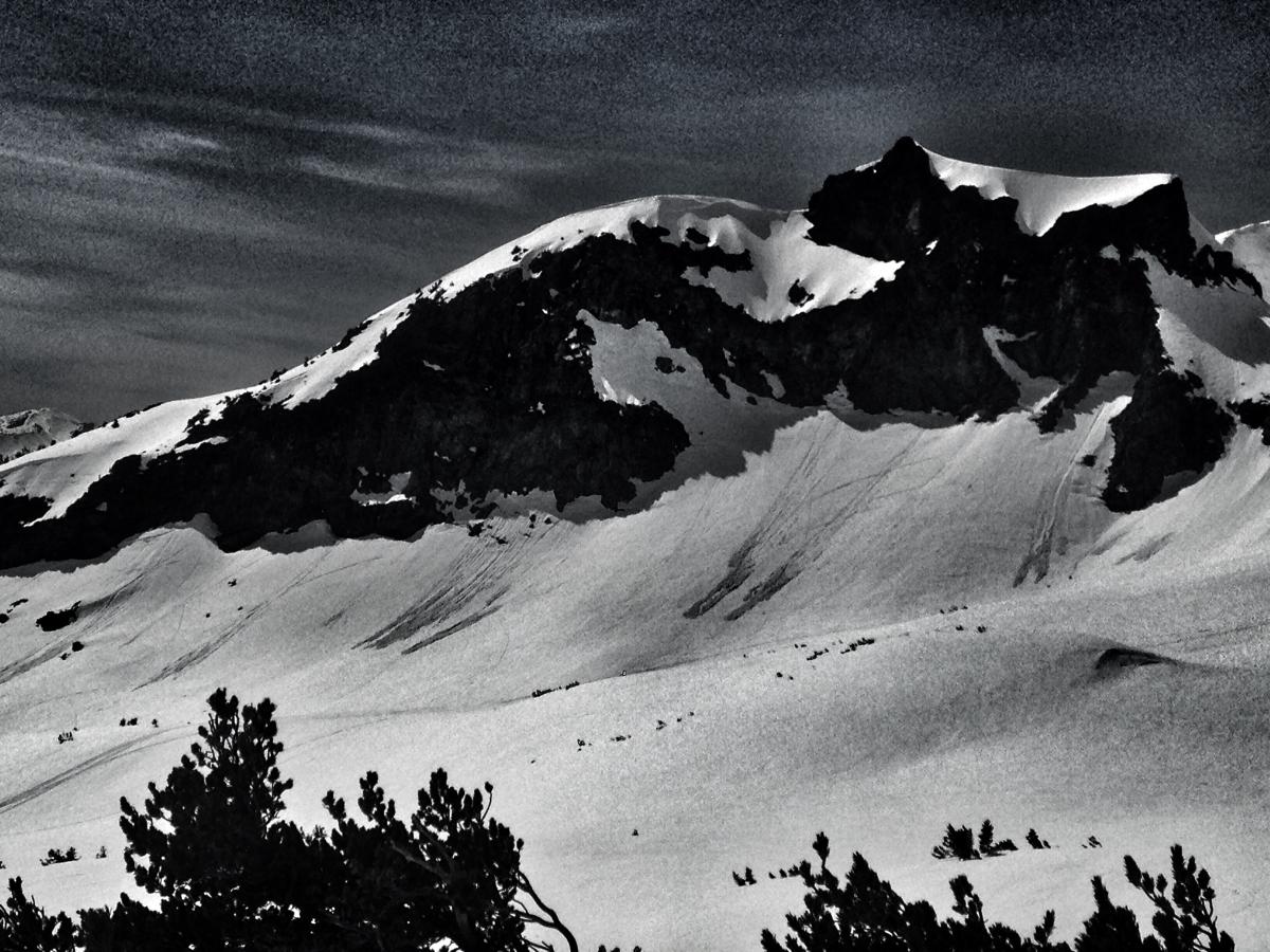
A half dozen or so loose wet slides off the southeast aspect of Green Butte on 4.7.16 - Photo: N Meyers
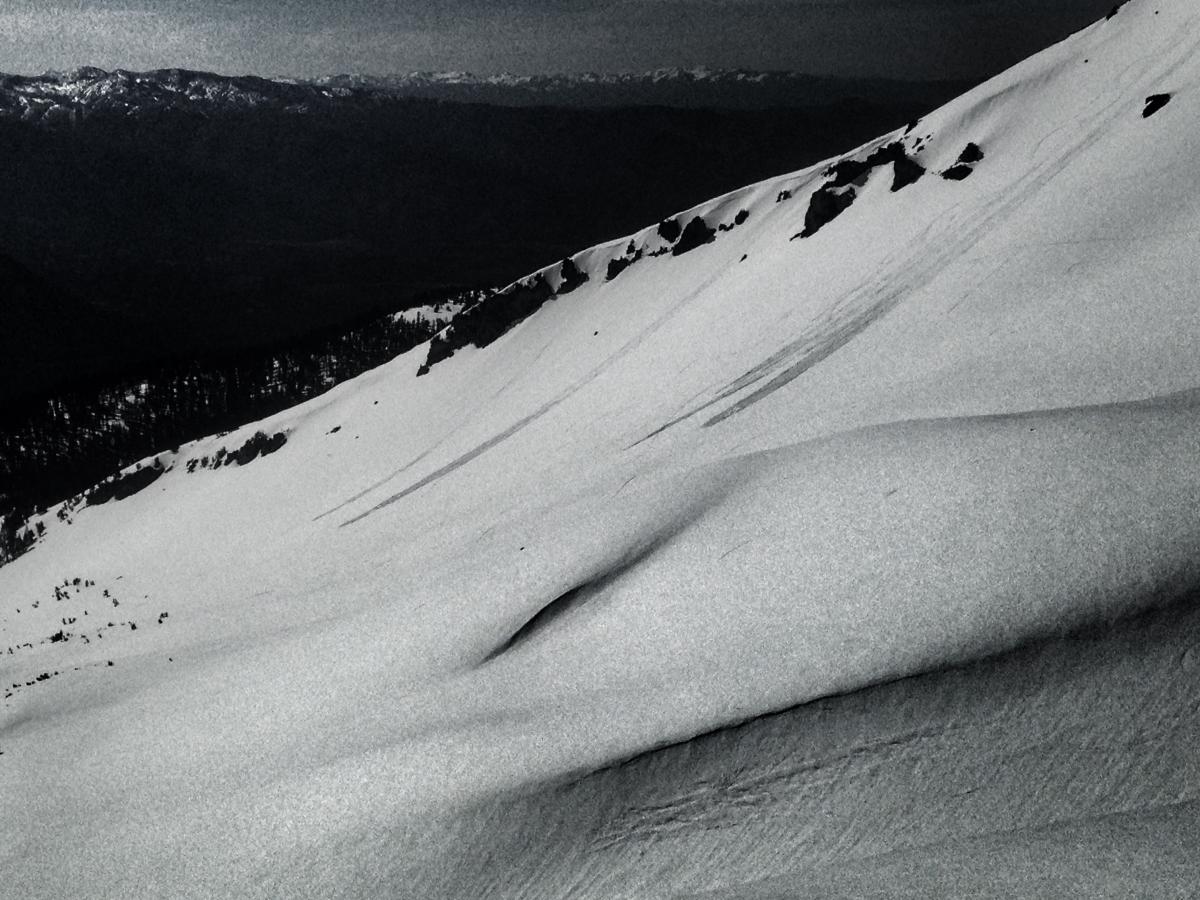
Several natural and skier triggered loose wets on a southeast aspect of Casaval Ridge into Avalanche Gulch, 4.7.16. Starting zone elevation approx. 9,200 feet - Photo: N Meyers
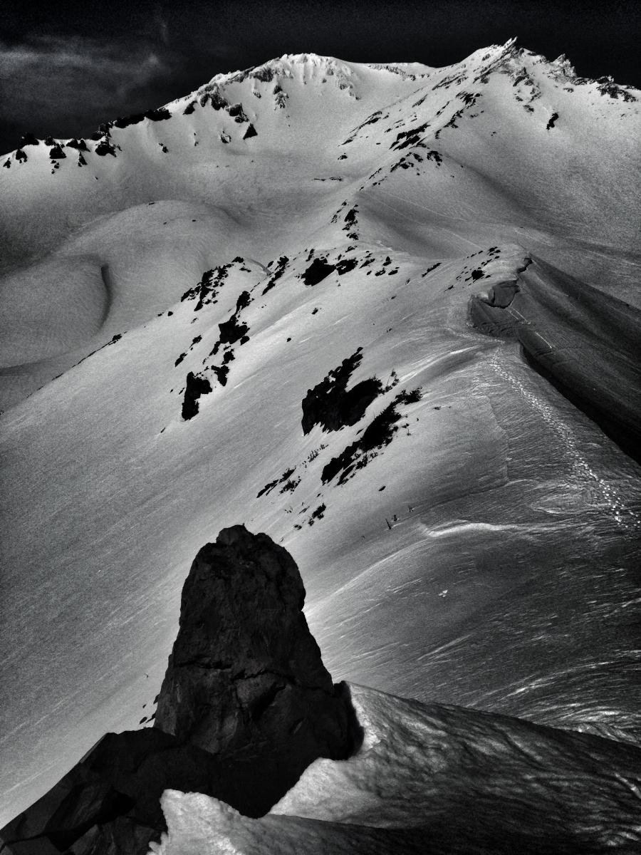
A look up into Avalanche Gulch and Green Butte / Sargents ridge. Conditions were soft and punchy along the ridgeline. 4.7.16 - Photo: N Meyers
Close-up of loose wet slides off Green Butte, 4.7.16 - Photo: N Meyers
Climbing Conditions: Current climbing conditions are good to great. Steadily increasing temperatures this week with overnight lows above freezing will not allow a solid snow re-freeze at night. This could mean post-holing at lower elevations. At higher elevations (11,000 feet and above), however, snow will refreeze better and be firm in the morning hours making crampons (and ice axe) necessary equipment.
Below are some things to think about when planning your trip this Spring:
- Avalanche Danger & Weather: You may encounter a variety of snow conditions during the spring time. Late season storms can bring fresh snow and high winds to the mountains. Avalanche danger can quickly spike due to new wind and storm slabs on top of icy, firm melt/freeze snow. Further, warm and sometimes downright hot days can create loose wet avalanches. Low danger in the cool morning hours may rise rapidly to higher danger during the afternoon hours on sunny aspects. These are two different avalanche problems associated with different weather patterns with both being possible during the same week, or even the same day. A beacon, shovel and probe continue to be essential, even during Spring time. Always check the avalanche advisory before starting your climb, and call the ranger station for the latest in weather and conditions. Spring time weather patterns can bring it all. The point is... you need to bring the appropriate attire to accommodate all weather conditions. Snow, rain, sun, wind... you can count on all of it on Shasta at some point during Spring time. Further, Mt Shasta can often host a cloud cap creating poor visibility conditions. DO NO climb into a white-out. It is very easy to wander off the WRONG side of Mt Shasta when on the upper mountain, >12,500 feet. This can create a long day and perhaps night for climber, party members, rescue resources and family. Play it safe.
- Firm and smooth snow (slide for life conditions): Snow conditions on Mount Shasta are great right now. That being said, the snow in the morning hours is very firm and very smooth. These types of conditions have caused serious injury in the past to those who slip, trip, or fall and fail to self-arrest as they slide. You MUST know how to self-arrest with an ice axe. This is one of your best defenses for a safe trip on Mt Shasta. Practice this and other climbing skills on small, short slopes in soft snow. If you fall, you must immediately self-arrest or you will take a long, sliding, tumbling fall resulting in serious injury or death. Along with your solid ice axe skills, know how to walk/climb with crampons on. It is easy to catch the front points of the crampon on the cuff of your pant leg resulting in a fall if you are not careful with each step.
- Rime Ice: What is rime ice? Rime ice forms on rocks, towers, etc. as super cooled water droplets freeze upon contact with a solid object. The ice grows into the wind taking on a cauliflower like appearance. The exposed rocks on Mt Shasta at higher elevations are currently plastered in rime ice. This hazard will diminish as the ice flakes off on warm days, but until then... HEADS UP! You absolutely should wear a helmet if climbing. As the days warm, chances increase of getting hit by falling ice until all of it falls off.
-----------------------------------------------------------------------------------------------------------------------------------------------------------
LOCAL AREA ROAD, NORDIC, AND SNOWMOBILE PARK STATUS:
The Sand Flat cross country ski trails are in good shape still and ready for your cross country skis and snow shoes. These are backcountry routes marked with blue diamonds on trees. Trails are not groomed. Snow shoers, please blaze a parallel trail to cross country skiers staying out of the skin track. These trails can be accessed via the Everett Memorial Highway. Thank you, and enjoy!
The Mt. Shasta Nordic Center is CLOSED for the season. http://www.mtshastanordic.org
The Pilgrim Creek & Deer Mountain Snowmobile Parks are open, however snow is dwindling fast at these locations. One had to drive down the 19 road (Military Pass) a mile or so to get to consistent snow before unloading just a few days ago. Head to our "Education" tab on our website and find the snowmobile section for trail information, grooming status, and other sledder resources.
The Castle Lake Road is OPEN. The Everett Memorial Highway is OPEN. The Castle Lake and Everett Hwy are plowed year round to the trailheads. The roads are not always first priority, so your dawn patrol powder mission might be ceased if the plow has not made it up yet. Siskiyou County does a great job keeping the roads clear. Be respectful of the plow drivers if you encounter them. If you get to Bunny Flat before or during when the plow is there, please park on the uphill, LEFT side of the parking lot as you drive in. This is uphill and lookers right of the bathrooms. Thank You!
The Five Red Flags of Avalanche Danger any time of year include: 1) Recent/current avalanche activity 2) Whumphing sounds or shooting cracks 3) Recent/current heavy snowfall 4) Strong winds transporting snow 5) Rapid warming or rain on snow.
Weather and Current Conditions
Weather Summary
Good Morning! In Mt Shasta City at 0500, we have a current temperature of 52 F, five degrees warmer than yesterday at this time. Skies are mostly cloudy with calm wind.
On Mt Shasta (South Side) in the last 24 hours...
Old Ski Bowl - 7,600 feet, the current temperature is 44 degrees F. Snow on the ground totals 133 inches with no new snow and 2 inches of settlement. Temperatures have ranged from 39 F to 53 F.
Gray Butte - 8,000 feet, the current temperature is 44 degrees F. Temperatures have ranged from 38 F to 56 F. Wind speeds are not available for Gray Butte at this time. The anemometer was taken down due to the need for repairs. Thank you for your understanding.
Mt Eddy Range (West side of Interstate-5)...
Castle Lake - 5,600 feet, the current temperature is 46 degrees F. Temperatures have ranged from 43 F to 69 F. Snow on the ground totals 56 inches with no new snow and 3 inches of settlement.
Mt Eddy - 6,500 feet, the current temperature is 39 degrees F. Temperatures have ranged from 39 F to 59 F. Snow on the ground measures 65 inches with no new snow and 4 inches of settlement. Winds have been primarily west/southwest in nature with an average of 3 mph, and a maximum gust of 8 mph out of the south/southwest.
Always check the weather before you attempt to climb Mt Shasta. Further, monitor the weather as you climb. Becoming caught on the mountain in any type of weather can compromise life and limb. Be prepared.
| 0600 temperature: | 37 |
| Max. temperature in the last 24 hours: | 61 |
| Average wind direction during the last 24 hours: | N/A |
| Average wind speed during the last 24 hours: | N/A mi/hr |
| Maximum wind gust in the last 24 hours: | N/A mi/hr |
| New snowfall in the last 24 hours: | 0 inches |
| Total snow depth: | 77 inches |
Two Day Mountain Weather Forecast
Produced in partnership with the Medford NWS
| For 7000 ft to 9000 ft | |||
|---|---|---|---|
|
Saturday (4 a.m. to 10 p.m.) |
Saturday Night (10 p.m. to 4 a.m.) |
Sunday (4 a.m. to 10 p.m.) |
|
| Weather | Mostly cloudy with a 30% chance of showers this morning, then chance of showers and a slight chance of thunderstorms this afternoon. | Cloudy with rain showers likely and a chance of thunderstorms in the evening, then rain showers likely after midnight. Chance of precip. 60% | Mostly cloudy with a slight chance of rain showers in the morning, then chance of rain showers and slight chance of thunderstorms in the afternoon. Chance of precip. 50% |
| Temperature (°F) | 51 | 39 | 50 |
| Wind (mi/hr) | Southwest 5-10 mph | West 5-10 mph | West 5-10 mph |
| Precipitation SWE / Snowfall (in) | / 0 | / 0 | / 0 |
| For 9000 ft to 11000 ft | |||
| Saturday | Saturday Night | Sunday | |
| Weather | Mostly cloudy with a 50% chance of snow showers. Some thunder is also possible. Breezy | Cloudy with snow showers likely. Some thunder is also possible. Chance of precip. 60% | Mostly cloudy with a 50% chance of snow showers, mainly after 11 am. Some thunder is also possible. Blustery |
| Temperature (°F) | 35 | 31 | 31 |
| Wind (mi/hr) | Northeast 10-15 mph | Northeast 0-.5 | Northeast 10-15 mph |
| Precipitation SWE / Snowfall (in) | / 0-.5 | / 1-3 | / 1-3 |

