

You are here
Avalanche Advisory for 2016-04-14 07:00:14
- EXPIRED ON April 15, 2016 @ 7:00 amPublished on April 14, 2016 @ 7:00 am
- Issued by Nick Meyers - Shasta-Trinity National Forest
Bottom Line
Expect LOW avalanche danger for all elevations and aspects this morning. The forecast area received only 1 inch of new snow in the last 24 hours. Some isolated areas could see MODERATE danger this afternoon pending on how much more new snow the area receives today. Breezy westerly winds could also cause MODERATE danger in wind loaded areas. Small, isolated wind pillows/pockets/slabs are possible near and above treeline on S-SE-E-NE-N aspects.


Avalanche Problem 1: Wind Slab
-
Character ?

-
Aspect/Elevation ?
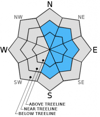
-
Likelihood ?CertainVery LikelyLikelyPossible
 Unlikely
 -
Size ?HistoricVery LargeLargeSmall

Snow totals are much less than expected this morning with only 1 inch reported from weather stations. Cool temperatures will keep loose wet slides in check and it's pretty hard to believe that any new wind and storm slabs are large enough to cause trouble for backcountry skiers, riders or climbers today.
I'm predicting LOW avalanche danger this morning that could rise to MODERATE danger in areas based on a couple variables:
1- How much more new snow we get today...
2- Size and distribution of wind deposited snow (Westerly winds 40-50 mph above treeline)
Below treeline, I think it's safe to say the avalanche danger will stay LOW all day. Near and above treeline, one will have to use their skills in identifying areas of wind deposited snow in avalanche terrain: wind pillows behind rocks, pockets of wind deposited snow in the tops of couloirs, convexities in a steep gully bottom, leeward open slopes along ridgelines.
We have not been up to these areas since the storm arrived last night, so some uncertainty exists in the new snow layers. We do not have any concern with any existing snow layers. Weakness/instability today, if found, will be within new snow near and above treeline. Wind deposited snow in leeward areas should be of most concern and you need to be able to identify these areas, tread lightly or stay off.
Forecast Discussion
So far the storm set for last night and today has been a little underwhelming. It certainly looks windy on the mountain but the whole precipitation thing... not exactly panning out quite yet. Radar this morning shows a good band of precip to the west and perhaps it's on the way to Shasta. With these westerly tracking storms however, much of the water will get dumped along the coast range and Trinity mountains. If we are going to meet the snow and precip totals expected, Mother Nature has some work to do today... kind of like the JPR fund drive. Overall, about .5" inches of water was expected out of this storm and we've only received .15" at the Old Ski Bowl and .07" inches water in Mt Shasta City. Temperatures are drastically cooler, averaging another 5-8 degrees cooler than yesterday. For today, more rain and snow expected with cloudy skies and windy conditions above treeline on the mountain. If things pan out, another .35 inches of water is forecast with snow levels in the 4 to 5,000 foot range. That could mean a few inches of snow to the mountains, but based on the lack of a stormy storm thus far, I'm not getting to excited over this one. All weather will disipate later today and tomorrow and give way to a nice weekend... winds mellowing out, sunshine, a little bit of fresh snow! Oh, Spring! If recreational stress has some of you jammed up...just remember, the only bad decision is not making one!
THIS SEASON PRECIPITATION for MT SHASTA CITY: Since October 1st (the wet season), we have received 37.61 inches of water, normal is 36.87 inches, putting us at 102% of normal. For the month of April we've received 0.88 inches of water, normal is 1.41 inches, putting us at 62% of normal, and finally... for the year of 2016 we've received 28.12 inches of water, normal is 21.66 inches, putting us at 129% of normal.
Recent Observations
Temperatures have continued to drop today, another 5-8 degrees from yesterday. Overnight lows in the 6,000 to 8,000 foot range were 18 to 24 degrees F.
Winds started out southwest, switched to west and will swing around to northwest/west later tonight. It's certain that some new snow has blown around, but reports from yesterday noted that not a whole lot of snow was available for transport. A bit of new snow from days prior helped smooth things out. A photo below is taken from just below Lake Helen on 4.13.16. Some old tracks were still visible, evidence of the trace amount of new snow.
Weather stations are reporting 1 inch of new snow at best this morning, over the past 24 hours. Gullies are likely to have a bit more. Riders today should find a thin layer of new snow to help smooth things out. Winds will continue, 40-50 mph above treeline out of the west today, with cool temps and a good chance at more precipitation.
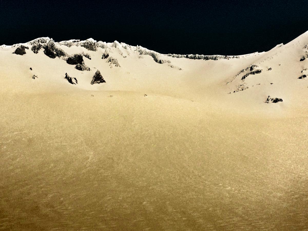
Photo taken just below Lake Helen in Avalanche Gulch yesterday, 4.13.16 - Photo: C Carr / Shasta Mtn Guides
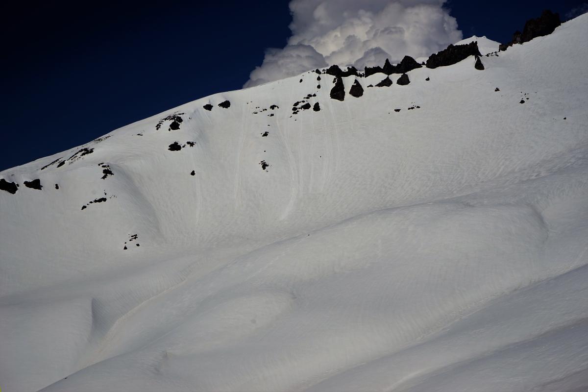
Small loose wet point releases off Casaval Ridge below 10,000 feet. Loose wet slides will not be a problem today, but an example of what we've been seeing during our warm spell and likely of what is to come with a rapid warming this weekend. - 4.11.16 - Photo: C Carr / Shasta Mtn Guides
Climbing Conditions: Current climbing conditions are good to great. Steadily increasing temperatures this week with overnight lows above freezing will not allow a solid snow re-freeze at night. This could mean post-holing at lower elevations. At higher elevations (11,000 feet and above), however, snow will refreeze better and be firm in the morning hours making crampons (and ice axe) necessary equipment.
Below are some things to think about when planning your trip this Spring:
- Avalanche Danger & Weather: You may encounter a variety of snow conditions during the spring time. Late season storms can bring fresh snow and high winds to the mountains. Avalanche danger can quickly spike due to new wind and storm slabs on top of icy, firm melt/freeze snow. Further, warm and sometimes downright hot days can create loose wet avalanches. Low danger in the cool morning hours may rise rapidly to higher danger during the afternoon hours on sunny aspects. These are two different avalanche problems associated with different weather patterns with both being possible during the same week, or even the same day. A beacon, shovel and probe continue to be essential, even during Spring time. Always check the avalanche advisory before starting your climb, and call the ranger station for the latest in weather and conditions. Spring time weather patterns can bring it all. The point is... you need to bring the appropriate attire to accommodate all weather conditions. Snow, rain, sun, wind... you can count on all of it on Shasta at some point during Spring time. Further, Mt Shasta can often host a cloud cap creating poor visibility conditions. DO NO climb into a white-out. It is very easy to wander off the WRONG side of Mt Shasta when on the upper mountain, >12,500 feet. This can create a long day and perhaps night for climber, party members, rescue resources and family. Play it safe.
- Firm and smooth snow (slide for life conditions): Snow conditions on Mount Shasta are great right now. That being said, the snow in the morning hours is very firm and very smooth. These types of conditions have caused serious injury in the past to those who slip, trip, or fall and fail to self-arrest as they slide. You MUST know how to self-arrest with an ice axe. This is one of your best defenses for a safe trip on Mt Shasta. Practice this and other climbing skills on small, short slopes in soft snow. If you fall, you must immediately self-arrest or you will take a long, sliding, tumbling fall resulting in serious injury or death. Along with your solid ice axe skills, know how to walk/climb with crampons on. It is easy to catch the front points of the crampon on the cuff of your pant leg resulting in a fall if you are not careful with each step.
- Rime Ice: What is rime ice? Rime ice forms on rocks, towers, etc. as super cooled water droplets freeze upon contact with a solid object. The ice grows into the wind taking on a cauliflower like appearance. The exposed rocks on Mt Shasta at higher elevations are currently plastered in rime ice. This hazard will diminish as the ice flakes off on warm days, but until then... HEADS UP! You absolutely should wear a helmet if climbing. As the days warm, chances increase of getting hit by falling ice until all of it falls off.
-----------------------------------------------------------------------------------------------------------------------------------------------------------
LOCAL AREA ROAD, NORDIC, AND SNOWMOBILE PARK STATUS:
The Sand Flat cross country ski trails are in good shape still and ready for your cross country skis and snow shoes. These are backcountry routes marked with blue diamonds on trees. Trails are not groomed. Snow shoers, please blaze a parallel trail to cross country skiers staying out of the skin track. These trails can be accessed via the Everett Memorial Highway. Thank you, and enjoy!
The Mt. Shasta Nordic Center is CLOSED for the season. http://www.mtshastanordic.org
The Pilgrim Creek & Deer Mountain Snowmobile Parks are open, however snow is dwindling fast at these locations. One had to drive down the 19 road (Military Pass) a mile or so to get to consistent snow before unloading just a few days ago. Head to our "Education" tab on our website and find the snowmobile section for trail information, grooming status, and other sledder resources.
The Castle Lake Road is OPEN. The Everett Memorial Highway is OPEN. The Castle Lake and Everett Hwy are plowed year round to the trailheads. The roads are not always first priority, so your dawn patrol powder mission might be ceased if the plow has not made it up yet. Siskiyou County does a great job keeping the roads clear. Be respectful of the plow drivers if you encounter them. If you get to Bunny Flat before or during when the plow is there, please park on the uphill, LEFT side of the parking lot as you drive in. This is uphill and lookers right of the bathrooms. Thank You!
The Five Red Flags of Avalanche Danger any time of year include: 1) Recent/current avalanche activity 2) Whumphing sounds or shooting cracks 3) Recent/current heavy snowfall 4) Strong winds transporting snow 5) Rapid warming or rain on snow.
Weather and Current Conditions
Weather Summary
Good Morning! In Mt Shasta City at 0500, we have a current temperature of 34 F, 1 degrees cooler than yesterday at this time. Skies are obscured with light wind.
On Mt Shasta (South Side) in the last 24 hours...
Old Ski Bowl - 7,600 feet, the current temperature is 18 degrees F. Snow on the ground totals 127 inches with 1-2 inches of new snow and little settlement. Temperatures have ranged from 18 F to 37 F.
Gray Butte - 8,000 feet, the current temperature is 21 degrees F. Temperatures have ranged from 21 F to 34 F. Wind speeds are not available for Gray Butte at this time. The anemometer was taken down due to the need for repairs. Thank you for your understanding.
Mt Eddy Range (West side of Interstate-5)...
Castle Lake - 5,600 feet, the current temperature is 24 degrees F. Temperatures have ranged from 23 F to 52 F. Snow on the ground totals 46 inches with a trace of new snow and little settlement.
Mt Eddy - 6,500 feet, the current temperature is 22 degrees F. Temperatures have ranged from 21 F to 42 F. Snow on the ground measures 56 inches with a trace of new snow and little settlement. Winds have been southerly in nature with an average of 1-2 mph, and a maximum gust of 12 mph, ESE.
Always check the weather before you attempt to climb Mt Shasta. Further, monitor the weather as you climb. Becoming caught on the mountain in any type of weather can compromise life and limb. Be prepared.
| 0600 temperature: | 23 |
| Max. temperature in the last 24 hours: | 40 |
| Average wind direction during the last 24 hours: | N/A |
| Average wind speed during the last 24 hours: | N/A mi/hr |
| Maximum wind gust in the last 24 hours: | N/A mi/hr |
| New snowfall in the last 24 hours: | 1 inches |
| Total snow depth: | 72 inches |
Two Day Mountain Weather Forecast
Produced in partnership with the Medford NWS
| For 7000 ft to 9000 ft | |||
|---|---|---|---|
|
Thursday (4 a.m. to 10 p.m.) |
Thursday Night (10 p.m. to 4 a.m.) |
Friday (4 a.m. to 10 p.m.) |
|
| Weather | Snow showers. Some thunder is also possible. Breezy. Chance of precipitation is 100%. | A 50 percent chance of snow showers. Mostly cloudy. | Partly cloudy to mostly sunny |
| Temperature (°F) | 33 | 24 | 44 |
| Wind (mi/hr) | Southwest 10-20 mph | North/Northwest 10-20 mph | North 10-20 mph |
| Precipitation SWE / Snowfall (in) | / 2-4 | / 0-1 | / 0 |
| For 9000 ft to 11000 ft | |||
| Thursday | Thursday Night | Friday | |
| Weather | Snow showers. Some thunder is also possible. Windy. Wind chill values as low as -16. Chance of precipitation is 100%. | A 50 percent chance of snow showers. Mostly cloudy Windy. | Sunny. Windy. Wind chill values as low as -13. |
| Temperature (°F) | 11 | 10 | 25 |
| Wind (mi/hr) | West 40-50 mph | West 3-5 | Northwest/North 25-35 mph |
| Precipitation SWE / Snowfall (in) | / 3-5 | / 0-1 | / 0 |

