

You are here
Avalanche Advisory for 2018-01-16 07:00:46
- EXPIRED ON January 17, 2018 @ 7:00 amPublished on January 16, 2018 @ 7:00 am
- Issued by Andrew Kiefer - Mt Shasta Avalanche Center
Bottom Line
The avalanche danger is LOW. Shallow wind slabs may have recently formed on N-NE-E-SE-S aspects above 9,000ft on Mount Shasta. Expect a break today and tomorrow before the active weather pattern returns Thursday.


Avalanche Problem 1: Wind Slab
-
Character ?

-
Aspect/Elevation ?

-
Likelihood ?CertainVery LikelyLikelyPossible
 Unlikely
 -
Size ?HistoricVery LargeLargeSmall

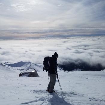
Westerly winds paired with new snow overnight have created the potential for shallow wind slabs above treeline on N-NE-E-SE-S aspects. Natural and human triggered wind slab avalanches are unlikely, but unstable snow may exist in isolated areas. Watch for recent deposits of wind transported snow in leeward terrain above 9,000ft.
Forecast Discussion
Three inches of wet and sloppy snow fell near treeline overnight, but uncertainty exists as to how much new snow fell above treeline where it stayed cold. Southwest, west, and northwest winds may have loaded leeward slopes and terrain features above treeline creating fresh wind slabs. Monitor change in the height of new snow as you gain elevation, and check to see how the new snow is bonding to the old snow surface.
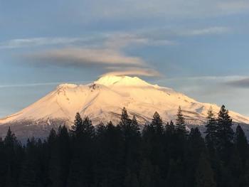
The overnight storm was warm, and once again delivered mostly rain to below treeline areas, a rain/snow mix near treeline, and a few inches of drier snow high on Mount Shasta. It’s just beginning though, and Thursday into next week looks colder with a good chance for a wallop of snow.
Recent Observations
The Old Ski Bowl weather station (7,600ft) recorded 3 inches of snow and .31 inches of water in the past 24 hours. Sand Flat (6,750ft) picked up 1 inch of snow. All this came in very wet and heavy with freezing levels near 7,500ft. Very light precipitation began yesterday around 2pm, but the majority of new snow and rain fell after midnight. Winds were southerly, but shifted west and northwest early this morning. Yesterday in the Old Ski Bowl, skies were cloudy and a few rumbles of thunder were heard. No avalanches or signs of instability were observed.
Weather and Current Conditions
Weather Summary
Lingering precipitation from the overnight storm will end by 10am this morning. A break in the active weather pattern should last through late afternoon on Wednesday. Today, expect mostly cloudy skies, highs in the 40s, and moderate southwest winds. The focus now shifts to the next system. Precipitation should begin late on Wednesday night, with the majority of rain and snow falling Thursday during the day. One inch of water is forecast during this time with 6,000-7,000ft snow levels. This low-pressure system should remain over the region on Friday and through the weekend.
-------------------------
THIS SEASON PRECIPITATION for MOUNT SHASTA CITY: Since October 1st (the wet season), we have received 7.88 inches of water, normal is 18.81 inches, putting us at 42% of normal. For the month of January and 2018, we have received 2.05 inches of water, normal is 3.60 inches, which is 57% of normal.
Always check the weather before you attempt to climb Mount Shasta. Further, monitor the weather as you climb. Becoming caught on the mountain in any type of weather can compromise life and limb. Be prepared.
24 Hour Weather Station Data @ 3:00 AM
| Weather Station | Temp (°F) | Wind (mi/hr) | Snow (in) | Comments | ||||||||
|---|---|---|---|---|---|---|---|---|---|---|---|---|
| Cur | Min | Max | Avg | Avg | Max Gust | Dir | Depth | New | Water Equivalent | Settlement | ||
| Mt. Shasta City (3540 ft) | 40 | 35 | 55 | 45 | 3 | N | ||||||
| Sand Flat (6750 ft) | 32 | 31 | 42 | 37 | 12 | 1 | .16 | 0 | ||||
| Ski Bowl (7600 ft) | 31 | 28 | 40 | 34 | 26 | 3 | .3 | 0 | ||||
| Gray Butte (8000 ft) | 29 | 27 | 38 | 33 | 10 | 37 | SW | |||||
| Castle Lake (5870 ft) | 32 | 31 | 46 | 38 | 0 | 0 | 0 | |||||
| Mount Eddy (6509 ft) | 29 | 29 | 43 | 37 | 1 | 14 | S | 9 | 0 | 0 | ||
| Ash Creek Bowl (7250 ft) | station down | |||||||||||
| Ash Creek Ridge (7895 ft) | station down |
Two Day Mountain Weather Forecast
Produced in partnership with the Medford NWS
| For 7000 ft to 9000 ft | |||
|---|---|---|---|
|
Tuesday (4 a.m. to 10 p.m.) |
Tuesday Night (10 p.m. to 4 a.m.) |
Wednesday (4 a.m. to 10 p.m.) |
|
| Weather | 40% chance of snow showers before 10am. Mostly cloudy. | Mostly cloudy | Rain likely after 4pm. Cloudy and breezy. Chance of precipitation 60%. |
| Temperature (°F) | 38 | 33 | 40 |
| Wind (mi/hr) | Southwest 5-10 mph | South/Southeast 5-10 mph | South 10-15 mph |
| Precipitation SWE / Snowfall (in) | / <.5 | / 0 | / 0 |
| For 9000 ft to 11000 ft | |||
| Tuesday | Tuesday Night | Wednesday | |
| Weather | 40% chance of snow showers before 10am then mostly cloudy. | Mostly cloudy. | 60% chance of rain after 4pm. Mostly cloudy and breezy. |
| Temperature (°F) | 38 | 33 | 40 |
| Wind (mi/hr) | Southwest 10-15 mph | South/Southeast <.5 | South 15-25 mph, gusting 30 mph |
| Precipitation SWE / Snowfall (in) | / <.5 | / 0 | / 0 |
Season Precipitation for Mount Shasta City
| Period | Measured (in) | Normal (in) | Percent of Normal (%) |
|---|---|---|---|
| From Oct 1, 2023 (the wet season) | 8.03 | 19.04 | 42 |
| Month to Date (since Apr 1, 2024) | 2.20 | 3.83 | 57 |
| Year to Date (since Jan 1, 2024) | 2.20 | 3.83 | 57 |

