

You are here
Avalanche Advisory for 2018-03-12 07:03
- EXPIRED ON March 13, 2018 @ 7:03 amPublished on March 12, 2018 @ 7:03 am
- Issued by Andrew Kiefer - Mt Shasta Avalanche Center
Bottom Line
A potent storm will begin this afternoon. Heavy rain and snow are expected tonight and tomorrow with snow levels ranging between 6,500-8,000 ft. The avalanche danger will rise over the next 24 hours as wind slabs develop above treeline.


Avalanche Problem 1: Wind Slab
-
Character ?

-
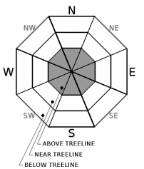
Aspect/Elevation ?
-
Likelihood ?CertainVery LikelyLikelyPossible
 Unlikely
 -
Size ?HistoricVery LargeLargeSmall

Strong southerly winds accompanying the storm will create wind slabs above treeline on leeward slopes. Wind slab development will occur late in the afternoon and overnight. Wind slabs will grow in size and distribution as the storm progresses. As snow begins to accumulate today, watch for blowing snow, cornices/wind lips, textured snow surfaces and hollow sounding snow as evidence wind loading has occurred.
Forecast Discussion
The bulk of precipitation will come between 11 pm tonight through 5 pm tomorrow. Avalanche danger will rise to MODERATE late this afternoon and overnight as wind slabs develop. Storm slabs will likely become a problem tomorrow as a rapid load of new snow is added to our snowpack. The rain/snow line will be as high as 8,000 ft during the storm. Rain may melt much of our existing low elevation snowpack, while several feet of snow expected near and above treeline will create dangerous avalanche conditions tomorrow.
Recent Observations
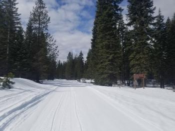
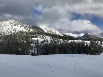
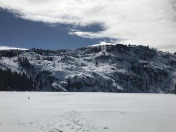
Spring-like weather brought warm temperatures and sunshine yesterday. Highs in Mount Shasta City hit 62 degrees and the mid 40s on Grey Butte at 8,000 ft. Light winds blew out of the SE in the afternoon but ramped up overnight with gusts to 30 mph near treeline. No avalanche activity has occurred over the past week. Shallow snowpack hazards still exist in all zones throughout the advisory area. The Pilgrim Creek Snowmobile Park trails have recently been groomed.

Weather and Current Conditions
Weather Summary
A strong frontal system will impact the area tonight through Tuesday bringing heavy rain and snow. Skies will remain clear this morning with increasing cloud cover throughout the day. Highs will be in the mid 40s and south winds will become strong this afternoon and overnight. Precipitation should begin after 5pm, with the bulk of rain and snow expected overnight and during the day tomorrow. Snow levels will be high ranging between 6,500-8,000 ft over the next 48 hours. The advisory area should receive over 2 inches of water by Wednesday morning. This should translate to 18-24 inches of snow for upper elevation terrain. Precipitation will continue through the end of the week.
24 Hour Weather Station Data @ 6:00 AM
| Weather Station | Temp (°F) | Wind (mi/hr) | Snow (in) | Comments | ||||||||
|---|---|---|---|---|---|---|---|---|---|---|---|---|
| Cur | Min | Max | Avg | Avg | Max Gust | Dir | Depth | New | Water Equivalent | Settlement | ||
| Mt. Shasta City (3540 ft) | 32 | 27 | 62 | 45 | 1 | N | ||||||
| Sand Flat (6750 ft) | ||||||||||||
| Ski Bowl (7600 ft) | 31.5 | 26.5 | 42.5 | 34.5 | 61.5 | 0 | 0 | .5 | ||||
| Gray Butte (8000 ft) | 30 | 28 | 41.5 | 33.5 | 8 | 25 | E | station down | ||||
| Castle Lake (5870 ft) | 31.5 | 31.5 | 31.5 | 31.5 | 27 | 0 | 0 | |||||
| Mount Eddy (6509 ft) | 34 | 25 | 45 | 36.5 | 2 | 9 | WSW | 41 | 0 | 1 | ||
| Ash Creek Bowl (7250 ft) | station down | |||||||||||
| Ash Creek Ridge (7895 ft) | station down |
Two Day Mountain Weather Forecast
Produced in partnership with the Medford NWS
| For 7000 ft to 9000 ft | |||
|---|---|---|---|
|
Monday (4 a.m. to 10 p.m.) |
Monday Night (10 p.m. to 4 a.m.) |
Tuesday (4 a.m. to 10 p.m.) |
|
| Weather | Rain and snow likely after 11am. Chance of precipitation 70% | Heavy rain and windy. Chance of precipitation 100%. | Rain and snow, becoming all snow after 11am. Windy with a chance of thunderstorms. |
| Temperature (°F) | 39 | 37 | 35 |
| Wind (mi/hr) | S 10-15 mi/hr | S 10-15 mi/hr | S 10-15 mi/hr |
| Precipitation SWE / Snowfall (in) | / < .5 | / 0 | / 5-9 |
| For 9000 ft to 11000 ft | |||
| Monday | Monday Night | Tuesday | |
| Weather | Snow mainly after 11am. Windy. | Heavy snow and windy | Snow. The snow could be heavy at times. Slight chance of thunderstorms. |
| Temperature (°F) | 26 | 25 | 20 |
| Wind (mi/hr) | S 25-35 mi/hr | S 2-3 | S 35-45 mi/hr |
| Precipitation SWE / Snowfall (in) | / 2-3 | / 5-8 | / 18-24 |
Season Precipitation for Mount Shasta City
| Period | Measured (in) | Normal (in) | Percent of Normal (%) |
|---|---|---|---|
| From Oct 1, 2023 (the wet season) | 12.52 | 32.15 | 39 |
| Month to Date (since Apr 1, 2024) | 1.63 | 2.65 | 62 |
| Year to Date (since Jan 1, 2024) | 6.69 | 16.94 | 39 |

