

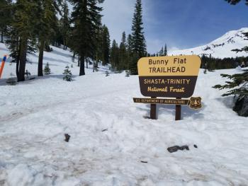
You are here
Avalanche Advisory for 2018-04-04 06:15
- EXPIRED ON April 5, 2018 @ 6:15 amPublished on April 4, 2018 @ 6:15 am
- Issued by Aaron Beverly - Mount Shasta Avalanche Center
Bottom Line
Avalanche danger is LOW at all elevations. Watch for wet loose instabilities and falling rime ice during periods of intense solar radiation. An atmospheric river event will bring significant rain to the region starting tomorrow night.


Avalanche Problem 1: Normal Caution
-
Character ?

-
Likelihood ?CertainVery LikelyLikelyPossible
 Unlikely
 -
Size ?HistoricVery LargeLargeSmall

Generally safe avalanche conditions exist in the backcountry. Both natural and human triggered avalanches are unlikely. Exercise NORMAL CAUTION and watch for isolated wet loose instabilities on steep southerly aspects. Strong solar radiation and warm temperatures can cause wet loose avalanches. Travel when the snow surface is colder and stronger. Avoid crossing on or under very steep sunlit slopes with wet, unconsolidated snow surfaces.
Forecast Discussion
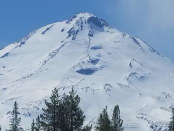
Cloud cover may keep snow surfaces cooler today despite warm temperatures. Snow above treeline will be smooth and firm. If climbing, bring crampons and an ice axe to help prevent a slide for life. Falling ice below Red Banks and the Trinity Chutes is possible. Wear a helmet if traveling below these areas.
Tomorrow night a potent storm will begin impacting the region. Monitor the advisory over the next few days for updates on changing conditions.
Recent Observations
The last 24 hours saw light steady winds blowing from the west. Temperatures averaged 39 °F with highs reaching 45 °F. The snowpack settled about 1 in.
Snow surfaces are firm and icy at upper elevations, and a corn cycle has begun on southerly aspect below 9,000 ft. Not much wet loose activity has been seen in the last couple of days.
Ash Creek Butte has good snow coverage above 6,500 ft with consistent snow depths of 4-6 ft. Below, the Tri-Forest Snowmobile area trails are getting thin and melting out quickly. The east side climbing routes on Mount Shasta have good coverage, but access is limited by several miles of snow covered roads.
Weather and Current Conditions
Weather Summary
There is a slight chance of rain today and tonight below 8000 ft. A skiff of snow may be seen above. Expect light S winds below 9000 ft, moderate SW winds up to 25 mi/hr above. Temperatures will reach the upper 40's at 7000 ft.
An atmospheric river event will bring the Pineapple Express back to station tomorrow night. Over 2 inches of water is contained in this one. Snow levels are expected to remain over 7000 ft for the bulk of it.
24 Hour Weather Station Data @ 4:00 AM
| Weather Station | Temp (°F) | Wind (mi/hr) | Snow (in) | Comments | ||||||||
|---|---|---|---|---|---|---|---|---|---|---|---|---|
| Cur | Min | Max | Avg | Avg | Max Gust | Dir | Depth | New | Water Equivalent | Settlement | ||
| Mt. Shasta City (3540 ft) | 46 | 25 | 67 | 50.5 | 1 | N | ||||||
| Sand Flat (6750 ft) | station down | |||||||||||
| Ski Bowl (7600 ft) | 36 | 31.5 | 48 | 39.5 | 73.5 | 0 | 0 | 1 | ||||
| Gray Butte (8000 ft) | 34 | 32 | 45.5 | 37.5 | 10 | 25 | WNW | |||||
| Castle Lake (5870 ft) | station down | |||||||||||
| Mount Eddy (6509 ft) | 39 | 26 | 48.5 | 41 | 2 | 7 | WSW | 40.5 | 0 | 1 | ||
| Ash Creek Bowl (7250 ft) | station down | |||||||||||
| Ash Creek Ridge (7895 ft) | station down |
Two Day Mountain Weather Forecast
Produced in partnership with the Medford NWS
| For 7000 ft to 9000 ft | |||
|---|---|---|---|
|
Wednesday (4 a.m. to 10 p.m.) |
Wednesday Night (10 p.m. to 4 a.m.) |
Thursday (4 a.m. to 10 p.m.) |
|
| Weather | A slight chance of rain and snow before 11 a.m., then a slight chance of rain. Mostly cloudy. Chance of precipitation is 20%. | A 50 percent chance of rain. Cloudy. | Rain and snow likely before 11 a.m., then rain. Chance of precipitation is 90%. Little or no snow accumulation expected. |
| Temperature (°F) | 48 | 35 | 41 |
| Wind (mi/hr) | S 5-10 | S 5-10 | S 10-15 |
| Precipitation SWE / Snowfall (in) | / 0 | / 0 | / 0 |
| For 9000 ft to 11000 ft | |||
| Wednesday | Wednesday Night | Thursday | |
| Weather | A 30 percent chance of snow, mainly before 11 a.m. Mostly cloudy | Snow likely, mainly before 11 p.m. Cloudy. Chance of precipitation is 60%. | Snow. Windy. Chance of precipitation is 100%. |
| Temperature (°F) | 29 | 26 | 31 |
| Wind (mi/hr) | SW 15-20 | SW <1 | SW 30-35 |
| Precipitation SWE / Snowfall (in) | / <1 | / <1 | / <1 |
Season Precipitation for Mount Shasta City
| Period | Measured (in) | Normal (in) | Percent of Normal (%) |
|---|---|---|---|
| From Oct 1, 2023 (the wet season) | 15.95 | 35.81 | 45 |
| Month to Date (since Apr 1, 2024) | 0.00 | 0.35 | 0 |
| Year to Date (since Jan 1, 2024) | 10.12 | 20.60 | 49 |

