

You are here
Avalanche Advisory for 2016-04-05 06:42:10
- EXPIRED ON April 7, 2016 @ 6:42 amPublished on April 5, 2016 @ 6:42 am
- Issued by Jon Dove - Shasta-Trinity National Forest
Bottom Line
LOW avalanche danger exists for all elevations and aspects across the forecast area this morning. MODERATE danger will develop through the afternoon as the sun softens snow on E-SE-S-SW aspects on slopes 35 degrees and steeper below 10,000 feet. Human trigger of loose wet snow instabilities will be possible. Poor overnight refreeze near and below treeline may elevate potential for loose wet avalanches.
THIS ADVISORY EXPIRES ON APRIL 7th @ 7 AM


Avalanche Problem 1: Loose Wet
-
Character ?

-
Aspect/Elevation ?
-
Likelihood ?CertainVery LikelyLikelyPossible
 Unlikely
 -
Size ?HistoricVery LargeLargeSmall

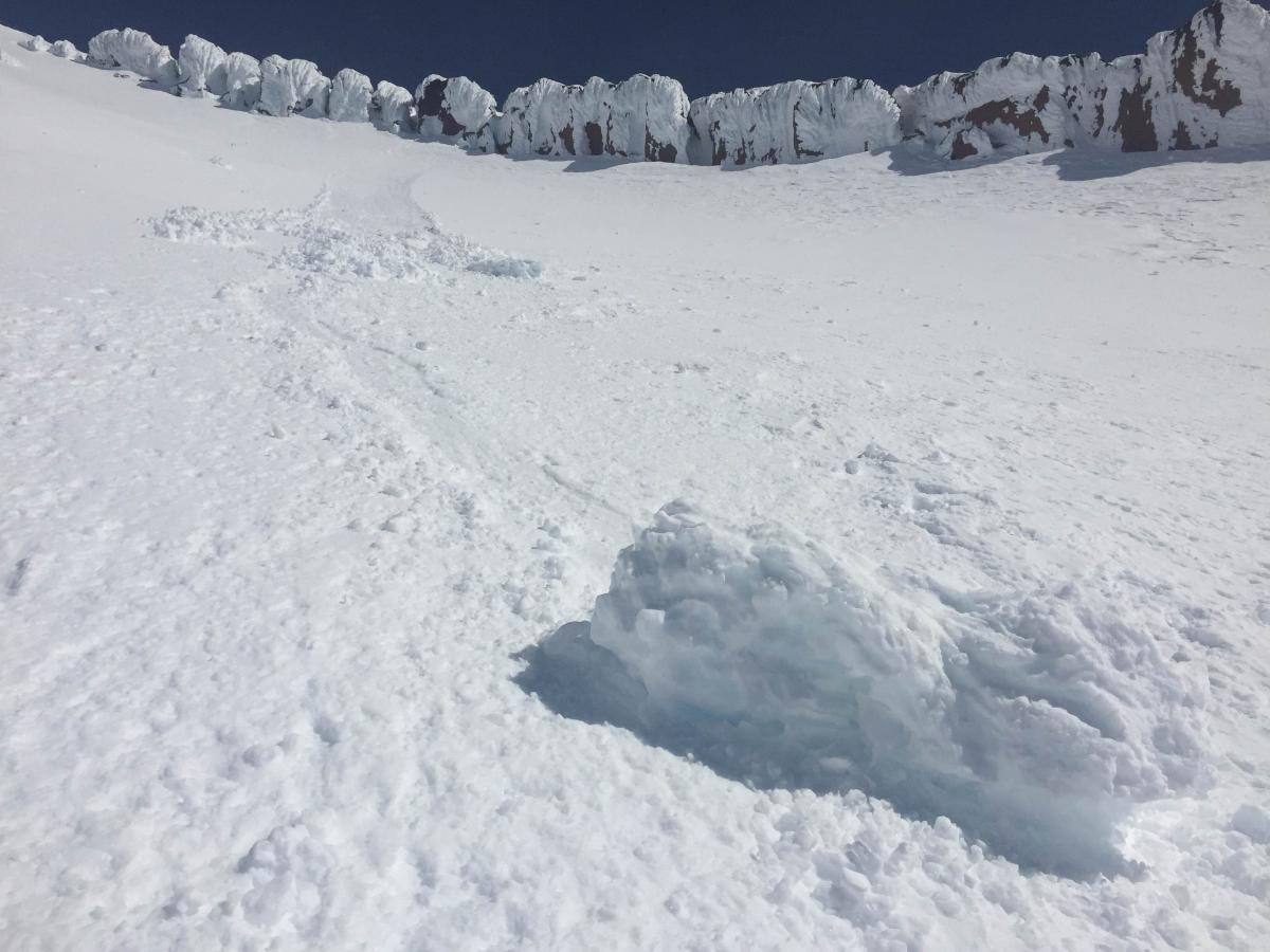
Avalanche danger for loose wet snow instabilities such as roller balls, pinwheels, and point release loose wet snow avalanches will increase today and Wednesday as temperatures steadily rise. Loose wet slides generally are not the big "killers" in the backcountry, but that does not mean they should be taken lightly. They could easily entrain enough snow to be a hazard to back country travelers. The snow is typically wet and heavy, and could knock you off of your feet and take you over a cliff, strain you through trees, or push you into a terrain trap where enough snow may gather to fully bury you. Snow will be most susceptible to solar gain, and therefore failure, on sun exposed E-SE-S-SW aspects on slopes 35 degrees and steeper. Be cautious with your route finding and back country travel skills. Ski one at a time to and from "safe zones", and space out when crossing suspect slopes. Continue to be smart and safe out there while enjoying the famous Mount Shasta corn snow!
Forecast Discussion
Despite being an otherwise bright and sunny day, slightly cooler temperatures and some high, thin Stratus clouds kept things fairly mild for the day. The snow's surface did soften up a bit near and below treeline, but not enough to influence any loose wet snow instabilities. A high pressure ridge is beginning to build over the region and after a cool morning, temperatures will trend rapidly upward by the afternoon. Expect today to be around 10 degrees warmer than yesterday. Northerly winds will begin to shift to the East by this evening and the resulting pressure gradient will bring an increase in wind speeds. Light to moderate north winds will be 15-30 mph above treeline today, and 20-35 mph tonight. Ridge top winds, especially at the higher elevations, will see gusts of 40+ mph overnight. By Wednesday morning winds will begin to ease slightly. The freezing level is set to rise to around 11,000 feet today, stay that way tonight, and reach 12,000 feet by tomorrow. We could see loose wet snow instabilities at higher elevations both Wednesday and Thursday as temperatures are set to be well above normal this week with record high's being met or broken.
THIS SEASON PRECIPITATION for MT SHASTA CITY: Since October 1st (the wet season), we have received 36.76 inches of water, normal is 35.92 inches, putting us at 102% of normal. For the month of April we've received 0.03 inches of water, normal is 0.46 inches, putting us at 6% of normal, and finally... for the year of 2016 we've received 27.27 inches of water, normal is 20.71 inches, putting us at 131% of normal.
Recent Observations
The sun was shining bright yesterday, by the cool air that swooped in behind the cold front that passed through kept the day from feeling unseasonable. The cool temperatures coupled with moderate winds kept the snow in place, and no loose wet snow avalanches were reported. That is all going to change starting today. Temperatures will begin to climb, and by the afternoon we should reach a level around 10 degrees warmer than yesterday. Wednesday will be warmer, and Thursday warmer still. This will, in turn, increase the avalanche danger for loose wet snow instabilities. We typically are worried through the winter of dry slab avalanche problems that take the form of wind slabs, storm slabs, or even persistent slabs. Loose wet snow avalanche problems such as roller balls, pinwheels, and point release loose wet slides are not generally the big "killers" in the back country. That does not, however, mean that they should be ignored. A loose wet slide could entrain enough snow to easily knock a person off of their feet and push them over a cliff, strain them through trees, or push one into a terrain trap where enough snow may gather to easily bury a person. They consists of wet and heavy snow that could twist a knee, tweak a back, or cause other physical harm as well. Therefore, loose wet snow instabilities should be on your radar over the coming days. "Where might these loose wet instabilities be found?" you might be thinking. You will encounter, and could possibly trigger, loose wet avalanches on sun exposed E-SE-S-SW-W facing aspects on slopes 35 degrees and steeper during the warmest parts of the day. You can avoid any incidents involving loose wet snow by continuing to practice safe back country travel techniques. Space out when crossing steep, sun exposed aspects, identify and ski one at a time to and from "safe zones", and use good group communication. Be smart, stay safe, and have fun out there!
Climbing Conditions: Current climbing conditions are good to great. Good overnight refreeze has made for firm snow conditions in the morning hours, then softening up some by the afternoon. Steadily increasing temperatures this week with overnight lows above freezing near and below treeline will limit the potential for snow to refreeze at night. At higher elevations (11,000 feet and above), however, snow will refreeze overnight and be firm in the morning hours making crampons necessary equipment. Rime ice is still a concern. Large chunks of rime ice can do some damage! Other snow conditions on the mountain consist of scattered scabs of wind effected snow and sastrugi features creating for less than ideal skiing in some areas. Skiers have been reporting great conditions where one may link up sections of smooth snow. Below treeline, tree wells are starting to show dirt in our lower elevation areas (6,000 feet and below) like Castle Lake. Coverage is still decent, but melting fast with the warm temps.
- Avalanche Danger & Weather: You may encounter a variety of snow conditions during the spring time. Late season storms can bring fresh snow and high winds to the mountains. Avalanche danger can quickly spike due to new wind and storm slabs on top of icy, firm melt/freeze snow. Further, warm and sometimes downright hot days can create loose wet avalanches. Low danger in the cool morning hours may rise rapidly to higher danger during the afternoon hours on sunny aspects. These are two different avalanche problems associated with different weather patterns with both being possible during the same week, or even the same day. A beacon, shovel and probe continue to be essential, even during Spring time. Always check the avalanche advisory before starting your climb, and call the ranger station for the latest in weather and conditions. Spring time weather patterns can bring it all. The point is... you need to bring the appropriate attire to accommodate all weather conditions. Snow, rain, sun, wind... you can count on all of it on Shasta at some point during Spring time. Further, Mt Shasta can often host a cloud cap creating poor visibility conditions. DO NO climb into a white-out. It is very easy to wander off the WRONG side of Mt Shasta when on the upper mountain, >12,500 feet. This can create a long day and perhaps night for climber, party members, rescue resources and family. Play it safe.
- Firm and smooth snow (slide for life conditions): Snow conditions on Mount Shasta are great right now. That being said, the snow in the morning hours is quite firm and very smooth. These types of conditions have caused serious injury in the past to those who slip, trip, or fall and fail to self-arrest as they slide. You MUST know how to self-arrest with an ice axe. This is one of your best defenses for a safe trip on Mt Shasta. Practice this and other climbing skills on small slopes in soft snow along the side of a gully or just above Helen Lake. Any where will little consequence if you can not stop. If you fall, you must immediately self-arrest or you will take a long, sliding, tumbling fall resulting in serious injury or death. Along with your solid ice axe skills, know how to walk/climb with crampons on. It is easy to catch the front points of the crampon on the cuff of your pant leg resulting in a fall if you are not careful with each step.
- Rime Ice: We've been talking about rime ice for over a week now. What is rime ice? Rime ice forms on rocks, towers, etc. as super cooled water droplets freeze upon contact with a solid object. The ice grows into oncoming wind taking on a cauliflower like appearance. The exposed rocks on Mt Shasta at higher elevations are currently plastered in rime ice. This hazard will diminish as the ice flakes off on warm days, but until then... HEADS UP! You absolutely should wear a helmet if climbing. As the days warm, chances increase of getting hit by falling ice.
Enjoy the backcountry skiing/riding and good climbing as the melt/freeze cycle begins! Be sure to stay on your "A" game this Spring...
This is a fantastic photo by S. Rathbun taken on April 1st highlighting the rime ice hazard. Red Banks looms above and is plastered in rime ice. A large chunk as fallen off in this photo and slid down the slope. As climbers make their way up Avalanche Gulch, until all the rime is melted off, this hazard is a serious one.
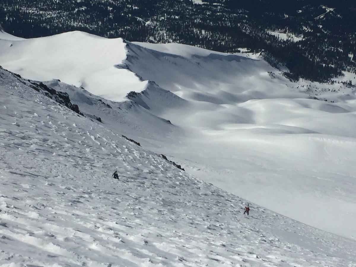
4.1.16 - Looking down Avalanche Gulch with Green Butte ridge to the left. Note sastrugi snow surface conditions. This photo was taken from near The Heart of the Avalanche Gulch route. Lake Helen is barely visible middle, right side of photo. Photo: S Rathbun
-----------------------------------------------------------------------------------------------------------------------------------------------------------
LOCAL AREA ROAD, NORDIC, AND SNOWMOBILE PARK STATUS:
The Sand Flat cross country ski trails are in good shape still and ready for your cross country skis and snow shoes. These are backcountry routes marked with blue diamonds on trees. Trails are not groomed. Snow shoers, please blaze a parallel trail to cross country skiers staying out of the skin track. These trails can be accessed via the Everett Memorial Highway. Thank you, and enjoy!
The Mt. Shasta Nordic Center is CLOSED for the season. http://www.mtshastanordic.org
The Pilgrim Creek & Deer Mountain Snowmobile Parks are open, however snow is dwindling fast at these locations. One had to drive down the 19 road (Military Pass) a mile or so to get to consistent snow before unloading just a few days ago. Head to our "Education" tab on our website and find the snowmobile section for trail information, grooming status, and other sledder resources.
The Castle Lake Road is OPEN. The Everett Memorial Highway is OPEN. The Castle Lake and Everett Hwy are plowed year round to the trailheads. The roads are not always first priority, so your dawn patrol powder mission might be ceased if the plow has not made it up yet. Siskiyou County does a great job keeping the roads clear. Be respectful of the plow drivers if you encounter them. If you get to Bunny Flat before or during when the plow is there, please park on the uphill, LEFT side of the parking lot as you drive in. This is uphill and lookers right of the bathrooms. Thank You!
The Five Red Flags of Avalanche Danger any time of year include: 1) Recent/current avalanche activity 2) Whumphing sounds or shooting cracks 3) Recent/current heavy snowfall 4) Strong winds transporting snow 5) Rapid warming or rain on snow.
Weather and Current Conditions
Weather Summary
Good Morning! In Mt Shasta City at 0500, we have a current temperature of 39 F, the same as yesterday at this time. Skies are clear with light northerly wind.
On Mt Shasta (South Side) in the last 24 hours...
Old Ski Bowl - 7,600 feet, the current temperature is 33 degrees F. Snow on the ground totals 142 inches with no new snow and 1 inch of settlement. Temperatures have ranged from 28 F to 44 F.
Gray Butte - 8,000 feet, the current temperature is 36 degrees F. Temperatures have ranged from 29 F to 41 F. Wind speeds are not available for Gray Butte at this time. The anemometer was taken down due to the need for repairs. Thank you for your understanding.
Mt Eddy Range (West side of Interstate-5)...
Castle Lake - 5,600 feet, the current temperature is 32 degrees F. Temperatures have ranged from 31 F to 46 F. Snow on the ground totals 64 inches with no new snow and 1 inch of settlement.
Mt Eddy - 6,500 feet, the current temperature is 35 degrees F. Temperatures have ranged from 27 F to 41 F. Snow on the ground measures 75 inches with no new snow and 1 inch of settlement. Winds have been variable in nature with an average of 2 mph, and a maximum gust of 12 mph, ESE.
Always check the weather before you attempt to climb Mt Shasta. Further, monitor the weather as you climb. Becoming caught on the mountain in any type of weather can compromise life and limb. Be prepared.
| 0600 temperature: | 29 |
| Max. temperature in the last 24 hours: | 43 |
| Average wind direction during the last 24 hours: | N/A |
| Average wind speed during the last 24 hours: | N/A mi/hr |
| Maximum wind gust in the last 24 hours: | N/A mi/hr |
| New snowfall in the last 24 hours: | 0 inches |
| Total snow depth: | 85 inches |
Two Day Mountain Weather Forecast
Produced in partnership with the Medford NWS
| For 7000 ft to 9000 ft | |||
|---|---|---|---|
|
Tuesday (4 a.m. to 10 p.m.) |
Tuesday Night (10 p.m. to 4 a.m.) |
Wednesday (4 a.m. to 10 p.m.) |
|
| Weather | Sunny | Clear | Sunny |
| Temperature (°F) | 53 | 44 | 64 |
| Wind (mi/hr) | North 10-15 mph | Northeast 10-15 mph | East 10-15 mph |
| Precipitation SWE / Snowfall (in) | / 0 | / 0 | / 0 |
| For 9000 ft to 11000 ft | |||
| Tuesday | Tuesday Night | Wednesday | |
| Weather | Sunny and breezy | Clear and windy | Sunny and breezy |
| Temperature (°F) | 34 | 34 | 40 |
| Wind (mi/hr) | North 15-20 mph with gusts to 30 mph | Northeast 0 | East 15-20 mph with gusts to 30 mph |
| Precipitation SWE / Snowfall (in) | / 0 | / 0 | / 0 |

