

You are here
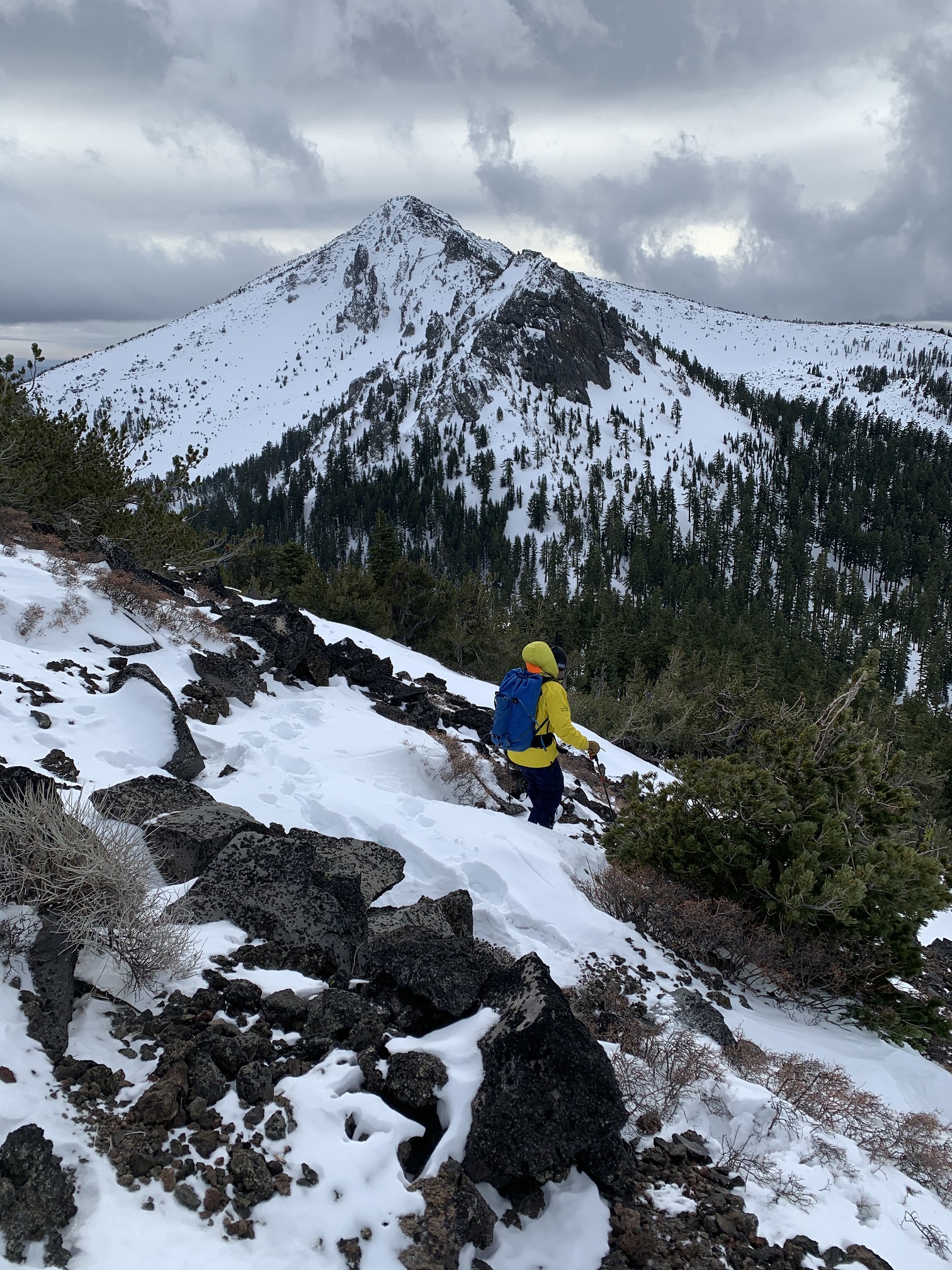
Ash Creek Butte
 was installed and working.")
Location Name:
Ash Creek ButteRegion:
East of Mt ShastaDate and time of observation:
Wed, 12/30/2020 - 2:30pmObservation made by:
ForecasterLocation Map
96067
Mount Shasta
, CA
United States
41° 27' 32.8572" N, 122° 2' 47.1876" W
See map: Google Maps
California US
Snowpack Observations
Details
Photos
Weather Observations
Statistics
Cloud Cover:
75% of the sky covered by cloudsBlowing Snow:
YesPrecipitation:
SnowAccumulation rate:
Less than 1 in. per hourAir temperature:
Below FreezingAir temperature trend:
CoolingWind Speed:
LightWind Direction:
South

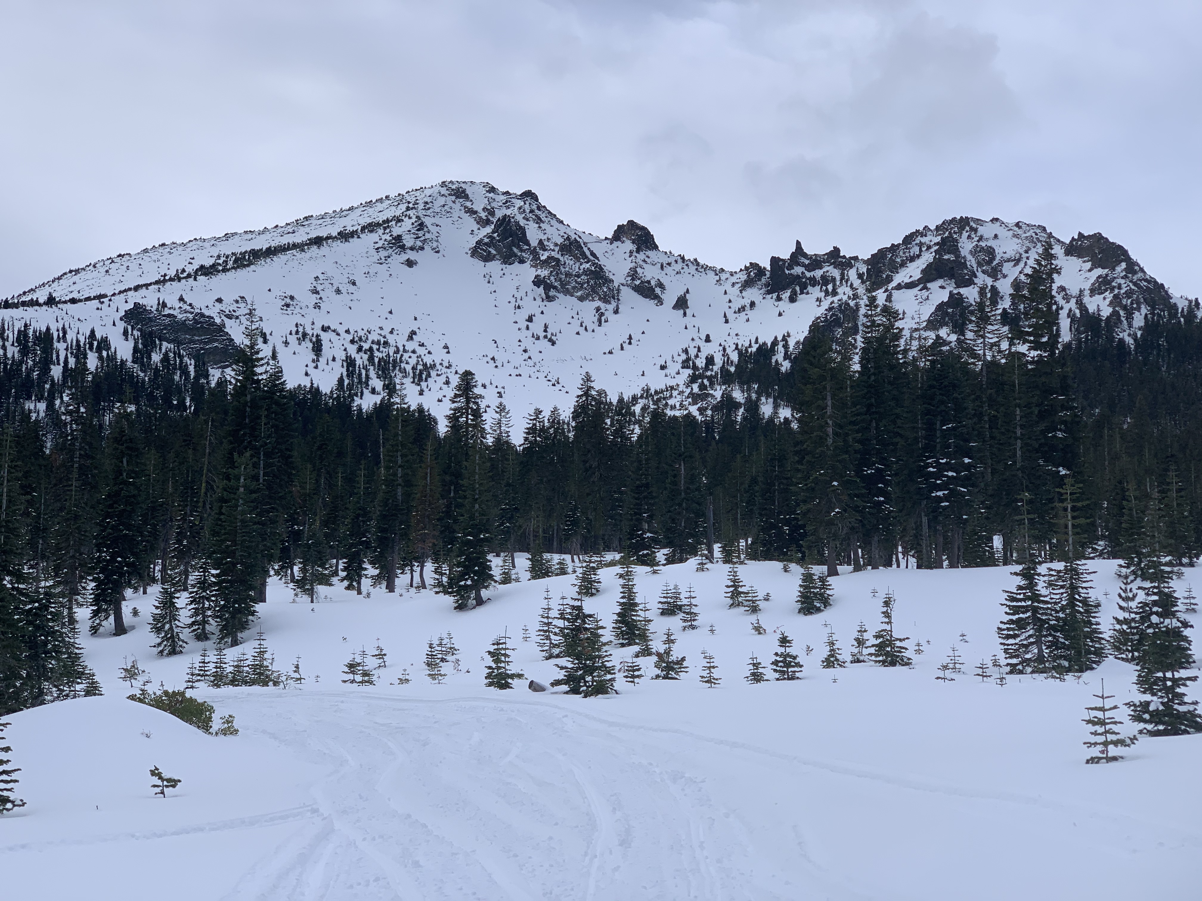
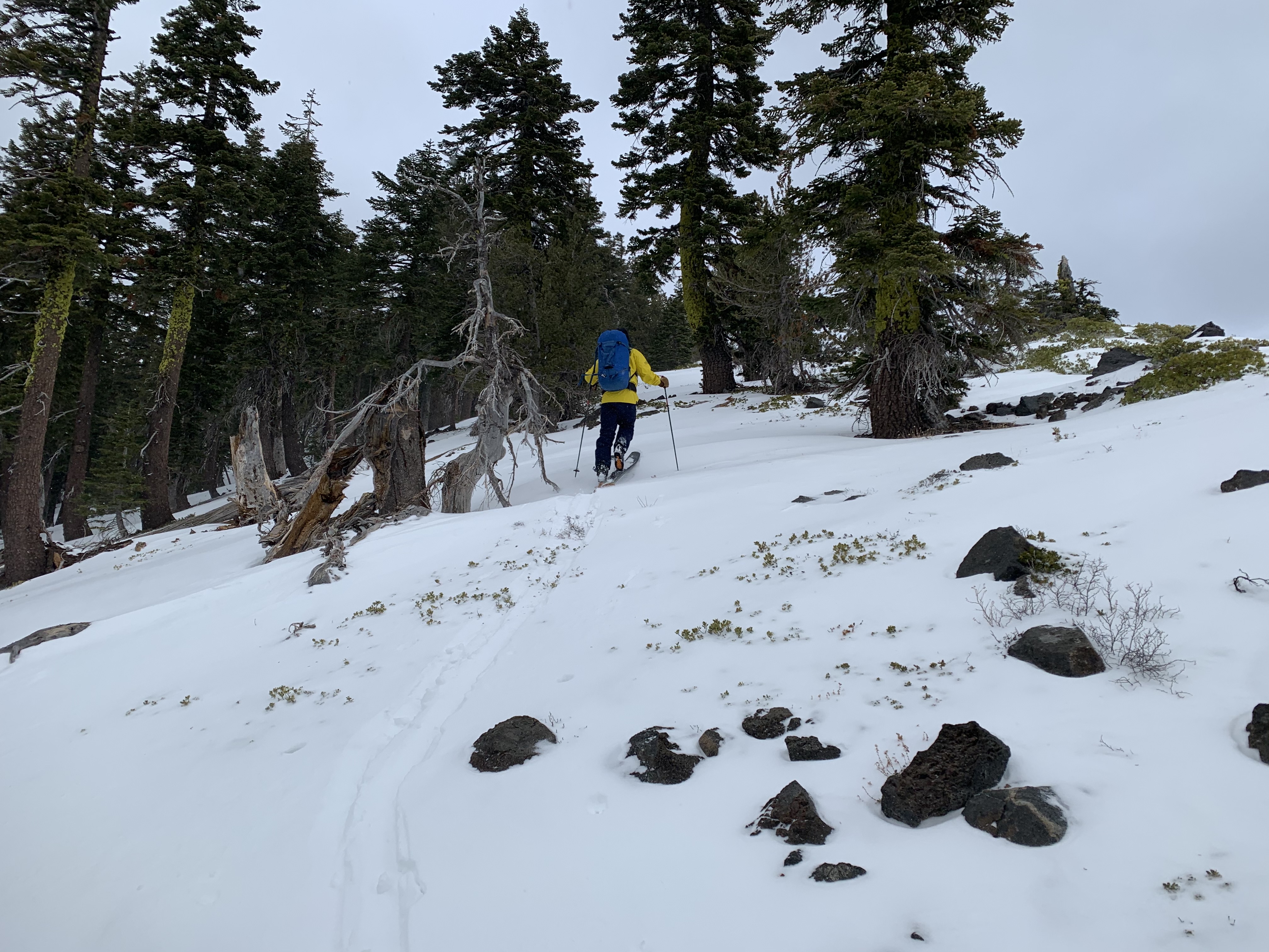
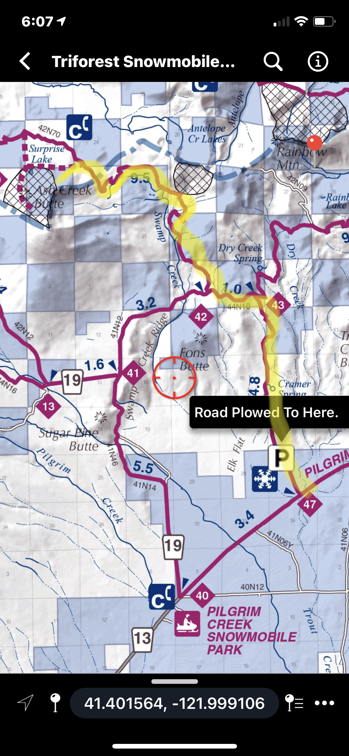
Today, Aaron and I went out to Ash Creek Butte to install an anemometer (wind sensor) on the ridge station and to update the operating systems for the data loggers on both the ridge and bowl stations. We approached via the Cramer Springs road (43) off Pilgrim Ck road, (see photo illustration). The Pilgrim Creek Sno-Park has snow on the ground, but logging operations have roads plowed past the park. Variable road conditions and unknown plowing regimes make for your best guess on truck and trailer approaches. All part of the adventure, eh?
Mostly clear skies started the day, but tonight's incoming storm began to blow in around the noon hour. The afternoon included very light snow flurries (no accumulation), gusty winds out of the south and gradually increasing clouds. Snow conditions remain variable. Soft, powder snow can still be found below and near treeline on wind protected, colder aspects (E-NE-N-NW) and other warmer aspects shaded by large trees. Above treeline is more scoured and hosts less snow. One will find wind packed powder, variable sastrugi and icy crusts. Tree wells are showing in many areas at all elevations. A number of rocks were hit with skis. Tree stumps were nudged by snowmobiles. It's recommended to still tread lightly out there with all recreational snow equipment!
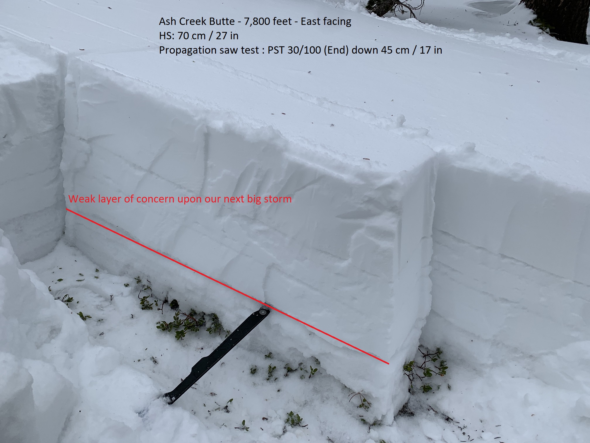
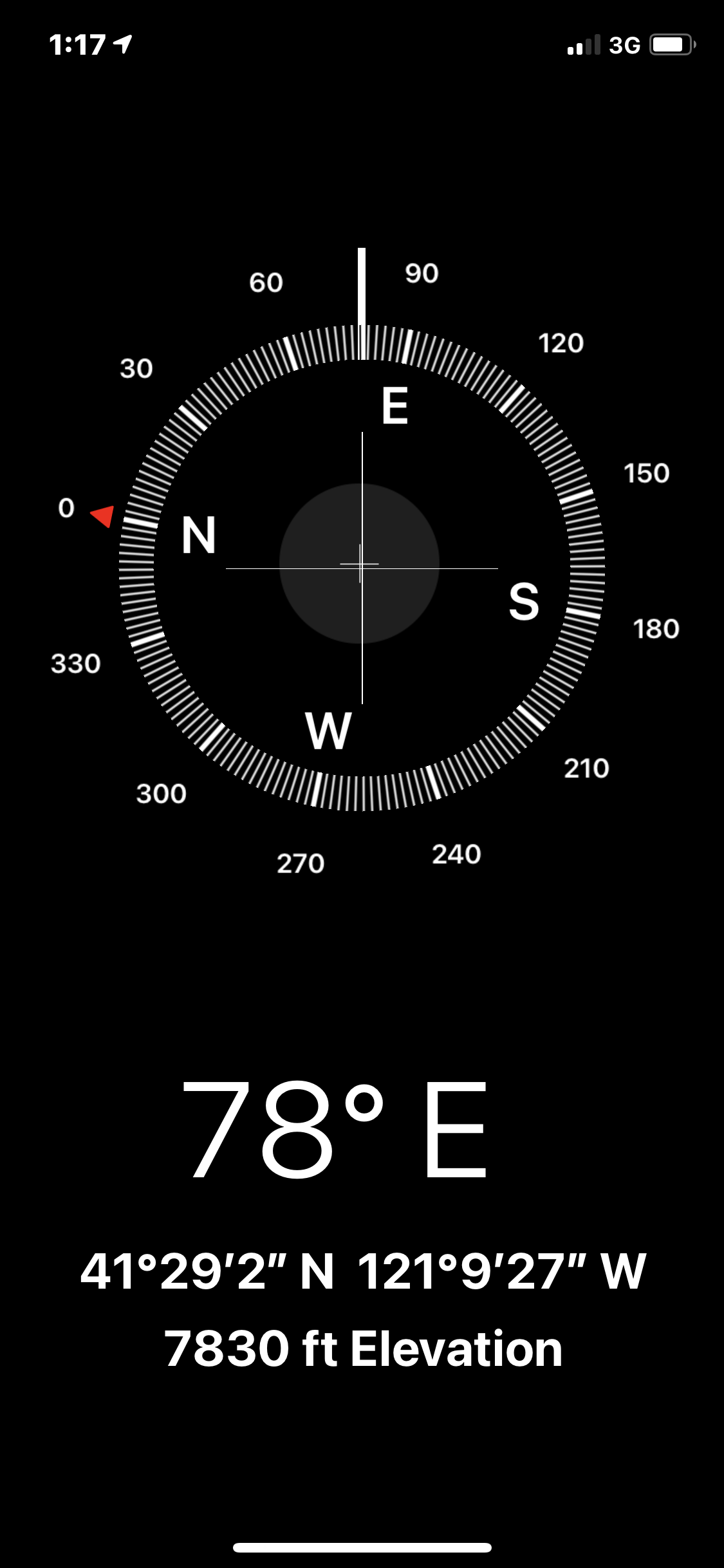
Along the northeast crest on cold northerly aspects, a persistent weak layer continues to be found. Today, we found it first dig on an E/NE facing slope at 7,800 feet near treeline. This layer is 45-50 cm deep and consists of a 3-5 cm thick layer of weak, sugary, faceted snow. A propagation saw test - PST 30/100 (End) down 45 cm - illustrated unstable conditions for this layer and a propensity to propagate. The question is if this persistent weak layer is widespread enough on an avalanche prone slope to become a problem with our next big storm. A couple inches tonight will not awake this layer. However, it will be important to monitor this layer and remember it upon our next big dump.
Overall, a bit of blowing snow was observed from southerly winds today, but no wind slab formation.
Oh, and by the way, both the bowl and ridge weather stations are functioning. Access the data via our weather tab on the site!