

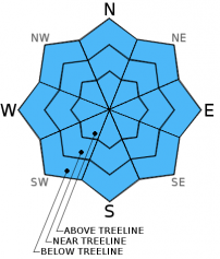
You are here
Avalanche Advisory for 2013-03-23 06:18:07
- EXPIRED ON March 24, 2013 @ 6:18 amPublished on March 23, 2013 @ 6:18 am
- Issued by Nick Meyers - Shasta-Trinity National Forest
Bottom Line
The avalanche danger for today is low for all aspects and elevations. This past week we received a warm storm that brought 4"-8" inches of snow to elevations above 6,500 ft and rain below that. Yesterday, northwest winds howled on the mountain for the majority of the day and any snow available for transport probably got blown away! The main concern for today will be areas of wind deposited snow in isolated areas near rock outcrops, chutes, gullies and wind eddies. Wind slabs will be small, hard to find and likely of no consequence if triggered. Remember that low avalanche danger means that avalanches are still possible!


Avalanche Problem 1: Wind Slab
-
Character ?

-
Aspect/Elevation ?
-
Likelihood ?CertainVery LikelyLikelyPossible
 Unlikely
 -
Size ?HistoricVery LargeLargeSmall

While the north wind has blown most of the snow away, small wind slabs will be found in isolated areas on Mt. Shasta near rock outcrops, chutes, gullies and wind eddies. These wind slabs are small in size, and if triggered, will likely not be of consequence. It will still be prudent to keep your eye out for potentially larger pockets of wind deposited snow as you travel on the mountain.
Avalanche Problem 2: Normal Caution
-
Character ?

-
Likelihood ?CertainVery LikelyLikelyPossible
Unlikely
-
Size ?HistoricVery LargeLargeSmall
Recent Observations
Overall, snow conditions are in transition and a variety of skiing conditions will be found out in the backcountry. Four to six inches of new snow fell this past work week over Tuesday night and Wednesday. Snow levels were high, above 6,500 feet mostly for that storm. Any elevations lower than that reveived rain on snow and took a hit. The Castle Lake area has reported grim snow coverage and the lake is looking quite slushy. On the mountain, pack powder and "cardboard" like snow exist with erosional wind features mixed in.
Most areas are scoured and firm from the north winds of the past few days. Snowpits were difficult to even dig in most areas above treeline.
No recent avalanche activity has been witnessed or reported.
While loose-wet avalanches are not a concern at this time, as Spring approaches and temperatures begin to warm, spring skiers and climbers should keep these type of avalanches in mind. Sunny days and spring time can cause folks to forget their "avalanche awareness". Loose-wet slides occur every year on Mt. Shasta and can be very large and harmful to human life! This is a great video from the Gallatin Avalanche Center, Bozeman, MT demonstrating small loose-wet slides: http://www.youtube.com/watch?v=zWpRQzgtL3o&feature=share&list=PLXu5151nmAvT7gHqdNajDBGfGY4u5XMSL
Weather and Current Conditions
Weather Summary
Northwest flow continues today which will host more wind for the first half of the day. We should see winds die down in the afternoon, though likely still windy on the upper mountain, above 12,000 feet. The Medford sounding is already showing warmer temperatures this morning and a general warming trend is in effect through the end of the weekend. Nothing extremely notable for this weekend other that a couple beautiful days.
Next week near Tuesday afternoon will host a change in the weather pattern which appears more like "spring showers" than a "winter storm". Snow levels should be 5,000 to 6,000 feet with a few tenths of an in of water forecasted.
WEATHER STATIONS - (last 24 hours):
In Mt. Shasta City at 0500, we have clear skies and with and a current temperature of 25 F.
On Mt. Shasta: In the Old Ski Bowl (7,600') on the south side of Mt. Shasta, we have a current temperature of 21F. Snow on the ground totals 106" inches with no setttlement. Temperatures have ranged from 21F to 35F. At Grey Butte (8,000') on the south side of Mt. Shasta winds averaged 40-50 mph from the NNW up to 0900 yesterday, then switched to ESE, averaging 5-10 mph and with a max gust of 71 mph over the last 24 hours. The current temperature is 25F and temps have ranged 16F to 30F. While winds decreased on Gray Butte, northwest winds ripped all day long on the upper mountain, visible from town.
Castle/Mt. Eddy: Castle Lake - Castle Lake is hosting a current temp of 18F. Temperatures have ranged from 17F to 30F. Snow depth measures 43" inches with little settlement. On Mt Eddy, we have 60" inches of snow on the ground with little settlement. The current temperature reads 26F with temps ranging from 13F to 28F. Winds have been averaging 3 mph from the SE and gusting to 19 mph - SE.
THIS SEASON: September and October were warm and dry with September recording exactly zero precipitation. November remained warmer than normal with precipitation almost double normal values, 9.16" vs. 5.08". A local weather COOP observed the 2nd wettest November on record. December started out wet and warm, but temperatures cooled and brought snow to very low elevations. Since our avalanche cycle near Christmas, we've had a few small storms that brought some amounts of snow to the area, but did not produced any notable avalanches. January was below normal for precipitation with a long period of high pressure and sun that kept skiing conditions somewhat meager. We've had a few storms for 2013 that have brought us glimpses of wintery weather, but nothing to write home about! California and the Sierra Nevada have recorded the driest January and February on record. We currently have 5'-8.5' feet of snow above 6,500 ft. Since September 1st, Mt Shasta sits at 70% of normal, 24.60" recorded; normal 34.87". For 2013, we sit at 20% of normal with 3.90" recorded and 18.99" normal.
| 0600 temperature: | 18 |
| Max. temperature in the last 24 hours: | 33 |
| Average wind direction during the last 24 hours: | North until 0900, then ESE |
| Average wind speed during the last 24 hours: | 40-50mph until 0900, then 5-10mph mi/hr |
| Maximum wind gust in the last 24 hours: | 71 on Gray Butte mi/hr |
| New snowfall in the last 24 hours: | 0 inches |
| Total snow depth: | 60-106 inches |
Two Day Mountain Weather Forecast
Produced in partnership with the Medford NWS
| For 7000 ft to 9000 ft | |||
|---|---|---|---|
|
Saturday (4 a.m. to 10 p.m.) |
Saturday Night (10 p.m. to 4 a.m.) |
Sunday (4 a.m. to 10 p.m.) |
|
| Weather | Sunny | Partly cloudy | Mostly sunny |
| Temperature (°F) | 44 | 19 | 49 |
| Wind (mi/hr) | North 10-15 mph with gusts higher | Northwest 10-15 mph with gusts higher | North 10-15 with gusts higher |
| Precipitation SWE / Snowfall (in) | / 0 | / 0 | / 0 |
| For 9000 ft to 11000 ft | |||
| Saturday | Saturday Night | Sunday | |
| Weather | Sunny and windy | Clear and windy! | Sunny and windy! |
| Temperature (°F) | 30 | 12 | 34 |
| Wind (mi/hr) | NW 35-45 mph this morning and then decreasing to 30-40 mph this afternoon, with gusts higher as always! | NW 0 | NW 30-40 mph with gusts higher |
| Precipitation SWE / Snowfall (in) | / 0 | / 0 | / 0 |

