You are here
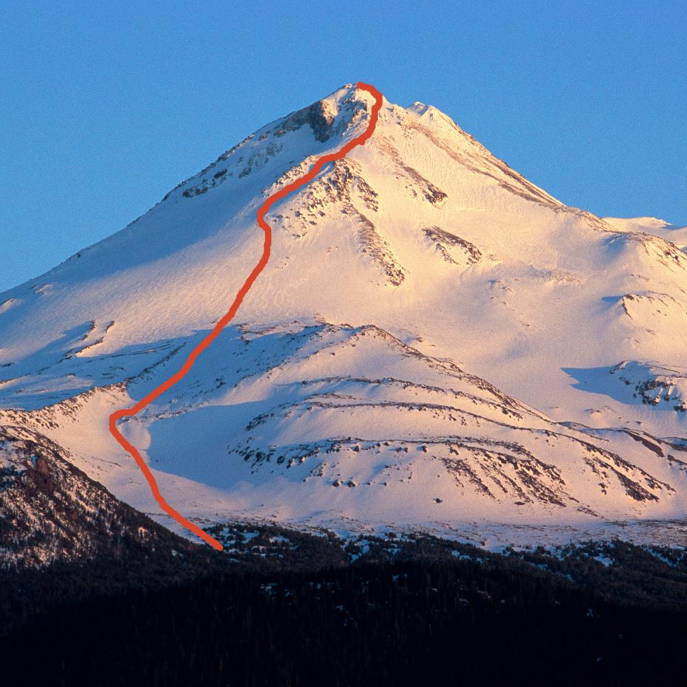
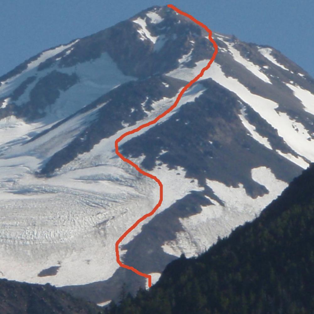
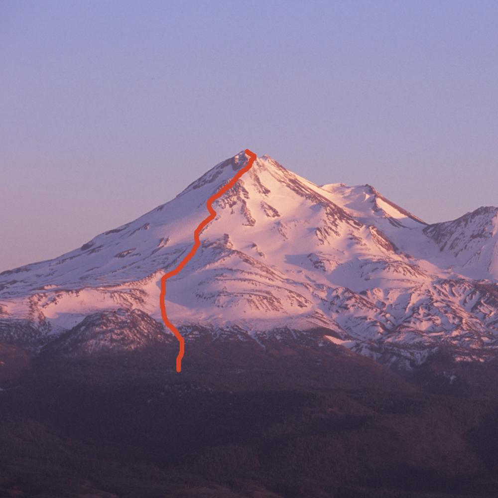
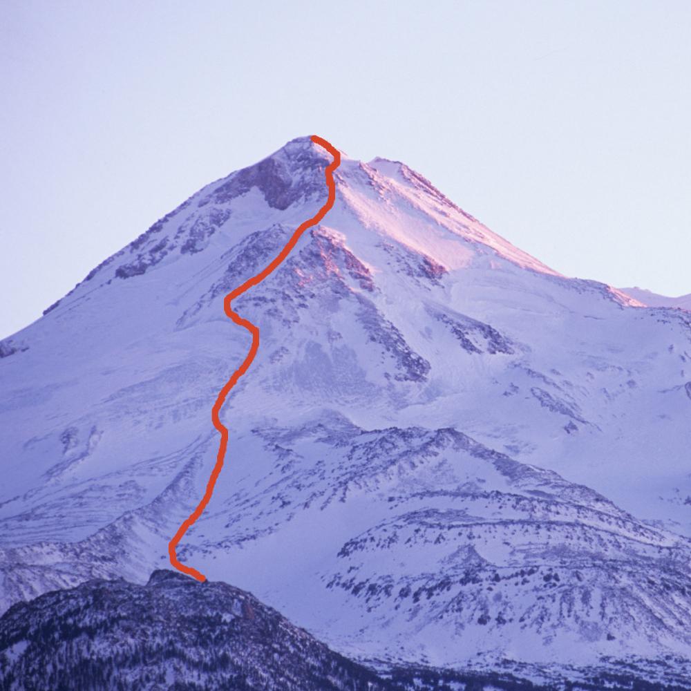
Hotlum/Bolam Ridge
This is a spectacular route with stellar views of the Hotlum and Bolam glaciers, as well as the Shasta Valley reaching up to Oregon.
From the North Gate trail head enjoy the shaded hike through old growth Red Fir winding your way to tree line. You will also encounter stretches of krummholz White Bark Pine. At tree line camp sites are abundant giving the option of camping relatively low to avoid any strong winds and still have a reasonable summit day. The more desirable high camp at around 10,000 feet offers good bivouac sites with access to running water mid to late season.
From the high camp, ascend along the obvious lateral moraine that stretches up toward the Ramp. There is a bergschrund below the Ramp that one can easily circle around the right side and traverse above to enter the Ramp. Be careful on your descent when the bergschrund is gapping open. The Ramp offers relatively easy climbing leading up to the Step at 13,100 feet. Very icy conditions can develop late season at the bottom of and along the Ramp. It is not unreasonable to follow the line of the moraine and find safer climbing on mixed ground between the Ramp and the Bolam during late season conditions.
The Step is a nice flat repose that offers scenic views and a great spot for a break. From the Step the route climbs up a snow apron toward two rock spires called the Rabbit Ears. Below these spires the route traverses climber’s right circling counter clockwise around a rock buttress crossing the Bolam gulley toward another obvious rock outcropping called the Shark’s Tooth. This climbing traverse is fun and icy conditions can make it very challenging. A variation of this route continues up passed the Rabbit Ears staying on steep rock. Although a fun twist, it can be a very dangerous descent. It is perhaps best to save this variation for another time, descending the route described above.
From above the Bolam gulley ascend along the ridge to the North Summit. A ridge line extends horizontal from the North Summit to the Summit proper. Another variation from the Shark’s Tooth leads through a broad gap between the North and West summits past the odiferous Sulfur vents below the summit pinnacle. Descend along the same traverse.
Options for experienced climbers are abundant. Late season conditions can be icy. Be very careful descending. This route is best done in two, even three days.