

You are here
Avalanche Advisory for 2013-04-05 06:37:58
- EXPIRED ON April 6, 2013 @ 6:37 amPublished on April 5, 2013 @ 6:37 am
- Issued by Nick Meyers - Shasta-Trinity National Forest
Bottom Line
Loose-wet snow avalanches will be one's main concern for today and this weekend. Recent warm temperatures and rain on snow could allow for more loose-wet snow instabilities in the form of roller balls, point releases and potentially larger wet snow sloughs. Slopes steeper than 35 degrees from 6,000 to 11,500 feet, all aspects, will be most prone to these instabilities.


Avalanche Problem 1: Loose Wet
-
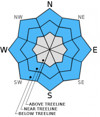
Character ?

-
Aspect/Elevation ?

-
Likelihood ?CertainVery LikelyLikelyPossible
 Unlikely
 -
Size ?HistoricVery LargeLargeSmall

Loose-wet avalanches will be possible today and this weekend. The main concern for loose-wet slides will lie within the top couple inches of the snowpack. Slopes steeper than 38 degrees will be most susceptible to these type of slides. Loose-wet slides involve the release of wet, unconsolidated snow or slush. These slides typically occur within layers of wet snow near the surface of the snowpack, though can gouge into lower snowpack layers. They usually start at a point and entrain more snow as they move downhill, forming a fan-shaped avalanche. Loose-wet slides generally move slowly, but can contain enough mass to easily cause damage to trees, etc., not to meniton human life and limbs.
Be sure to stay clear of runnout zones and pay attention to who is above you. If skiing, be aware of who is below you! Large slopes with long runnout zones on Mt. Shasta can allow for a lot of snow to be entrained as a slide moves downhill. A slide moving 15-25mph and several feet high is not uncommon and was witnessed this past week off of the east facing side of Casaval Ridge, above Lake Helen.
Avalanche Problem 2: Wet Slab
-
Character ?

-
Aspect/Elevation ?
-
Likelihood ?CertainVery LikelyLikelyPossible
Unlikely
-
Size ?HistoricVery LargeLargeSmall
Wet slab avalanche activity remains unlikely today due to a lack weak layers within the snowpack. Drainage channels exist to prevent water from pooling in the snowpack . Still, variability in storm snow amounts and deep wet snow mean that a very isolated wet slab avalanche is not impossible below the rain line.
Recent Observations
A couple fairly large loose-wet avalanches that could be seen from town were skier triggered on an east aspect off of Casaval Ridge, approximately 11,700 feet this past week.A local observer of the slides mentioned the slides to be moving at a fairly good clip and several feet high as they slid down the hill.... most definitely enough force to cause some bodily harm, especially if swept into undesireable consequences.
Small, loose-wet sloughs were easily triggered early in the week as well; the slope was near 40 degrees, lower in elevation, approximately 8,500 feet and east facing on the south side of the moutain (Criblet Ridge)
Rain on snow and warmish temps have created an extremely wet and mushy snowpack. Wet snow instabilities will likely persist through the weekend. Low and mid to upper elevations are showing wet snow instabilities in the past week. Be sure to stay clear of runnout zones and pay attention to who is above you!
Skiing conditions are changing all the time. Yesterday hosted extremely soft, wet and sticky snow. Upper elevations may be better if you can grab a moment of visibility during the day. It was not uncommon to sink up to your boot-tops in the Gray Butte area yesterday, 4-4-13.
Castle Lake area is still skiable, but not for the faint of heart. A thin and variable snowpack exists.
As spring approaches and temperatures begin to warm, spring skiers and climbers should keep LOOSE-WET AVALANCHES in mind. Sunny days and spring time can cause folks to forget their "avalanche awareness". Loose-wet slides occur every year on Mt. Shasta and can be very large and harmful to human life! Even though the avalanche danger may be low, this means that avalanches are still possible. A BEACON, SHOVEL & PROBE are STILL A GREAT IDEA in spring time!
Significant rain can also cause WET-LOOSE AVALANCHES. Use caution this weekend.
This is a great video from the Gallatin Avalanche Center, Bozeman, MT demonstrating small loose-wet slides: http://www.youtube.com/watch?v=zWpRQzgtL3o&feature=share&list=PLXu5151nmAvT7gHqdNajDBGfGY4u5XMSL
Weather and Current Conditions
Weather Summary
The general trend for this weekend will be wet, breezy and cooling. Mt. Shasta could see another quarter inch of water by Monday with a gradually lowering snow level. Snow levels in general appear to hover around 6,000 to 7,000 feet, though we could see snow down to 5000ft. Winds looks light below treeline and moderate above, up to 25mph with west flow. The cooling will occur Sunday / Monday. Rain showers and upper elevation snow with little accumulation will occur all weekend with the strongest portion of the weather late Saturday night into Sunday morning
WEATHER STATIONS - (last 24 hours):
In Mt. Shasta City at 0500, we have cloudy skies, light rain and a current temperature of 41 F.
On Mt. Shasta: In the Old Ski Bowl (7,600') on the south side of Mt. Shasta, we have a current temperature of 27F. Snow on the ground totals 104" inches with 2-4" of new, wet snow and little settlement. Temperatures have ranged from 27 F to 34 F. At Grey Butte (8,000') on the south side of Mt. Shasta winds averaged 18 mph and westerly in direction with a max gust to 42 mph from the West. The current temperature is 27F and temps have ranged 27F to 33F.
Castle/Mt. Eddy: Castle Lake - Castle Lake is hosting a current temp of 33F. Temperatures have ranged from 33F to 40F. Snow depth measures around 34" inches with 2"+ settlement from rain on snow. (Castle Lake snow depth sensor stopped taking readings this morning. This is likely from to little snow. Snow depth measurements are within 6 inches of the actual snow depth.) On Mt Eddy, we have 52" inches of snow on the ground with 2" settlement due to rain and no new snow. The current temperature reads 31F with temps ranging from 31F to 37F. Winds have been averaging 2 mph from the south and gusting to 12 mph - south.
THIS SEASON: September and October were warm and dry with September recording exactly zero precipitation. November remained warmer than normal with precipitation almost double normal values, 9.16" vs. 5.08". A local weather COOP observed the 2nd wettest November on record. December started out wet and warm, but temperatures cooled and brought snow to very low elevations. Since our avalanche cycle near Christmas, we've had a few small storms that brought some small amounts of snow to the area, but did not produced any notable avalanches. January was below normal for precipitation with a long period of high pressure and sun that kept skiing conditions somewhat meager. We've had a few storms for 2013 that have brought us glimpses of wintery weather, but nothing to write home about! California and the Sierra Nevada have recorded the driest January and February on record. We currently have 4.5'-8.5' feet of snow above 6,500 ft. Since September 1st, Mt Shasta sits at 70% of normal, 25.91" recorded; normal 36.59". For 2013, we sit at 25% of normal with 5.21" recorded and 20.71" normal.
| 0600 temperature: | 30 |
| Max. temperature in the last 24 hours: | 36 |
| Average wind direction during the last 24 hours: | Westerly |
| Average wind speed during the last 24 hours: | 15-20 mi/hr |
| Maximum wind gust in the last 24 hours: | 42 mi/hr |
| New snowfall in the last 24 hours: | 2-4 and rain on snow inches |
| Total snow depth: | 53-103 inches |
Two Day Mountain Weather Forecast
Produced in partnership with the Medford NWS
| For 7000 ft to 9000 ft | |||
|---|---|---|---|
|
Friday (4 a.m. to 10 p.m.) |
Friday Night (10 p.m. to 4 a.m.) |
Saturday (4 a.m. to 10 p.m.) |
|
| Weather | MOSTLY CLOUDY WITH A 50 PERCENT CHANCE OF RAIN AND SNOW SHOWERS. | RAIN AND SNOW LIKELY IN THE EVENING...THEN RAIN AND SNOW AFTER MIDNIGHT. | MOSTLY CLOUDY WITH A 50 PERCENT CHANCE OF RAIN AND SNOW SHOWERS. |
| Temperature (°F) | 39 | 31 | 41 |
| Wind (mi/hr) | SOUTH/SOUTHWEST 10-15MPH | SOUTH/SOUTHWEST 5-10MPH | SOUTH/SOUTHWEST 5-10MPH |
| Precipitation SWE / Snowfall (in) | / .5-1 | / 1-3 | / .5-1 |
| For 9000 ft to 11000 ft | |||
| Friday | Friday Night | Saturday | |
| Weather | A 50 PERCENT CHANCE OF SNOW SHOWERS, MOSTLY CLOUDY | SNOW. | A 50 PERCENT CHANCE OF SNOW SHOWERS, MOSTLY CLOUDY |
| Temperature (°F) | 29 | 20 | 27 |
| Wind (mi/hr) | WEST/SOUTHWEST 20-30MPH WITH GUSTS HIGHER | WEST 1-3 | WEST/SOUTHWEST 35-45 WITH GUSTS HIGHER |
| Precipitation SWE / Snowfall (in) | / 1-3 | / 2-4 | / 1 |

