

You are here
Avalanche Advisory for 2014-12-14 07:02:14
- EXPIRED ON December 15, 2014 @ 7:02 amPublished on December 14, 2014 @ 7:02 am
- Issued by Nick Meyers - Shasta-Trinity National Forest
Bottom Line
For above 9,000 feet, MODERATE avalanche danger will exist for lingering wind and deep slabs on all aspects. While these avalanches will be stubborn to trigger, the consequences of triggering said avalanches will be large and destructive. Use caution in extreme terrain, near ridgetops and bowls.
For all other areas and elevations, expect LOW avalanche danger. Remember, LOW avalanche danger means that avalanches are still possible, so don't let your guard down.


Avalanche Problem 1: Wind Slab
-
Character ?

-
Aspect/Elevation ?
-
Likelihood ?CertainVery LikelyLikelyPossible
 Unlikely
 -
Size ?HistoricVery LargeLargeSmall

Upper elevation (>9,000 feet) isolated areas in extreme terrain, bowls and wind loaded ridgelines will pose the best chance to encounter thick wind slabs. While these slides will be stubborn to trigger, avalanche size could be very large, destructive and most definitely a threat to human life.
Avalanche Problem 2: Deep Slab
-
Character ?

-
Aspect/Elevation ?

-
Likelihood ?CertainVery LikelyLikelyPossible
Unlikely
-
Size ?HistoricVery LargeLargeSmall
Deep slabs are typically hard to trigger, are very destructive and dangerous due to the large mass of snow involved. The are particularly difficult to forecast and manage. Test slopes, snow pits, slope cuts, previous tracks and cornice drops are unreliable.
Given the amount of new snow we recieved in a short amount of time just a few days ago, I think it's worth mentioning that deep slab avalanches remain a possibility. Deep slabs could exists above treeline on all aspects.
Recent Observations
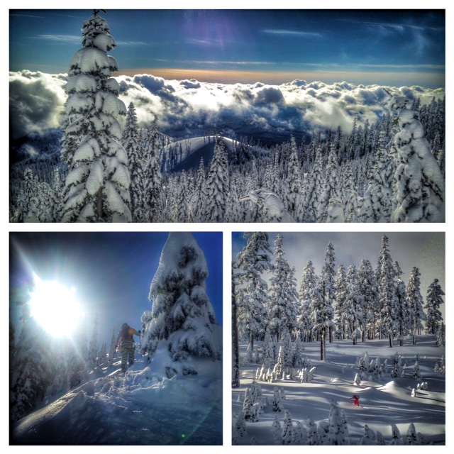
The storm that began on Wednesday the 10th of December gave the Mt Shasta area a large dollup of new snow that came in mostly "right side up". That is, heavier snow on the bottom and lighter snow on the top. As much as 4 feet of snow fell in 48 hours and was accompanied with moderate, southwest winds. Wind slabs and deep slabs are the avalanche problems of most concern, however that concern is decreasing and snowpack stability improving.
Yesterday, folks from all over the Northstate came to Bunny Flat to recreate. Recreationalists of all types fanned up onto the mountain with their tools of choice. I had most concern for snowmobilers, however by the end of the day, we saw no major slides and/or incidents. One natural surface slough was noted off of Sargents Ridge and several skier triggered sloughs off of Gray Butte, though nobody was caught. Perfect visibility allowed for good viewing of upper elevations. No large slabs were recorded. Observations from several locals also noted no signs of instability.
My travels took me to many aspects on and around the Gray Butte area yesterday. Stability tests resulted in only a sore hand from smacking CT and ECT tests. I was hard pressed to get any failure or note any weak layer with tests and pit profiles. That being said, I still am slightly suspect of isolated areas, high on the mountain (>9,000 ft). While wind and storm slabs will be stubborn to trigger, though if triggered by snowmobiler and/or multiple people on a slope, the consequences would likely be a large and destructive slide. Continue to use caution in extreme terrain, bowls, and wind loaded ridgelines on the upper mountain.
Well-developed surface hoar was seen in low lying areas as well as ridgelines, all over Gray Butte. While beautiful and fun to ski now, if the surface hoar remains intact as the new storm arrives tonight, this could create our next weak layer in the coming days. Take note!
Photo: Meyers
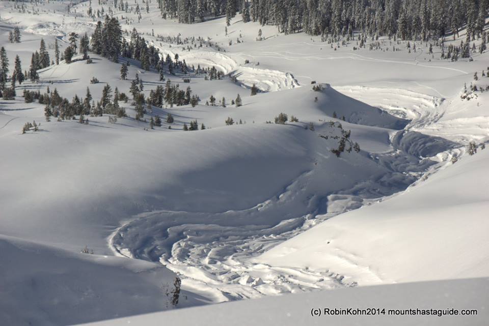
Backcountry skiers on 12/12/14 came across some impressive debris of a large natural avalanche (HS-N-D3-R3) that slid down Avalanche Gulch proper and ran past the Horse Camp (Sierra Club) cabin. The avalanche likely occured on 12/11/14. The avalanche came down through Avalanche Gulch proper, and not the "climbers gully". Thus, the starting zone was likely the Sargents Ridge, Thumb, Redbanks area. This slide is a good reminder of the potential for large avalanches on Mt Shasta during heavy winter storms. Slides like this can easily extend into runout zones on relatively flat terrain...ground that one might travel on and think they are not in avalanche terrain. Always know what slopes are above you and travel with caution even when below treeline. You may be in a runout zone.
Slide path from Avalanche Gulch slide. Impressive! Thanks Robin! Photo: Robin Kohn
Faint crown line seen off of Green Butte/Sargents Ridge. Photo: Shane Rathbun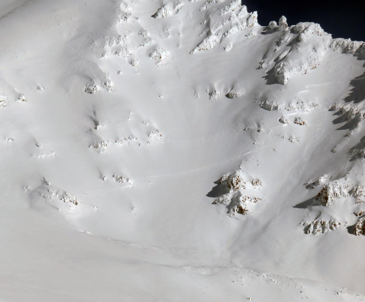
Report your observations to the MSAC! A photo, a few words... send them in! (nimeyers@fs.fed.us or 530-926-9614)
Castle Lake area still has very little snow. The road is also closed due to road damage from flooding.
Mt Eddy area is hosting about a 18" of snow. I have not been up into that area yet and have received no reports.
Sand Flat Winter Trails: OPEN
-------------------------------------------------------------------------------------------------------------------------------
Terrain: Remember most of the terrain that we like to play on is greater than 30 degrees. Avalanches are possible on anything steeper than 30 degrees. Avoid cornices, rock bands, terrain traps and runout zones of avalanche paths.
Weather: Most of our areas avalanche danger will occur 24-48 hours after a storm. We still can see persistent weak layers from time to time and we always will be sure to let you know about that! Heed the basic signs: Wind (significant snow transport and depositions), Temperature (rain/snow/rain/snow, which in turn weakens the snowpack), and Precipitation (Snow or rain add weight and stress to the current snowpack).
Snowpack: If snow accumulates, give the snowpack a chance to adjust to the new snow load before you play on or near steep slopes (greater than 30 degrees). Most direct action avalanches occur within 24-48 hours of recent snowfall. Watch for obvious signs of snowpack instability such as recent natural avalanche activity, collapsing of the snowpack (often associated with a “whumphing” sound), and shooting cracks. If you see these signs of instability, limit your recreation to lower angle slopes.
Human Factor: Don’t forget to carry and know how to use avalanche rescue gear. You should NOT be skiing or climbing potential avalanche slopes without having beacons, shovels, and probes. Only one person in a group should be exposed to potential avalanche danger at a time. Remember, climbing, skiing, and riding down the edge of slopes is safer than being in the center. Just because another person is on a slope doesn’t mean that it is safe. Be an individual! Make your own decisions. Heed the signs of instability: rapid warming, “whumphing” noises, shooting cracks, snowing an inch an hour or more, rain, roller balls, wind loading, recent avalanche activity.
The Five Red Flags of Avalanche Danger any time of year include: 1) Recent/current avalanche activity 2) Whumpfing sounds or shooting cracks 3) Recent/current heavy snowfall 4) Strong winds transporting snow 5) Rapid warming or rain on snow.
Weather and Current Conditions
Weather Summary
In Mt Shasta City this morning at 0500, we have a current temperature of 30 F with low lying fog/clouds.
WEATHER STATION INFORMATION (0500hrs):
On Mt Shasta (South Side) in the last 24 hours...
Old Ski Bowl - 7,600 feet, the current temperature of 20 F. Snow on the ground totals 66 inches with 1 inch of settlement. Storm total since 12/10/14 (Wednesday) is 50 inches. Temperatures have ranged from 16 F to 30 F.
Gray Butte - 8,000 feet, winds have averaged 7mph from the Northwest, with gusts to 28 mph from the Northwest. The current temperature is 18 F and temps have ranged from 16 F to 31 F in the last 24 hours.
Castle Lake and Mt Eddy (West side of Interstate-5)...
Castle Lake - 5,600 feet, the current temperature is 25 F. Temps have ranged from 24 F to 45 F in the last 24 hours. Castle has no snow on the ground yet. The road to Castle Lake is currently closed due to road damage from flooding.
Mt Eddy - 6,500 feet, the current temperature is 21 F. Temps have ranged from 16 F to 29 F in the last 24 hours. Current snow depth is 18 inches with no new snow in the last 24 hours. Wind information is unavailable this morning.
WEATHER SYNOPSIS: More wintery weather is moving toward the Mt Shasta area today. While it won't be as impressive as this past weeks storm, we still should see a slow and steady drip of precip over the week. Today, increasing clouds will form and we could see some snow and rain by this afternoon. The brunt of this first wave of precip will fall on Monday. Temperatures are rising slightly today, but will cool again tomorrow. The cooling trend and precip will have good timing and lower snow levels to around 4,500 feet. This is great news for the Ski Park! Models show as much as 1 inch of water to fall in the Mt Shasta area over the full week. Winds will remain light to moderate at low and mid mountain levels. All in all, snow flakes are in the box for the week and this is good!
THIS SEASON: Since September 1st , we have received 19.04 inches of water, normal is 11.10 inches, putting us at 171% of normal. For the year of 2014, Mt Shasta has received 31.32 inches of water with normal being 38.43 inches which puts us at 81% of normal. And lastly, for December we sit at 318% of normal, receiving 9.79 inches of water, normal is 3.07 inches.
Always check the weather before you attempt to climb Mt Shasta. Further, monitor the weather as you climb. Becoming caught on the mountain in any type of weather can compromise life and limb. Be prepared.
| 0600 temperature: | 20 |
| Max. temperature in the last 24 hours: | 30 |
| Average wind direction during the last 24 hours: | Northwest |
| Average wind speed during the last 24 hours: | 6 mi/hr |
| Maximum wind gust in the last 24 hours: | 28 mi/hr |
| New snowfall in the last 24 hours: | 0 inches |
| Total snow depth: | 66" inches |
Two Day Mountain Weather Forecast
Produced in partnership with the Medford NWS
| For 7000 ft to 9000 ft | |||
|---|---|---|---|
|
Sunday (4 a.m. to 10 p.m.) |
Sunday Night (10 p.m. to 4 a.m.) |
Monday (4 a.m. to 10 p.m.) |
|
| Weather | Partly sunny, slight chance of snow in the afternoon | Mostly cloudy, chance of snow | Snow |
| Temperature (°F) | 32 | 28 | 29 |
| Wind (mi/hr) | South/Southeast 5-10 mph | South/Southeast 10-20 mph | South/Southeast 10-20 mph |
| Precipitation SWE / Snowfall (in) | / 0-.5 | / 1" | / 2" - 4" |
| For 9000 ft to 11000 ft | |||
| Sunday | Sunday Night | Monday | |
| Weather | Partly sunny, slight chance of snow in the afternoon | Mostly cloudy, chance of snow | Snow |
| Temperature (°F) | 31 | 23 | 35 |
| Wind (mi/hr) | South/Southwest 15-25 mph, gusts into the 40's | South/Southwest 0-.5 | South 15-20 mph, increasing to 35-35 mph in the afternoon |
| Precipitation SWE / Snowfall (in) | / 0-.5 | / 1"-2" | / 2" - 4" |

