

You are here
Avalanche Advisory for 2015-01-11 07:00:08
- EXPIRED ON January 12, 2015 @ 7:00 amPublished on January 11, 2015 @ 7:00 am
- Issued by Nick Meyers - Shasta-Trinity National Forest
Bottom Line
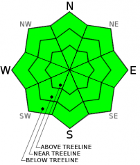
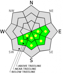
Overall, LOW avalanche danger exists for all aspects and elevations. Always practice safe travel habits and sound decision making when traveling in the backcountry.
Smooth and firm conditions persist near and above treeline on Mt Shasta. A slip and fall on steeper terrain will result in a slide for life without self-arrest skills. An ice axe, crampons and helmet are highly recommended.
Be prepared and know how to use your equipment.


Avalanche Problem 1: Normal Caution
-
Character ?

-
Aspect/Elevation ?
-
Likelihood ?CertainVery LikelyLikelyPossible
 Unlikely
 -
Size ?HistoricVery LargeLargeSmall

LOW avalanche danger exists for all aspects and elevations. Always practice safe travel habits and sound decision making when traveling in the backcountry.
As mentioned above, concern continues for slide for life conditions if one is to slip and fall on the steeper slopes of Mt Shasta. Many areas are hosting smooth snow with an icy glaze on top. Self-arresting on this type of snow surface is very difficult.
Other areas consist of wind blown sastrugi, hard and chalky snow. While this snow is still very smooth and potential for a long slide is there, this type of snow surface allows for better chance at self-arrest should one fall.
An ice axe, crampons and helmet are highly recommended for upper mountain adventures and as ALWAYS, carry a beacon, shovel, probe and know how to use all this equipment!
Avalanche Problem 2: Wind Slab
-
Character ?

-
Aspect/Elevation ?
-
Likelihood ?CertainVery LikelyLikelyPossible
Unlikely
-
Size ?HistoricVery LargeLargeSmall
At this point, the avalanche danger remains low for all aspects and elevations today.
The avalanche danger may rise for a short period near the end and after this small storm arriving late today, tonight and into Monday. Wind loading on E-SE-S-SW aspects near and above treeline will be of most concern, IF we receive measureable snow.
This rise in avalanche danger will all hinge on new snow accumulation: dust on crust - likely not too much of a concern. A couple inches of new snow with some wind blowing it around... we may see some small wind slabs develop in extreme terrain, near ridgetops, gullies, rock outcrops, etc.
Remember, specifically on Mt Shasta, funky wind eddies and local orographics can load slopes not suspected.
Recent Observations
Not much new to mention since yesterday...clouds and cooling temps are keeping the snow on the firm side at elevations >8,000 on the mountain. The weak storm forecasted for late today/Monday is on track. Precipitation amounts will be light, potentially 1-4 inches of new snow (.04" water) with freezing levels as low as 5,000 - 5,500 feet. We hope this will be a nice little "refresh" and help smooth out some of the lingering sastrugi and rough spots. Northwest winds are going to kick up late today and crescendo into Monday reaching 25-35 mph with gusts higher above treeeline - not gale force but strong enough to move some new snow around. Even though new storm snow totals are not looking fat, wind blown snow loading on leeward aspects could create small wind slabs on our old, hard snow. At this point, the avalanche danger remains low for all aspects and elevations today. Staring into the crystal ball, the avalanche danger may rise for a short period near the end and after this small storm. Wind loading on E-SE-S-SW aspects near and above treeline will be of most concern. Remember, specifically on Mt Shasta, funky wind eddies and local orographics can load slopes not suspected. This slight rise in avalanche danger will all hinge on new snow accumulation: dust on crust - likely not too much of a concern. A couple inches of new snow with some wind blowing it around... we may see some small wind slabs develop in extreme terrain, near ridgetops, gullies, rock outcrops, etc.
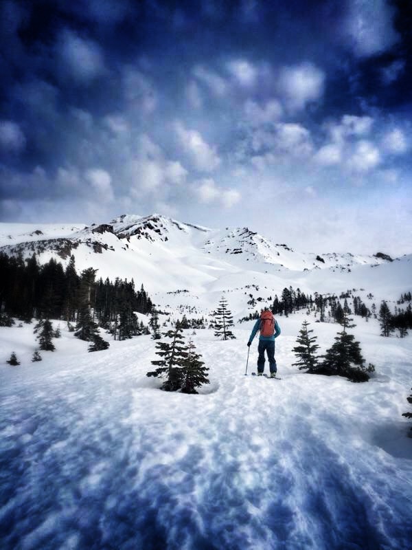
Its a mixed bag out there. All snow available for decent recreation in the forecast area is limited to areas above 6,000 feet. Mt Shasta, Mt Eddy, Castle Lake, Ash Creek Butte all are holding anywhere from 1-6 feet of snow. This snow is a fantastic base ready for some new snow to freshen things up. We've seen a slow transition in surface conditions on Shasta itself where most skiing and other recreation has been taking place. No single snow surface condition dominates and thus one will need a variety of skiing techniques to stylishly shred Shasta's slopes. Inversions over the past week have kept lower elevation temps cooler and mid elevations warmer. Given that and some daytime sunshine, east, southeast and south facing slopes that are out of the wind and at low to mid elevations have been seeing some softening during the warmest portions of the day, ie. corn snow. Other areas one will find wind packed powder, rough sastrugi, and icy ridgetops/exposed areas. Overall, I would say conditions have improved over the week and numerous reports have come in of decent, smooth skiing if willing to hunt it down.
Smooth and firm snow conditions still persist for folks venturing onto the upper mountain, climbers and skiers alike. A helmet, ice axe and crampons are strongly recommended and self arrest skills mandatory for a safe trip.
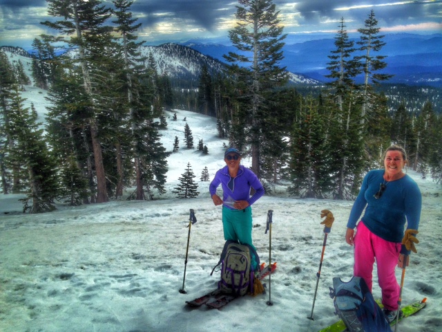
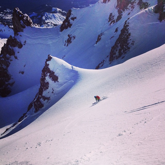
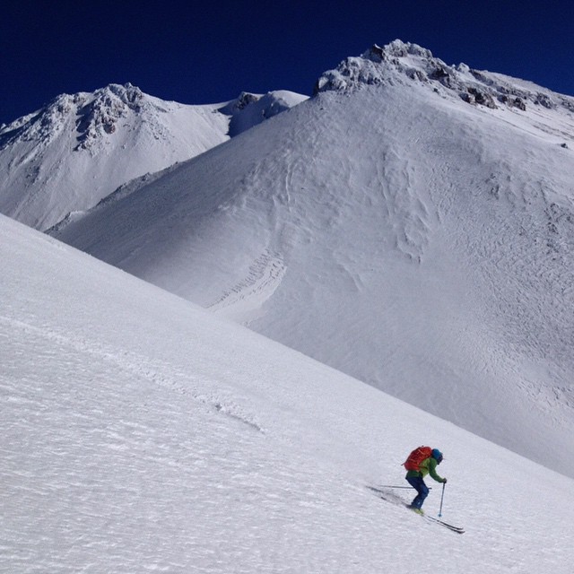
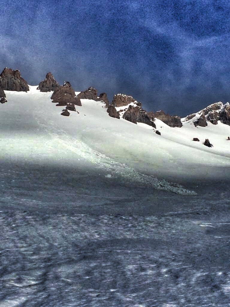
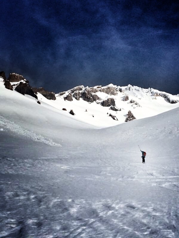
Beginning from top left and working clockwise: FC dropping into the East side from Thumb Rock area - {Photo: Ingmar} / South side Shastina ski with Shasta proper in the background {Photo: Ingmar} / Forrest skins up Avalanche Gulch on 1.9.15, below Lake Helen (Photo: H. Meyers} / Small wet sluff that occured sometime in the past week due to daytime warming and above freezing night time temps on the East aspect of Casaval Ridge into Avalanche Gulch, approx. 9,700 feet. {Photo: H Meyers}
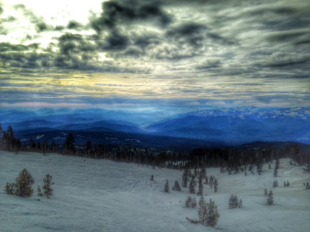
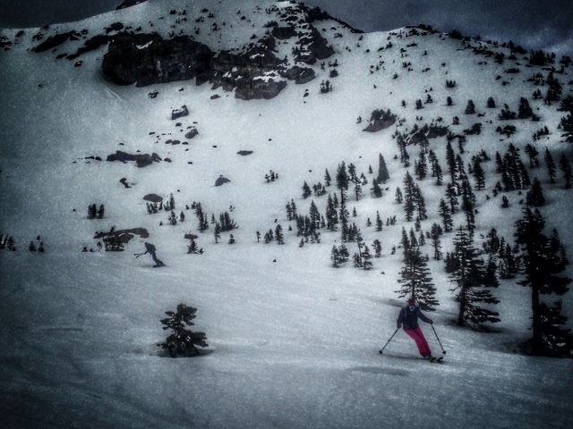
Below: Riders and sliders make their way down some decent snow found in Powder Bowl, 1.10.15 {Photo: N Meyers}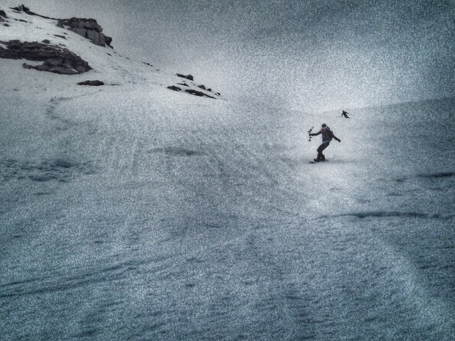
Report your observations to the MSAC! A photo, a few words... send them in! (nimeyers@fs.fed.us or 530-926-9614)
Castle Lake area has a shallow snowpack. Be careful of shallow buried objects. Skiing has been reported as poor to non-existent.
Sand Flat Winter Trails: OPEN
Pilgrim Creek Snowmobile Park: OPEN, however due to lack of low elevation snow, one must drive up the road several miles before enough snow is encountered. One CANNOT DRIVE over Military Pass.
-------------------------------------------------------------------------------------------------------------------------------
Terrain: Remember most of the terrain that we like to play on is greater than 30 degrees. Avalanches are possible on anything steeper than 30 degrees. Avoid cornices, rock bands, terrain traps and runout zones of avalanche paths.
Weather: Most of our areas avalanche danger will occur 24-48 hours after a storm. We still can see persistent weak layers from time to time and we always will be sure to let you know about that! Heed the basic signs: Wind (significant snow transport and depositions), Temperature (rain/snow/rain/snow, which in turn weakens the snowpack), and Precipitation (Snow or rain add weight and stress to the current snowpack).
Snowpack: If snow accumulates, give the snowpack a chance to adjust to the new snow load before you play on or near steep slopes (greater than 30 degrees). Most direct action avalanches occur within 24-48 hours of recent snowfall. Watch for obvious signs of snowpack instability such as recent natural avalanche activity, collapsing of the snowpack (often associated with a “whumphing” sound), and shooting cracks. If you see these signs of instability, limit your recreation to lower angle slopes.
Human Factor: Don’t forget to carry and know how to use avalanche rescue gear. You should NOT be skiing or climbing potential avalanche slopes without having beacons, shovels, and probes. Only one person in a group should be exposed to potential avalanche danger at a time. Remember, climbing, skiing, and riding down the edge of slopes is safer than being in the center. Just because another person is on a slope doesn’t mean that it is safe. Be an individual! Make your own decisions. Heed the signs of instability: rapid warming, “whumphing” noises, shooting cracks, snowing an inch an hour or more, rain, roller balls, wind loading, recent avalanche activity.
The Five Red Flags of Avalanche Danger any time of year include: 1) Recent/current avalanche activity 2) Whumpfing sounds or shooting cracks 3) Recent/current heavy snowfall 4) Strong winds transporting snow 5) Rapid warming or rain on snow.
Weather and Current Conditions
Weather Summary
In Mt Shasta City this morning at 0500, we have a current temperature of 30 degrees, calm winds and clear skies.
WEATHER STATION INFORMATION (0500hrs):
On Mt Shasta (South Side) in the last 24 hours...
Old Ski Bowl - 7,600 feet, the current temperature is 30 F. Snow on the ground totals 61 inches with 1 inch settlement. We've had no new snow in the last 24 hours or over the past week. Temperatures have ranged from 30 F to 41 F.
Gray Butte - 8,000 feet, winds have averaged 5-15 mph from the WNW , with a max gust to 21 mph from the WNW. The current temperature is 31 F and temps have ranged from 31 F to 38 F in the last 24 hours.
Castle Lake and Mt Eddy (West side of Interstate-5)...
Castle Lake - 5,600 feet, the current temperature is 35 F. Temps have ranged from 35 F to 50 F in the last 24 hours. The Castle Lake area has 1-3 feet of snow on the ground and a few folks have been sliding around on skis up there, however conditions are poor.
Mt Eddy - 6,500 feet, the current temperature is 29 F. Temps have ranged from 29 F to 45 F in the last 24 hours. Current snow depth is 22 inches with no new snow and 1 inch settlement. Winds have averaged 1-3 mph and SW in direction, with gusts to 6 mph from the SW.
WEATHER SYNOPSIS: A weak system enters the region late today into early Monday bringing a chance of light showers with precipitation totals up to .04" by early Monday morning. Winds will blow out of the west at 10 mph this morning and increase as the front passes through to 25-35 mph out of the NW with occasional higher gusts possible. Snow levels could drop to as low as 5,000 to 5,500 ft. during this storm. Temperatures will warm soon after and that darn high pressure ridge will rebuild, bringing more sun to the forecast area. It won't be until next weekend that we see temperatures begin to drop with very windy conditions and a decent looking storm on tap.
THIS SEASON: Since September 1st (the wet season) , we have received 22.08 inches of water, normal is 18.27 inches, putting us at 120% of normal. For the year of 2014, Mt Shasta finished off with 34.36 inches of water with normal being 43.21 inches, leaving us at 79% of normal for 2014. For December, Mt Shasta finished at 163% of normal, receiving 12.83 inches of water, normal is 7.85 inches. For January/2015, we've received 0.00 inches of water, normal is 2.39.
Always check the weather before you attempt to climb Mt Shasta. Further, monitor the weather as you climb. Becoming caught on the mountain in any type of weather can compromise life and limb. Be prepared.
| 0600 temperature: | 30 |
| Max. temperature in the last 24 hours: | 41 |
| Average wind direction during the last 24 hours: | WNW |
| Average wind speed during the last 24 hours: | 5-15 mi/hr |
| Maximum wind gust in the last 24 hours: | 21 mi/hr |
| New snowfall in the last 24 hours: | 0 inches |
| Total snow depth: | 61 inches |
Two Day Mountain Weather Forecast
Produced in partnership with the Medford NWS
| For 7000 ft to 9000 ft | |||
|---|---|---|---|
|
Sunday (4 a.m. to 10 p.m.) |
Sunday Night (10 p.m. to 4 a.m.) |
Monday (4 a.m. to 10 p.m.) |
|
| Weather | Cooling trend, clear this morning with increasing clouds throughout the day, snow flurries after 4pm | Cloudy, snow showers overnight | Snow showers before 10am, clearing and mostly sunny by the afternoon |
| Temperature (°F) | 41 | 33 | 43 |
| Wind (mi/hr) | North 5-15 mph | Northwest 5-15 mph | North/Northwest 5-10 mph |
| Precipitation SWE / Snowfall (in) | / 0-.5 | / .5-1 | / 0 - .5" |
| For 9000 ft to 11000 ft | |||
| Sunday | Sunday Night | Monday | |
| Weather | Cooling trend, clear this morning with increasing clouds throughout the day, snow flurries after 4pm | Cloudy, snow showers | Snow showers before 10am, clearing and mostly sunny by the afternoon |
| Temperature (°F) | 27 | 22 | 29 |
| Wind (mi/hr) | West/Northwest 15-25 mph, increasing, gusts higher | Northwest 0-.5 | North/Northwest 25-35 mph with gusts higher |
| Precipitation SWE / Snowfall (in) | / 0-.5 | / .5 - 1" | / 0-.5" |

