

You are here
Avalanche Advisory for 2015-12-05 07:04:29
- EXPIRED ON December 6, 2015 @ 7:04 amPublished on December 5, 2015 @ 7:04 am
- Issued by Nick Meyers - Shasta-Trinity National Forest
Bottom Line
LOW avalanche danger exists for all elevations and aspects.
The MSAC forecast area hosts 12-20 inches of snow on the ground currently.
Shallow buried object are the primary hazard.


Avalanche Problem 1: Normal Caution
-
Character ?

-
Aspect/Elevation ?
-
Likelihood ?CertainVery LikelyLikelyPossible
 Unlikely
 -
Size ?HistoricVery LargeLargeSmall

Low danger prevails for the entire forecast area, all elevations and aspects. If one were to find any instability, wind slabs would be the avalanche problem and the best place for these slabs is where new snow has fallen on existing snow. Existing snow patches were far and few between before this past storm and limited to upper elevations, above 10,000 feet. At this point, it is difficult to know where the existing snow was and if any weak layers exist. We think it unlikely that anybody would venture up into those elevations anytime soon, but worth mentioning. We don't have any observations at this time from said areas.
With tonights storm approaching, new snow and high winds will create wind and storm slabs on our shallow snowpack. Always check the avalanche advisory before you head out for the latest!
Forecast Discussion
The next 7 to 10 days of weather, at this point, appears to be wintery! This makes our hearts swell with joy. Looking into the immediate future, today we'll see increasing clouds and wind as a nice looking storm hits the coast of California. This first system will bring us snow and high winds to the area. The bummer with this storm is the relatively high snow levels to begin. That said, cold air is close behind so we will see the "right side up" sort of storm, wet to start and colder and dryer to finish off. This is good with us as some nice, wet, heavy plaster is always good to grout the early season cracks of the mountain... followed by a sweet, soft topping. Precipitation amounts are forecasted to be just shy of a half inch with snow levels 4-5,000 feet. Winds are certainly notable for near and above treeline areas on Mt Shasta. Expect extreme wind chill factors to accompany wind speeds of 30-40 mph out of the southwest today, increasing tonight to 50-60mph tonight. Gusts are guaranteed higher! Batten the hatches!
THIS SEASON PRECIPITATION: Since October 1st (the wet season), we have received 3.38 inches of water, normal is 8.29 inches, putting us at 40% of normal. For the month of December, we have received 1.35 inches of water, normal is .90 putting us at 150% of normal! For the year of 2015 we've received 20.56 inches of water, normal is 36.26 inches putting us at 56 % of normal.
Recent Observations
Mt Shasta from afar looks to be steep and deep, full of snow and ready for backcountry action, however don't be fooled! While about 15-20 cars were parked at Bunny Flat yesterday and hard chargers out getting in some of the first turns of the season, a shallow snowpack still is the soup de jour. The Old Ski Bowl weather station is recording 17 inches of snow and this is accurate. Areas of drifting were measured up to 21 inches. At Bunny Flat (6,950 ft) a solid 12-15 inches was measured.
Avalanche danger is not much of a concern at this point as the forecast area grows some roots for the season. During this time, rocks, logs, stumps and everything else lie just beneath the seemingly smooth snow surface. We say this every year and I don't see a reason to not say it again this season: Be careful, take it easy, watch out, shred lightly.
Cross country skiing is a great option at this point, either up the road into the Old Ski Bowl or a nice cruise to Horse Camp. If venturing onto steeper terrain, a hard carve left or right will likely find a hard object. If you find yourself in some low angle gullies, they may be filled in enough for a harder turn however we recommend french fries, not pizzas.
The Sand Flat cross country ski trails are covered and good to go! Enjoy!
Pilgrim Creek Snowmobile Park has 4-6 inches of snow at the parking area as of 12.4.15.
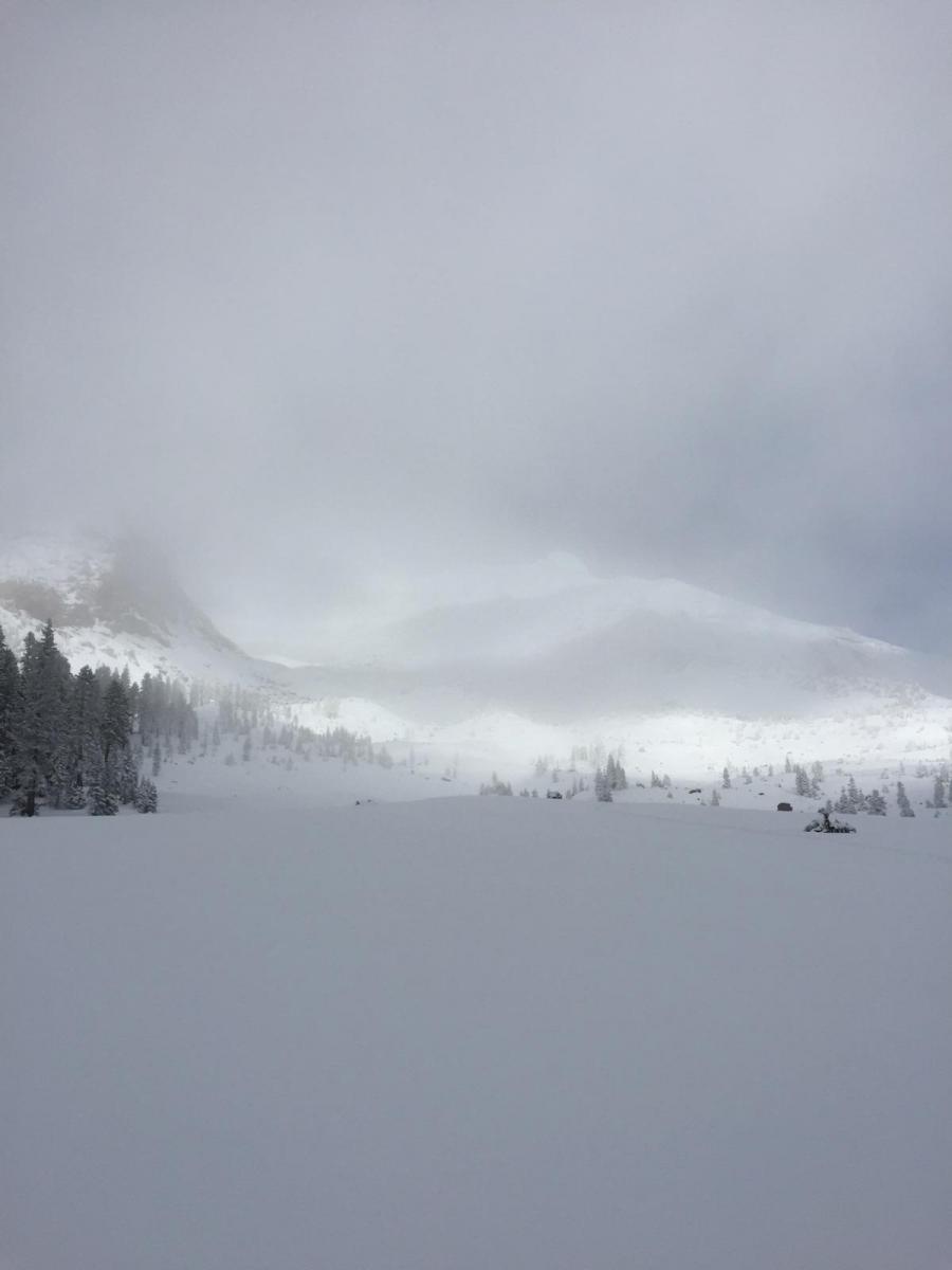
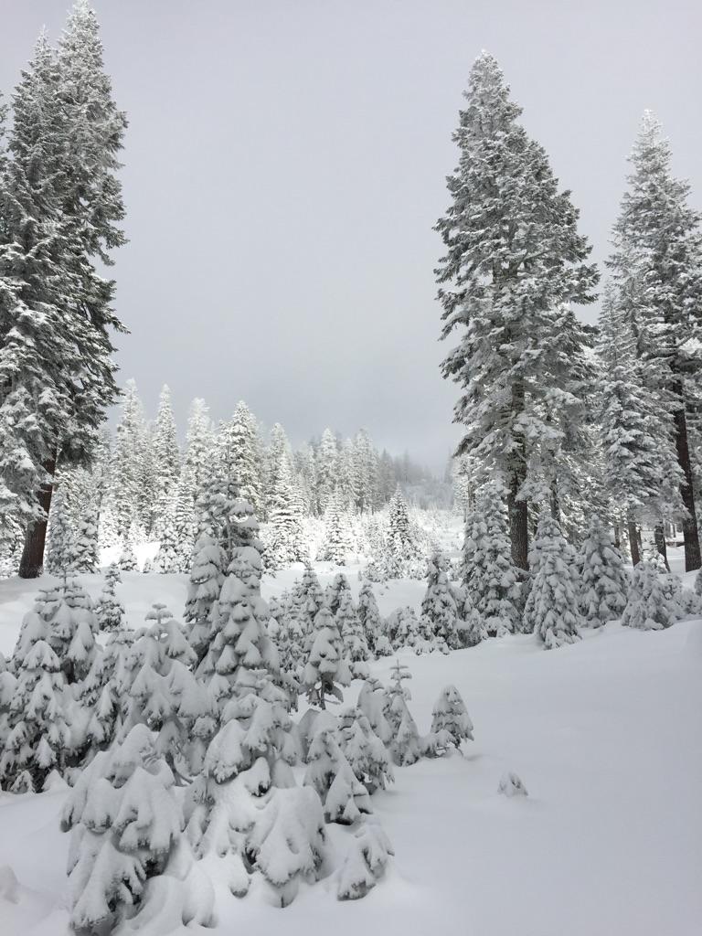
Photos: F Coots, 12.4.15, Old Ski Bowl area, 8,000 feet, Mt Shasta
The Five Red Flags of Avalanche Danger any time of year include: 1) Recent/current avalanche activity 2) Whumpfing sounds or shooting cracks 3) Recent/current heavy snowfall 4) Strong winds transporting snow 5) Rapid warming or rain on snow.
Weather and Current Conditions
Weather Summary
Good Morning! In Mt Shasta City at 0500, we have a current temperature of 35 F with obscured skies.
MOUNTAIN WEATHER STATION INFORMATION (0500hrs):
On Mt Shasta (South Side) in the last 24 hours...
Old Ski Bowl - 7,600 feet, the current temperature is 20 degrees F. Snow on the ground totals 18 inches. Temperatures in the last 24 hours have ranged from 18 F to 27 F. Storm total is 14 inches.
Gray Butte - 8,000 feet, the current temperature is 20 degrees F. Temperatures have ranged from 18 F to 28 F in the last 24 hours. We are having technical problems with the anemometer at this time. Working on fixing this!
Castle Lake and Mt Eddy (West side of Interstate-5)...
Castle Lake - 5,600 feet, the current temperature is 27 degrees F. Temperatures have ranged from 25 F to 32 F in the last 24 hours. Snow on the ground measures 10 inches with 3 inches settlement. Storm total is 11 inches.
Mt Eddy - 6,500 feet, the current temperature is 24 degrees F. Temperatures have ranged from 21 F to 27 F. Snow on the ground measures 24 inches. Storm total is 10 inches. Winds have averaged 2 mph and southeast in direction with a max gust to 10 mph, SE.
Always check the weather before you attempt to climb Mt Shasta. Further, monitor the weather as you climb. Becoming caught on the mountain in any type of weather can compromise life and limb. Be prepared.
| 0600 temperature: | 23 |
| Max. temperature in the last 24 hours: | 30 |
| Average wind direction during the last 24 hours: | Southerly |
| Average wind speed during the last 24 hours: | n/a mi/hr |
| Maximum wind gust in the last 24 hours: | n/a mi/hr |
| New snowfall in the last 24 hours: | 0-1 inches |
| Total snow depth: | 17 inches |
Two Day Mountain Weather Forecast
Produced in partnership with the Medford NWS
| For 7000 ft to 9000 ft | |||
|---|---|---|---|
|
Saturday (4 a.m. to 10 p.m.) |
Saturday Night (10 p.m. to 4 a.m.) |
Sunday (4 a.m. to 10 p.m.) |
|
| Weather | Mostly cloudy and breezy later in the day | Snow and windy | Snow and breezy, snow showers likely |
| Temperature (°F) | 33 | 26 | 32 |
| Wind (mi/hr) | South/southeast 10-20 mph, increasing | South/southeast 15-25 mph with gusts to 40-50 mph | South 10-20 mph, decreasing in afternoon |
| Precipitation SWE / Snowfall (in) | / 0 | / 3-5 | / 2-4 |
| For 9000 ft to 11000 ft | |||
| Saturday | Saturday Night | Sunday | |
| Weather | Mostly cloudy, windy | Snow after 10pm, windy | Snow, windy in the morning, then decreasing |
| Temperature (°F) | 38 | 28 | 41 |
| Wind (mi/hr) | South/southwest 30-40 mph increasing in afternoon | South/southwest 0 | West/Southwest 40-50 mph in the AM, decreasing to 30-40 mph in the PM. |
| Precipitation SWE / Snowfall (in) | / 0 | / 3-5 | / 3-5 |

