

You are here
Avalanche Advisory for 2015-12-06 07:02:18
- EXPIRED ON December 7, 2015 @ 7:02 amPublished on December 6, 2015 @ 7:02 am
- Issued by Jon Dove - Shasta-Trinity National Forest
Bottom Line
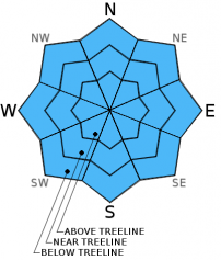
Moderate avalanche danger exists for all aspects above treeline due to storm and wind slab formation.
LOW avalanche danger exists with pockets of MODERATE avalanche danger at near treeline due to wind slab formation in isolated pockets on NW-N-NE-E aspects
Shallow buried objects are also still a hazard.


Avalanche Problem 1: Storm Slab
-
Character ?

-
Aspect/Elevation ?
-
Likelihood ?CertainVery LikelyLikelyPossible
 Unlikely
 -
Size ?HistoricVery LargeLargeSmall

Last nights storm brought 7+ inches of new snow forming a storm slab on top of the existing, shallow snowpack. The bonding of this new storm layer will accelerate as the day progresses due to rising temperatures in the afternoon.
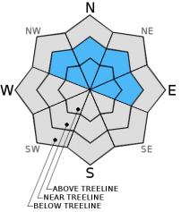
Avalanche Problem 2: Wind Slab
-
Character ?

-
Aspect/Elevation ?
-
Likelihood ?CertainVery LikelyLikelyPossible
Unlikely
-
Size ?HistoricVery LargeLargeSmall
High SSW winds that accompanied last nights storm have transported snow onto NW-N-NE-E aspects at near and above treeline. That being said the winds were strong enough that any wind slabs that may have formed will be mostly fairly thin, and the likely hood of triggering a wind slab avalanche is unlikely. As the temperatures rises over the next day or two wind slab sensitivity to triggers will decrease as the snow crystals melt and bond.
Forecast Discussion
A series of storms are lined up across the Pacific and will be affecting our area through next weekend. Any storm system is good news, however, snow levels will begin to rise on Monday to around 8300 ft, and toping out near 9000 ft. on Wednesday. Colder air will begin to return on Thursday pushing snow levels back down to around 6000 ft. Precipitation amounts for today are forecasted to be around 0.03 inches of water which translates into 1-3 inches of snow. Snow levels will be at 4000 ft. today rising to 5800 ft. tonight. Winds are certainly notable for near and above treeline areas on Mt Shasta. Expect extreme wind chill factors down to -7 degrees F to accompany wind speeds of 40-45 mph out of the south/southwest today, decreasing tonight to 30-35 mph tonight. Higher wind gusts are guaranteed!
THIS SEASON PRECIPITATION: Since October 1st (the wet season), we have received 3.38 inches of water, normal is 8.49 inches, putting us at 39% of normal. For the month of December, we have received 1.35 inches of water, normal is 1.13 putting us at 119% of normal! For the year of 2015 we've received 20.56 inches of water, normal is 36.49 inches putting us at 56 % of normal.
Recent Observations
Mt Shasta appears as a winter wonderland currently, with lots of snow to enjoy. However, the snow pack is still thin with plenty of rocks, stumps, down trees, and other hidden obstacles lying just beneath the surface. Backcountry skiers and snowboarders should use caution, and avoid making hard turns as you descend. A snow pit was dug yesterday in Old Ski bowl at approximately 8000 ft. on a SSE aspect with a 21 degrees slope. Snow depth ranged from 35-44 cm. The snow layers present seem to have bonded quite well, and an extended column test was performed resulting in a score of ECTX. Due to the new snow overnight and the high southerly winds that came with it wind slab formation above teeline on NW-N-NE-E aspects are likely. Due to the intensity of the wind the wind slabs that may have formed will be thin. Travel above treeline, however, may be limited due to poor visibility today. The Old Ski Bowl weather station is recording 24 inches of total snow this morning with 7 inches new snow overnight. At Bunny Flat (6,950 ft) a snow depth of 21 inches was measured.
Avalanche danger is not much of a concern at near and below treeline due to the shallow snow depth that is just covering rocks, down trees, and brush. Beware of any bumps or rolls in the snow as that indicates a freshly buried object. We say this every year and I don't see a reason to not say it again this season: Be careful, take it easy, watch out, and shred lightly.
The parking lot at Bunny Flat was almost full yesterday with backcountry skiers/split boarders, sledders, and a few snowmobilers. Please park wisely and respect other snow recreation users. Cross country skiing or snowshoeing is a great option at this point, either up the road into the Old Ski Bowl or a nice cruise around the Sand Flat winter trail. If venturing onto steeper terrain, a hard carve left or right will likely find a hard object. If you find yourself in some low angle gullies, they may be filled in enough for a harder turn however we recommend skiing/riding with caution.
The Sand Flat cross country ski trails are covered and good to go! Enjoy!
Pilgrim Creek Snowmobile Park has 4-6 inches of snow at the parking area as of 12.4.15.
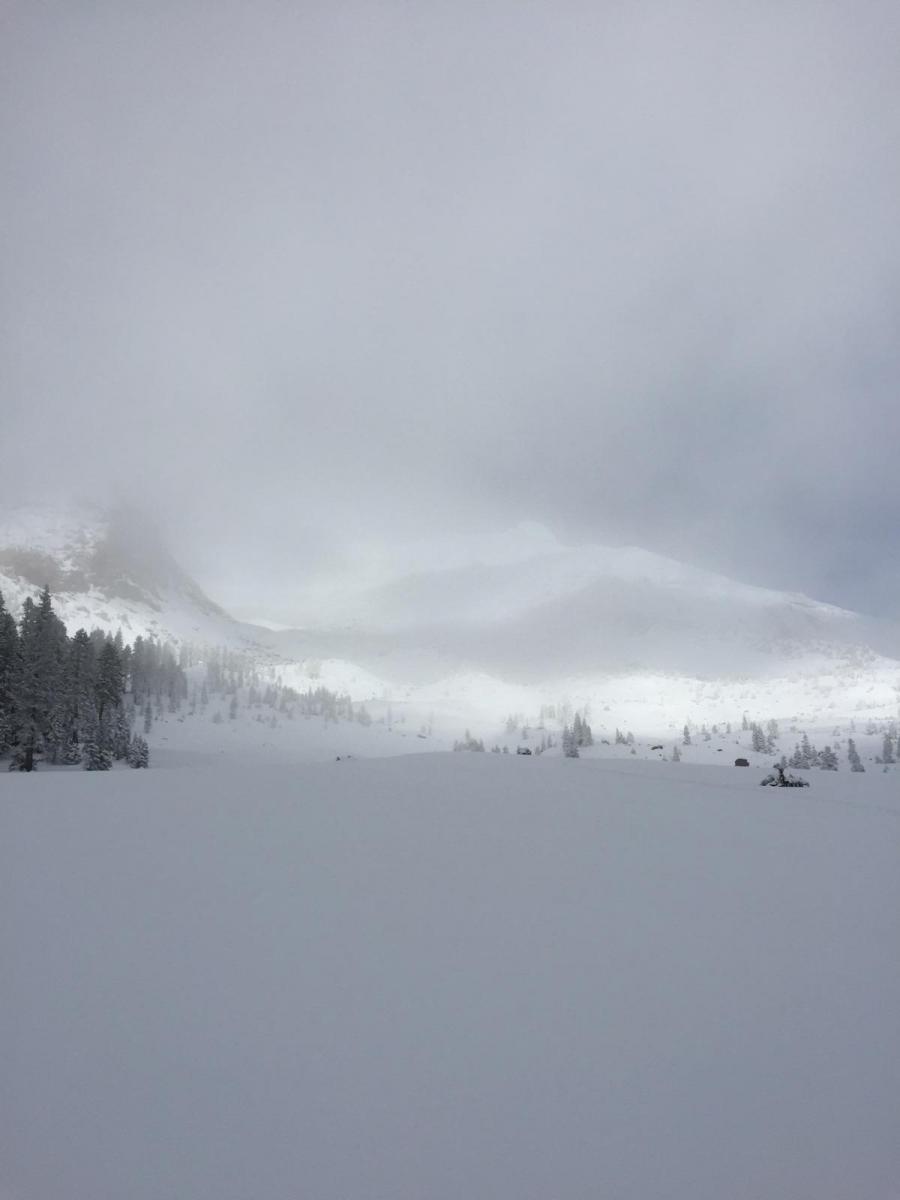
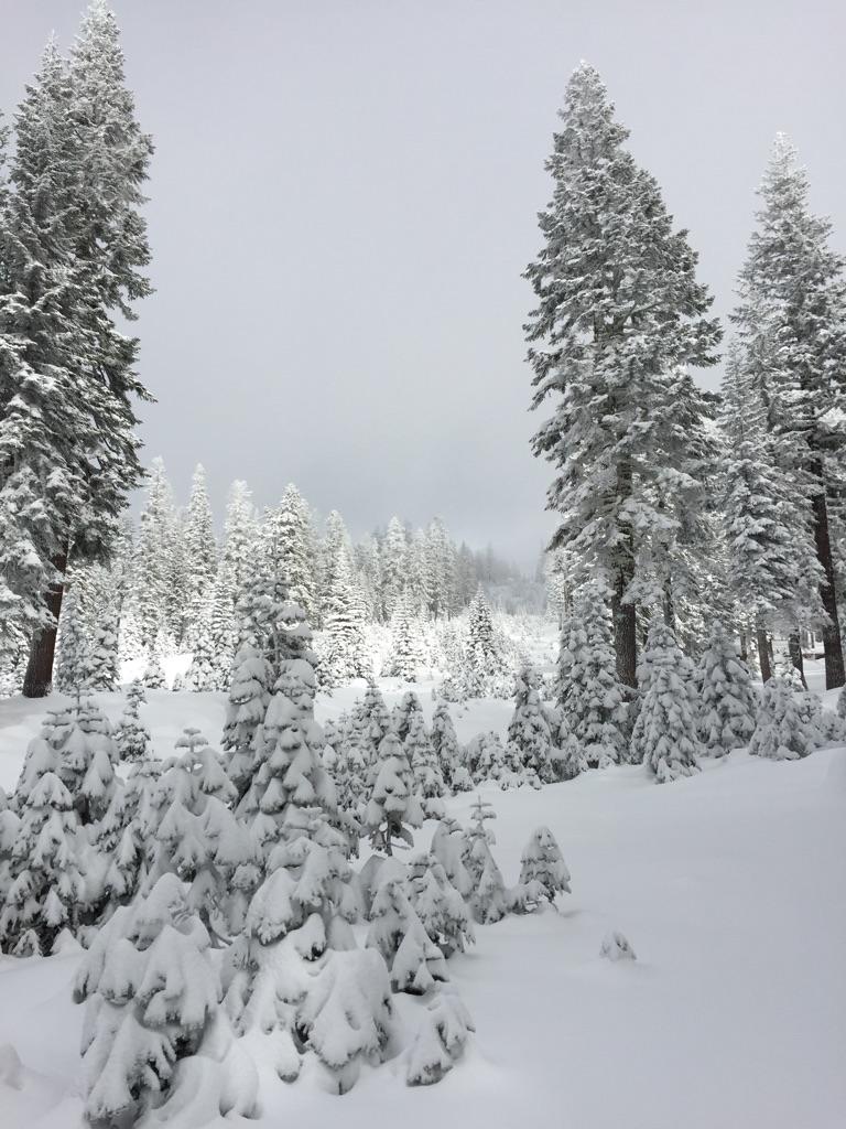
Photos: F Coots, 12.4.15, Old Ski Bowl area, 8,000 feet, Mt Shasta
The Five Red Flags of Avalanche Danger any time of year include: 1) Recent/current avalanche activity 2) Whumpfing sounds or shooting cracks 3) Recent/current heavy snowfall 4) Strong winds transporting snow 5) Rapid warming or rain on snow.
Weather and Current Conditions
Weather Summary
Good Morning! In Mt Shasta City at 0500, we have a current temperature of 33 F with cloudy skies and light snow.
MOUNTAIN WEATHER STATION INFORMATION (0500hrs):
On Mt Shasta (South Side) in the last 24 hours...
Old Ski Bowl - 7,600 feet, the current temperature is 22 degrees F. Snow on the ground totals 24 inches. Temperatures in the last 24 hours have ranged from 21 F to 27 F. Storm total is 7 inches.
Gray Butte - 8,000 feet, the current temperature is 21 degrees F. Temperatures have ranged from 19 F to 23 F in the last 24 hours. We are having technical problems with the anemometer at this time. Working on fixing this!
Castle Lake and Mt Eddy (West side of Interstate-5)...
Castle Lake - 5,600 feet, the current temperature is 26 degrees F. Temperatures have ranged from 25 F to 32 F in the last 24 hours. Snow on the ground measures 17.5 inches with no settlement. Storm total is 7 inches.
Mt Eddy - 6,500 feet, the current temperature is 24 degrees F. Temperatures have ranged from 24 F to 29 F. Snow on the ground measures 31 inches. Storm total is 7 inches. Winds have averaged 2 mph and south-southwest in direction with a max gust to 18 mph, S.
Always check the weather before you attempt to climb Mt Shasta. Further, monitor the weather as you climb. Becoming caught on the mountain in any type of weather can compromise life and limb. Be prepared.
| 0600 temperature: | 26 |
| Max. temperature in the last 24 hours: | 32 |
| Average wind direction during the last 24 hours: | SSW |
| Average wind speed during the last 24 hours: | n/a mi/hr |
| Maximum wind gust in the last 24 hours: | n/a mi/hr |
| New snowfall in the last 24 hours: | 7 inches |
| Total snow depth: | 24 inches |
Two Day Mountain Weather Forecast
Produced in partnership with the Medford NWS
| For 7000 ft to 9000 ft | |||
|---|---|---|---|
|
Sunday (4 a.m. to 10 p.m.) |
Sunday Night (10 p.m. to 4 a.m.) |
Monday (4 a.m. to 10 p.m.) |
|
| Weather | Cloudy. Snow before 10 am, then snow likely after 10 am. Breezy | 50% chance snow, mostly cloudy. | Rain likely, cloudy. |
| Temperature (°F) | 34 | 35 | 32 |
| Wind (mi/hr) | South 10-20 mph, increasing | South 15-25 mph with gusts to 40-50 mph | South/southwest 10-20 mph, decreasing in afternoon |
| Precipitation SWE / Snowfall (in) | / 1-3 | / 0-.5 | / 0 |
| For 9000 ft to 11000 ft | |||
| Sunday | Sunday Night | Monday | |
| Weather | Cloudy with snow before 10 am, then snow likely after 10 am. Wind chill values as low as -7. Windy | Mostly cloudy with 50% chance snow. Windy | Cloudy, snow likely. Windy |
| Temperature (°F) | 28 | 30 | 30 |
| Wind (mi/hr) | Southwest 40-45 mph with higher gusts, decreasing in afternoon | West 2-4 | West 35-40 mph then increasing to 50-55 mph in the PM |
| Precipitation SWE / Snowfall (in) | / 2-4 | / 0-1 | / 0-1 |

