

You are here
Avalanche Advisory for 2015-12-12 07:06:13
- EXPIRED ON December 13, 2015 @ 7:06 amPublished on December 12, 2015 @ 7:06 am
- Issued by Nick Meyers - Shasta-Trinity National Forest
Bottom Line
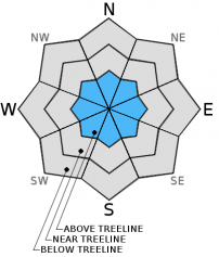
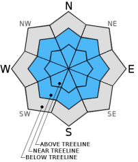
LOW avalanche danger exists for all elevations and aspects this morning. Pockets of MODERATE danger may be encountered this afternoon above treeline.
The avalanche danger is expected to rise as significant amounts of new snow accumulate this weekend.
Early season snowpack conditions exist. Watch out for shallow buried objects!


Avalanche Problem 1: Wind Slab
-
Character ?

-
Aspect/Elevation ?
-
Likelihood ?CertainVery LikelyLikelyPossible
 Unlikely
 -
Size ?HistoricVery LargeLargeSmall

Wind for this weekends storm will begin out of the north/northwest, shift to west and finish off southwest/south. Near and above treeline areas are of most concern for wind slab formation and small to large slabs could develop on all aspects if we receive the snow totals forecasted. The avalanche danger for said slabs will be low this morning and only increase as we get more snow and wind today and tomorrow. Just below ridge tops and extreme, complex terrain will be the best areas to find wind slabs.
Avalanche Problem 2: Storm Slab
-
Character ?

-
Aspect/Elevation ?
-
Likelihood ?CertainVery LikelyLikelyPossible
Unlikely
-
Size ?HistoricVery LargeLargeSmall
Storm slabs will develop with ensuing storm this weekend. Low danger this morning will increase as new snow piles up. Near and above treeline terrain in open bowls should be most suspect. Don't center punch your line!
Forecast Discussion
The weather forecast and actual reality of the forecast over the past few days has been a bit disapointing. We will give it another go this weekend. If all goes as planned, a major storm system will take hold of Northern California bringing a full spectrum of maritime weather. and new snow totals and winds are eyebrow raising. It will go something like this: a warm front moves on shore today, driving higher snow levels initially, near 6,000 to 7,000 feet with about .5 inches precipitation expected. Near and above treeline could see 3-5 inches of new snow. Saturday night into Sunday is expected to be the tooth and nails of the storm. About one inch of water is expected over a 24 hour period beginning 4am Sunday. With this blast, temperatures are expected to drop also, dragging snow levels down to town, and perhaps even a bit lower as further cooling occurs near the end of the storm. Hold on to your hats because near and above treeline wind will be cranking with this storm system. It will begin to blow out of the north/northwest and swing around counter clockwise over the course of the weekend, switching west later today and tonight and then southwest/south by Sunday. Peak gusts could reach 60-70 mph and we'll see steady speeds of 30-40 mph likely in exposed terrain.
THIS SEASON PRECIPITATION: Since October 1st (the wet season), we have received 6.00 inches of water, normal is 9.93 inches, putting us at 60% of normal. For the month of December, we have received 3.97 inches of water, normal is 2.57 putting us at 154% of normal. For the year of 2015 we've received 23.18 inches of water, normal is 37.93 inches putting us at 61% of normal.
Recent Observations
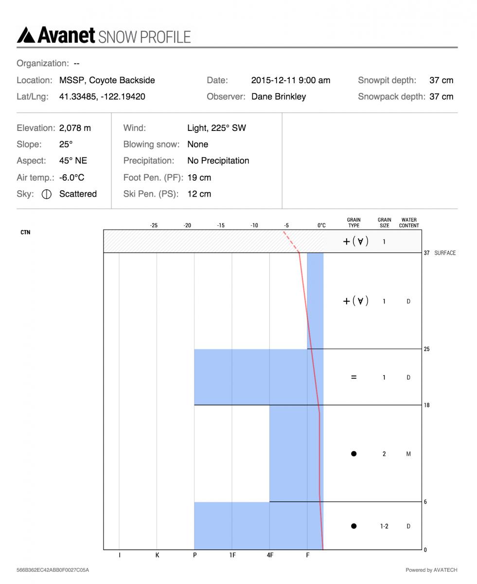
Cooler temperatures locked up the breakable crust near the surface of the snowpack and the recent small amounts of new snow has created for some pretty good skiing in the backcountry, despite the relatively shallow snowpack still. Near and slightly above treeline hosted the best skiing, particularly in gullies and areas devoid of too much wind. Upper elevations and exposed ridgelines are mostly scoured down to a bullet proof ice layer. Some small, shallow wind slabs lurk our there but have not been very responsive to triggering.
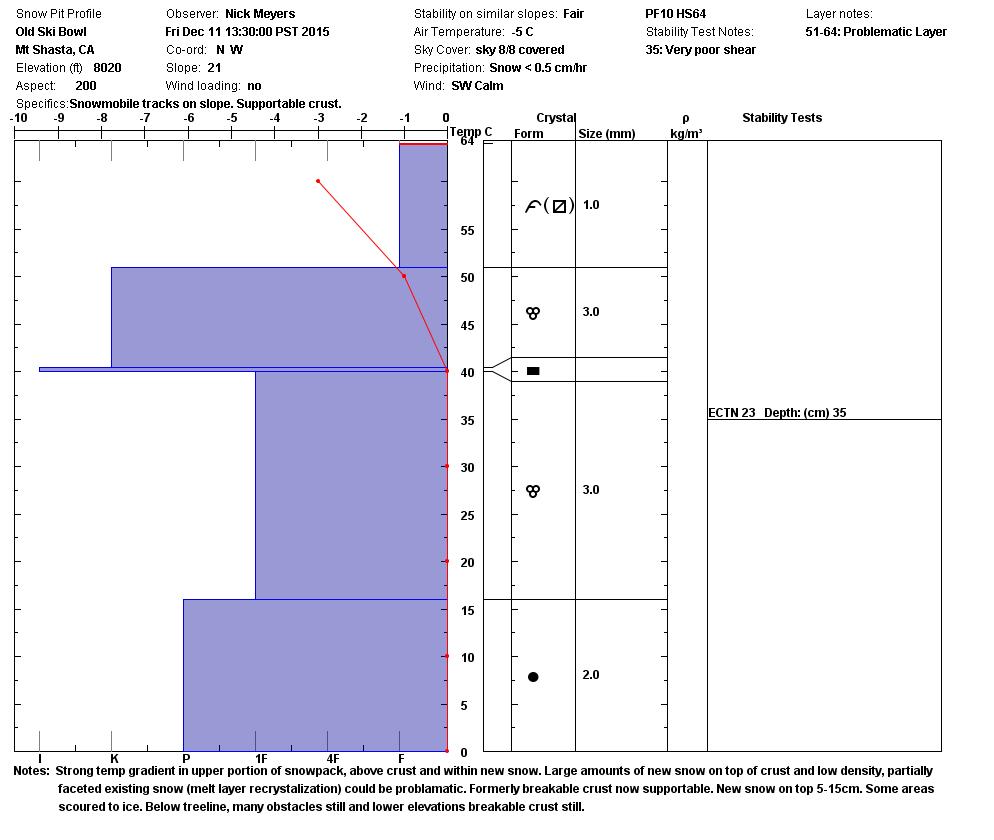
A strong temperature gradient and early stage facet growth was observed yesterday in the Old Ski Bowl area, just above treeline at 8,020 feet on a SSW facing slope. The melt layer recrystallization is caused by the burial of a warm layer (usually a rain layer) that then freezes while it is covered by a layer of new snow. A steep temperature gradient then causes faceting above the crust, in the bottom part of the new snow layer. I see two likely outcomes for the next few days: the brief warm spell force facets to rounds and elimitating potential weak layer or, temps stay cool and the weak layer persists. If said weak layer (now on top of snow) gets up to several feet of new snow piled on top, this could increase avalanche activity near and above treeline.
Until the skies clear and temperatures warm, I would have a highetend concern for this weekends new snow on top of a potential weak layer. Use cautious route finding and stay out of large avalanche path run out zones.
The Sand Flat cross country ski trails are snow covered and ready for your cross country skis. These are backcountry trails marked with blue diamonds on trees. Trails are not groomed. Enjoy!
The Five Red Flags of Avalanche Danger any time of year include: 1) Recent/current avalanche activity 2) Whumpfing sounds or shooting cracks 3) Recent/current heavy snowfall 4) Strong winds transporting snow 5) Rapid warming or rain on snow.
Weather and Current Conditions
Weather Summary
Good Morning! In Mt Shasta City at 0500, we have a current temperature of 30F with obscured, foggy skies.
MOUNTAIN WEATHER STATION INFORMATION (0500hrs):
On Mt Shasta (South Side) in the last 24 hours...
Old Ski Bowl - 7,600 feet, the current temperature is 23 degrees F. Snow on the ground totals 25 inches with a trace of new snow in the last 24 hours. Temperatures have ranged from 15 F to 24 F.
Gray Butte - 8,000 feet, the current temperature is 17 degrees F. Temperatures have ranged from 16 F to 21 F in the last 24 hours. Winds have averaged 10 mph with max gusts to 21 mph. southwest.
Mt Eddy (West side of Interstate-5)...
Castle Lake - 5,600 feet, the current temperature is 23 degrees F. Temperatures have ranged from 21 F to 33 F in the last 24 hours. Snow on the ground measures 5-6 inches with no new snow in the last 24 hrs.
Mt Eddy - 6,500 feet, the current temperature is 21 degrees F. Temperatures have ranged from 16 F to 28 F. Snow on the ground measures 24 inches with no new snow in the last 24 hours. Winds have averaged 2 mph and southerly in direction with a max gust to 14 mph, SE.
Always check the weather before you attempt to climb Mt Shasta. Further, monitor the weather as you climb. Becoming caught on the mountain in any type of weather can compromise life and limb. Be prepared.
| 0600 temperature: | 23 |
| Max. temperature in the last 24 hours: | 26 |
| Average wind direction during the last 24 hours: | Southerly |
| Average wind speed during the last 24 hours: | 10 mi/hr |
| Maximum wind gust in the last 24 hours: | 21 mi/hr |
| New snowfall in the last 24 hours: | trace inches |
| Total snow depth: | 25 inches |
Two Day Mountain Weather Forecast
Produced in partnership with the Medford NWS
| For 7000 ft to 9000 ft | |||
|---|---|---|---|
|
Saturday (4 a.m. to 10 p.m.) |
Saturday Night (10 p.m. to 4 a.m.) |
Sunday (4 a.m. to 10 p.m.) |
|
| Weather | Snow, mainly after 10am, breezy. | Snow, windy | Snow, heavy at times, windy |
| Temperature (°F) | 31 | 28 | 30 |
| Wind (mi/hr) | West/Northwest 10 mph | West/Northwest, becoming southwest in the afternoon 20-25 mph | South/Southwest 15-20 mph |
| Precipitation SWE / Snowfall (in) | / 3-5 | / 8-12 | / 11-17 |
| For 9000 ft to 11000 ft | |||
| Saturday | Saturday Night | Sunday | |
| Weather | Snow, mainly after 10am, windy | Snow, windy | Snow, heavy at times, windy. |
| Temperature (°F) | 25 | 23 | 13 |
| Wind (mi/hr) | North/Northwest 25-35 mph | West/Southwest 4-8 | South 30-40 mph |
| Precipitation SWE / Snowfall (in) | / 4-8 | / 10-16 | / 19-25 |

