

You are here
Avalanche Advisory for 2015-12-15 07:02:54
- EXPIRED ON December 16, 2015 @ 7:02 amPublished on December 15, 2015 @ 7:02 am
- Issued by Nick Meyers - Shasta-Trinity National Forest
Bottom Line
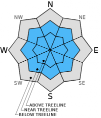
MODERATE avalanche danger exists near and above treeline. Pockets of CONSIDERABLE danger may be found on uniform, open W-SW-S-SE-E-NE facing slopes steeper than 30 degrees, 7,500 to 8,500 feet. Near crust facets forming a persistent weak layer, 40-50cm deep in the snowpack, continues to be a concern.
Wind slabs above treeline are also a concern with ongoing north/northwest winds loading primarily E-SE-S-SW slopes. Limited upper elevation observations leave uncertainty of wind slab sensitivity.
Below treeline, the avalanche danger is LOW


Avalanche Problem 1: Persistent Slab
-
Character ?

-
Aspect/Elevation ?
-
Likelihood ?CertainVery LikelyLikelyPossible
 Unlikely
 -
Size ?HistoricVery LargeLargeSmall

While we had some eye brow raising stability test results on December 13th (see videos), we have not observed or had any natural or human triggered avalanches reported since then. It would seem that with the results of our many tests, the forecast area would see some avalanche activity. That has not been the case. I've thought about this and what I've come up with is... perhaps because of our still shallow snowpack, the weak layer bed surface is not uniform and planar due to many ground protrusions still sticking up into the snowpack. So, while yes a small 30 by 90 cm block will fracture and propagate, a full slope will not propagate due to rocks, stumps and down trees creating an uneven bed surface where the old rain crust exists.
I want to make it very clear: by no means am I saying that this problem has past. Hence the name "persistent weak layer", I do believe the persistent slab problem still remains an issue, especially with continued cold temperatures. The classic notion of "we only get avalanche activity 24-48 hours after a storm" should not be abided by with this avalanche problem.
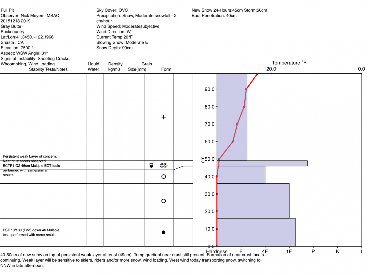
The details: the persistent weak layer in the form of near crust facets, first observed on December 11th, lies 40-50cm deep in the snowpack. Rounded facets likely remain loose and weak. The presence or absence of the avalanche problem will vary widely from one location to another due to depth of snow, aspect and elevation, and ground anchors/protrusions. Continued wind loading or, a skier or rider on this persistent weak layer could tip the stress vs strength scale where all ingredients for an avalanche come together perfectly. Soft to hard slabs have been observed 1-2 feet thick.
The geograhpic location of said weak layer is a tough one and has been difficult to track. For the time being, avoid wide open, smooth and planar looking slopes just below, near and slightly above treeline or in other words, between 7,500 to 8,500 feet. The persistent weak layer has been found on NW-W-SW-S-SE facing slopes in this elevation band, some areas better developed than others. Unfortunately, we cannot nail this weak layer down perfectly. It is up to YOU to get your shovel out, dig a pit and identify the presence or absence of the weak layer. Further, conduct a few stability tests before considering skiing or riding on suspect slopes!
Avalanche Problem 2: Wind Slab
-
Character ?

-
Aspect/Elevation ?

-
Likelihood ?CertainVery LikelyLikelyPossible
Unlikely
-
Size ?HistoricVery LargeLargeSmall
Recent light density snow has been readily available for wind transport. Wind slabs will continue to build in size and distribution. Strong winds can deposit wind slabs far down the slope below traditional avalanche start zones as well as creating wind slabs below treeline. Avoid these areas by traveling in areas less than 30 degrees in slope angle without steeper terrain above. Even on scoured, windward aspects small wind slabs can develop. We've seen the full spectrum of wind loading on all aspects. Local orographics allow non-typical aspects to wind load on Mt Shasta. Over the course of the past week, we've had wind from all directions though the highest wind speeds have been blowing from the north/northwest. Uncertainty exists for wind slab sensitivity to triggering due to lack of upper elevation observations. Watch out for near and above treeline terrain near/below ridgetops, on the leeward side of rocks and tree outcrops, round/hollow sounding snow pillows, shooting cracks, narrow couloirs and extreme terrain.
Forecast Discussion
Today and today only will function as our best view of blue sky, albeit a windy one. Don't let a bluebird day potentially suck you into dangerous avalanche terrain. A steady line up of winter storms will fire up again tomorrow and through the weekend. Rising temperatures over the next couple days will drive snow levels up a bit to 6,000-7,000 feet before another cold front dips down and cools us off again. Precipitation totals are not jaw dropping for Mt Shasta, but we'll still gets a few inches here and there as the storms move through.
THIS SEASON PRECIPITATION: Since October 1st (the wet season), we have received 7.17 inches of water, normal is 10.68 inches, putting us at 67% of normal. For the month of December, we have received 5.14 inches of water, normal is 3.32 putting us at 154% of normal. For the year of 2015 we've received 24.35 inches of water, normal is 38.68 inches putting us at 62% of normal.
Recent Observations
Yesterday, we took a tour to Ash Creek Butte (ACB) to work on the weather station and take a look at the snowpack out there. A SE facing slope, 31 degrees at 7,500 feet, we observed 40-50 cm new snow, similar to new snow amounts on Mt Shasta. The persistent weak layer found on the west facing aspect of Gray Butte was not as readily identifiable on ACB. The rain crust layer hosting our persistent weak layer had poorly developed facets and numerous ECT tests resulted in ECTN20-25 indicating a stronger snowpack at this location. Propagation saw tests resulted in PST 50/100 (Arr) down 45cm.
The Old Ski Bowl weather station recorded less than a foot of new snow from the latest storm that swept over the area this past weekend, however field observations observed 1 to 1.5 feet of new snow on the ground! Winds have been all over the compass though primarily W/NW/N.
We did not receive any new observations from the Mt Shasta/Gray Butte area yesterday.
"Testing the snow" on ACB - Photo: N Meyers
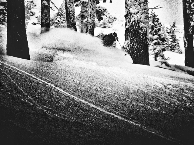
VIDEOS of ECT tests performed on 12.13.15:
Pit profile below from December 13, 2015:
The Sand Flat cross country ski trails are snow covered and ready for your cross country skis. These are backcountry trails marked with blue diamonds on trees. Trails are not groomed. Enjoy!
The Five Red Flags of Avalanche Danger any time of year include: 1) Recent/current avalanche activity 2) Whumpfing sounds or shooting cracks 3) Recent/current heavy snowfall 4) Strong winds transporting snow 5) Rapid warming or rain on snow.
Weather and Current Conditions
Weather Summary
Good Morning! In Mt Shasta City at 0500, we have a current temperature of 30 F, mostly clear skies and windy conditions.
MOUNTAIN WEATHER STATION INFORMATION (0500hrs):
On Mt Shasta (South Side) in the last 24 hours...
Old Ski Bowl - 7,600 feet, the current temperature is 26 degrees F. Snow on the ground totals 32 inches with no new snow in the last 24 hours and 5 inches of settlement. Recent storm totals have been 1-1.5 feet of new snow. Temperatures have ranged from 12 F to 26 F.
Gray Butte - 8,000 feet, the current temperature is 12 degrees F. Temperatures have ranged from 11 F to 21 F in the last 24 hours. Northerly winds have been blowing steady 20-30 mph with gusts to 56 mph up until 1700 when they died down and averaged 7-14 mph and variable in direction.
Mt Eddy Range (West side of Interstate-5)...
Castle Lake - 5,600 feet, the current temperature is 19 degrees F. Temperatures have ranged from 18 F to 24 F in the last 24 hours. Snow on the ground measures 17 inches with no new snow and 1 inch settlement. Storm totals have been about 10 inches.
Mt Eddy - 6,500 feet, the current temperature is 17 degrees F. Temperatures have ranged from 15 F to 21 F. Snow on the ground measures 33 inches with no new snow in the last 24 hours and 2 inches settlement. Winds have averaged 3 mph and SE in direction with a max gust to 25 mph, SE.
Always check the weather before you attempt to climb Mt Shasta. Further, monitor the weather as you climb. Becoming caught on the mountain in any type of weather can compromise life and limb. Be prepared.
| 0600 temperature: | 18 |
| Max. temperature in the last 24 hours: | 26 |
| Average wind direction during the last 24 hours: | Northerly |
| Average wind speed during the last 24 hours: | 20-30 mph until 1700, then 7-14 mph @ Gray Butte mi/hr |
| Maximum wind gust in the last 24 hours: | 56 mph @ Gray Butte mi/hr |
| New snowfall in the last 24 hours: | 0 inches |
| Total snow depth: | 32 inches |
Two Day Mountain Weather Forecast
Produced in partnership with the Medford NWS
| For 7000 ft to 9000 ft | |||
|---|---|---|---|
|
Tuesday (4 a.m. to 10 p.m.) |
Tuesday Night (10 p.m. to 4 a.m.) |
Wednesday (4 a.m. to 10 p.m.) |
|
| Weather | Mostly sunny, blustery | Partly cloudy | Partly to mostly cloudy |
| Temperature (°F) | 29 | 21 | 33 |
| Wind (mi/hr) | North 15-20 mph | North 10-15 mph | North becoming West/Northwest 10-15 mph |
| Precipitation SWE / Snowfall (in) | / 0 | / 0 | / 0 |
| For 9000 ft to 11000 ft | |||
| Tuesday | Tuesday Night | Wednesday | |
| Weather | Mostly sunny, windy | Partly cloudy, windy | Partly to mostly cloudy, windy |
| Temperature (°F) | 18 | 16 | 20 |
| Wind (mi/hr) | North 30-40 mph G-50 | North 0 | Northwest 15-25 mph G-35 |
| Precipitation SWE / Snowfall (in) | / 0 | / 0 | / 0 |

