

You are here
Avalanche Advisory for 2016-02-26 06:48:38
- EXPIRED ON February 27, 2016 @ 6:48 amPublished on February 26, 2016 @ 6:48 am
- Issued by Nick Meyers - Shasta-Trinity National Forest
Bottom Line
Overall, the avalanche danger is LOW for all elevations and aspects. Increasing cloud cover will keep loose-wet instabilities at bay and any lingering, small wind slabs will be stubborn to trigger. Rain on snow below and near treeline is likely late this afternoon, but not expected to change the avalanche danger. A few inches of new snow is possible above treeline tonight.
Normal caution is advised today.


Avalanche Problem 1: Normal Caution
-
Character ?

-
Aspect/Elevation ?
-
Likelihood ?CertainVery LikelyLikelyPossible
 Unlikely
 -
Size ?HistoricVery LargeLargeSmall

Overall LOW avalanche danger exists across the forecast area. You need to remember that risk is ALWAYS present in mountain travel. Even with LOW danger, avalanches can still happen in isolated places.
Some current considerations:
- Lingering, stubborn wind drifts may be encountered on the upper mountain. After our storm from last week, northerly winds cranked on the upper mountain. If climbing, small wind pockets may linger. The consequences are low, burial is unlikely, but if on a steep slope with a long fetch that may take you over a cliff or into rocks...you get it.
- Loose wet instability hazard is always low in the morning but can become moderate to considerable in the warm afternoon hours, especially after poor overnight re-freeze. Today, clouds will keep snow in place likely. We havn't seen any major activity yet this year, however roller balls and pin wheels are a good sign that the snow is loosing strength and larger slides are possible. Mt Shasta has slopes with long fetch and this allows loose wet slides to gain a good bit of momentum and snow. Throw in a terrain trap or two and burial is likely. These larger loose wet slides will become more of a problem as we move into Spring.
- Cornices, some very large, have been observed in the area backcountry. While none have been able to trigger, the old elevator drop is always certain to get your heart pumping and can send you for a ride...not magic mountain style. Simply, stay back on terra firma by noting rocks or trees protruding from the landscape.
Forecast Discussion
An incoming cold front nudges toward land today and will arrive by nightfall. Clouds will increase and temperatures will begin to fall. This short lived storm is forecast to bring .45 inches of water over a 4-6 hour period tonight, from 4 to 10 pm. Winds actually look remarkably light over the next couple days. Snow levels today will linger at 8,400 feet, fall to 7,000 feet tonight and lower to 5,700 feet by tomorrow. Rain on snow is likely and only an inch or two expected at below and near treeline areas and perhaps a few more inches at upper elevations above treeline. So... this first wave not an impressive Shasta snowmaker, but the storm is said to mark the beginning of a "parade of storms" that NWS forecasters claim are on the way with each one increasing in intensity next week. March is on deck and it's supposed to be a wet one! One more blast of winter would be good with us.
THIS SEASON PRECIPITATION for MT SHASTA CITY: Since October 1st (the wet season), we have received 25.36 inches of water, normal is 28.69 inches, putting us at 88% of normal. For the month of February we've received 2.87 inches of water, normal is 6.42 inches, putting us at 44% of normal, and finally... for the year of 2016 we've received 15.87 inches of water, normal is 13.48 inches, putting us at 117% of normal .
Recent Observations
Temperatures are very warm this morning, 10 degrees warmer than yesterday in Mt Shasta City. The past few days have been carbon copies of each other with few new, notable observations. Low danger dominates and will continue as such today. Despite poor overnight low temps and sunny days, wet loose instabilities have been few. A variety of snow surface conditions will be found, pending your aspect and elevation. Overall, good riding conditions can be enjoyed throughout the different types of snow surfaces. Clouds are already filtering into the area this morning which will keep loose-wet snow instabilities at bay. We will see some precipitation begin late this afternoon. The rain on snow is not expected to cause any stability concerns.
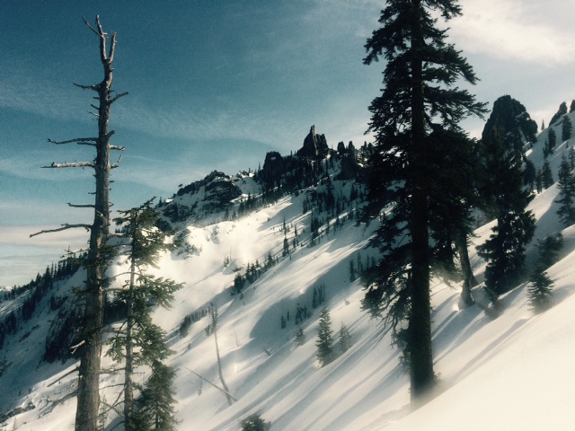
West side of the forecast area, Castle Crags area, 2.24.26 - Photo: C. Carr, Shasta Mountain Guides
-----------------------------------------------------------------------------------------------------------------------------------------------------------
LOCAL AREA ROAD, NORDIC, AND SNOWMOBILE PARK STATUS:
The Sand Flat cross country ski trails are in good shape and ready for your cross country skis and snow shoes. These are backcountry routes marked with blue diamonds on trees. Trails are not groomed. Snow shoers, please blaze a parallel trail to cross country skiers staying out of the skin track. These trails can be accessed via the Everett Memorial Highway. Thank you, and enjoy!
The Mt. Shasta Nordic Center is open! These beautiful, groomed trails can be accessed via the Ski Park Highway. http://www.mtshastanordic.org
The Pilgrim Creek & Deer Mountain Snowmobile Parks are open! Trails have not been groomed in the past week and a half due to warm temperatures. Head to our "Education" tab on our website and find the snowmobile section for trail information, grooming status, and other sledder resources.
The Castle Lake Road is plowed to the lake. The Everett Memorial Highway is plowed to Bunny Flat.
The Five Red Flags of Avalanche Danger any time of year include: 1) Recent/current avalanche activity 2) Whumphing sounds or shooting cracks 3) Recent/current heavy snowfall 4) Strong winds transporting snow 5) Rapid warming or rain on snow.
Weather and Current Conditions
Weather Summary
Good Morning! In Mt Shasta City at 0500, we have a current temperature of 41 F, ten degrees warmer than yesterday at this time, with partly cloudy skies and calm wind.
On Mt Shasta (South Side) in the last 24 hours...
Old Ski Bowl - 7,600 feet, the current temperature is 40 degrees F. Snow on the ground totals 119 inches with no new snow and little settlement. Temperatures have ranged from 34 F to 52 F.
Grey Butte - 8,000 feet, the current temperature is 38 degrees F. Temperatures have ranged from 35 F to 47 F. Winds have averaged 5-7 mph and variable in nature with a max gust to 21 mph south/southeast. At 0300 this morning the winds picked up out of the west/southwest averaging 10-15 mph with gusts to 28mph.
Mt Eddy Range (West side of Interstate-5)...
Castle Lake - 5,600 feet, the current temperature is 41 degrees. Temperatures have ranged from 39 F to 59 F. Snow on the ground totals 67 inches with no new snow and 2 inches settlement.
Mt Eddy - 6,500 feet, the current temperature is 40 degrees F. Temperatures have ranged from 34 F to 49 F. Snow on the ground measures 78 inches with no new snow and 1 inch of settlement. Winds have averaged 1-3 mph, southerly in direction with a max gust of 11 mph, southerly.
Always check the weather before you attempt to climb Mt Shasta. Further, monitor the weather as you climb. Becoming caught on the mountain in any type of weather can compromise life and limb. Be prepared.
| 0600 temperature: | 41 |
| Max. temperature in the last 24 hours: | 51 |
| Average wind direction during the last 24 hours: | Variable |
| Average wind speed during the last 24 hours: | 4-6 mi/hr |
| Maximum wind gust in the last 24 hours: | 28 (Gray Butte) mi/hr |
| New snowfall in the last 24 hours: | 0 inches |
| Total snow depth: | 85 inches |
Two Day Mountain Weather Forecast
Produced in partnership with the Medford NWS
| For 7000 ft to 9000 ft | |||
|---|---|---|---|
|
Friday (4 a.m. to 10 p.m.) |
Friday Night (10 p.m. to 4 a.m.) |
Saturday (4 a.m. to 10 p.m.) |
|
| Weather | Increasing clouds, rain mainly after 4pm | Rain before 10pm, then rain mixed with snow | A 20% chance of lingering rain and snow showers before 10am, then partly sunny, clearing. |
| Temperature (°F) | 47 | 31 | 44 |
| Wind (mi/hr) | South 10-20 | West 10-15 | Southeast 5-10 |
| Precipitation SWE / Snowfall (in) | / .10 to .25 in water | / 0-1 | / 0 |
| For 9000 ft to 11000 ft | |||
| Friday | Friday Night | Saturday | |
| Weather | Increasing clouds, snow, mainly after 4pm | Snow before 10pm, then snow showers | 20% chance of snow showers before 10am, clearing, partly cloudy |
| Temperature (°F) | 32 | 20 | 24 |
| Wind (mi/hr) | Southwest 30-35 mph | Southwest 1-3 | West 20-25 mph |
| Precipitation SWE / Snowfall (in) | / 1-3 | / 4-8 | / 0 |

