

You are here
Avalanche Advisory for 2016-02-29 06:21:18
- EXPIRED ON March 1, 2016 @ 6:21 amPublished on February 29, 2016 @ 6:21 am
- Issued by Jon Dove - Shasta-Trinity National Forest
Bottom Line
LOW avalanche danger exist at all elevations and aspects through out the entire forecast area. Snow instabilities will be very hard to find.
Normal caution is advised and safe travel techniques should always be a steady habit.


Avalanche Problem 1: Normal Caution
-
Character ?

-
Aspect/Elevation ?

-
Likelihood ?CertainVery LikelyLikelyPossible
 Unlikely
 -
Size ?HistoricVery LargeLargeSmall

Normal caution is advised for today. Snow instabilities such as isolated wind slabs or loose wet slides will be few and far between. Scattered clouds, moderate wind, and relatively cool temperatures will limit the possibility of any roller balls, pinwheels, or loose wet avalanches today. Wind slab formations from the scant amount of snow received this last Friday are widely spaced with poor uniformity and pose little threat. Triggering anything of size and consequence is slim to none. It is always smart to continue to practice safe travel techniques for backcountry travel.
Forecast Discussion
A couple fronts are lined up to pass over our area this week, however, they will be fairly weak with only modest amounts of precipitation expected. That being said various weather models have been leaning towards a significant pattern change by this coming weekend. The jet stream will elongate and provide more support to systems arriving in our area resulting in stronger storms, overall. As for today, expect more sunshine with increasing mid to high level clouds as a warm front approaches. The system that is set to arrive by early to mid-day tomorrow will bring a scant 0.15 inches of water. Snow levels will be high, hovering around treeline at 7,000-8,000 feet. Winds above treeline at mid and upper mountain elevations (10,000 feet and up) will be moderate to strong at 30-45 mph, and southerly in nature. The National Weather Service is calling for a change toward a more strong wet weather pattern by next weekend. We're hoping for a winter revival, so we'll just have to cross our fingers and see what happens.
THIS SEASON PRECIPITATION for MT SHASTA CITY: Since October 1st (the wet season), we have received 25.52 inches of water, normal is 29.50 inches, putting us at 86% of normal. For the month of February we've received 3.03 inches of water, normal is 7.23 inches, putting us at 41% of normal, and finally... for the year of 2016 we've received 16.03 inches of water, normal is 14.29 inches, putting us at 112% of normal .
Recent Observations
Observations for yesterday are limited to what our weather stations have recorded over the past 24 hours, and what was reported from Saturday. Temperatures remained relatively cool, and winds were moderate out of a northwesterly direction. There was no soft snow to transport by winds, so there is no chance of newly developed wind slabs. Some lofty clouds and the cool temperatures prevented any loose wet snow instabilities from occurring. For skiers and riders the best snow was found in Avalanche Gulch where gully bottoms hosted some relatviely smooth surfaces to slide on. Elsewhere "scabs" of wind sculpted snow form last Friday's weak system were scattered about with firm, icy snow in between. Overall, a pretty bomb proof snowpack exists with the probability of triggering any type of avalanche being fairly remote. There were no reports or observations of any recent avalanche activity with our forecast area. We are hoping that NOAA is right, and a transition back into a more wet weather pattern is imminent. For today, continue to practice safe backcountry travel techniques.
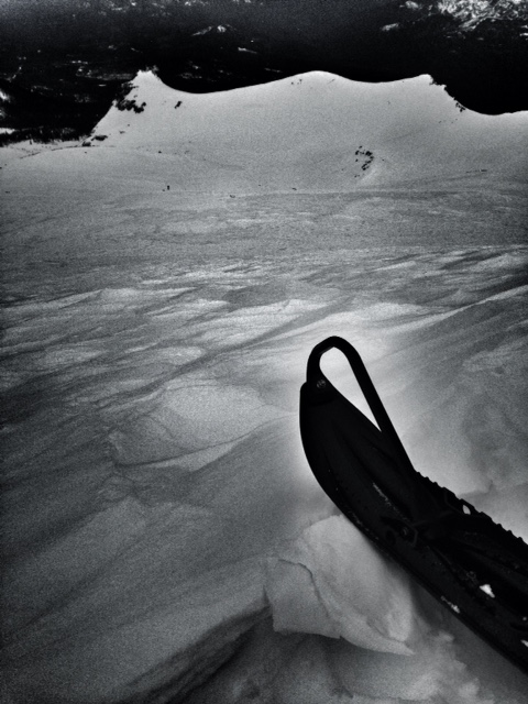
Sastrugi feature in the Old Ski Bowl with Green Butte in the background, photo taken on 2.27.16
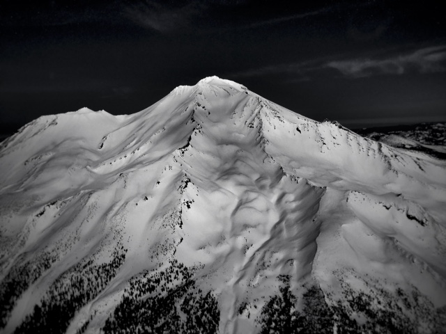
Aerial photo of Mt Shasta taken late February, 2016 by Jimmy Williams with his son Billy as pilot. Thanks for sharing you guys!
-----------------------------------------------------------------------------------------------------------------------------------------------------------
LOCAL AREA ROAD, NORDIC, AND SNOWMOBILE PARK STATUS:
The Sand Flat cross country ski trails are in good shape and ready for your cross country skis and snow shoes. These are backcountry routes marked with blue diamonds on trees. Trails are not groomed. Snow shoers, please blaze a parallel trail to cross country skiers staying out of the skin track. These trails can be accessed via the Everett Memorial Highway. Thank you, and enjoy!
The Mt. Shasta Nordic Center is open! These beautiful, groomed trails can be accessed via the Ski Park Highway. http://www.mtshastanordic.org
The Pilgrim Creek & Deer Mountain Snowmobile Parks are open! Trails have not been groomed in the past week and a half due to warm temperatures. Head to our "Education" tab on our website and find the snowmobile section for trail information, grooming status, and other sledder resources.
The Castle Lake Road is plowed to the lake. The Everett Memorial Highway is plowed to Bunny Flat.
The Five Red Flags of Avalanche Danger any time of year include: 1) Recent/current avalanche activity 2) Whumphing sounds or shooting cracks 3) Recent/current heavy snowfall 4) Strong winds transporting snow 5) Rapid warming or rain on snow.
Weather and Current Conditions
Weather Summary
Good Morning! In Mt Shasta City at 0500, we have a current temperature of 28 F, four degrees cooler than yesterday at this time, with clear skies and calm wind.
On Mt Shasta (South Side) in the last 24 hours...
Old Ski Bowl - 7,600 feet, the current temperature is 32 degrees F. Snow on the ground totals 116 inches with no new snow and one inch settlement. Temperatures have ranged from 27 F to 42 F.
Gray Butte - 8,000 feet, the current temperature is 31 degrees F. Temperatures have ranged from 27 F to 38 F. Winds have averaged 15-20 mph and northwesterly in direction with a max gust to 35 mph northwest.
Mt Eddy Range (West side of Interstate-5)...
Castle Lake - 5,600 feet, the current temperature is 32 degrees. Temperatures have ranged from 31 F to 51 F. Snow on the ground totals 64 inches with no new snow and 1 inch of settlement.
Mt Eddy - 6,500 feet, the current temperature is 27 degrees F. Temperatures have ranged from 27 F to 44 F. Snow on the ground measures 76 inches with no new snow and 1 inch of settlement. Winds have averaged 2-3 mph, southerly in direction with a max gust of 16 mph, southeast.
Always check the weather before you attempt to climb Mt Shasta. Further, monitor the weather as you climb. Becoming caught on the mountain in any type of weather can compromise life and limb. Be prepared.
| 0600 temperature: | 29 |
| Max. temperature in the last 24 hours: | 44 |
| Average wind direction during the last 24 hours: | Northwesterly |
| Average wind speed during the last 24 hours: | 15-20 mi/hr |
| Maximum wind gust in the last 24 hours: | 35 (Gray Butte) mi/hr |
| New snowfall in the last 24 hours: | 0 inches |
| Total snow depth: | 82 inches |
Two Day Mountain Weather Forecast
Produced in partnership with the Medford NWS
| For 7000 ft to 9000 ft | |||
|---|---|---|---|
|
Monday (4 a.m. to 10 p.m.) |
Monday Night (10 p.m. to 4 a.m.) |
Tuesday (4 a.m. to 10 p.m.) |
|
| Weather | Mostly sunny then increasing clouds. | Mostly cloudy with 20% chance of rain before 10 pm, then a slight chance of snow. | Partly sunny with a 40% chance of rain between 10 am and 4 pm, then a chance of rain and snow showers after 4 pm. Windy. |
| Temperature (°F) | 44 | 34 | 44 |
| Wind (mi/hr) | East then shifting to southwest in the afternoon 5-10 mph | South 5-10 mph | South 15-25 mph |
| Precipitation SWE / Snowfall (in) | / 0 | / 0 | / 0-.5 |
| For 9000 ft to 11000 ft | |||
| Monday | Monday Night | Tuesday | |
| Weather | Mostly sunny then increasing clouds. Windy. | Mostly cloudy with a 20% chance of snow before 4 am. | Partly sunny with a 40% chance of snow after 10 am. WIndy |
| Temperature (°F) | 27 | 27 | 30 |
| Wind (mi/hr) | West 20-25 mph with gusts to 35 | West/southwest 0 | Southwest 40-45 mph with gusts to 55+mph |
| Precipitation SWE / Snowfall (in) | / 0 | / 0 | / 1-2 |

