

You are here
Avalanche Advisory for 2016-03-04 06:46:27
- EXPIRED ON March 5, 2016 @ 6:46 amPublished on March 4, 2016 @ 6:46 am
- Issued by Nick Meyers - Shasta-Trinity National Forest
Bottom Line
The avalanche danger is LOW for all elevations and aspects today.
Tonight, a potent storm will begin to move into the area for the weekend. Up to 3 inches of water (1-2+ feet snow) is expected by Sunday morning. Southerly winds will reach hurricane force speeds of 60-70 mph at mid-mountain levels. Snow levels will start near 6,700 feet and gradually fall to 3,600 feet by the end of the weekend.
The avalanche danger will rise this weekend. Be ready.


Avalanche Problem 1: Normal Caution
-
Character ?

-
Aspect/Elevation ?
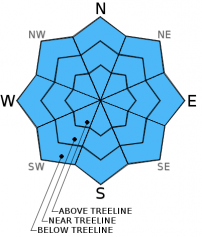
-
Likelihood ?CertainVery LikelyLikelyPossible
 Unlikely
 -
Size ?HistoricVery LargeLargeSmall

Normal caution is advised for today, and only today! A very strong snowpack exists across the forecast area, but that will soon change. We do not have any remaining layers that pose a concern beneath the snow surface. That said, existing icy, smooth snow surfaces could act as a good bed surface for new snow. The temperatures are starting out warm and will gradually cool. This slow decline in temp will encourage good bonding of new snow, hopefully pasting it on there, good 'ol Cascade glue. Where we can typically run into weak layers is yes, at the old/new snow interface, but more commonly at slight density changes within the new snow layers. A thin layer of graupel, a slight shift in air temperatures, or even a slight change in wind direction can affect the snow density and create weak layers within storm and wind slabs.
Storm and wind slabs are going to lead the avalanche problems this weekend. With very windy southwesterlies, it will be interesting to see how much of the new snow actually sticks around above treeline. With winds of this speed, sometimes the snow simply blows away...sublimation! It is more probable that the highest avalanche danger will be in partially protected areas near treeline. Regardless, the danger is set to rise and everyone is going to need to have their avalanche awareness antennas on high.
Forecast Discussion
We are fast approaching the flood gates that still remain closed but will begin to crack this Friday evening. Today, increasing clouds with some pre-frontal showers... tonight however, is when the games will begin for what looks like a pretty good looking storm... of note are the very high winds that are forecasted for the 700mb level, or about 10,000 feet. Wind speeds, southerly in direction, will blow upwards of 60-70 mph in exposed areas and likely higher on the upper mountain. Any climbers out there? NOT a good weekend for a summit attempt. Read again, climbers, this weekend is NOT a good time to climb Mt Shasta. If precipitation models are correct, just shy of 3 inches of water is set to fall from Friday evening through Sunday morning. Snow levels will sit at 6,700 feet today, 5,900 feet tonight, 6,100 feet tomorrow. Saturday night, temps will continue to cool and we will see snow levels drop to 5,100 feet...Sunday we should bottom out with snow levels near 3,500 feet. So...snow is in the box for the forseeable future. Blizzard conditions with hurricane force winds this weekend above treeline. The avalanche danger is guaranteed to rise and we'll keep you posted on that!
THIS SEASON PRECIPITATION for MT SHASTA CITY: Since October 1st (the wet season), we have received 25.89 inches of water, normal is 30.28 inches, putting us at 85% of normal. For the month of March we've received .37 inches of water, normal is .78 inches, putting us at 47% of normal, and finally... for the year of 2016 we've received 16.40 inches of water, normal is 15.07 inches, putting us at 108% of normal .
Recent Observations
At this point, we wait patiently for the party to start! El Nino is ready to fire up the whistles and tequila poppers for this weekend. We do not have any new and notable observations from the field today. Variable snow surface conditions with excellent stability has been the standard for several days now. Firm, icy old snow, wind packed powder, isolated-scab like sastrugi features, corn... you name it, it's probably out there. The avalanche danger will certainly rise this weekend and all eyes are on the incoming storm. Southerly winds looking excessively strong, stronger than we typically see. Forecasts show 60-70 mph wind speeds at mid-mountain levels. Yowzer! With feet of snow and hurricane force winds on tap, it is time to get your A game fired back up if you plan on venturing into the backcountry for some powder skiing.
-----------------------------------------------------------------------------------------------------------------------------------------------------------
LOCAL AREA ROAD, NORDIC, AND SNOWMOBILE PARK STATUS:
The Sand Flat cross country ski trails are in good shape and ready for your cross country skis and snow shoes. These are backcountry routes marked with blue diamonds on trees. Trails are not groomed. Snow shoers, please blaze a parallel trail to cross country skiers staying out of the skin track. These trails can be accessed via the Everett Memorial Highway. Thank you, and enjoy!
The Mt. Shasta Nordic Center is open! These beautiful, groomed trails can be accessed via the Ski Park Highway. http://www.mtshastanordic.org
The Pilgrim Creek & Deer Mountain Snowmobile Parks are open! Trails have not been groomed in the past week and a half due to warm temperatures. Head to our "Education" tab on our website and find the snowmobile section for trail information, grooming status, and other sledder resources.
The Castle Lake Road is plowed to the lake. The Everett Memorial Highway is plowed to Bunny Flat.
The Five Red Flags of Avalanche Danger any time of year include: 1) Recent/current avalanche activity 2) Whumphing sounds or shooting cracks 3) Recent/current heavy snowfall 4) Strong winds transporting snow 5) Rapid warming or rain on snow.
Weather and Current Conditions
Weather Summary
Good Morning! In Mt Shasta City at 0500, we have a current temperature of 46 F, the same temperature as yesterday at this time. Winds are calm and skies are partly cloudy.
On Mt Shasta (South Side) in the last 24 hours...
Old Ski Bowl - 7,600 feet, the current temperature is 29 degrees F. Snow on the ground totals 116 inches with no new snow and one inch of settlement. Temperatures have ranged from 28 F to 37 F.
Gray Butte - 8,000 feet, the current temperature is 28 degrees F. Temperatures have ranged from 27 F to 34 F. Winds have averaged 5-10 mph with a max gust to 28 mph, southwest.
Mt Eddy Range (West side of Interstate-5)...
Castle Lake - 5,600 feet, the current temperature is 35 degrees. Temperatures have ranged from 34 F to 41 F. Snow on the ground totals 60 inches with no new snow and little settlement.
Mt Eddy - 6,500 feet, the current temperature is 32 degrees F. Temperatures have ranged from 32 F to 41 F. Snow on the ground measures 74 inches with perhaps a trace of new snow and little settlement. Winds have averaged 2 mph with a max gust of 10 mph, southerly.
Always check the weather before you attempt to climb Mt Shasta. Further, monitor the weather as you climb. Becoming caught on the mountain in any type of weather can compromise life and limb. Be prepared.
| 0600 temperature: | 34 |
| Max. temperature in the last 24 hours: | 43 |
| Average wind direction during the last 24 hours: | Southerly |
| Average wind speed during the last 24 hours: | 10-15 mi/hr |
| Maximum wind gust in the last 24 hours: | 28 (Gray Butte) mi/hr |
| New snowfall in the last 24 hours: | 0 inches |
| Total snow depth: | 78 inches |
Two Day Mountain Weather Forecast
Produced in partnership with the Medford NWS
| For 7000 ft to 9000 ft | |||
|---|---|---|---|
|
Friday (4 a.m. to 10 p.m.) |
Friday Night (10 p.m. to 4 a.m.) |
Saturday (4 a.m. to 10 p.m.) |
|
| Weather | A slight chance of snow showers before 10am, then a slight chance of rain showers. Mostly cloudy | Snow.Breezy, winds increasing | Snow before 10am, then rain and snow. The rain and snow could be heavy at times. Very windy |
| Temperature (°F) | 42 | 33 | 42 |
| Wind (mi/hr) | South 10-15 mph | South 15-20 mph, increasing | South 20-30 mph with gusts higher |
| Precipitation SWE / Snowfall (in) | / 0-1 | / 4-8 | / 4-8 |
| For 9000 ft to 11000 ft | |||
| Friday | Friday Night | Saturday | |
| Weather | A slight chance of snow showers before 4pm, then snow after 4pm. High near 26. Windy | Snow. Windy, increasing wind speeds | Snow. The snow could be heavy at times. Windy |
| Temperature (°F) | 26 | 24 | 28 |
| Wind (mi/hr) | Southwest 20-30 mph | Southwest 0-1 | Southwest 65-75 mph |
| Precipitation SWE / Snowfall (in) | / 0-1 | / 5-9 | / 15-21 |

