

You are here
Avalanche Advisory for 2017-12-16 06:31:57
- EXPIRED ON December 17, 2017 @ 6:31 amPublished on December 16, 2017 @ 6:31 am
- Issued by Nick Meyers - Shasta-Trinity National Forest
Bottom Line
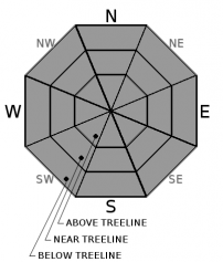
LOW avalanche danger remains for all elevations and aspects. Gale force winds out of the north will preside near and above treeline on Mt Shasta today.
Other notable hazards for the backcountry include:
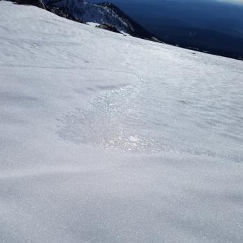
*firm, icy snow surfaces making self-arrest difficult
*numerous exposed and barely covered obstacles.
*rime ice / rockfall


Avalanche Problem 1: Normal Caution
-
Character ?

-
Aspect/Elevation ?
-
Likelihood ?CertainVery LikelyLikelyPossible
 Unlikely
 -
Size ?HistoricVery LargeLargeSmall

Natural and human triggered avalanches are unlikely. Normal caution is advised. Traveling in sheltered terrain that is not affected by wind or on snow covered, sun exposed terrain will provide the safest and most enjoyable soft snow conditions today.
As always:
- Be vigilant.
- Travel with a partner.
- Carry a beacon, shovel, and probe.
- Pay attention to changing snow conditions.
- Keep an eye out for isolated pockets of instability.
Forecast Discussion
We have slipped back into our un-comfort zone this morning with high pressure keeping winter at bay for another several days. The mountain is hosting a 2 day north wind event starting today and lasting through Sunday. Put a lanyard on all loose items if you take any steps above treeline. Wind will keep most snow surfaces sporty out there. We may not see as much spring-like softening of the snow today due to wind. Seek out protected areas near/below treeline for enjoyable sliding. Watch out for rocks.
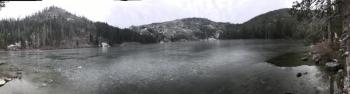
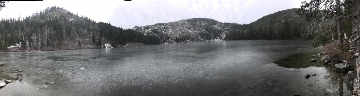 Castle Lake panorama with Left, Middle and Right Peaks visible. The lake has a thin layer of ice with watery edges. Skiing and ice skating are not possible currently. 12.15.16 / Photo: Meyers
Recent Observations
A venture to the Castle Lake weather station yesterday brought mild temperatures and calm winds. The lake is frozen with a thin layer of ice and watery edges. At approximately 1430, winds began to pick up and temperatures cooled as our wimpy "storm" moved into the area. Nothing notable was produced from this storm. Data from local weather stations is missing this morning but it does not appear that much new snow fell, if any. Winds out of the north are blowing and will continue today. Wind speeds at upper elevations are likely cranking, 40-50+ mph. Snow surfaces remain the same and the full smorgasboard can be enjoyed: firm, wind scoured near and above treeline; soft, spring-like snow on southerly, sunny aspects, lower elevations; rocks, and other low snowpack hazards for all areas. Temperatures did not drop below 46 F at Old Ski Bowl or Gray Butte.
Weather and Current Conditions
Weather Summary
Our blip of weather that came through last night has already past overhead and is making its way east. That pesky high pressure ridge will rebuild for the next several days. North/Northwest winds will howl today and tomorrow near and above treeline. The next best chance at weather is Tuesday night/Wednesday. Areas to the north like the Diamond Lake zone will see the most snow. We could receive near .25 inches of water, translating into several inches of snow on the mountain. That's looking into the crystal ball... for now, sunny skies and wind.
------------------------------------------------------------------
THIS SEASON PRECIPITATION for MT SHASTA CITY: Since October 1st (the wet season), we have received 5.72 inches of water, normal is 10.94 inches, putting us at 52% of normal. For the month of December, we have received .18 inches of water, normal is 3.58 inches, which is 5% of normal. And finally for the year of 2017, we received 44.71 inches of water, normal is 38.94 inches, putting us at 114% of normal.
Always check the weather before you attempt to climb Mt Shasta. Further, monitor the weather as you climb. Becoming caught on the mountain in any type of weather can compromise life and limb. Be prepared.
24 Hour Weather Station Data @ 8:00 AM
| Weather Station | Temp (°F) | Wind (mi/hr) | Snow (in) | Comments | ||||||||
|---|---|---|---|---|---|---|---|---|---|---|---|---|
| Cur | Min | Max | Avg | Avg | Max Gust | Dir | Depth | New | Water Equivalent | Settlement | ||
| Mt. Shasta City (3540 ft) | 37 | 28 | 51 | 38 | 3 | N | ||||||
| Sand Flat (6750 ft) | 31 | 25 | 49 | 37 | 14 | 1 | 0 | 1 | ||||
| Ski Bowl (7600 ft) | 48 | 48 | 52 | 49 | 18 | 0 | 0 | 0 | ||||
| Gray Butte (8000 ft) | 46 | 46 | 50 | 49 | 16 | 25 | NW | |||||
| Castle Lake (5870 ft) | 48 | 48 | 50 | 49 | 7 | 0 | 1 | |||||
| Mount Eddy (6509 ft) | 49 | 43 | 49 | 46 | 2 | 5 | WSW | 10 | 1 | 0 | ||
| Ash Creek Bowl (7250 ft) | station down | |||||||||||
| Ash Creek Ridge (7895 ft) | station down |
Two Day Mountain Weather Forecast
Produced in partnership with the Medford NWS
| For 7000 ft to 9000 ft | |||
|---|---|---|---|
|
Saturday (4 a.m. to 10 p.m.) |
Saturday Night (10 p.m. to 4 a.m.) |
Sunday (4 a.m. to 10 p.m.) |
|
| Weather | Mostly sunny and windy | Partly cloudy, windy | Mostly sunny, windy |
| Temperature (°F) | 33 | 29 | 42 |
| Wind (mi/hr) | North 10-20 mph | North 10-20 mph | North 5-15 mph |
| Precipitation SWE / Snowfall (in) | / 0 | / 0 | / 0 |
| For 9000 ft to 11000 ft | |||
| Saturday | Saturday Night | Sunday | |
| Weather | Mostly sunny and windy | Partly cloudy and windy | Mostly sunny and windy |
| Temperature (°F) | 29 | 29 | 31 |
| Wind (mi/hr) | North 40-50 mph | North 0 | North 20-30 mph |
| Precipitation SWE / Snowfall (in) | / 0 | / 0 | / 0 |

