

You are here
Avalanche Advisory for 2018-04-06 06:35
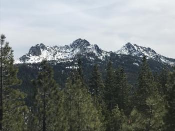
- Issued by Nick Meyers - Shasta-Trinity National Forest
Bottom Line
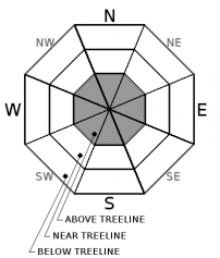
Heavy rain-on-snow and strong winds will impact Mount Shasta today. Expect rising avalanche danger as one gains elevation above the rain/snow line. Above treeline, MODERATE danger is possible this afternoon, rising to CONSIDERABLE danger tonight. For all other areas that receive rain on snow, the avalanche danger is LOW. Minor loose wet instabilities are possible, but not expected to be a serious problem.


Avalanche Problem 1: Wind Slab
-
Character ?

-
Aspect/Elevation ?
-
Likelihood ?CertainVery LikelyLikelyPossible
 Unlikely
 -
Size ?HistoricVery LargeLargeSmall

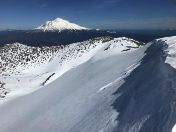
Snow levels are expected to begin at 9,000 ft today and rise to 10,500 ft later today/tonight. New snow combined with strong S winds will contribute to the development of wind slabs on leeward slopes above treeline. Firm, icy snow surfaces may provide ideal bed surfaces for wind slab avalanches.
Avoid wind slabs by traveling in windward areas where snow surfaces have been eroded. Avoid slopes greater than 35 degrees where wind loading has occurred. Evaluate conditions as you travel in safe terrain by looking for signs of the wind slab problem:
- Smooth rounded wind pillows
- Hollow sounding snow
- Harder snow atop softer snow
- Shooting cracks
Forecast Discussion
This afternoon and tonight will be the brunt of the storm. Expect high winds, heavy rain and ample snow at higher elevations. Warming temperatures resulting in rising snow levels will provide full value, WET conditions on Mount Shasta over the next 24 hours. Rising avalanche danger in alpine areas is a concern, as are environmental hazards. Below and near treeline areas will receive mostly rain on snow.
Recent Observations
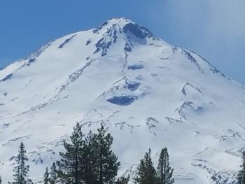
The cloud deck gradually descended upon Mount Shasta yesterday and by evening, the mountain was shrouded with clouds. A few rain drops fell in town during the day. At 1600 hrs, a light, dense dusting of snow was observed near and below treeline and the snow level was about 6,500 feet.
Relevant data from Gray Butte and Old Ski Bowl weather stations in the last 24 hours:
- Average temperature = 30 °F; high temperature = 35 °F
- Water equivalent = 0.56 in. / 3 in new snow
- Snow settlement = .2 in.
- Light to moderate W and SW winds averaging 9 mi/hr, gusts up to 25 mi/hr.
Recent observations from the Old Ski Bowl:
- Height of snow (HS) = 150-200 cm (60-80 in).
- Trace of new snow above 6,500 ft.
- No recent signs of instability. No loose wet avalanches.
- Snowpack stability good.
- 3-5 cm (1-2 in) of moist fist hard snow atop pencil hard melt forms up to 8500 ft.
- Firm icy conditions above 9000 ft, old wind textured snow surfaces.
Weather and Current Conditions
Weather Summary
A frontal system pushes over California and Oregon this morning. A surge of tropical moisture associated with an atmospheric river will move east-northeastward from the Pacific and will be directed into northern California. The heaviest rain will be just to the south of us, but moderate to, at times, heavy rainfall will occur in portions of Siskiyou County where orographics will enhance rainfall. Another impact from this storm will be strong southerly winds so hold on to your hats if near and above treeline on the mountain! We are looking at close to 1.5" of water by tomorrow afternoon. Temperatures will rise today/tonight and then cool off tomorrow. Snow level forecasts are 9,000 feet today, 10,500 feet tonight, and 6,300 feet tomorrow. Another storm with lower snow levels appears to be lining up for next week. April's outlook indicates above average precipitation and normal temperatures.
Disclaimer

