

You are here
Avalanches on Gray Butte

Location Name:
Gray ButteRegion:
Mt. ShastaDate and time of avalanche (best estimate if unknown):
Sat, 12/01/2018 - 2:00pmObservation made by:
PublicRed Flags:
Recent avalanche activity
Recent loading by new snow, wind, or rain
Location Map
96067
Mount Shasta
, CA
United States
41° 21' 0.1008" N, 122° 11' 38.1588" W
See map: Google Maps
California US
Avalanche Observations
Details
Photos
Characteristics
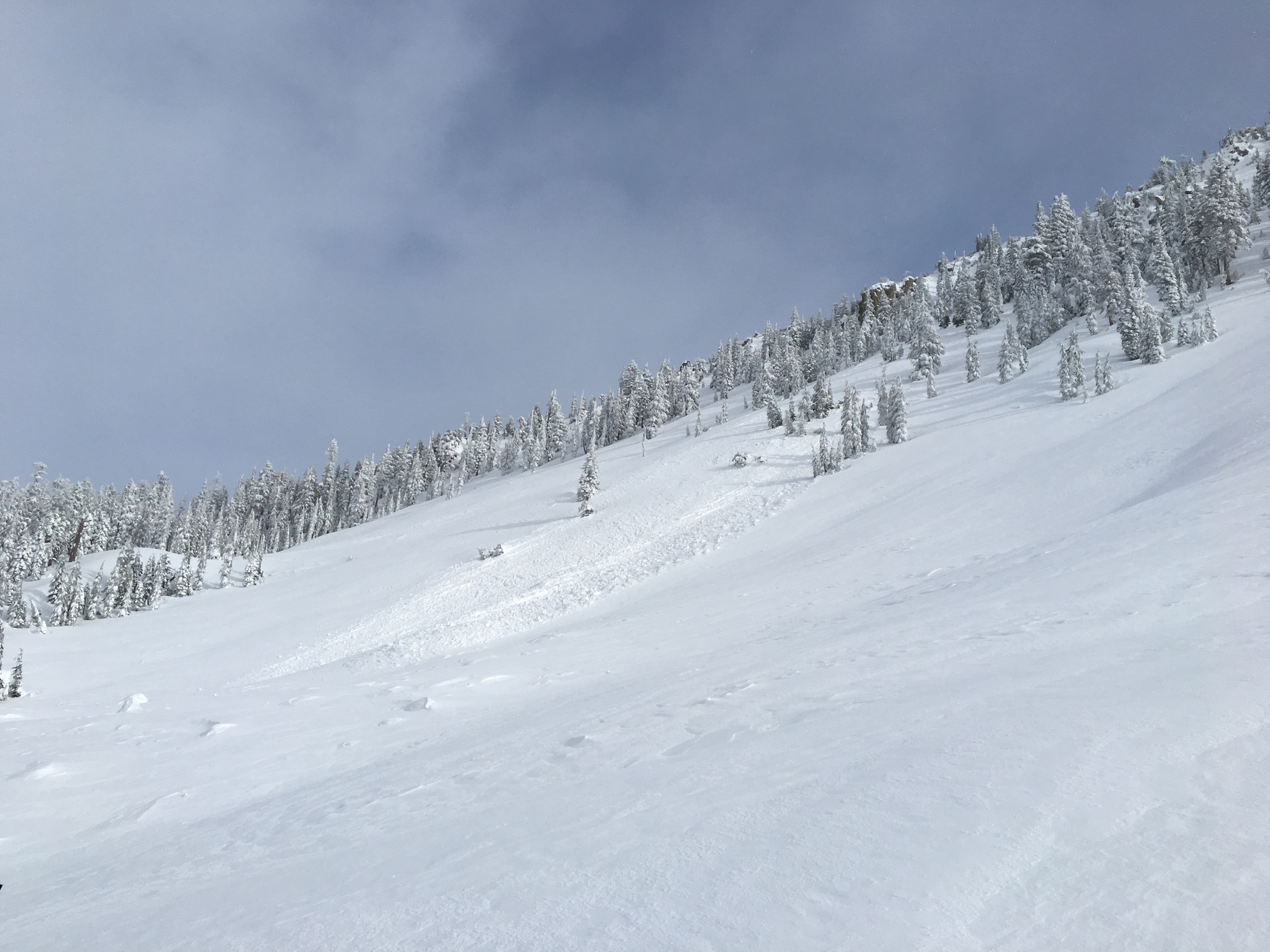
Avalanche Type:
SlabTrigger type:
NaturalAspect:
EastTerrain:
Near TreelineBed Surface:
UnknownCrown Height:
Less than 1 ftAvalanche Width:
20ft.Avalanche Length:
90ft.Number of similar avalanches:
1Number of people caught:
0Weather Observations
Statistics


Small avalanches observed on Gray Butte:
Latter two had similar characteristics: 10 inch crown, 20 ft wide, 90 ft length.