

You are here
Cedar Pass Avalanche
Location Name:
Cedar PassRegion:
Outside of the Forecast AreaDate and time of avalanche (best estimate if unknown):
Thu, 03/23/2023 - 3:30amObservation made by:
PublicRed Flags:
Recent loading by new snow, wind, or rain
Location Map
96067
Mount Shasta
, CA
United States
41° 32' 38.7096" N, 120° 16' 19.9488" W
See map: Google Maps
California US
Avalanche Observations
Details
Photos
Characteristics
Avalanche Type:
SlabTrigger type:
SkierSlope:
45degreesAspect:
NortheastElevation:
6 800ft.Terrain:
Below TreelineWeak Layer:
Other - explain belowBed Surface:
Old SnowCrown Height:
2 ftAvalanche Width:
50ft.Avalanche Length:
300ft.Number of people caught:
0Number of partial burials:
0Number of full burials:
0Weather Observations
Statistics
Cloud Cover:
75% of the sky covered by cloudsBlowing Snow:
YesPrecipitation:
SnowAccumulation rate:
Less than 1 in. per hourAir temperature:
Below FreezingAir temperature trend:
StaticWind Speed:
LightWind Direction:
Southwest

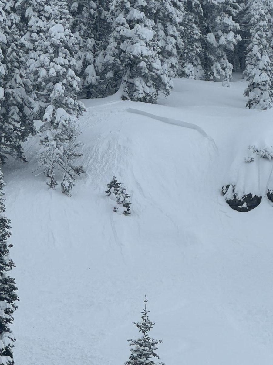
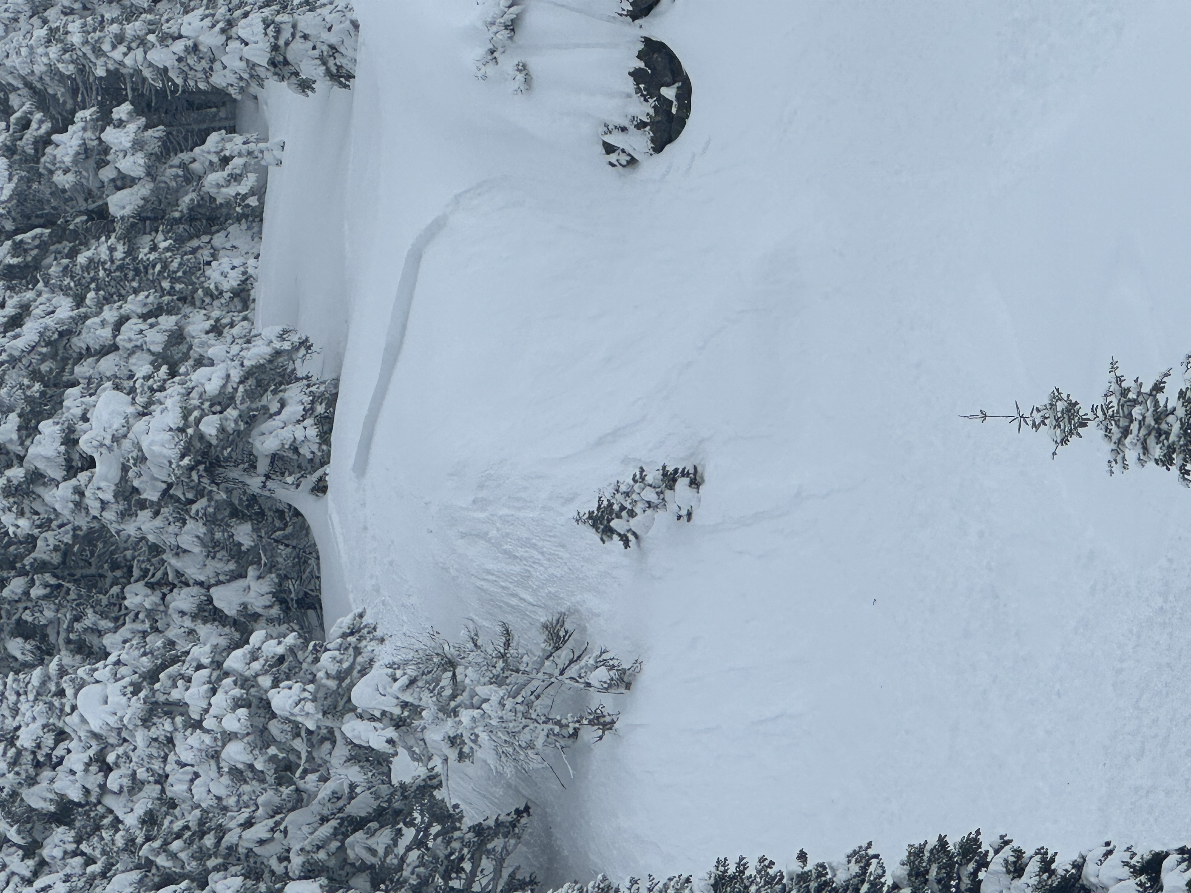
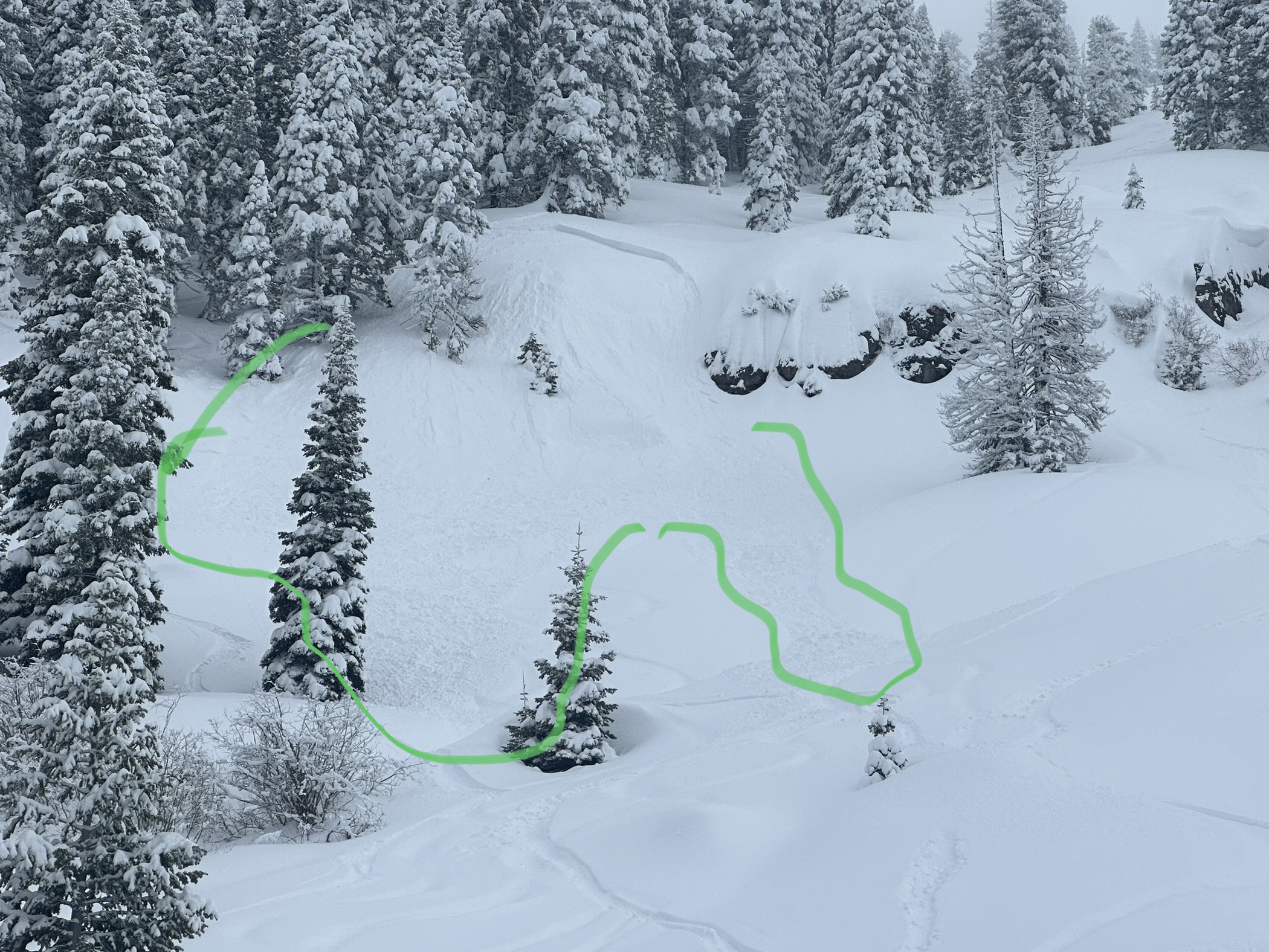
Slab Avalanche - Outside of forecast area - Warner Mountains - Cedar Pass area
A small but juicy wind slab was skier triggered in the Warner Mountains. Nobody was caught or injured. The slab was triggered on a NE facing slope below treeline. The crown was up to 2 feet thick and 50 feet wide, running approximately 300 feet downhill.