

You are here
Coyote Butte Avalanche
Location Name:
Coyote Butte AvalancheRegion:
Mt. ShastaDate and time of avalanche (best estimate if unknown):
Sat, 12/10/2022 - 12:20pmObservation made by:
ForecasterRed Flags:
Recent avalanche activity
Recent loading by new snow, wind, or rain
Obvious avalanche path
Terrain Trap
Location Map
96067
Mount Shasta
, CA
United States
41° 20' 5.0532" N, 122° 11' 38.6556" W
See map: Google Maps
California US
Weather Observations
Statistics


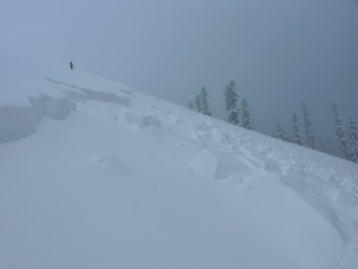
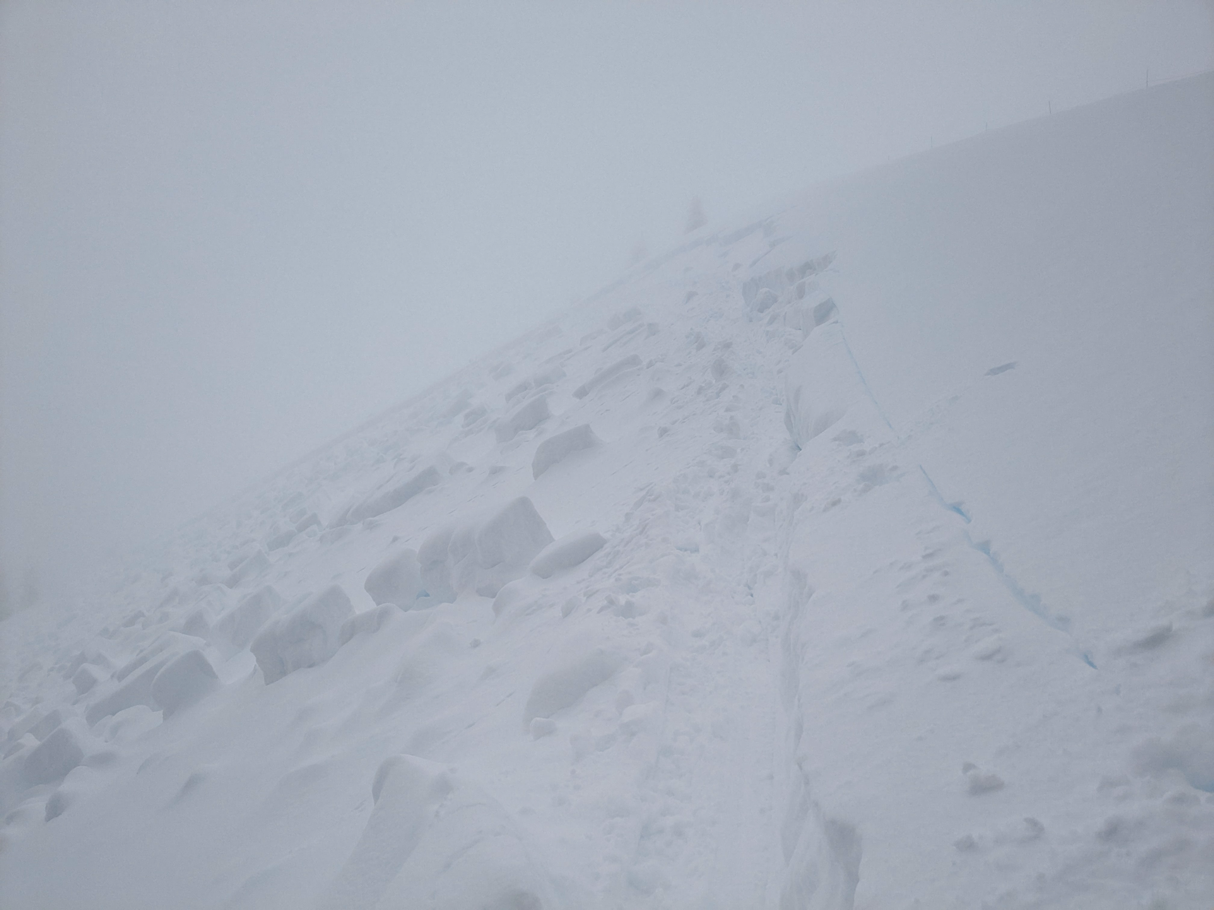
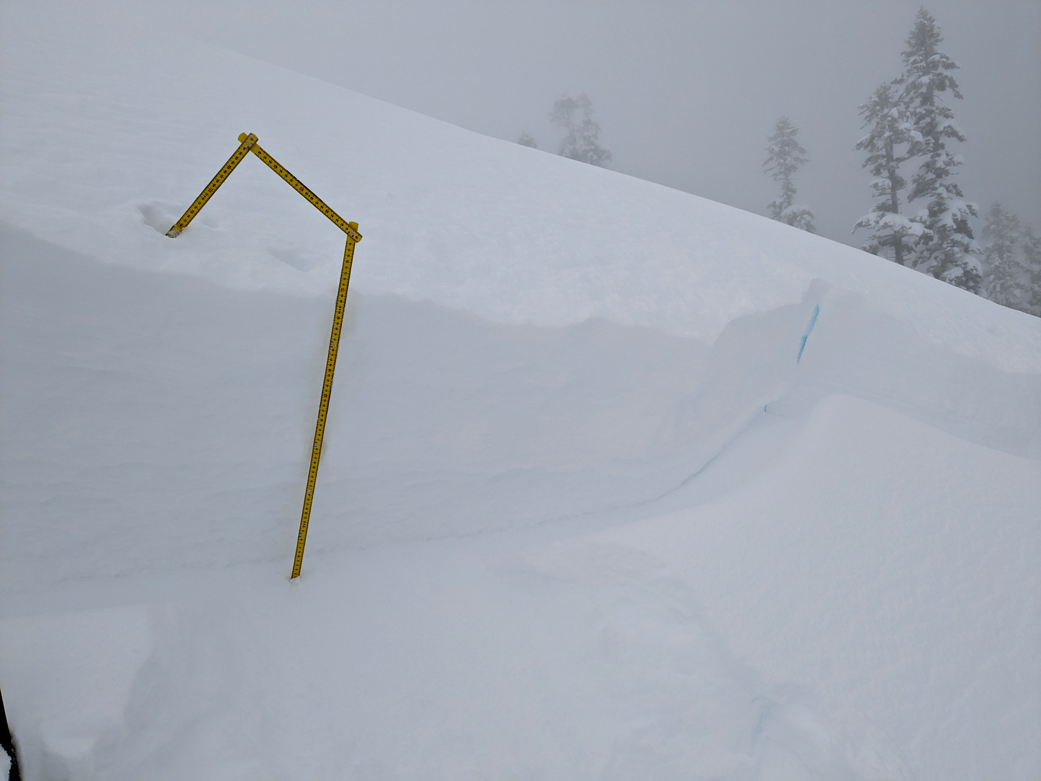
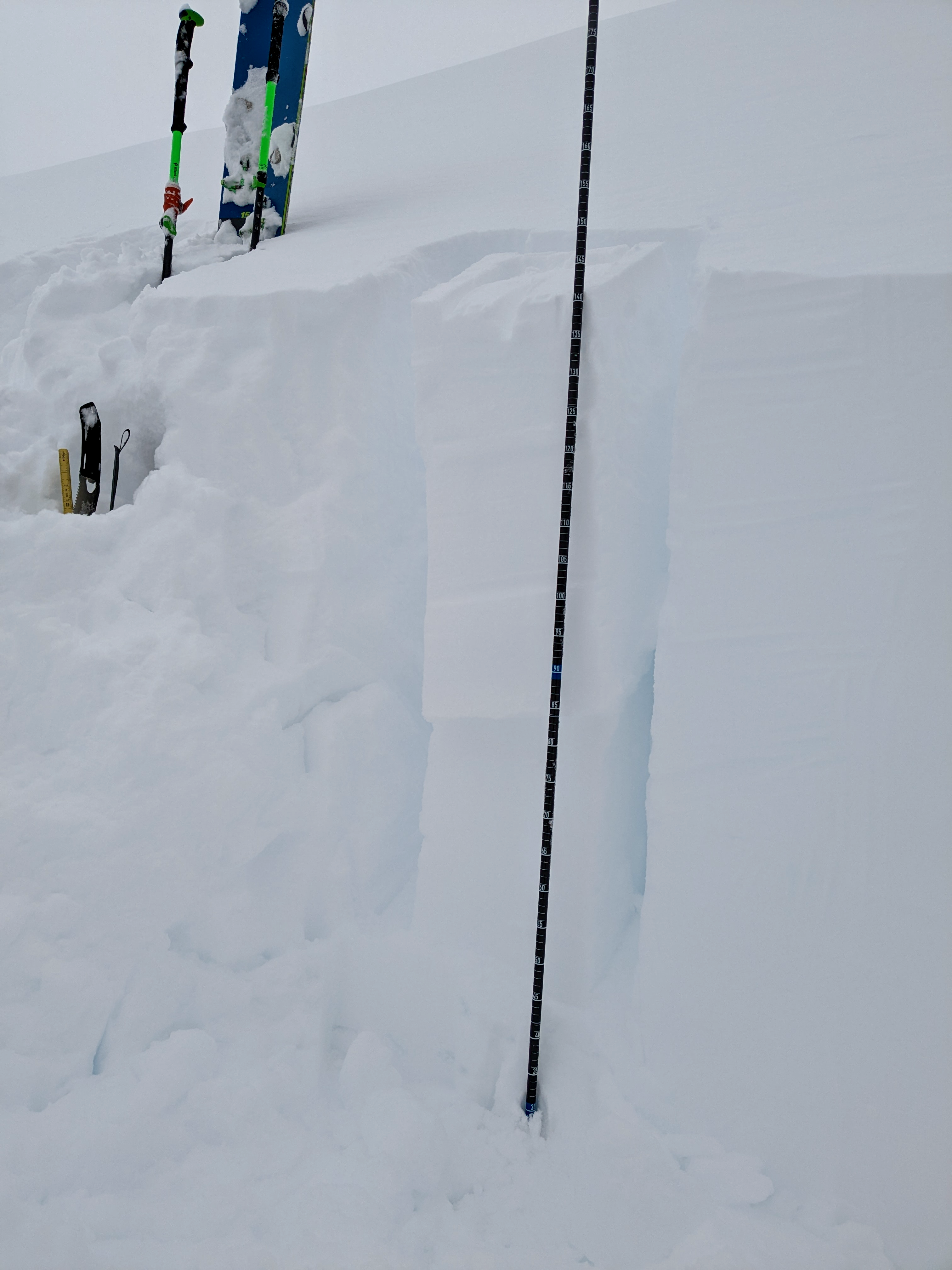
Avalanche Center forecasters and Mount Shasta Ski Park (MSSP) ski patrol investigated a storm slab avalanche just outside the MSSP boundary on Coyote Butte on a 38 deg NE facing slope. The crown was 2 feet deep and 150 feet wide. The avalanche was triggered naturally earlier in the day, estimated around 8:00am; No avalanche beacon signals were detected in the debris, no ski/board tracks were observed entering or exiting. The bed surface of the avalanche was a buried layer of graupel. The graupel layer fell on top of the snowpack on Friday 12/9 with relatively calm wind. Following was the whooper of a storm that brought ~2.5 feet of new snow (1.8" SWE) in a 40-hour period, beginning 2200 hours Friday night.
Avalanche Code: SS-N-R4-D2-I
DATA CODE: