

You are here
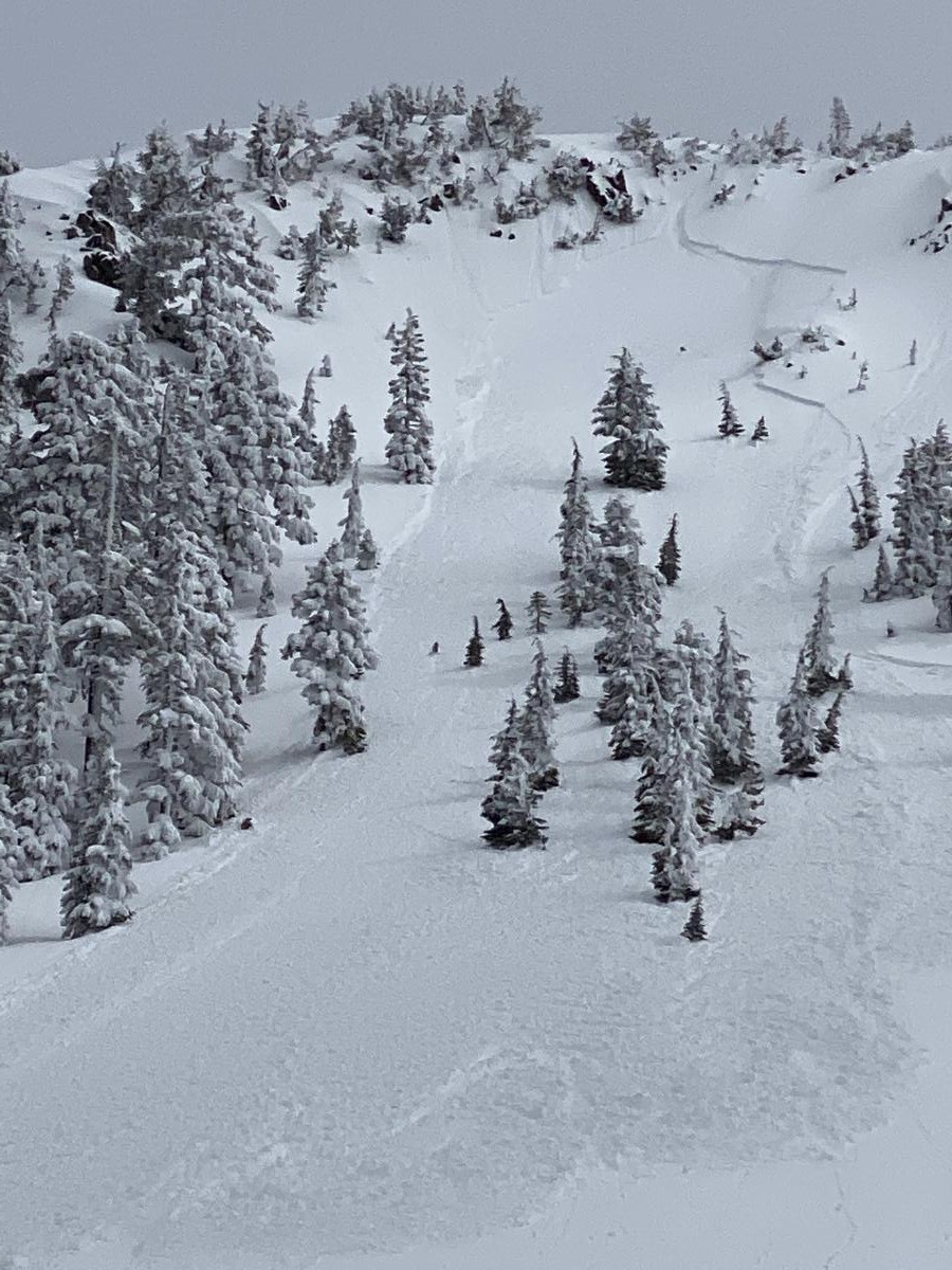
Grey Butte Skier Triggered Avalanche
Location Name:
Grey ButteRegion:
Mt. ShastaDate and time of avalanche (best estimate if unknown):
Sun, 03/29/2020 - 1:00pmObservation made by:
PublicRed Flags:
Recent loading by new snow, wind, or rain
Rapid warming
Obvious avalanche path
Location Map
96067
Mount Shasta
, CA
United States
41° 20' 57.7176" N, 122° 11' 33.8316" W
See map: Google Maps
California US
Avalanche Observations
Details
Characteristics
Avalanche Type:
SlabTrigger type:
SkierSlope:
38degreesAspect:
NorthwestElevation:
8 000ft.Terrain:
Near TreelineWeak Layer:
Storm SnowBed Surface:
UnknownCrown Height:
Less than 1 ftAvalanche Width:
50ft.Avalanche Length:
600ft.Number of similar avalanches:
1Weather Observations
Details
The cloud layer was thin and the sun was felt through it. Varying types of precipitation was noticed through out the day; some stellars earlier in the day then changing to needles and graupel.
Statistics
Cloud Cover:
100% of the sky covered by cloudsPrecipitation:
SnowAccumulation rate:
Less than 1 in. per hourAir temperature:
Above FreezingAir temperature trend:
WarmingWind Speed:
CalmWind Direction:
Southwest

Roller balls and rapid warming was observed. The first skier dropped in to the line from the top of the pitch making one turn and then breaking the slab loose. The slab appeared to be the warming top few inches of storm snow on top of the deeper, still cold storm snow. The slab was fast moving and picked up more snow as it moved downhill, leaving a moderate sized debris pile of soft, warm snow.