

You are here
Large Natural Avalanche in Avalanche Gulch

Location Name:
Avalanche GulchRegion:
Mt. ShastaDate and time of avalanche (best estimate if unknown):
Sun, 04/07/2019 - 11:00pmObservation made by:
ForecasterRed Flags:
Recent loading by new snow, wind, or rain
Rapid warming
Obvious avalanche path
Location Map
United States
41° 22' 40.8648" N, 122° 12' 47.8656" W
See map: Google Maps
US
Avalanche Observations
Details
Photos
Characteristics
Avalanche Type:
WetTrigger type:
NaturalSlope:
38degreesAspect:
SouthElevation:
9 100ft.Terrain:
Above TreelineWeak Layer:
UnknownBed Surface:
UnknownAvalanche Width:
100ft.Avalanche Length:
1 600ft.Weather Observations
Details
The recent storm to impact the Mount Shasta area has been warm, wet and rainy. Since it began early Saturday morning (04.06.2019) 3.83 inches of water has fallen as rain at 7,600 feet on Mount Shasta. Above freezing temperatures have been recorded since noon on Saturday. An average temperature of 34 degrees F since midday on Saturday. This rain on snow has settled the snow nearly 10 inches over the last three days.
Statistics
Cloud Cover:
75% of the sky covered by cloudsBlowing Snow:
YesPrecipitation:
SnowAccumulation rate:
Less than 1 in. per hourAir temperature:
Below FreezingAir temperature trend:
WarmingWind Speed:
ModerateWind Direction:
West

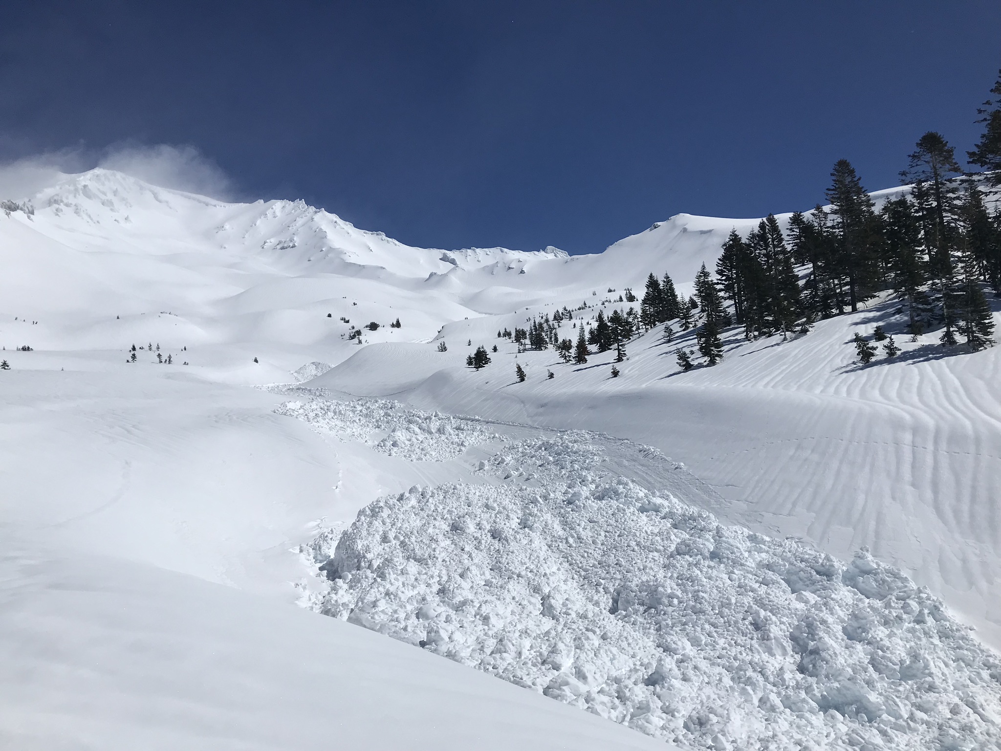
A large (R3/D3.5) natural loose-wet avalanche occurred in Avalanche Gulch between Saturday, April 6th and Monday, April 8th. This loose-wet avalanche likely released during a period of rapid warming and heavy precipitation. Best estimate puts this avalanche on Sunday, April 7th at 11 p.m.
This avalanche left an impressive track and debris pile. The debris pile was 5-8 feet deep with spots up to 15 feet deep. the track was 20 to 50 feet wide and nearly a mile long. Low visibility limited observations of the crown.
Avalanche Classification Code: WS-NS-R3-D3.5-U
Path Description
Path Characteristics