

You are here
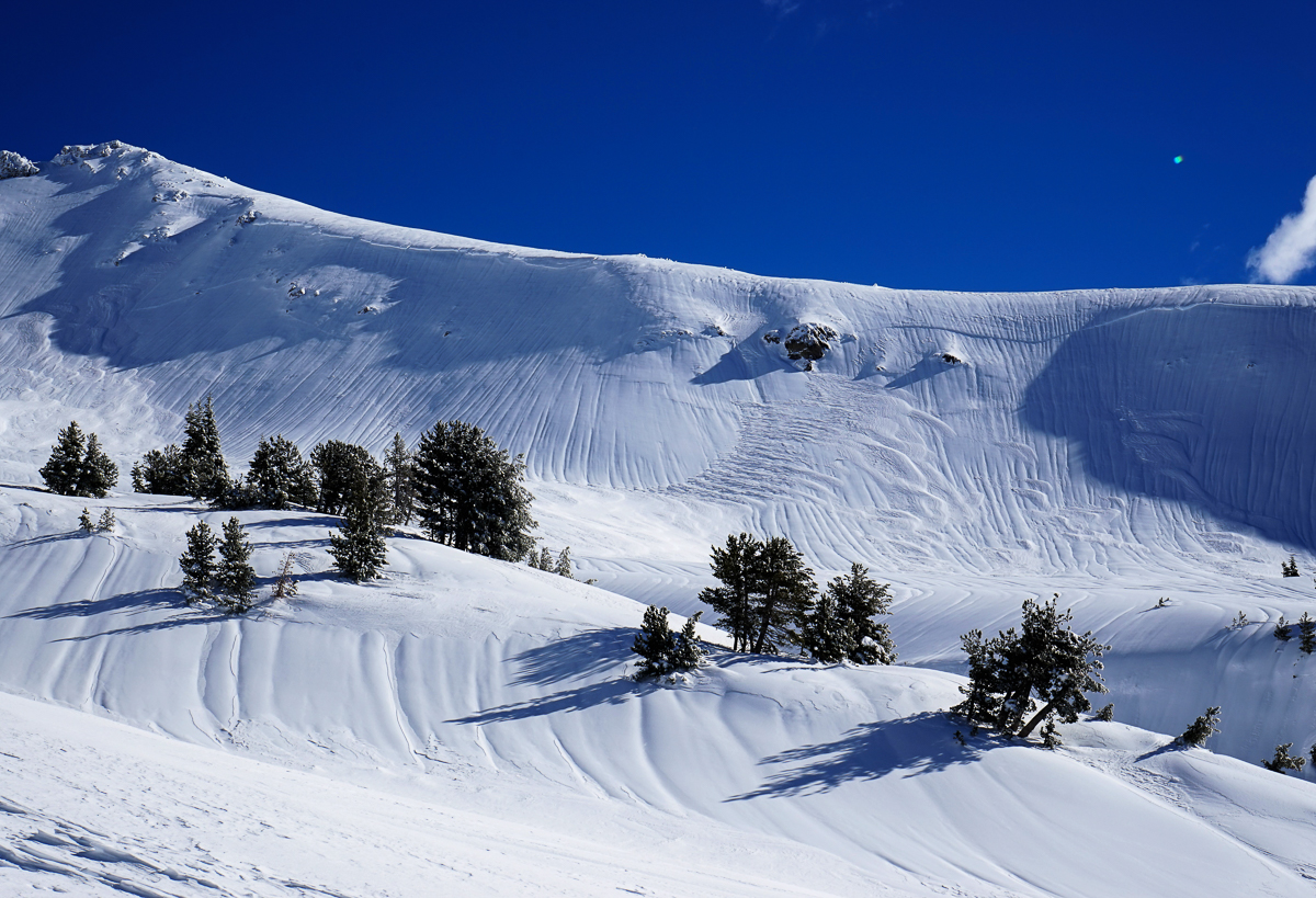
NW Green Butte Ridge Crown

Location Name:
Green Butte RidgeRegion:
Mt. ShastaDate and time of avalanche (best estimate if unknown):
Sat, 01/19/2019 - 6:00pmObservation made by:
PublicLocation Map
96067
Mount Shasta
, CA
United States
41° 22' 25.1508" N, 122° 12' 48.2616" W
See map: Google Maps
California US
Avalanche Observations
Details
Photos
Characteristics
Avalanche Type:
SlabTrigger type:
NaturalSlope:
30degreesAspect:
NorthwestElevation:
9 000ft.Terrain:
Above TreelineWeak Layer:
UnknownBed Surface:
UnknownCrown Height:
2 ftAvalanche Width:
1 000ft.Avalanche Length:
400ft.

Observed crown line approximately 1/4 mile along NW aspect Green Butte ridge. Triggered secondary slide lower down. Estimated natural release Saturday. Debris filled in and wind effected.