

You are here
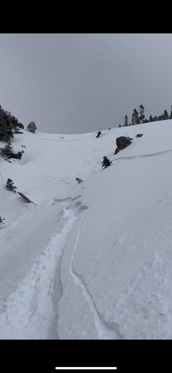
Small Slab - Gray Butte - West Face
Location Name:
Gray ButteRegion:
Mt. ShastaDate and time of avalanche (best estimate if unknown):
Wed, 03/01/2023 - 12:00pmObservation made by:
PublicRed Flags:
Recent avalanche activity
Obvious avalanche path
Terrain Trap
Location Map
96067
Mount Shasta
, CA
United States
41° 20' 47.3316" N, 122° 11' 55.8816" W
See map: Google Maps
California US
Avalanche Observations
Details
Characteristics
Avalanche Type:
DrySlabTrigger type:
SkierSlope:
40degreesAspect:
WestElevation:
7 700ft.Terrain:
Near TreelineWeak Layer:
Storm SnowBed Surface:
Storm SnowCrown Height:
Less than 1 ftAvalanche Width:
50ft.Avalanche Length:
50ft.Number of people caught:
0Number of partial burials:
0Number of full burials:
0Weather Observations
Details
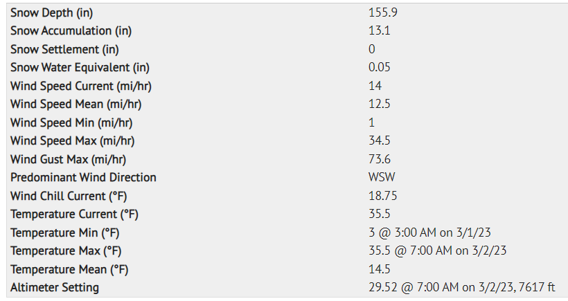
Statistics
Cloud Cover:
ClearBlowing Snow:
NoPrecipitation:
NoneAir temperature:
Below FreezingAir temperature trend:
StaticWind Speed:
Calm

West Face of Gray Butte, near treeline, small skier triggered storm slab. Nobody caught or injured.
DATA CODE: AS-SS-D1-R1