

You are here
Very Large Natural Avalanche in Avalanche Gulch
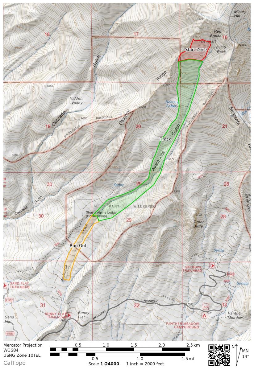
Location Map
Avalanche Observations
Details
Characteristics
Weather Observations
Details
On Wednesday Febuary 13th Mount Shasta received several feet of fresh snow in less than a 24 hours followed by a rapid warming, rain on snow/mist event on Thursday. This new snow was plastered onto a complicated snowpack with cold dry surface snow from a storm on the weekend of the Feb 9th and 10th. Most of the storms in February have been associated with periods of strong northerly wind continually loading the upper Casaval ridge area. The wet, heavy snow from Wednesday the 13th plastered enough snow to cause this large slide that likely stepped down into deeper weak layers, entraining more and more snow as it gouged its way down the nearly 5,000-foot run and depositing 30+ feet of snow in the climber's gully (Avalanche Gulch proper) down to 7,200 feet.
Statistics


A very large (R4/D4) natural avalanche occurred off of Casaval Ridge between the afternoon of Wednesday, February 13th and the morning of Thursday, February 14th. The avalanche likely released near 12,000 feet and ran to 7,200 feet in Avalanche Gulch (AG), down AG proper - over 3 miles and approximately 5,000 vertical feet. The tow of the debris pile is 30+ feet high. The widest portion of the slide was 250 feet wide. The deepest portion, 60 feet deep. The main avalanche could have caused a sympathetic release of other avalanche slopes on Casaval Ridge, Trinity Chutes, The Heart and Sargent's Ridge terrain. Some large trees were buried and seen carved by the debris. The bed surface for the slide is unknown. Avalanche occurred during or after a short period of significant snowfall followed by rapid warming.
Avalanche Classification Code: HS-NS-R4-D4-U
Low visibility limited observations of the crown.
Path Description
Path Characteristics
Along the high walls of the runout