

You are here
Wind Slab Avalanche in Sun Bowl
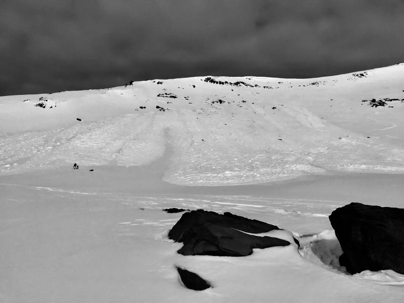
Location Name:
Sun Bowl Region:
Mt. ShastaDate and time of avalanche (best estimate if unknown):
Tue, 01/30/2018 - 6:15pmObservation made by:
PublicRed Flags:
Recent loading by new snow, wind, or rain
Obvious avalanche path
Location Map
96067
Mount Shasta
, CA
United States
41° 22' 11.8416" N, 122° 12' 55.6524" W
See map: Google Maps
California US
Avalanche Observations
Details
Characteristics
Avalanche Type:
SlabTrigger type:
NaturalSlope:
38degreesAspect:
SoutheastElevation:
8 700ft.Terrain:
Above TreelineWeak Layer:
UnknownBed Surface:
UnknownCrown Height:
2 ftAvalanche Width:
400ft.Avalanche Length:
800ft.Number of similar avalanches:
2Number of people caught:
0Number of partial burials:
0Number of full burials:
0Weather Observations
Details
Major wind loading observed in the alpine yesterday with moderate loading continuing today. Unknown if the warm temps yesterday was a causal or contributing factor. Debris looked dry, so likely occurred during cooler temps.
Statistics
Cloud Cover:
50% of the sky covered by cloudsBlowing Snow:
YesAir temperature:
Below FreezingAir temperature trend:
StaticWind Speed:
ModerateWind Direction:
Northwest

Recent wind slab activity in Sun Bowl, 8,700 ft, SE facing - 38-40 degree slope on Tuesday, January 30th at 10:15am. HS-N-D1.5 to D2 observed. Debris piles up to 3-4 ft+ deep. Ran approximately 400-500 vertical feet. Some cornice triggering and/or involvement likely.