You are here
Road Condition: Clear Creek TH
General Conditions
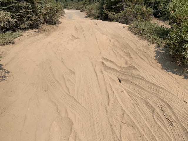
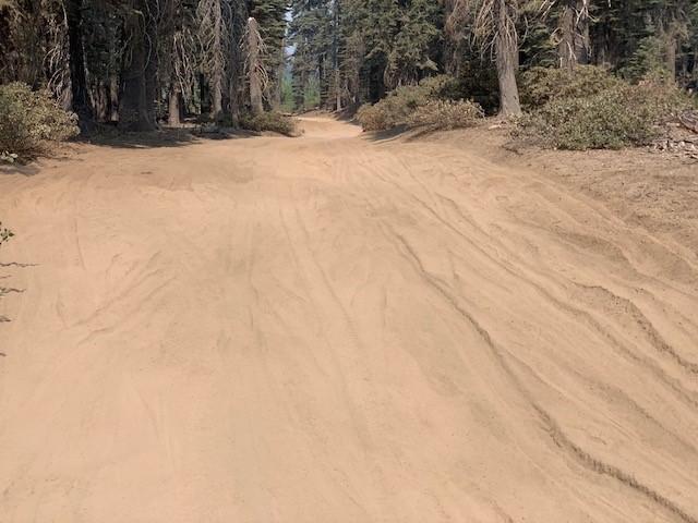
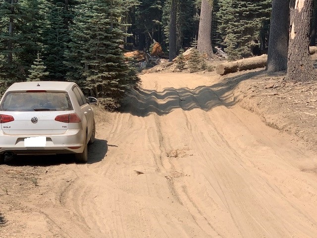
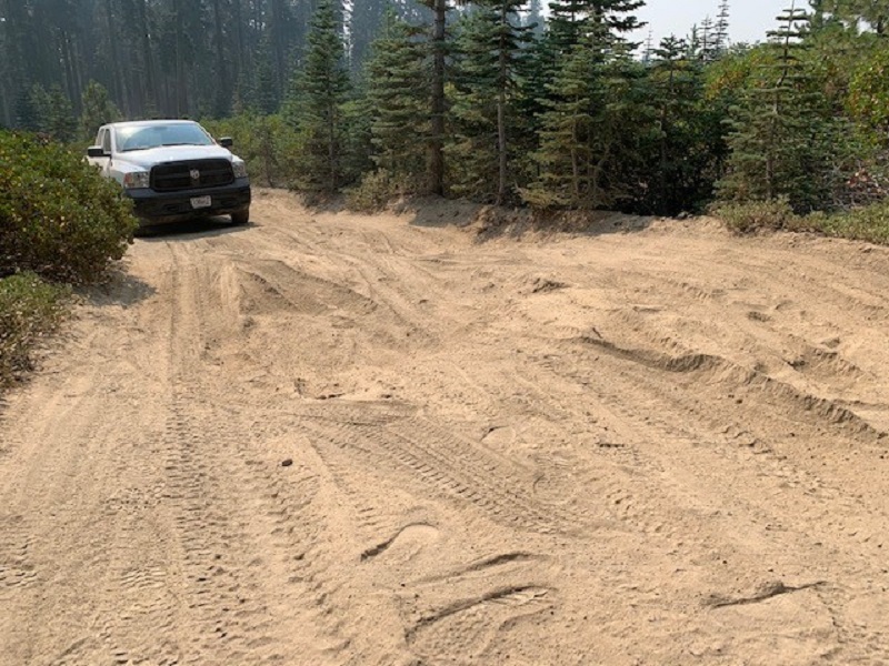
The Clear Creek road, trail and climbing route has experienced unprecedented use this summer. Most notably, the dirt road to the trailhead has degraded substantially and is now difficult for a 2wd vehicle to make it to the trailhead. Numerous soft areas of "moon dust" (soft, silty, volcanic ash material) exist above the 31 road. Vehicles have been parking along the road short of the trailhead due to impassable areas. That said, a handful of 2wd vehicles have made it...just a matter of how far you're willing to push the gas pedal and your vehicles undercarriage.
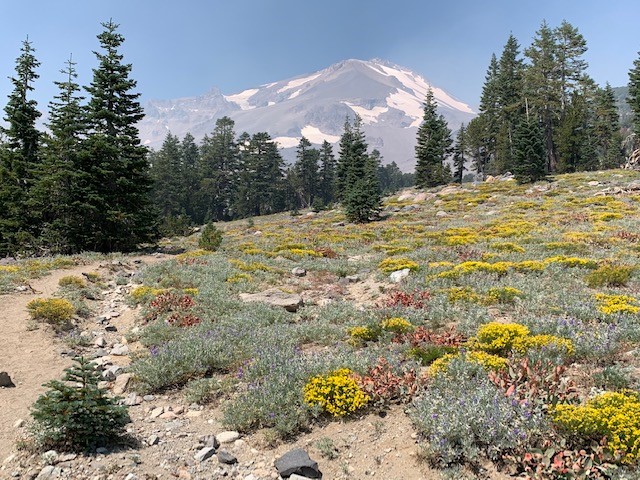
The area around the Clear Creek Springs (8,500 feet) has experienced some damage as well. This is caused by climbers and hikers walking and/or laying on the fragile grasses and plants that surround the spring(s). A few have also tried to alter the spring depth and moved large rocks around. All of this type of activity, if observed, is eligible for citation. Rangers take the well being of Mt Shasta and it's fragile ecosystems seriously and you should too....all in the spirit of preserving it for others to enjoy for many years to come. Please, walk on durable surfaces and stay off anything green!
The Clear Creek route is in, ummm... good shape...if you're into a 7,000 foot dirt, scree, gravel slog. Can you say, "one step up, two steps back?" This route is most certainly gorgeous, but don't take it lightly. Hike up the easy to follow trail from the trailhead to the springs. From here, several "climbers trails" exist. It's up to you to pick the most heavily used trail and climb up the route from here. There is no marked trail to the summit, but the climber trail(s) can be followed. At "mushroom rock", head straight up through the "headwall" section. Be careful through here. Pay attention where you top out and make note of it for your descent. Many climbers become lost/disoriented on their way down, especially during limited visibility conditions. Pay attention.
You do not need an ice axe or crampons at this time, though a helmet is always a good idea when mountaineering. Trekking poles are very useful for the loose nature of this route. Small, breathable gaiters are nice to keep debris out of your boots. Lightweight hikers or running shoes are not recommended. A mid-weight, high top hiker is the best boot in our opinion.
Most people camp near the springs. No snow is available for melt-water up higher. Please camp at least 100 feet away from all water sources. Many nice camp locations exist near the springs in the small trees. LEAVE NO TRACE, please, we beg you. Crazy amounts of trash have been left behind and collected by rangers this summer. Camping is also permitted at the trailhead. Park responsibly, leave room for others.
Enjoy and thanks for reading.