You are here
South Side Conditions Update
General Conditions
Climbing and skiing conditions on the south side are primo. Come enjoy it, but keep it to yourself. ![]() Currently, one can ski/board to within .10 mile from Bunny Flat trailhead. The gate is closed at Bunny Flat until July. Launching a snowmobile from Bunny is not possible anymore without riding on dirt and pavement. We don't advise it as it tears up the fragile vegetation.
Currently, one can ski/board to within .10 mile from Bunny Flat trailhead. The gate is closed at Bunny Flat until July. Launching a snowmobile from Bunny is not possible anymore without riding on dirt and pavement. We don't advise it as it tears up the fragile vegetation.
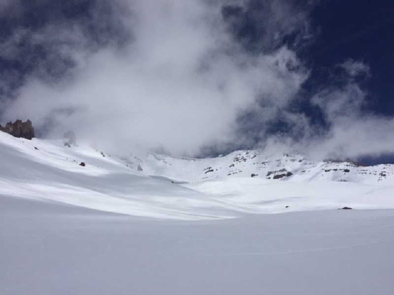
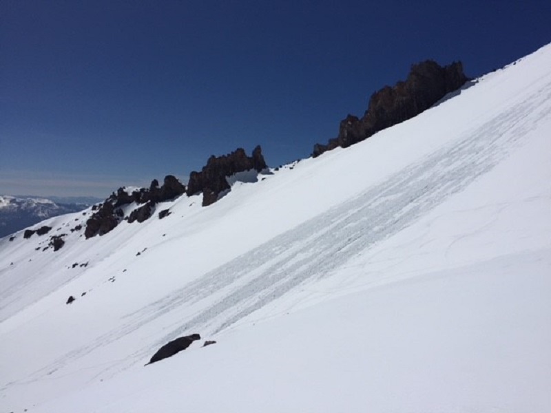
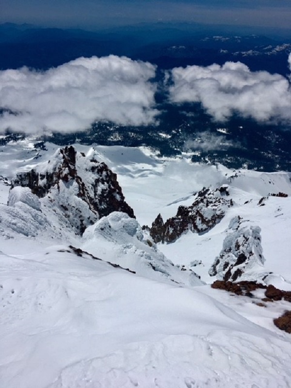
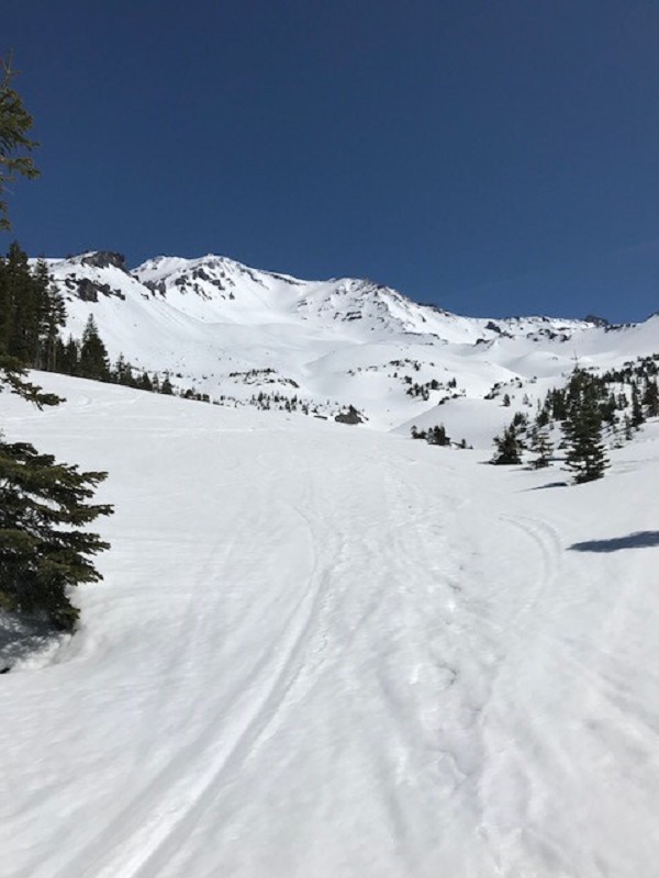
The snow has been firm in the morning and soft by afternoon. How soft is all dependant on aspect and elevation. Snowshoes have not been needed. Boot penetration in the afternoon has only been a couple inches in climbers gully, Avalanche Gulch. All camping on the mountain will still be in snow. Running water is not available, so bring extra fuel to melt snow. The spring at Horse Camp is NOT running, however the bathrooms are open. Some rockfall and rime icefall has been observed. You can expect this hazard to always be present on Mt Shasta. Snow surfaces are smooth with some light texturing in a few areas. Yesterday, skiing down from Helen Lake between 11am and noon was perfect. Some rocks may start to protrude through snow surfaces as the warm spring sun melts snow quickly. Be careful.
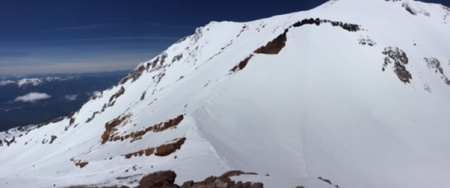
Casaval Ridge, Green Butte and Sargents Ridge routes are all in good shape. The Catwalk section of Casaval is passable and covered in snow. That said, the rock is loose with no chance for protection, the snow is soft and may not be supportable and the fall would send you off a cliff. It's essentially a free-solo, no-fall zone for a short distance with overhead rime ice and rockfall hazard as well. If this sparks your fancy, your in luck. If not, most have been avoiding by traversing left onto the West Face, topping out at the bottom of Misery Hill. Misery Hill is mixed snow and rock. The Summit Plateau is snow as is the Summit Pinnacle.
Yesterday hosted full sun and warm temps on the mountain with light and variable winds. We've had a few loose wet slides off Casaval Ridge over the past couple weeks during some of the warmer days. This weekend looks to bring the chance of clouds and thunderstorms tomorrow (Saturday, 5.5.18) DO NOT climb into a whiteout. Many climbers have become lost on the upper mountain due to whiteout conditions and descended the wrong side of the mountain. This is very easy to do. Pay attention to the weather and make sound decisions!
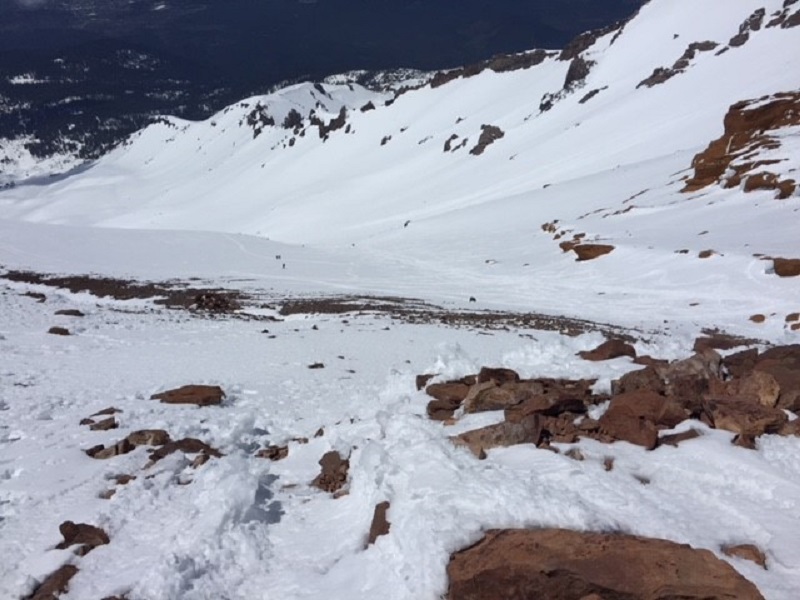
Most climbers are ascending up through the right side of Redbanks, through one of three chutes. Any of these chutes are in good shape and the best way to get through (and back down) Redbanks. Be careful in this area as it's the steepest portion of the Gulch route and where many slide for life falls take place.
Lake Helen is the typical high camp for the Gulch route. PLEASE, keep a clean camp and make sure to LEAVE NO TRACE! Rangers take this seriously...pack out ALL micro trash, food scraps, coffee grounds, etc. Further, it is REQUIRED for you to pack out your human waste. Free waste bags are provided at all open trailheads. Deposit full human waste packout bags at the trailhead. We ask that you urinate on the EAST side of the Lake Helen morain, downhill and away from camp. Gotta pee in the middle of the night? DO NOT just pee out your tent door. Have a pee bottle handy or make the short trek to the east side of the moraine. Rangers WILL check up on this and if your caught not obeying these simple rules, you may receive a citation.
Have fun and be safe up there!