

You are here
South Side Conditions Update

General Conditions
Conditions are really begin to deteriorate on the mountain. For this time of year however, conditions are still good for climbing. The snow has melted from Bunny Flat trailhead and a short hike on the trail is required to reach consistent snow. As the summer trails begin to melt out, PLEASE stay on path as best you can in an effort to limit resource degradation. The trail is wanded to Horse Camp and we are asking all traffic to please take this path for the remainder of the season.
The snow below Lake Helen is melting fast and many tracks, sun cups, and even a few rocks are showing. Above Lake Helen, smooth firm snow exists on the upper mountain. A good boot pack ascends Avalanche Gulch towards Thumb Rock. Many climbers have been climbing around the right end of the Red Banks near the Thumb, however, it is advised to climb through one of the Red Bank's right side chutes from now on as this avoids the dangerous crevasse features of the Konwakiton.
A rather deep glissade path has formed in the middle of the Avalanche Gulch route. This track may be difficult to exit once you begin glissading as it is well over head high in sections. Make sure to keep it under control and allow the snow to fully soften before attempting this icy slide. Always remember to take your crampons OFF before glissading.
The Casaval ridge route has melted out significantly and reports indicate that the Catwalk currently requires crossing a large section of exposed rock. This route is best done early to mid-season with ample snow coverage, this is no longer the case.
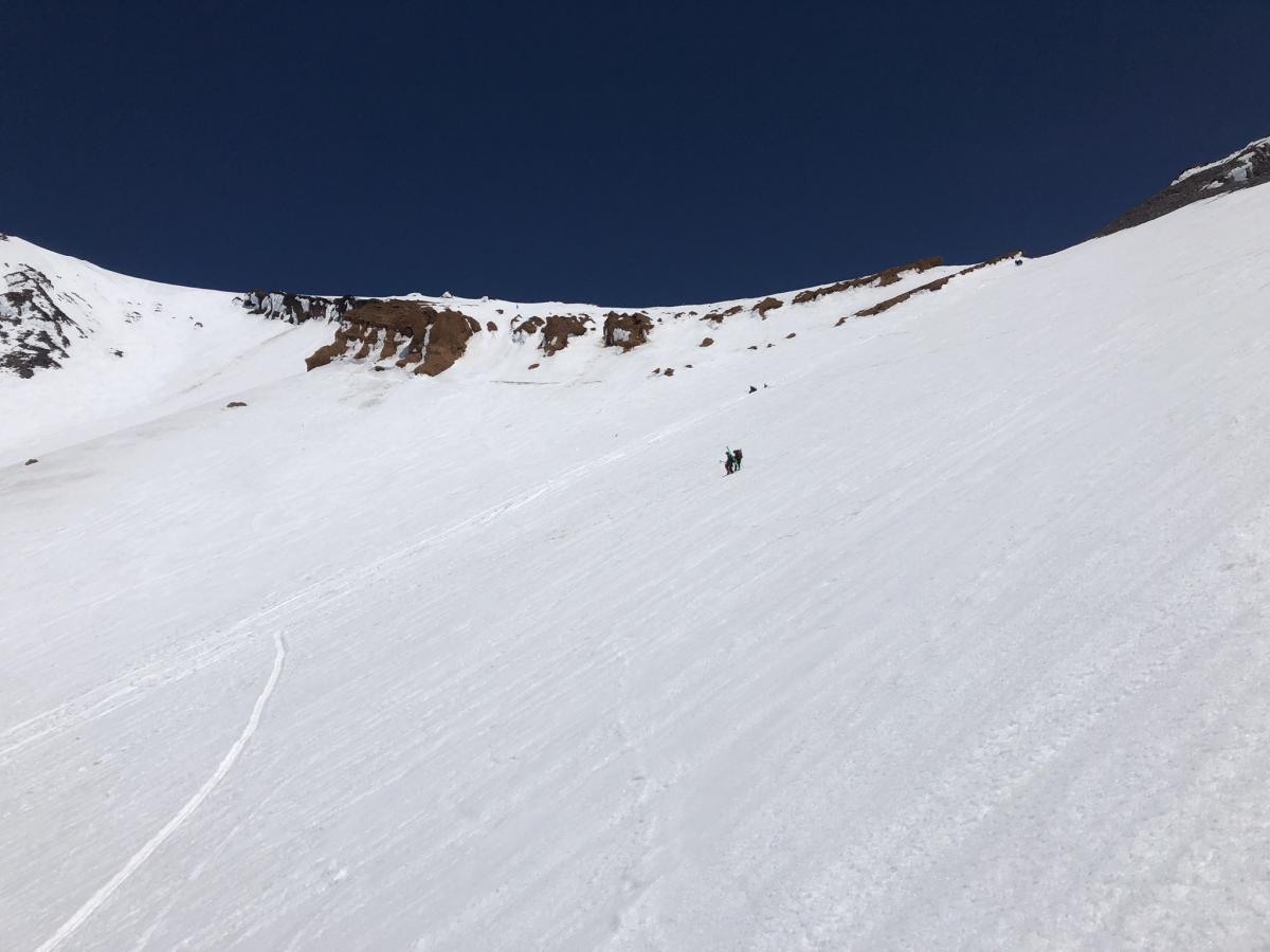
Looking up Avalanche Gulch toward the Redbanks and Short Hill. ~ 12,100 feet
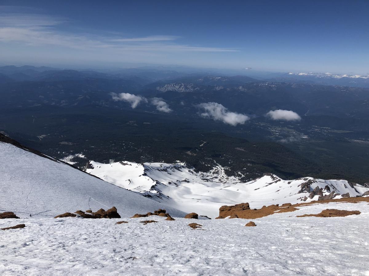
Looking down Avalanche Gulch from the top of the Red Banks. ~ 12,200 feet
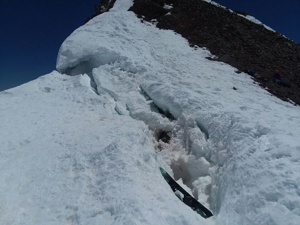
The ever-widening Konwakiton bergschrund around the right end of the Red Banks near the Thumb. Note: The Red Banks chutes are more favorable as this avoids the dangerous crevasse features of the Konwakiton. PLEASE do not through trash in the cravasse!
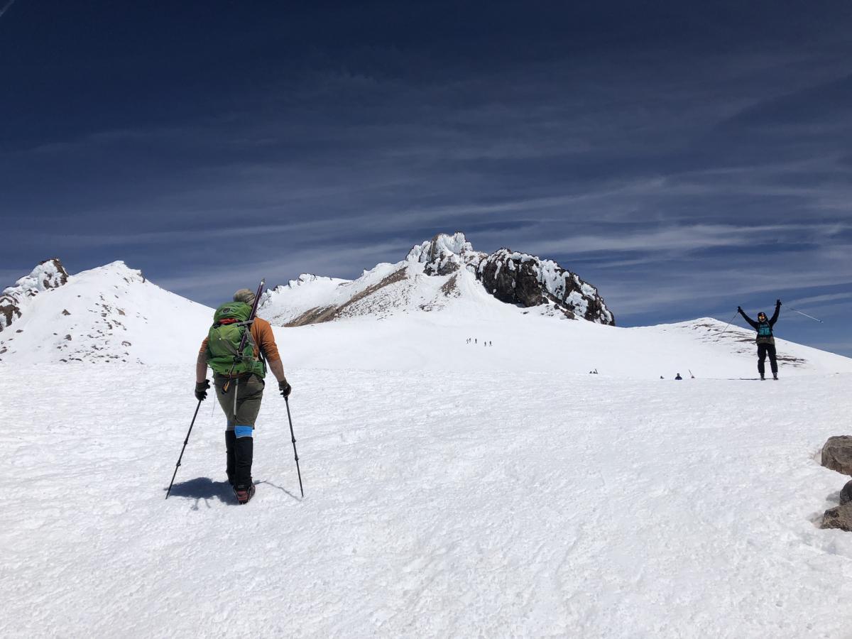
Looking towards the summit from the top of Misery Hill ~ 13,200 feet

