Near treeline on Mount Shasta in the last 24 hours, temperatures have averaged 16 °F with wind out of the southeast and northwest averaging 3-5 mi/hr with gusts to 25 mi/hr. New snow totals from the small January 18th storm measured an average of 2–6 inches, pending location and elevation. A tour in the Eddy Mountains found a couple inches of fresh, low density snow on top of supportable storm snow. A few older avalanche crown lines on northerly facing slopes were observed. These slides were likely from south wind loading northerly slopes during the parade of storms earlier in the month. Winds switched to northerly earlier in the week. Overall, the wind was light and very little blowing snow observed, despite plenty being available for transport. That said, one could see streams of blowing snow off the upper ramparts of Mount Shasta from a distance, another reminder to pay attention to localized conditions. Huge cornices are widespread along ridges. Visibility was tough in the north end of the range, but mostly clear from Parks Creek summit south. One can drive up the 42N17 for about 2 miles before snow is encountered. Up in the range, about 6–9 feet of snow was measured. No obvious signs of avalanche danger presented.
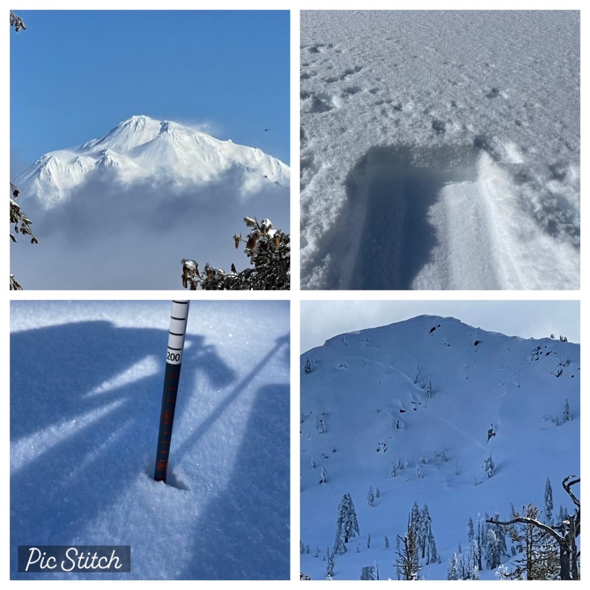
Clockwise from top-left: Mount Shasta view from Eddy Mountains with strong north wind visible / A couple inches fresh snow from the January 18th storm / A couple old crown lines on a north facing slope near treeline / Total height of snow measure 6–9 feet in the range - Photos: Meyers
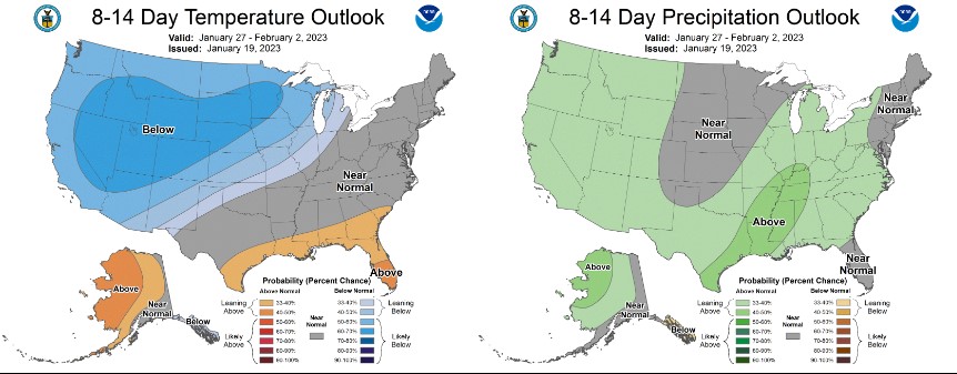
For the western states, below average temperatures and dry conditions will prevail through the end of the week, especially California. Upper level ridging is creating stable, calm conditions, with areas of fog in valleys and mostly clear skies. Mostly dry weather is in store for the remainder of the month. Expect cold mornings and seasonable afternoons. For the extended forecast beyond the next seven days, it looks like the high pressure ridge will hold through the rest of the month, but models suggest retrogression of the ridge beginning in February. This could result in a wetter pattern sometime during the first 10 days of February. The evolution of the Pacific jet stream is crucial. During west and northwest flow, the best precip is likely in the Cascades and PacNW.