It's that time of year again for the California Cooperative Snow Surveys (CCSS). The CCSS program provides mountain snowpack data and streamflow forecasts for the western United States. It is a partnership of more than 50 state, federal and private agencies. The agencies share a pool of expert staff and program funding, which collects, analyzes and disseminates snow data from more than 265 snow courses and 130 snow sensors located throughout the Sierra Nevada and Shasta-Trinity mountains. Common applications of snow survey products include water supply management, flood control, climate modeling, recreation and conservation planning. Yesterday, the Deadfall Lakes, Sweetwater and Parks courses were completed by Forest Service personnel. We will post the results when all surveys are completed. Overall in the Eddy Mountains, the snow line lingers near 5,000 feet, about 3.5 miles up the FS17 road from Stewart Springs. Most snow surfaces are variable, wind and sun affected. A soft, breakable crust with near surface facets below exists in some areas. North wind was moderate and gusty. Blowing snow was visible, but snow available for wind transport minimal. Small, shallow wind slabs were observed on leeward, southerly slopes, but unreactive to trigger. A few signs of old avalanches were observed on east and northwest facing slopes near and above treeline, respectively. A ski party was able to find some poor man's powder on shaded, sheltered slopes near and below treeline. Over the past 24 hours on Mount Shasta, temperatures have ranged from 20° to 38° with wind blowing predominantly out of the N-NW, averaging 12 mi/hr with gusts to 61 mi/hr. No red flags of avalanche danger have been observed and no reports of avalanches have come in since Monday, January 23rd. The Everitt Memorial Highway and Bunny Flat trailhead are open. Release the hounds.
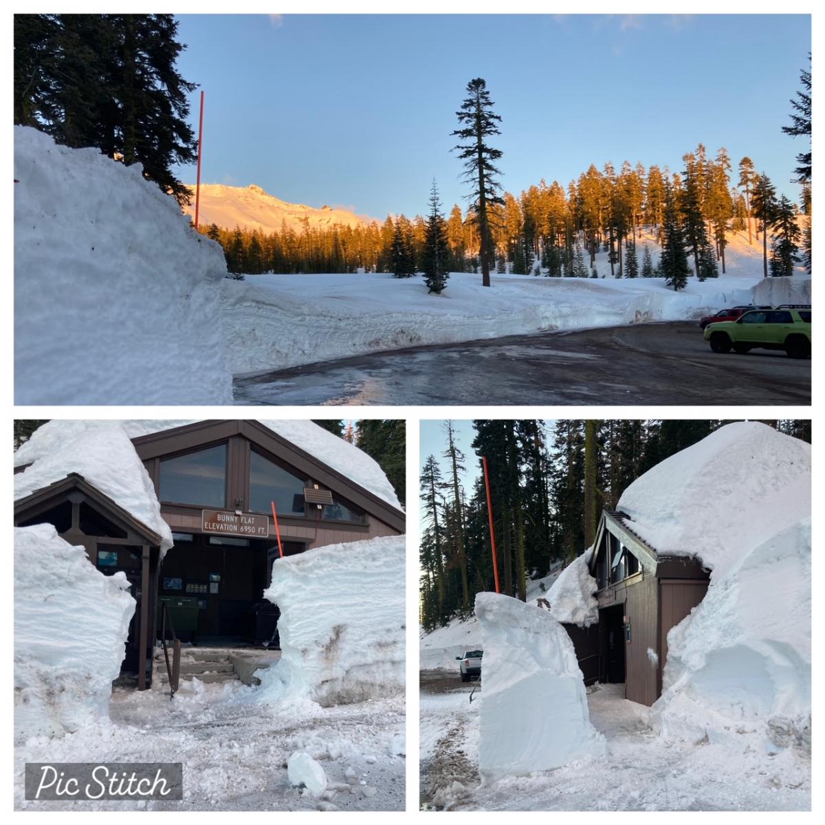
Photo: Bunny Flat trailhead and the Everitt Memorial Highway are open after nearly a month of closure due to intense winter storms / Meyers
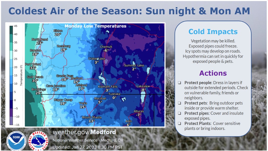
An arctic front will pass through the area tonight, with very light precipitation possible. Little to no accumulation is expected locally. The attention grabber is the cold temp and wind combination for the latter half of the weekend. Wind will increase beginning late tonight. Gusty wind blowing out of the northwest is expected during the day on Sunday, with cold temperatures. Wind chill will be significant and well into the negatives above treeline on Mount Shasta. Wind will weaken Sunday night as the coldest air of the season settles over the region. Temperatures will moderate after Monday, but still below normal. Weak high pressure will linger through next Thursday. Next weekend, long range models indicate a wetter storm track across the region.