Yesterday hosted fair weather with calm wind below treeline and light to moderate wind near and above treeline. On the upper ramparts of Mount Shasta, a lenticular cloud capped the mountain for most of the day, and we surmise that the wind was cranking up there. Blowing snow from the northwest wind was visible from below, collecting on southerly aspects. While some snow is moving around from the wind, snow available for wind transport is minimal. Much of above treeline and alpine terrain is scoured to old snow and ice. Smooth, slick surfaces dominate and should not be taken lightly for climbers. Warmer temperatures have definitely softened snow surfaces below and near treeline. Minor roller ball action was observed on sunny slopes. With a good freeze, a crust is likely in our near future. Soft, albeit moist snow still remains out there, but you'll have to hunt a little harder for it in the coming days. You know where to look! Think shade and protected.
Despite all the wind, no red flags of avalanche danger have presented. In the past 24 hours, temperatures have ranged from 31° to 43° F. Wind has blow predominantly out of the northwest, with a 12-hour session out of the southeast. Wind speeds have averaged 11 mi/hr with gusts to 61 mi/hr, recorded at our Gray Butte weather station at 8,000 feet. Near treeline on Mount Shasta, 130 inches of snow is on the ground. Height of snow elsewhere: Eddy Mtns - 104 inches / Ash Creek Butte - 119 inches
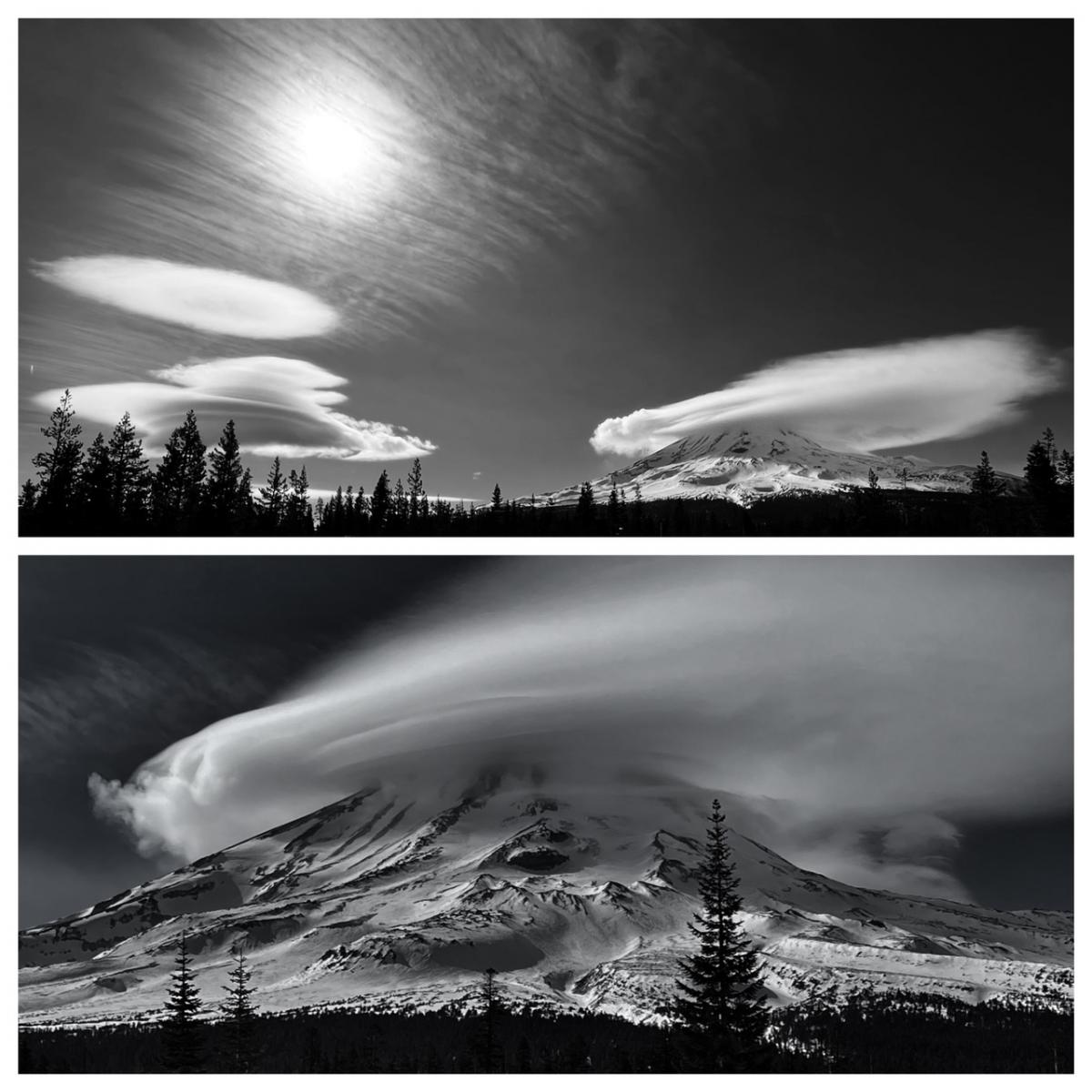
Photos taken on 2.8.23 from the east side of Mount Shasta. The Tri-Forest Snowmobile Trail system via Pilgrim Creek Sno-Park are in great shape and grooming is active. The coverage is awesome and soft snow is widespread, though icy in the mornings below treeline. The Esperanza road has been graded, but still in rough shape and muddy. Deer Mountain Sno-Park accesses this area also, and the road is paved. [Meyers]
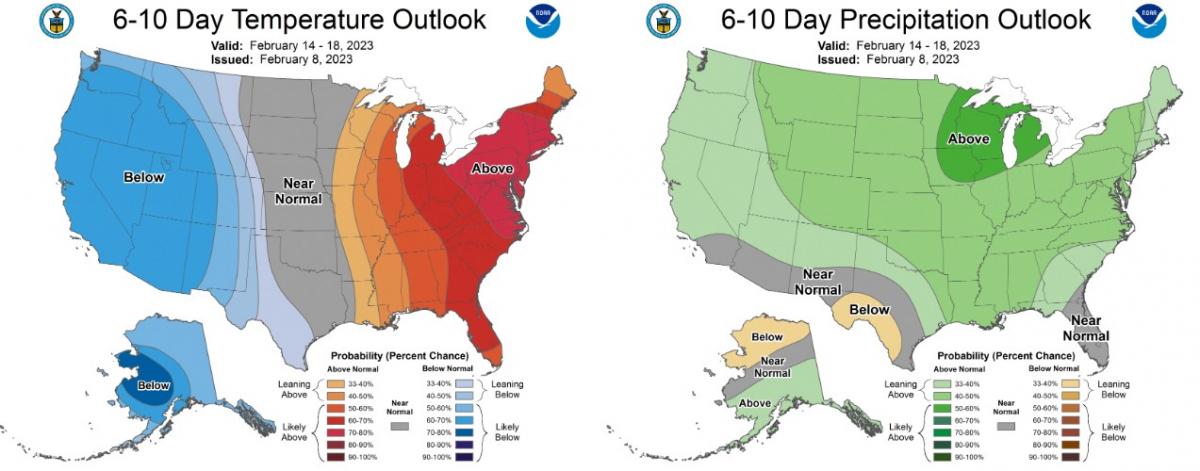
High pressure is keeping the area mostly clear and dry today. Sunny skies and above normal temperatures can be expected. Late this afternoon and evening, cloud cover will begin to build into the region. Southwest wind will increase over higher terrain. As the upper level trough moves onshore tonight, showers will spread across the area Friday. Precipitation amounts will be minimal. Snow levels will hover around 3,500 to 4,000 feet. We can expect 2 inches or less in the mountains and less than an inch elsewhere. Showers will taper off Friday evening. Clear and dry conditions will host the weekend, then another system arrives Monday into Tuesday.