Submitted by sclairmont on Sun, 03/19/2023 - 5:04am
Recent Observations:
Tranquil weather has been the story these last three days. Warm, sunny days with light to calm winds brought a large amount of settlement and upper level saturation to our snowpack. In the last 24 hours, clear skies slowly shifted to overcast as the approaching storm brought moisture into the area. Winds picked up, becoming moderate out of the southwest.
Yesterday's observations come from the Black Butte area. Soft, heavy snow can still be found in the most shaded of areas. However, a thin solar crust was found covering the majority of the observed terrain. This crust softened as the day warmed, and likely froze up overnight. Winds were moderate at ridge tops. Wind transport was not observed, likely due to the heavy snow and prevalent surface crust.
Signs of wet instabilities were abundant in the form of large roller balls, pinwheels, and old wet-loose avalanches. These avalanches entrained snow down to the rocks, leaving gouge marks across the slopes and debris blocks the size of microwaves. On the ski down, a ski cut triggered a 10-foot wide wet-loose avalanche that traveled 40 feet into trees.
Another party in the Mt Eddy area found similar conditions to Black Butte. The party noted stiff southwest winds, building overcast skies, and a surface crust on all but the most shaded aspects.
On another note, surface hoar has been found in basin and gully terrain features throughout the forecast area in the last couple of days. This could be an important layer to note with the new snow falling today.
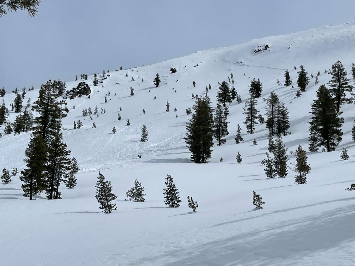
Image: An old avalanche found in the Mt Eddy area yesterday. This likely occurred during the widespread natural cycle on Monday and Tuesday this last week. Photo by N. Meyers
Mountain Weather:
An upper trough will approach the forecast area this morning, bringing southerly flow and heavy precipitation through the day. A winter weather advisory has been issued for the Mount Shasta area. A reinforcing pulse of precipitation will then move in later tonight, lasting until Monday morning. Peak precip intensities will happen this morning, with 0.84 inches of water expected by 5pm. Snow levels will be around 5,000 feet this morning, rising a little higher through the day. Snow levels are expected to drop to the base by Monday morning. Below treeline, wind will remain moderate, gusting to strong out of the south. Near and above treeline, strong to extreme winds are expected.
Monday will bring a short pause in weather, before a weaker low enters the area Monday night. Scattered showers are expected to continue through Wednesday.
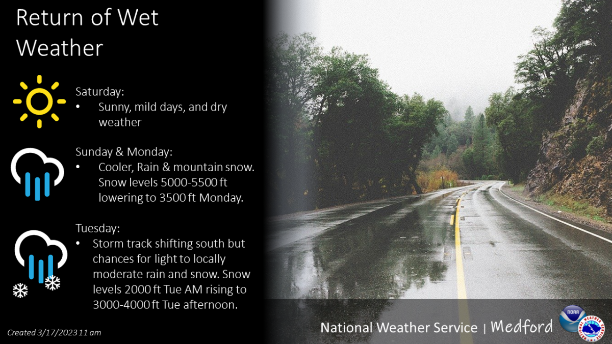
Image: Medford NWS.
Today 7-8 Weather :
Snow. Breezy, with gusts up to 40 mph. Snow level around 4,900 feet
Today 7-8 Wind Direction:
S
Today 8-9 Weather:
Snow. Windy, with gusts up to 80 mph. Wind chill values as low as -11 F
Today 8-9 Wind Direction:
S
Tomorrow 7-8 Weather:
Chance of snow showers, mainly before 11am. Partly sunny. Gusts up to 21 mph. Snow level will be at the base
Tomorrow 7-8 Wind Direction:
SW
Tomorrow 8-9 Weather:
Chance of snow showers, mainly before 11am. Mostly cloudy. Windy, with gusts up to 70 mph. Wind chill values as low as -23 F
Tomorrow 8-9 Wind Direction:
W
Tonight 7-8 Weather:
Snow before 2am, then snow showers after 2am. Gusts up to 24 mph. Snow level at 4,800 feet
Tonight 7-8 Wind Direction:
S
Tonight 8-9 Weather:
Snow before 2am, then snow showers after 2am. Windy, with gusts up to 65 mph. Wind chill values as low as -23 F
Tonight 8-9 Wind Direction:
SW
30
19
41
31
148
0
0
26
24
39
30
190.1
0
0.33
Grey Butte Temp Max:
34.5
Grey Butte Wind Max:
12.5
Grey Butte Wind Gust Max:
36.8
Castle Lake Temp Min:
48.5
Castle Lake Temp Max:
126.5
Castle Lake Temp Avg:
95.5
Castle Lake Snow Depth:
169.1
Mount Eddy Temp Cur:
28.5
Mount Eddy Temp Min:
25.5
Mount Eddy Temp Avg:
33.5
Mount Eddy Wind Gust Max:
9.22
Mount Eddy Snow Depth:
150.8
Ash Creek Bowl Temp Cur:
29.5
Ash Creek Bowl Temp Min:
25.5
Ash Creek Bowl Temp Max:
35
Ash Creek Bowl Temp Avg:
30.5
Ash Creek Bowl Snow New:
0
Ash Creek Ridge Temp Cur:
23
Ash Creek Ridge Temp Min:
22
Ash Creek Ridge Temp Max:
29
Ash Creek Ridge Temp Avg:
25.5
Ash Creek Ridge Wind Cur:
17
Ash Creek Ridge Wind Max:
24
Ash Creek Ridge Wind Gust Max:
44.48
Ash Creek Ridge Wind Avg:
E
Mt. Shasta City Temp Cur:
43
Mt. Shasta City Temp Min:
26
Mt. Shasta City Temp Max:
53
Mt. Shasta City Temp Avg:
42
Mt. Shasta City Wind Cur:
3
Mt. Shasta City Wind Min:
0
Mt. Shasta City Wind Max:
4
Mt. Shasta City Wind Avg:
0.5
Mt. Shasta City Wind Avg:
N
Ash Creek Ridge Wind Min:
6
Ash Creek Ridge Wind Avg:
16
Sand Flat Snow Settlement:
2
Ski Bowl Snow Settlement:
1.7
Castle Lake Snow Settlement:
2
Mount Eddy Snow Settlement:
2
Ash Creek Bowl Snow Settlement:
0
Measured Precipitation Oct:
36.5
Normal Precipitation Oct:
28.5
Percent Precipitation Oct:
128
Measured Precipitation MTD:
6.79
Normal Precipitation MTD:
3.56
Percent Precipitation MTD:
191
Measured Precipitation YTD:
27.37
Normal Precipitation YTD:
16.26
Percent Precipitation YTD:
168
Tomorrow Wind Max 7-9:
20
Tomorrow Wind Min 7-9:
10
Tonight Wind Max 9-11:
35
Tomorrow Wind Max 9-11:
35
Tonight Wind Min 9-11:
25
Tomorrow Wind Min 9-11:
25
Today Snow Max 7-9:
12.00
Tonight Snow Max 7-9:
3.00
Tomorrow Snow Max 7-9:
1.00
Tonight Snow Min 7-9:
1.00
Tomorrow Snow Min 7-9:
0.00
Today Snow Max 9-11:
12.00
Tonight Snow Max 9-11:
3.00
Tomorrow Snow Max 9-11:
1.00
Today Snow Min 9-11:
6.00
Tonight Snow Min 9-11:
1.00
Tomorrow Snow Min 9-11:
0.00
Weather Station Discussion:
The table below summarizes data reported from all of our weather stations over the last 24 hours.
Seasonal Stats Discussion:
The wet season is October 1 through May 1. The table below summarizes recorded vs. normal precipitation amounts for the City of Mount Shasta.
Overall Danger Rating:
Considerable


