Submitted by efalconer on Wed, 04/05/2023 - 5:47am
Recent Observations:
Strong northwest winds have been kept aloft and less active at the lower elevations. A southeast wind blowing at calm speeds with light gusts has been occurring over the last 24hrs. Mountain temperatures have stayed below freezing and clouds have allowed light sun exposure. I was unsuccessful finding any symptoms of wind slabs yesterday in the Eddy Mountains, even with plenty of signs and indications of wind effect. A southeast wind blew at calm to light speeds and a small amount of blowing snow was observed. Below and near treeline a uniform crust one to four inches down was discovered on all but due north aspects. The north face displayed 90 inches (35 cm) of semi cohesive snow above older weaker, decomposing snow with a thin crust at the interface. Areas subjected to the strong previous northwest winds looked loaded. Massive Cornices hung off ridgelines as for as the eye could see.
Folks at Castle Lake observed three old wind slab avalanches that likely failed during the 28th / 29th storm event. Although old and filled in, these avalanches were hefty and offer a good reminder of what the wind is capable of.
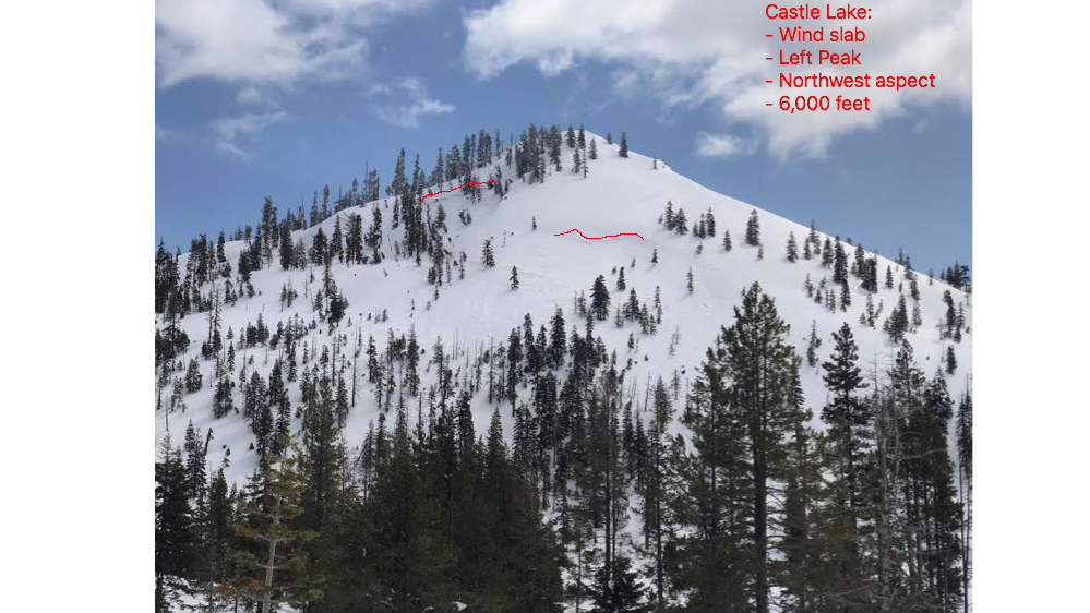
This avalanche likely occurred during the 28th / 29th storm event.
Mountain Weather:
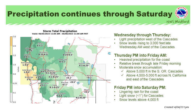
Partly cloudy conditions will persist throughout today as a weak upper ridge builds over the region with mostly dry weather expected for the area. Mountain temperatures will rest in the low to mid-thirties with valleys reaching a high near forty degrees F. A northwest wind will transition to a southwest flow as a warm front approaching the coast. The offshore trough looks to stay over the marine waters and coastal counties until advancing inland Thursday night. Active southerly winds are expected for high elevation terrain and valleys starting tonight. Widespread precipitation with snow levels starting out at 5,500 feet will begin Thursday evening through Friday morning.
Today 7-8 Weather :
Partly sunny
Today 7-8 Wind Direction:
S
Today 8-9 Weather:
Partly sunny. Wind chill values as low as -10
Today 8-9 Wind Direction:
NW
Tomorrow 7-8 Weather:
Snow. Chance of precipitation is 100 percent
Tomorrow 7-8 Wind Direction:
S
Tomorrow 8-9 Weather:
Cloudy, with a 30 percent chance of snow after 11am
Tomorrow 8-9 Wind Direction:
S
Tonight 7-8 Weather:
Mostly cloudy with gusts as high as 20 mph
Tonight 7-8 Wind Direction:
S
Tonight 8-9 Weather:
Mostly cloudy. Wind chill values as low as -2
Tonight 8-9 Wind Direction:
SW
26
2
29
16
146
0
0
12
6.5
27
17
202.1
0
0
Grey Butte Temp Max:
24.5
Grey Butte Temp Avg:
16.5
Grey Butte Wind Max:
15.5
Grey Butte Wind Gust Max:
36.8
Castle Lake Snow Depth:
177.7
Mount Eddy Temp Avg:
18.5
Mount Eddy Wind Gust Max:
7.09
Mount Eddy Snow Depth:
162.4
Ash Creek Bowl Temp Cur:
15
Ash Creek Bowl Temp Min:
11
Ash Creek Bowl Temp Max:
25
Ash Creek Bowl Temp Avg:
17.5
Ash Creek Bowl Snow New:
0
Ash Creek Ridge Temp Cur:
11.5
Ash Creek Ridge Temp Min:
7
Ash Creek Ridge Temp Max:
19.5
Ash Creek Ridge Temp Avg:
14
Ash Creek Ridge Wind Cur:
0
Ash Creek Ridge Wind Max:
0
Ash Creek Ridge Wind Gust Max:
0
Mt. Shasta City Temp Cur:
27
Mt. Shasta City Temp Min:
27
Mt. Shasta City Temp Max:
43
Mt. Shasta City Temp Avg:
34.5
Mt. Shasta City Wind Cur:
0
Mt. Shasta City Wind Min:
0
Mt. Shasta City Wind Max:
8
Mt. Shasta City Wind Avg:
3
Ash Creek Ridge Wind Min:
0
Ash Creek Ridge Wind Avg:
0
Sand Flat Snow Settlement:
1
Ski Bowl Snow Settlement:
2.6
Castle Lake Snow Settlement:
0.4
Mount Eddy Snow Settlement:
1.6
Ash Creek Bowl Snow Settlement:
0
Measured Precipitation Oct:
39.81
Normal Precipitation Oct:
30.82
Percent Precipitation Oct:
129
Measured Precipitation MTD:
0.09
Normal Precipitation MTD:
0.28
Percent Precipitation MTD:
32
Measured Precipitation YTD:
30.68
Normal Precipitation YTD:
18.58
Percent Precipitation YTD:
165
Tomorrow Wind Max 7-9:
20
Tomorrow Wind Min 7-9:
10
Tonight Wind Max 9-11:
20
Tomorrow Wind Max 9-11:
20
Tonight Wind Min 9-11:
10
Tomorrow Wind Min 9-11:
10
Tonight Snow Max 7-9:
0.50
Tomorrow Snow Max 7-9:
7.00
Tonight Snow Min 7-9:
0.00
Tomorrow Snow Min 7-9:
3.00
Today Snow Max 9-11:
0.00
Tonight Snow Max 9-11:
0.00
Tomorrow Snow Max 9-11:
3.00
Today Snow Min 9-11:
0.00
Tonight Snow Min 9-11:
0.00
Tomorrow Snow Min 9-11:
1.00
Weather Station Discussion:
The table below summarizes data reported from all of our weather stations over the last 24 hours.
Seasonal Stats Discussion:
The wet season is October 1 through May 1. The table below summarizes recorded vs. normal precipitation amounts for the City of Mount Shasta.
Overall Danger Rating:
Considerable


