You are here
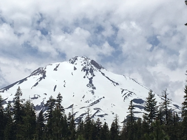
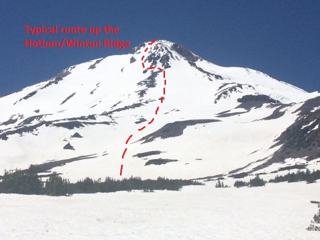
06-16-2016-Hotlum/Wintun Snowfield
General Conditions
Road access to Brewer Creek trailhead is currently still limited by snow coverage however the trailhead is open with summit passes, wilderness permits and packout bags available. A 2wd, low clearance vehicle can make it about 3/4 mile from the trailhead. A 4wd truck is able to make it all the way to the trailhead. The road is blocked by snow drifts at what is called the "wash out". This is a large gully that crosses the road, and currently contains enough snow for skiers/split boarders to skin up being able to stay on mostly snow for the majority of your ascent. The current conditions on this route are good for climbing and skiing. The snow has been transitioning into full spring/early summer conditions with firm snow in the early morning, then softening to corn by 10:30-11:00 a.m. Climb early to avoid any possible post-holing on hot days. As with all the east side routes, sun hits them early and too soft of snow is more of a problem to to firm of snow. However, cooler days or days with an easterly wind, the route can stay firm. Hopefully you can time it right!
Current avalanche danger is overall LOW, but will be at it most sensitive during the warmest parts of the day for loose wet snow instabilities. A beacon, shovel and probe are recommended. Even though you may not get fully buried by a loose wet slide, they can certainly sweep you into undesirable terrain and of course, still bury you in a terrain trap. Rock fall has been low but always be on the look out, especially 11,000 feet and above. Wear a helmet!
This route is pretty straight forward with a couple variations possible near the top. Stay on snow, don't knock rocks down onto climbers below. Icy patches may be found in areas as the seasonal snow pack dwindles. Where most people run into trouble on this route is descending back to their car. It's common to miss your vehicle too far to the south (skiers right). Skiers tend to try and ski as low as possible on the long fingers of snow that extend below tree line...while we don't blame them, this will take one far to the south. When descending, be sure to make a gradual trend skiers left, aligning yourself between Ash Creek Butte and the large lava flow that abruptly drops off at around 9,000 feet. If you put yourself in between these two land forms, you'll nail the descent every time. Again, just remember to trend left at the base of the lava flow at about 9,000 feet, not too far, but by placing yourself in between Ash Creek Butte and the blocky lava flow. This is mostly an issue for skiers and when there is snow down to the trailhead.
Water is sometimes found flowing from melting snow fields, but don't count on it. Bring extra fuel to melt snow.