

You are here
Crater Lake N.P. Garfield Peak
Location Name:
Garfield PeakRegion:
Outside of the Forecast AreaDate and time of observation:
Thu, 12/13/2018 - 12:00pmObservation made by:
PublicRed Flags:
Location Map
96067
Mount Shasta
, CA
United States
42° 54' 13.2912" N, 122° 7' 23.07" W
See map: Google Maps
California US
Snowpack Observations
Details
Photos
Weather Observations
Statistics
Cloud Cover:
25% of the sky covered by cloudsBlowing Snow:
YesPrecipitation:
NoneAccumulation rate:
NoneAir temperature:
Air temperature trend:
Wind Speed:
LightWind Direction:
Southwest

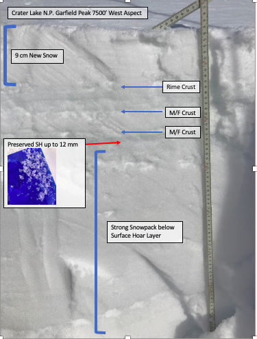
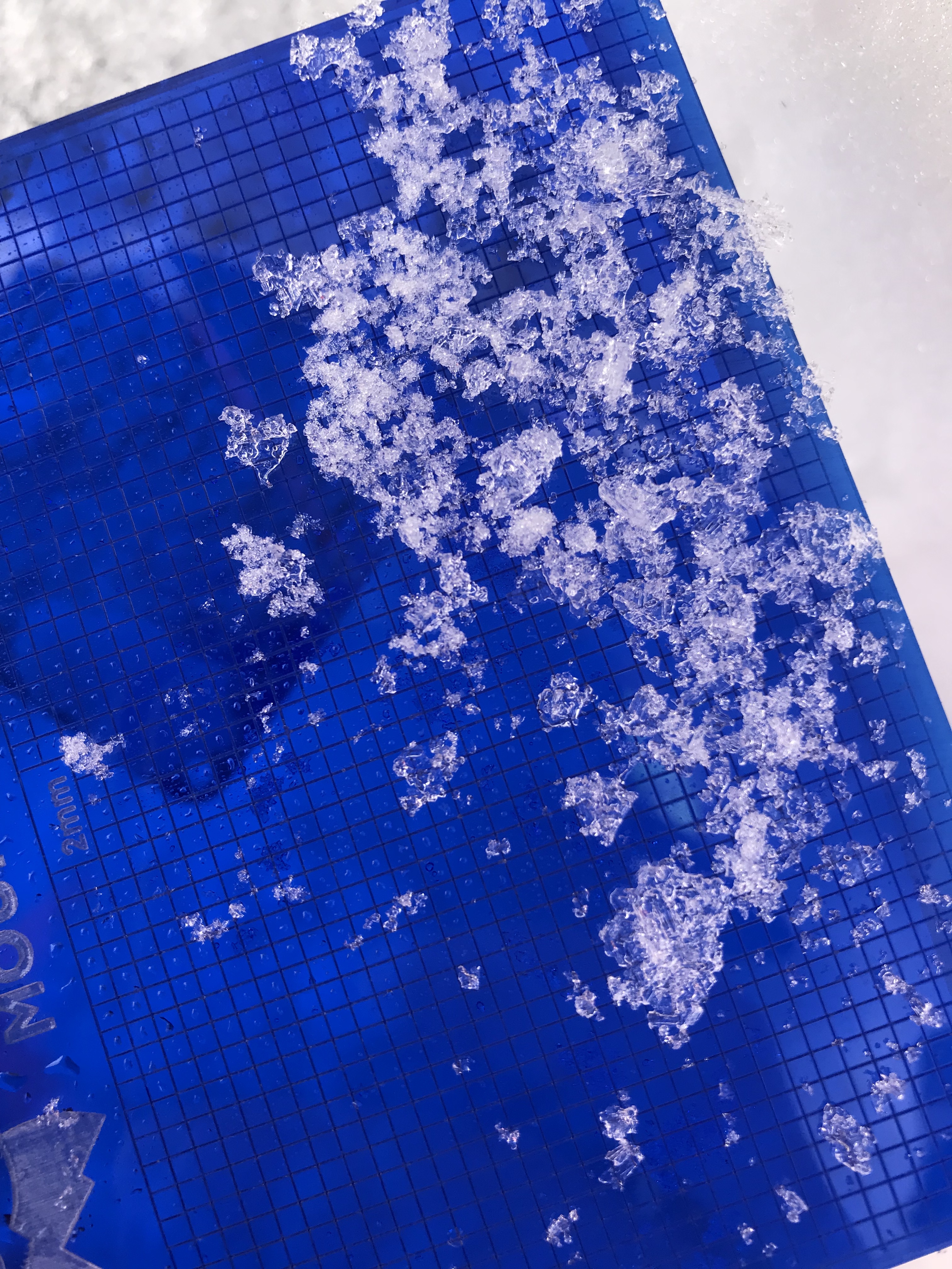
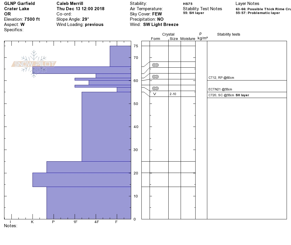
Toured in CLNP today, specifically West facing aspects of Applegate and Garfield Peaks. Found snow depths ranging from 60-90 cm. Lower elevation sheltered terrain held cold settled powder snow with 2-5mm surface hoar as the predominate surface grain type. As we gained elevation, we started to encounter a variable thickness crust underlying the 10cm of new snow from the last few days. In terrain exposed to the wind, there were many areas where the new snow had been blown off this crust leaving a supportive albeit foot massaging surface under skis. Below this crust lay a few other melt freeze crusts sandwiching decomposing grains. Dug a quick pit on West facing aspect at 7500'. 25 cm from the surface we found well preserved SH ranging in size from 2-12mm. See photos and profile for test results. Ski quality was variable, but was best on lower angle slopes in sheltered terrain.