

You are here
Av Gulch 1-29-21
Location Name:
Avalanche Gulch from Oberman CausewayRegion:
Mt. ShastaDate and time of observation:
Fri, 01/29/2021 - 12:30pmObservation made by:
PublicLocation Map
96067
Mount Shasta
, CA
United States
41° 22' 21.4356" N, 122° 13' 46.1136" W
See map: Google Maps
California US
Snowpack Observations
Details
Photos
Weather Observations
Details
Partly cloudy, 25 degree F., light SSE winds.
Statistics
Cloud Cover:
25% of the sky covered by cloudsAir temperature:
Below FreezingWind Speed:
LightWind Direction:
Southeast

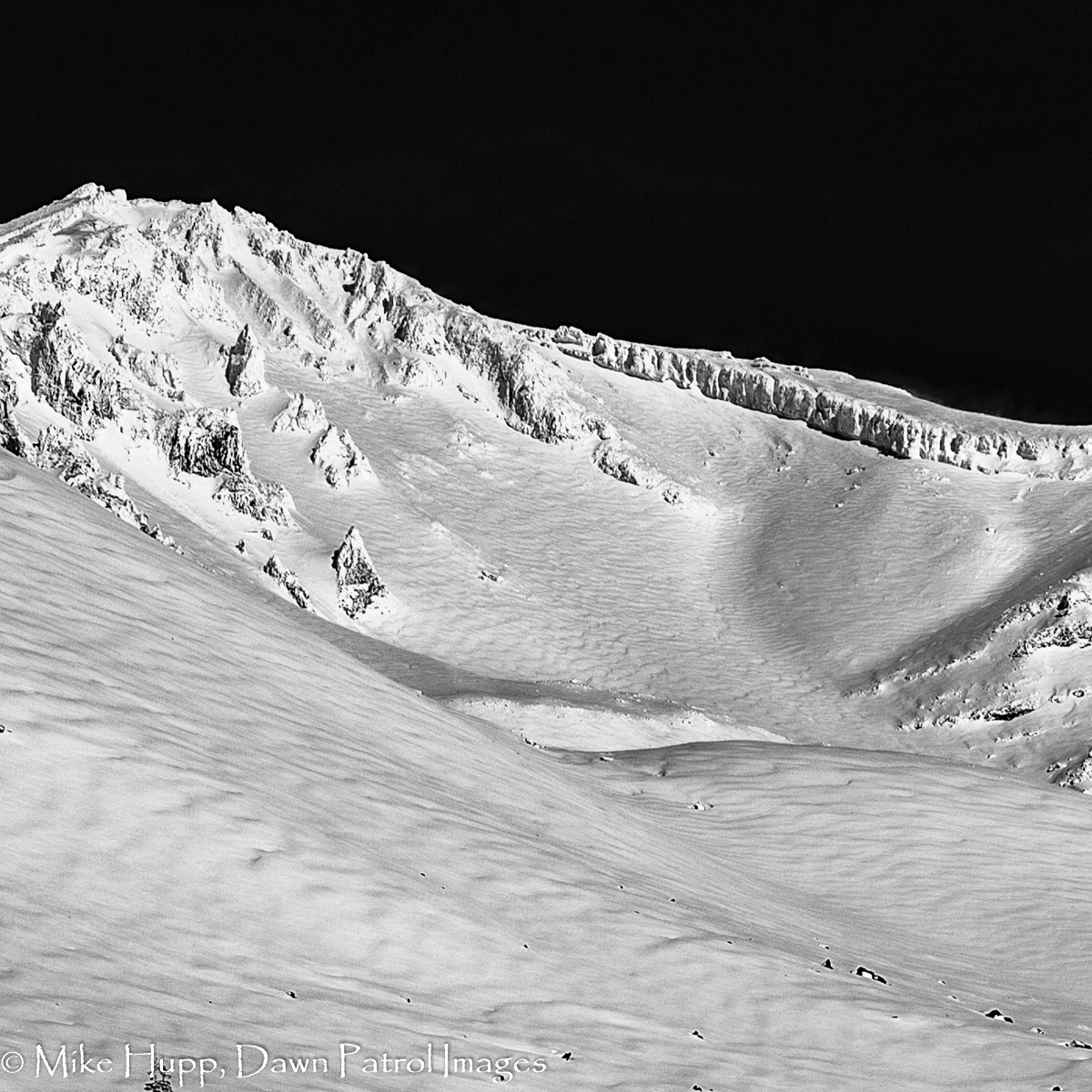
Cropped view of upper Avalanche Gulch taken ~300 yards NE of Sierra Club cabin. Wind impacts in exposed areas are obvious indicating snow tranport, wind-affected snow and likely rotten skiing. It looks like a storm slab came down on the left side of the Heart and was subsequently buried by snowfall. It appears to stop around the elevation of Lake Helen.
[MORE DETAILS]