

You are here
Cascade Gulch

Location Name:
Lower Cascade GulchRegion:
Mt. ShastaDate and time of observation:
Mon, 01/23/2017 (All day)Observation made by:
ForecasterRed Flags:
Recent loading by new snow, wind, or rain
Location Map
United States
41° 21' 20.2176" N, 122° 16' 19.956" W
See map: Google Maps
US
Snowpack Observations
Details
Snow Pit Photos
Weather Observations
Details
A break in precipitation and periods of blue sky occurred from mid morning to early afternoon today. Heavy snowfall occurred in the late afternoon with accumulation rates ranging from 1-3 inches an hour beginning at 3pm. Moderate south winds were observed. Visibility deteriorated throughout the day.
Statistics
Cloud Cover:
100% of the sky covered by cloudsBlowing Snow:
YesPrecipitation:
SnowAccumulation rate:
Greater than 1 in. per hourAir temperature:
Below FreezingAir temperature trend:
CoolingWind Speed:
CalmWind Direction:
South

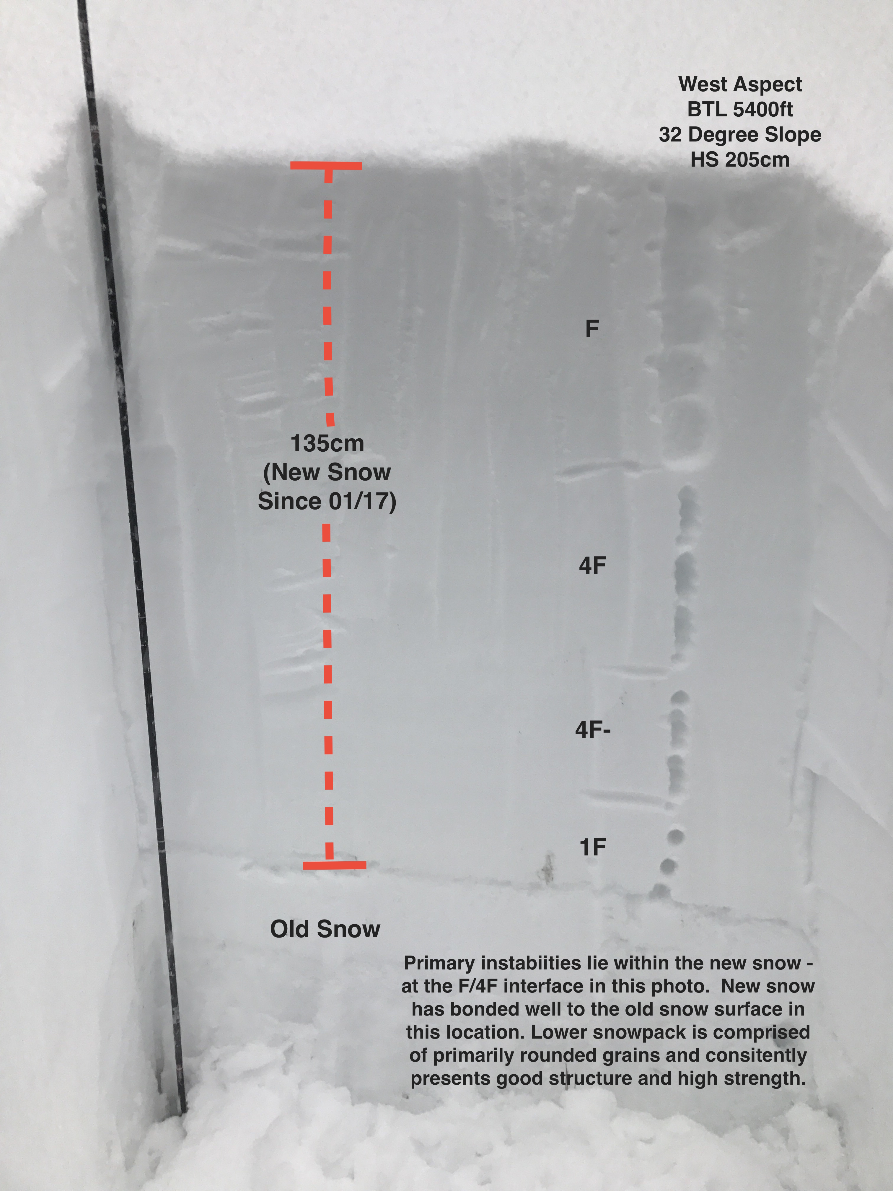
A test pit dug at 5400ft on a west aspect below treeline revealed the height of new snow since 01/17 to be 135cm. The bond between the new snow and the old snow surface was strong, and the lower snowpack showed no signs of instability. At this location the new snow was right side up, and surprisingly, did not produce unstable results in stability tests. The layer of greatest concern was about 50cm down on a density break. This layer produced progressive compression fractures and irregular breaks in small column tests and no propagation in large column tests. Boot penetration was 70cm and ski penetration was 40cm.