

You are here
Castle Lake

Location Name:
Castle Lake Region:
Castle LakeDate and time of observation:
Mon, 02/06/2023 - 12:30pmObservation made by:
ForecasterRed Flags:
Recent avalanche activity
Whumphing noises, shooting cracks, or collapsing
Recent loading by new snow, wind, or rain
Location Map
96067
Mount Shasta
, CA
United States
41° 13' 25.878" N, 122° 22' 45.5772" W
See map: Google Maps
California US
Snowpack Observations
Details
Photos
Weather Observations
Statistics
Cloud Cover:
25% of the sky covered by cloudsBlowing Snow:
YesPrecipitation:
NoneAccumulation rate:
NoneAir temperature:
Above FreezingAir temperature trend:
WarmingWind Speed:
ModerateWind Direction:
Northeast

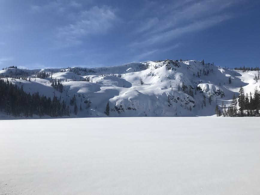
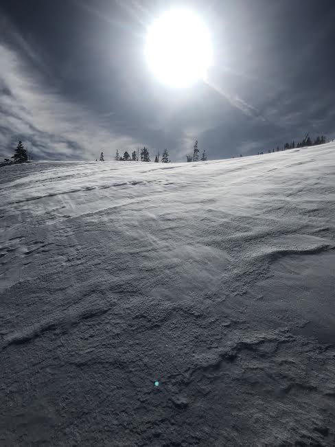
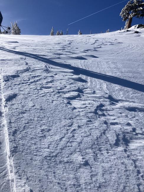
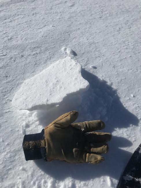
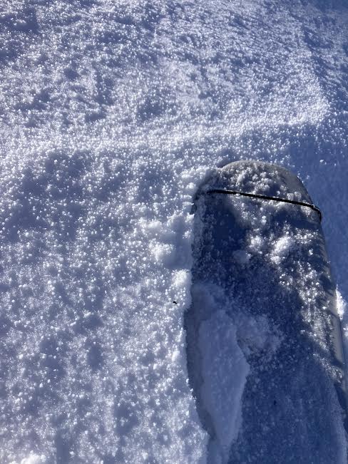
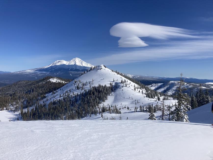
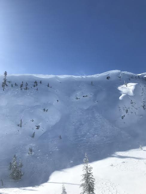
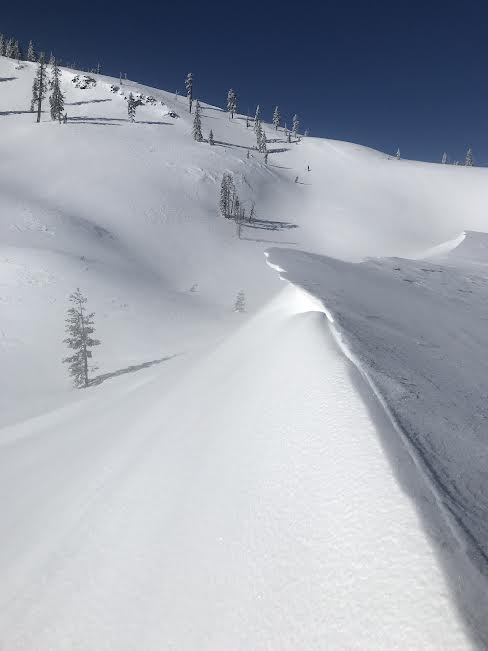
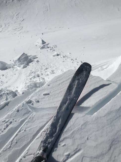
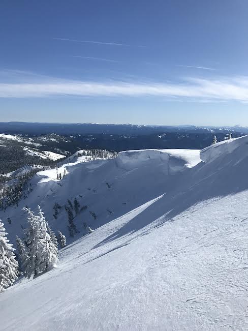
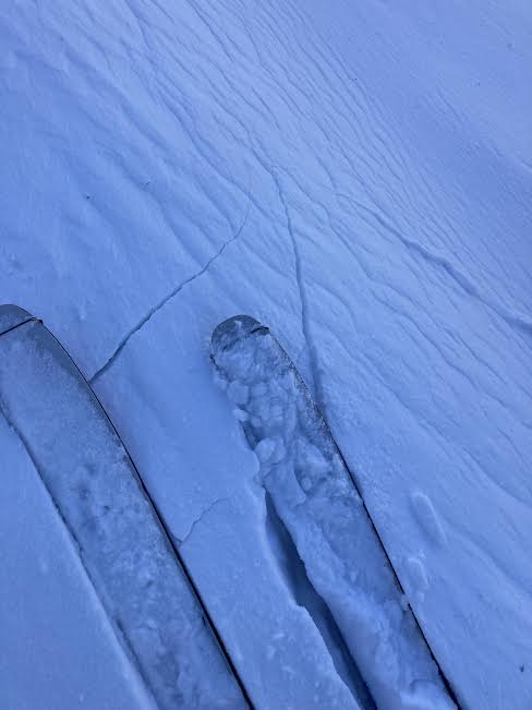
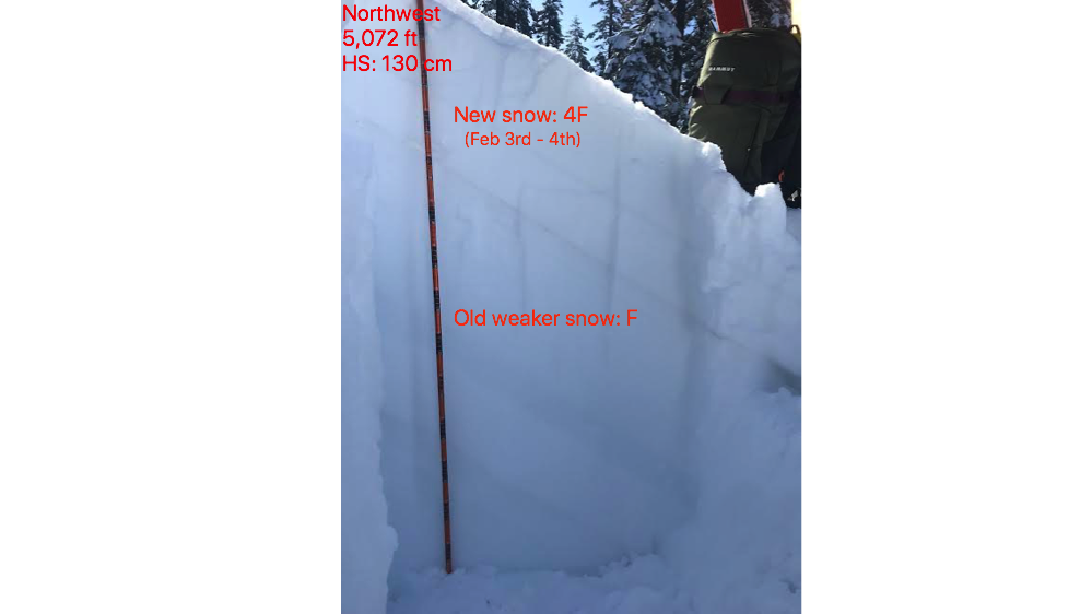
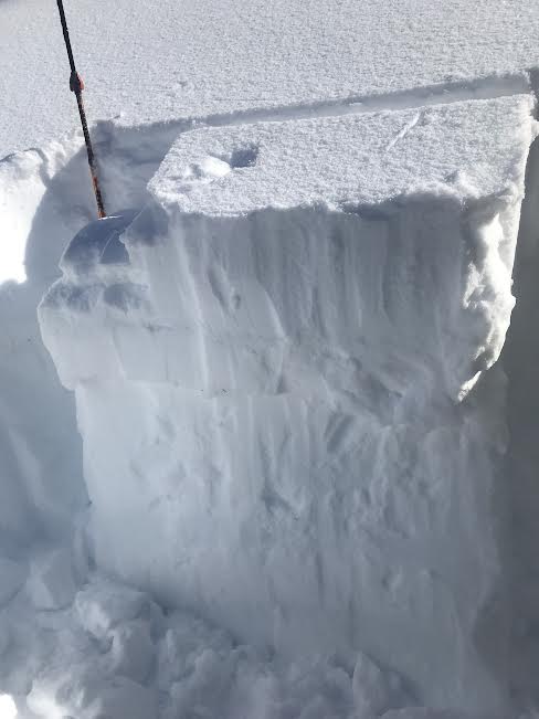
Today, Sam and I visited Castle Lake via snowmobile to check on snow conditions after the recent storm. Cracking and blocking were easy to initiate in recently wind-drifted snow above and below ridgelines. Large north-facing cornices with recent wind slab avalanches beneath them were visible. A moderate to strong north, northeast wind near treeline was blowing snow and depositing it onto southerly slopes. Cross-loaded pockets and depressions were a central theme within the terrain near treeline. Below north and south ridgelines, wind drifts up to one foot thick could be found. Below treeline on protected slopes, surfaces remained soft and unaffected. Near treeline on exposed areas, wind-hardened and firm surfaces existed. At 1230 the wind slackened, and the temperature increased, causing roller balls and trees to start dripping. Looking at the snowpack’s structure below treeline on a north aspect, we discovered the recent snow from February third and fourth, resting above weaker snow from mid-January. A stability test score of ECTP-14 reinforces the notion that if a lot of snow were to slide, it could step down to this older, weaker layer of snow.