

You are here
Castle Lake
Location Name:
Right PeakRegion:
Castle LakeDate and time of observation:
Wed, 03/15/2023 - 12:00pmObservation made by:
ForecasterRed Flags:
Recent avalanche activity
Recent loading by new snow, wind, or rain
Rapid warming
Location Map
96067
Mount Shasta
, CA
United States
41° 13' 49.998" N, 122° 23' 26.9016" W
See map: Google Maps
California US
Weather Observations
Statistics
Cloud Cover:
25% of the sky covered by cloudsBlowing Snow:
NoPrecipitation:
NoneAccumulation rate:
NoneAir temperature:
Below FreezingAir temperature trend:
WarmingWind Speed:
LightWind Direction:


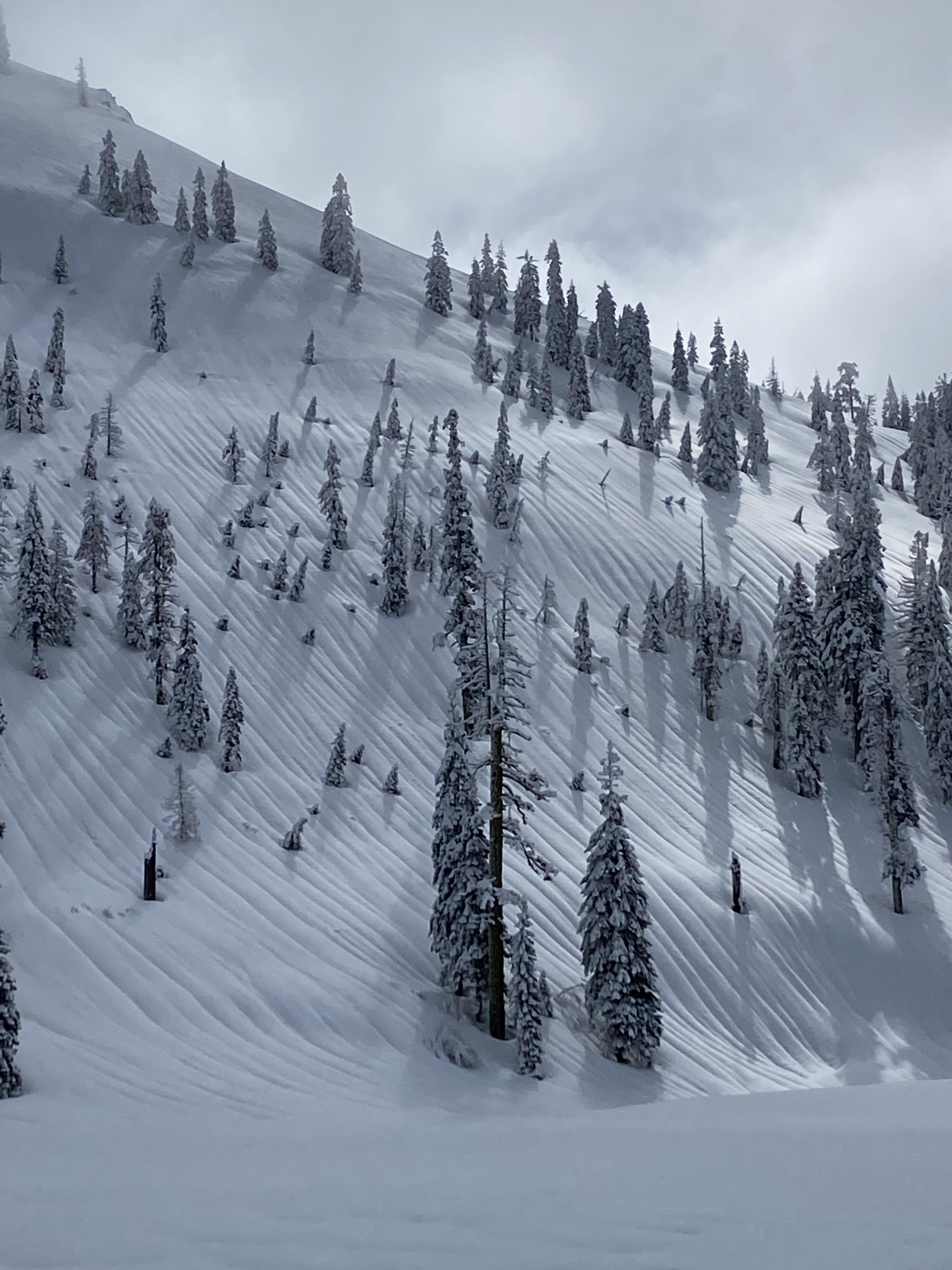
These observations were taken over the course of a few hours, between about 5,000 feet and the top of Right Peak, at about 6,300 feet.
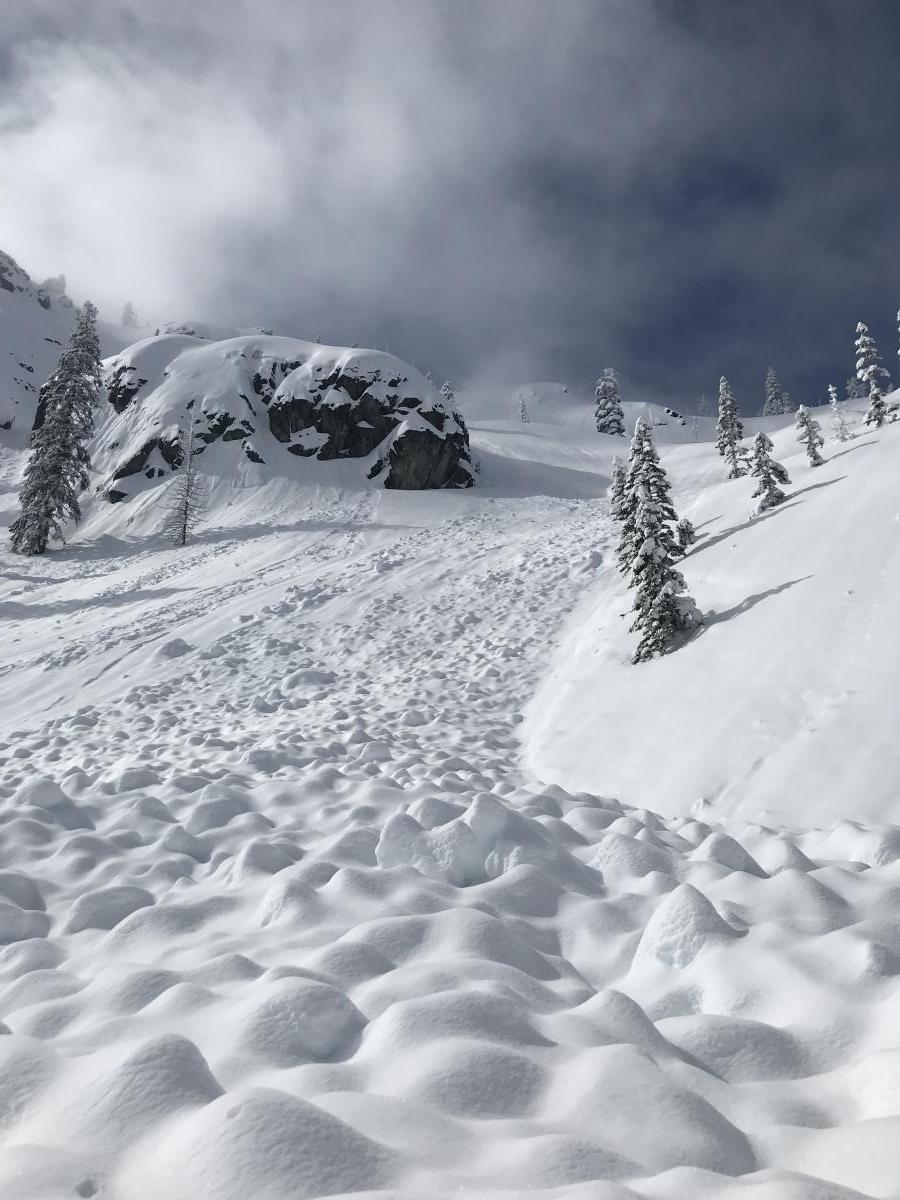
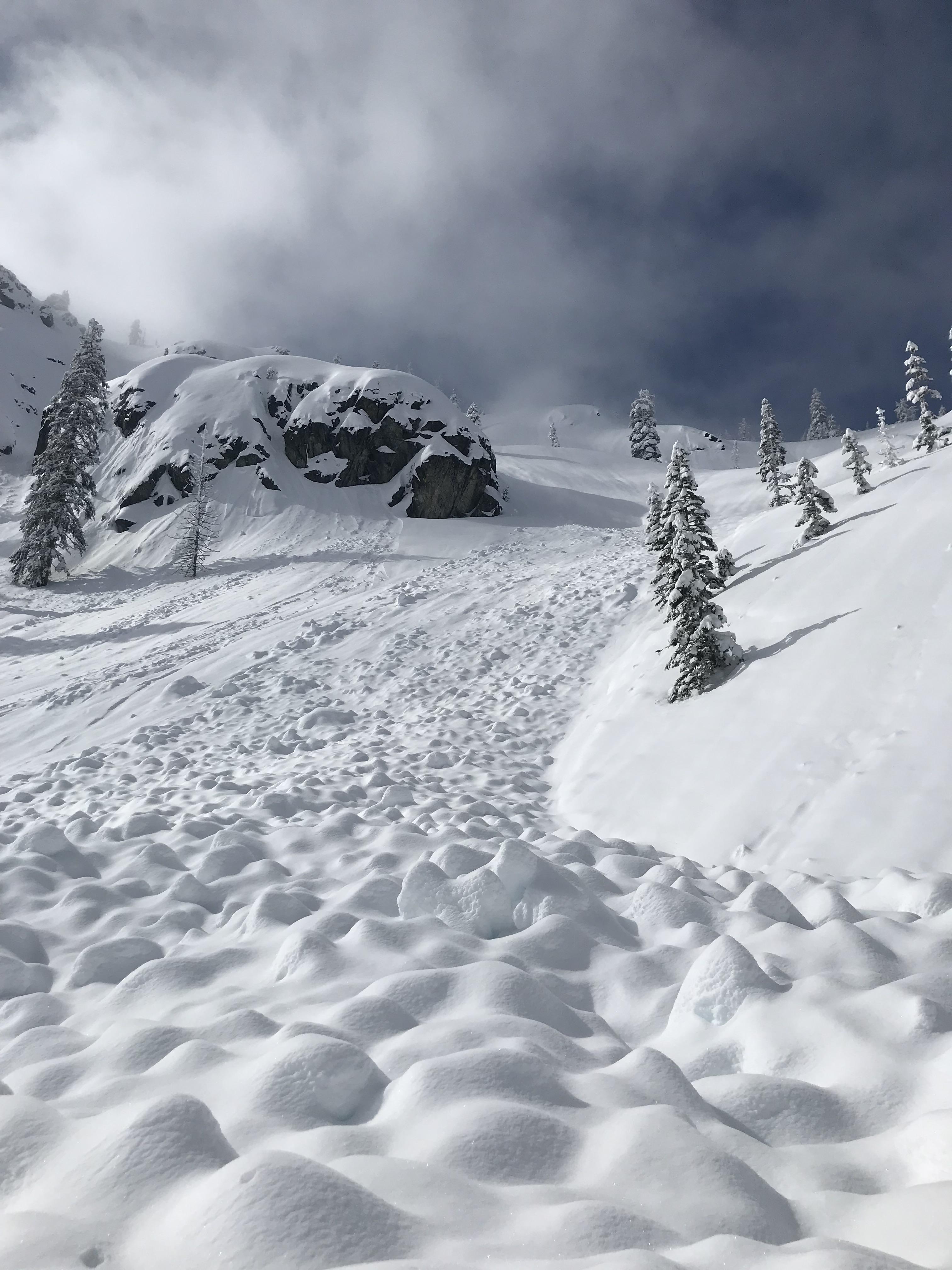
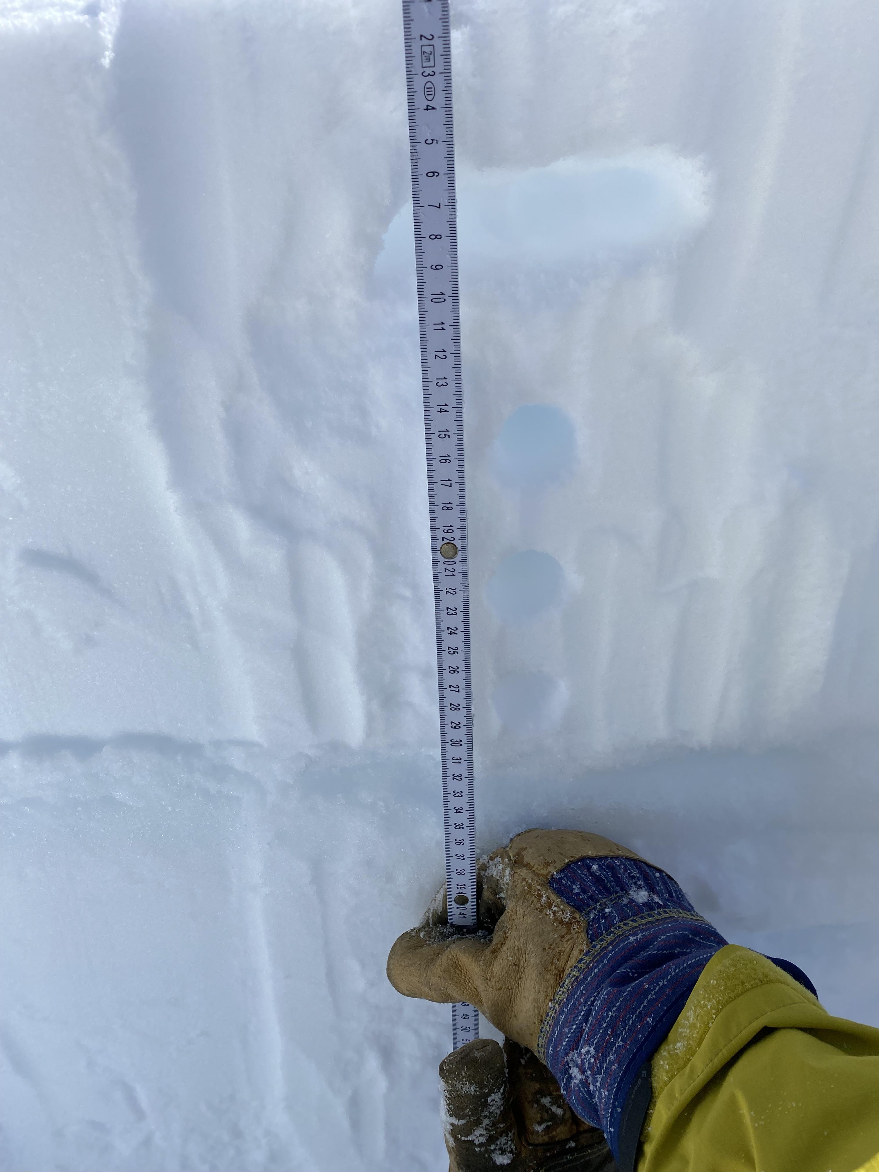
Making our way up from the gate and past Methodist Camp, we found about 8-9 inches of new snow from day prior and last night. On our way up, massive rain runnels were visible everywhere there was an exposed slope. The atmospheric river that delivered large amounts of rain to Mount Shasta and the surrounding area had clearly made its presence known up here as well. When we dug down there is an obvious 4-6 cm-thick rain crust, about 33 cm below the surface. This crust was evident on all aspects and areas, even up to the very top of Right Peak.
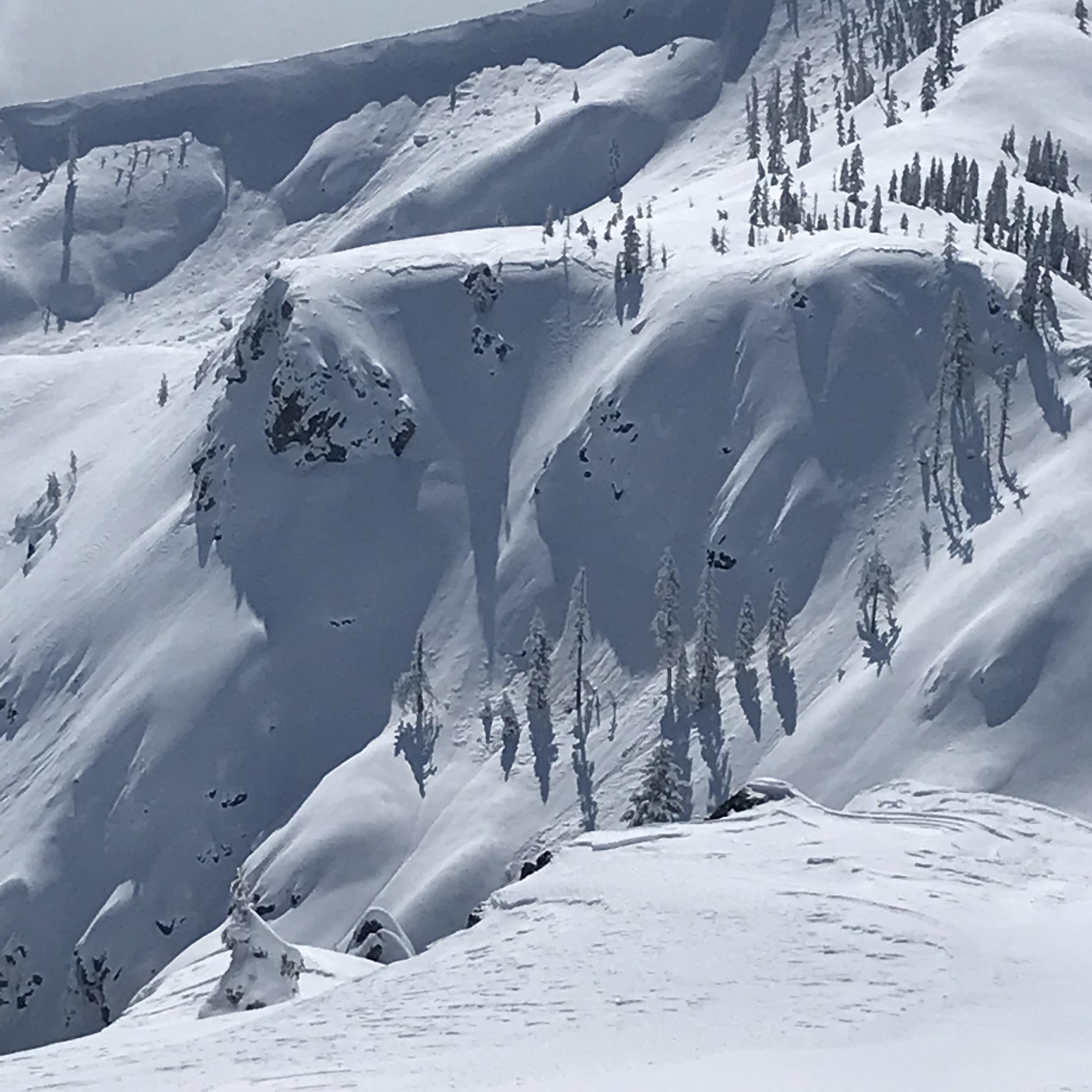
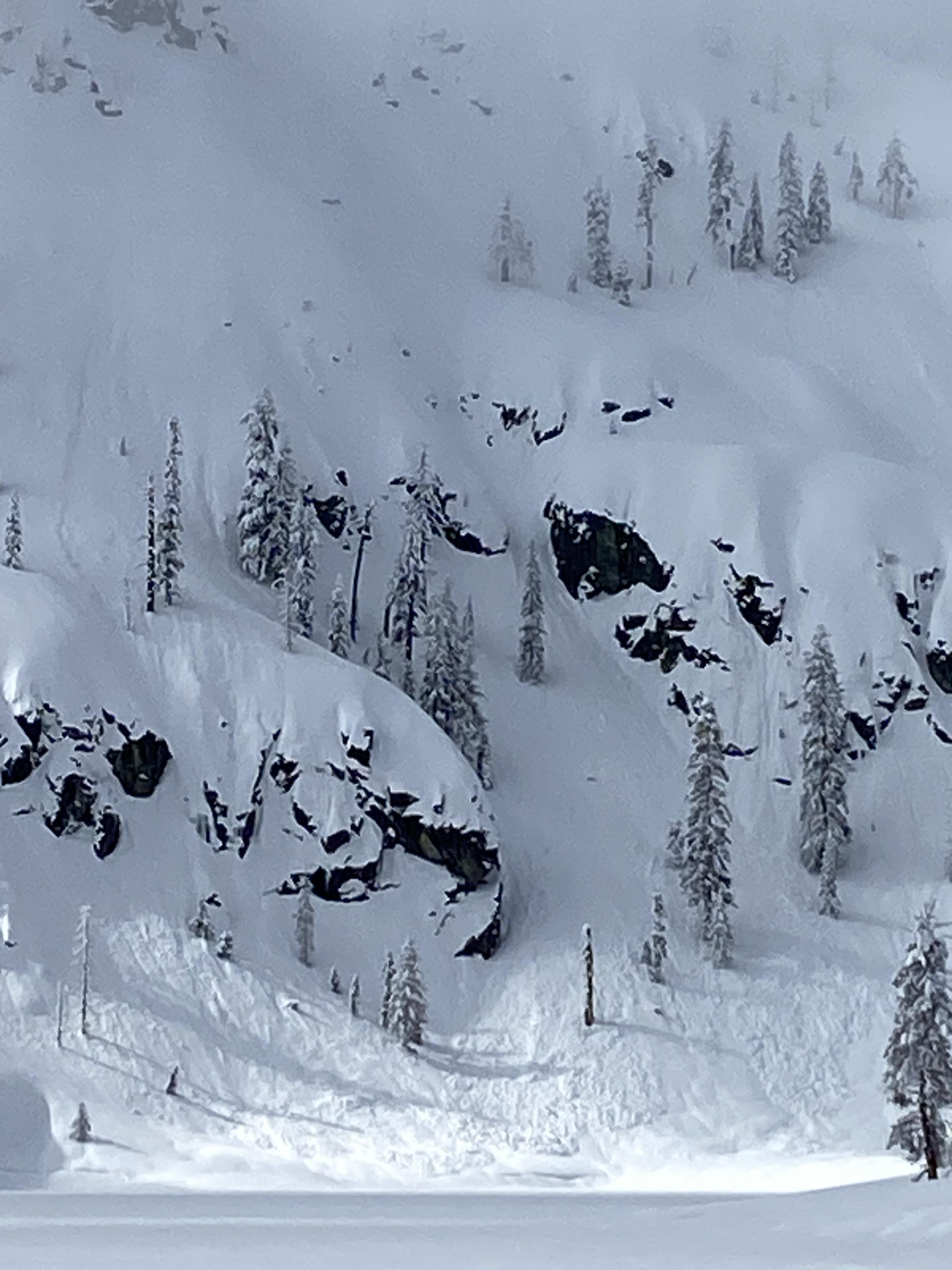
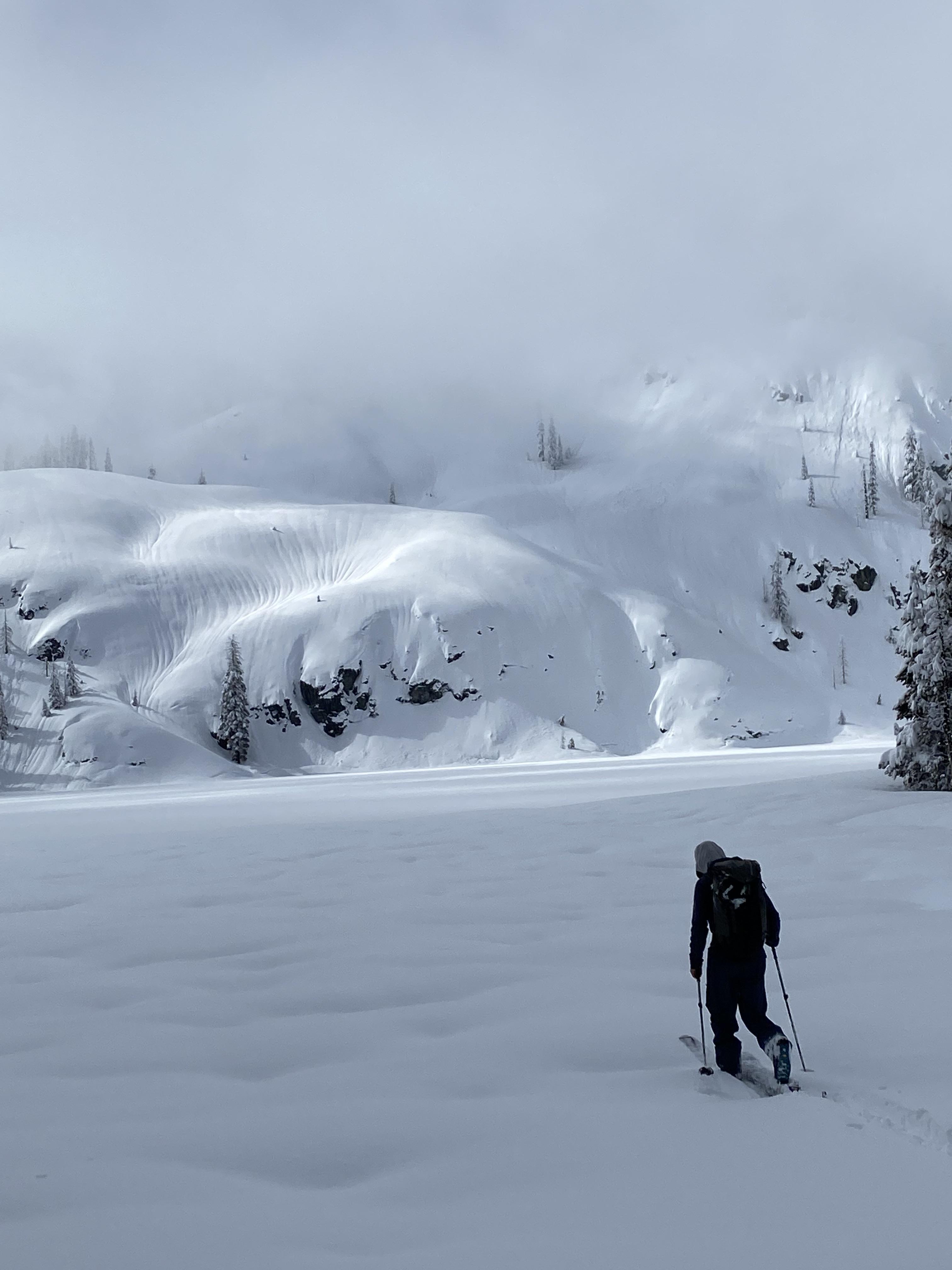
As we neared the parking lot and started to get our first views of the back side of the lake, avalanche debris was everywhere. Evidence of wet loose slides was in abundance, with 8-9 inches of fresh snow on top of the debris. Some prominent crowns were visible at the top of the Pinner Chute, as well as in a few other places. The heavy rains appear to have overloaded the snowpack and brought a fair amount of the snow down to the lake.
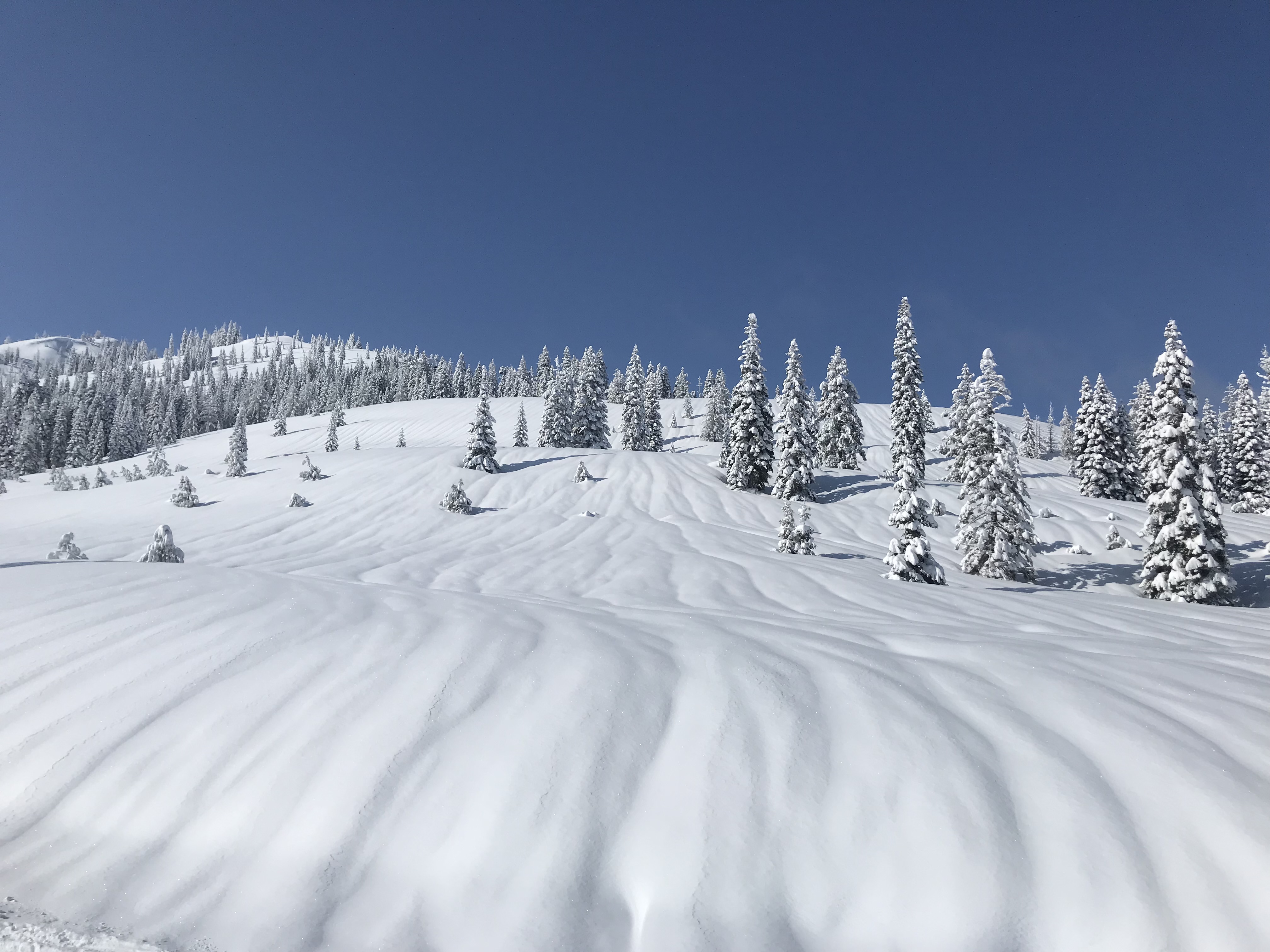
The southern aspects we toured up held the same 8-9 inches of new snow, but even just the morning's sun was already starting to have a profound effect, with the snow becoming heavier and stickier by the minute. From the saddle we were able to cut back around to the west and even a bit to the north, where the same snow is staying much lighter.
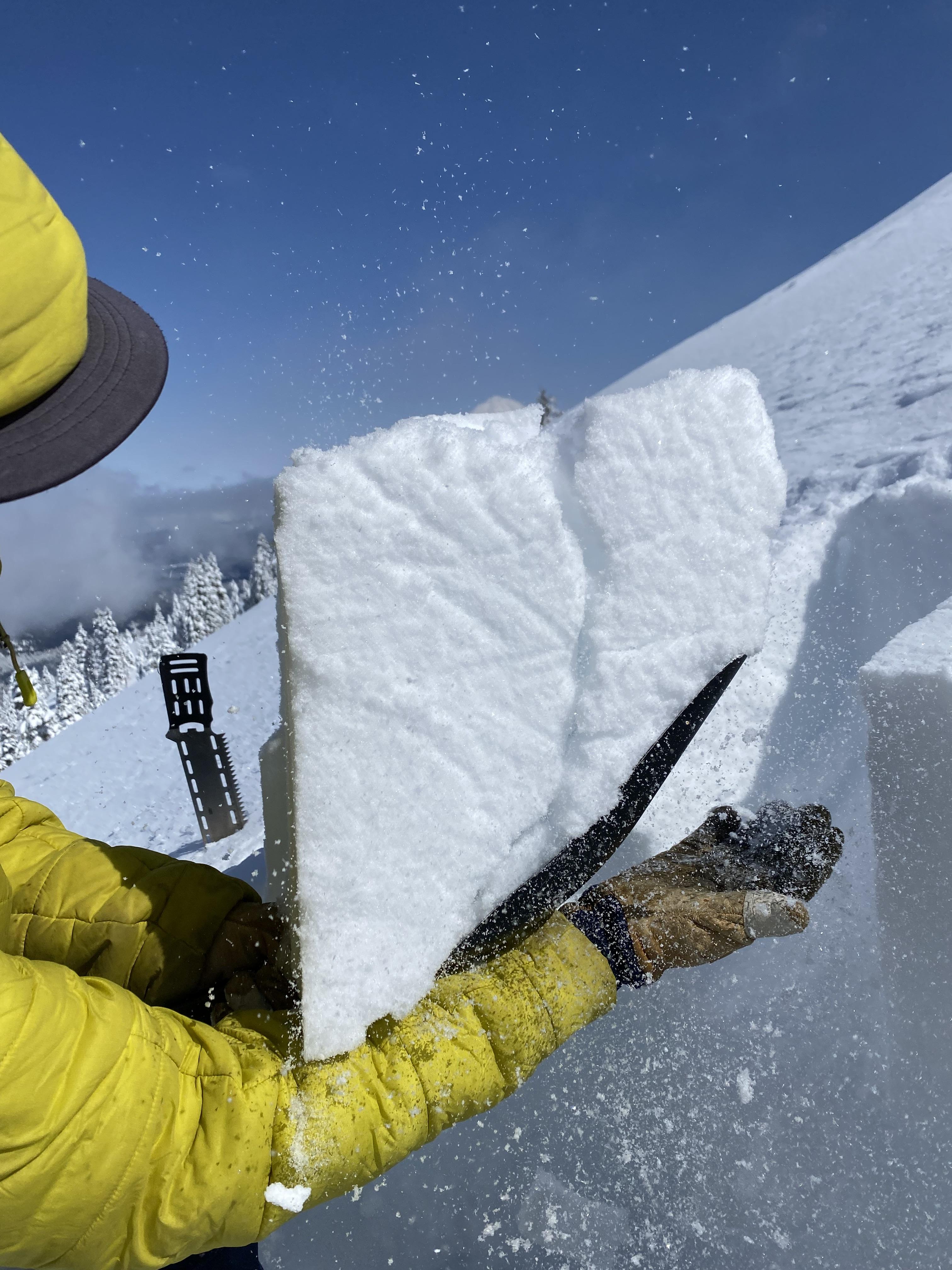
A good old-fashioned "burp the baby" test on the north side revealed a weakness at an almost imperceptible layer change within the top 30 cm of new snow, about 23 cm down. This was only evident on isolation however, and no amount of repeated jumping or ski-cutting on exposed test slopes caused any reaction in the snowpack whatsoever.
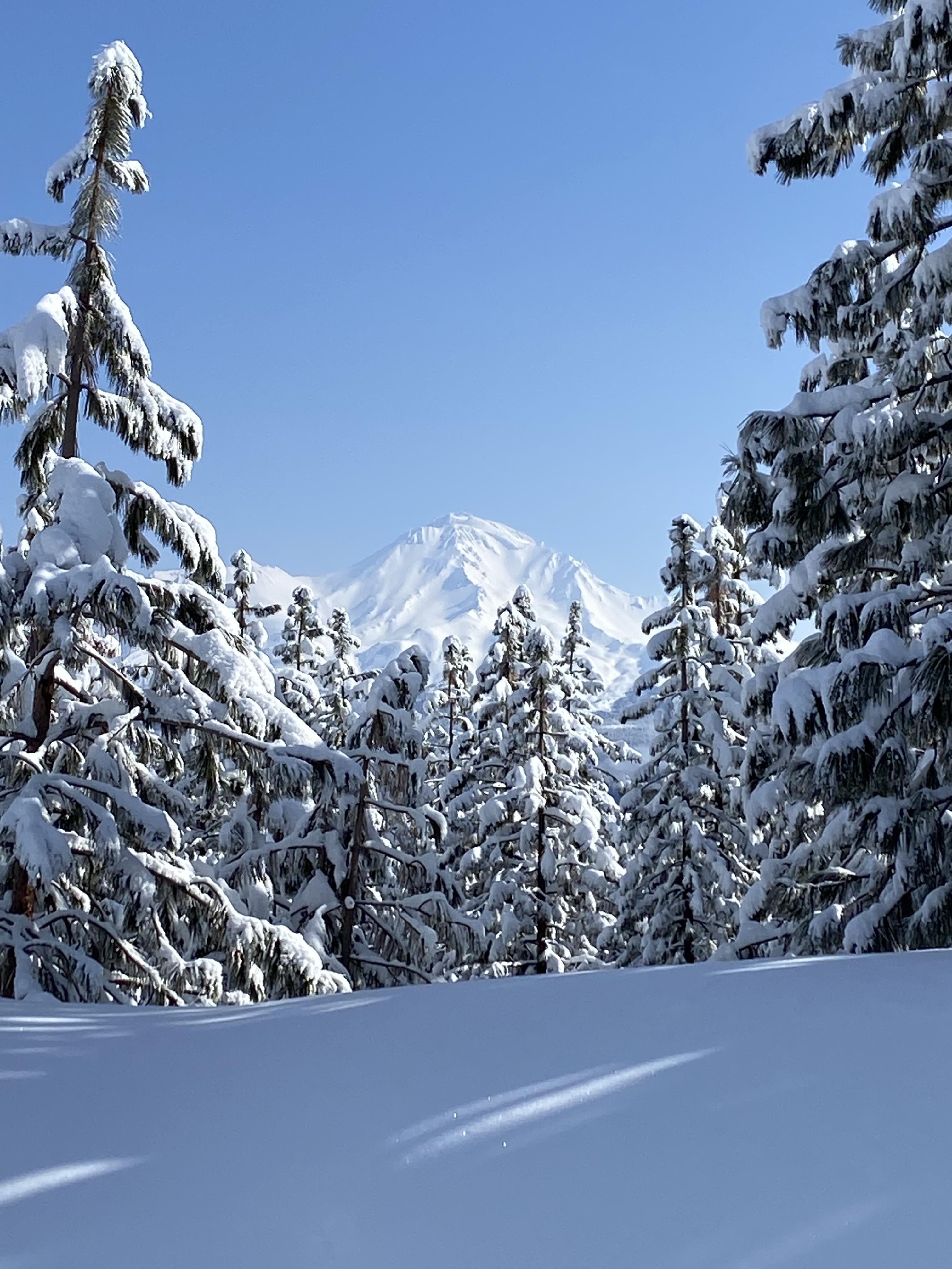
We were unable to get above the rain/snow line from Sunday-Monday rains, so I will be very curious to see what the snowpack looks like higher up, where all that precip fell as snow instead of water.