

You are here
Day After the Storm - Gray Butte
Location Name:
Gray ButteRegion:
Mt. ShastaDate and time of observation:
Fri, 04/07/2023 - 11:30amObservation made by:
ForecasterRed Flags:
Whumphing noises, shooting cracks, or collapsing
Recent loading by new snow, wind, or rain
Rapid warming
Location Map
96067
Mount Shasta
, CA
United States
41° 20' 57.7176" N, 122° 11' 34.296" W
See map: Google Maps
California US
Snowpack Observations
Details
Photos
Weather Observations
Details
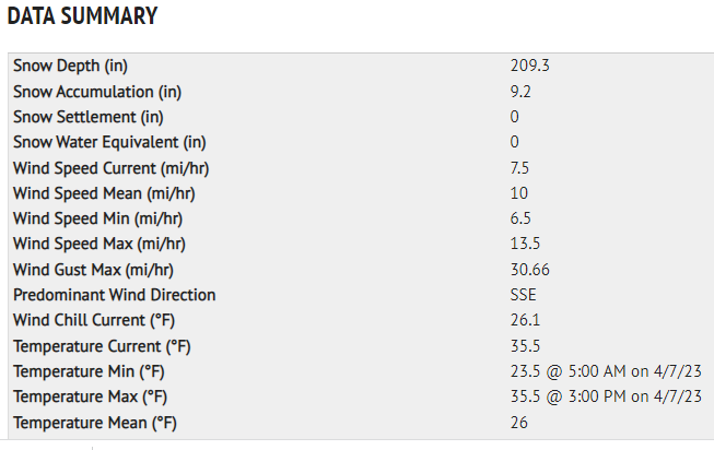
Last 24-hour weather data from Old Ski Bowl and Gray Butte weather stations combined, issued 4.7.23 at 1630 hours:
Statistics
Cloud Cover:
100% of the sky covered by cloudsBlowing Snow:
YesPrecipitation:
Mixed rain and snowAccumulation rate:
Less than 1 in. per hourAir temperature:
Above FreezingAir temperature trend:
WarmingWind Speed:
ModerateWind Direction:
Southeast

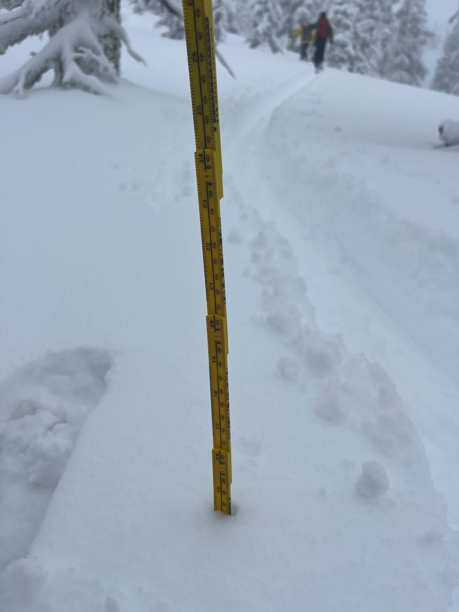
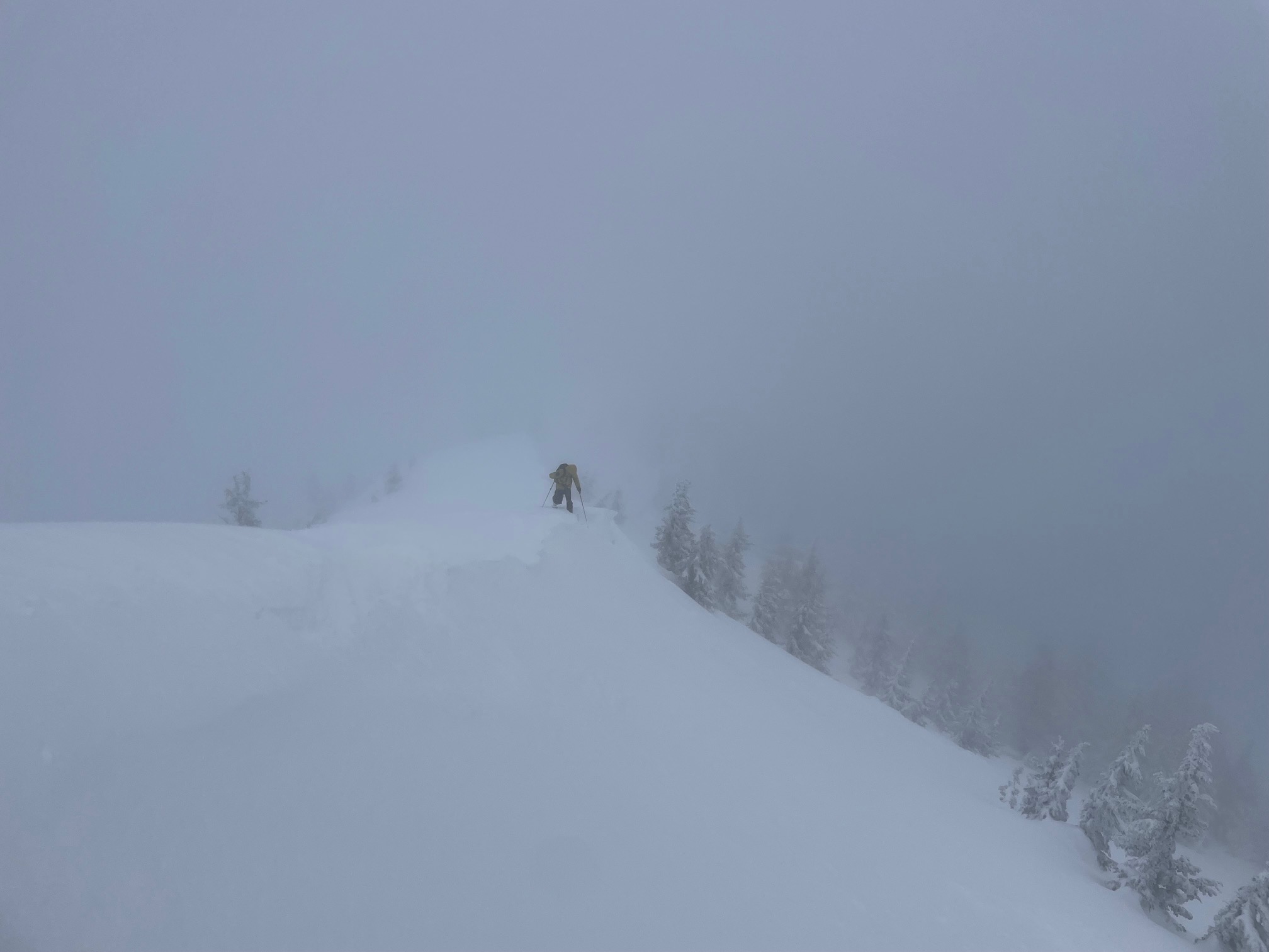
In the late afternoon of April 6th, a winter storm entered the area and, overnight, brought anywhere from 5 to 15 inches of moist snow to the mountains above 5,500 feet. Average new snow depths from 6,000 to 8,000 feet measured 10 to 12 inches with uniform coverage. Today we ventured out, the day after, onto Gray Butte via Ski Park. Light storm precipitation gradually faded as the day progressed. Snow levels lingered near 4,500 feet this morning, rising to 5,500 feet or higher during the day. Little to no accumulation was observed during daylight hours. South/southeast wind was light below treeline and moderate near and above treeline. Blowing snow was observed over ridges. Temperatures at 8,000 feet climbed from 23° early this morning to 35° this afternoon.
Two avalanche problems with associated warning signs were observed today, both wet loose and wind slabs.
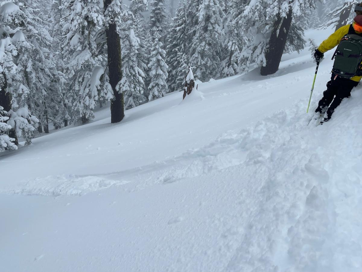
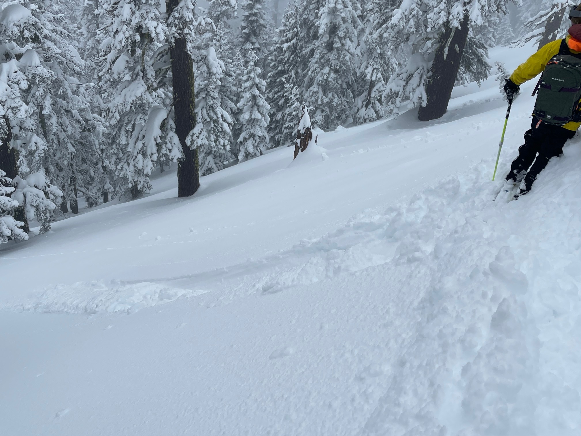
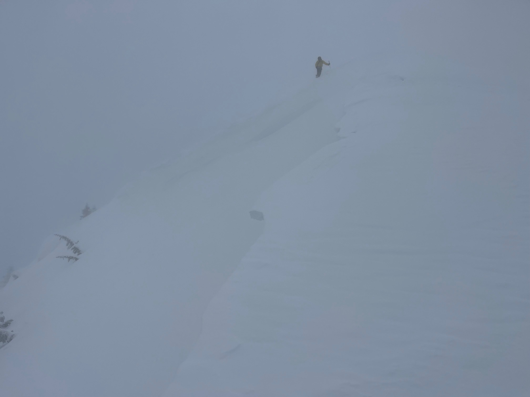
Below and near treeline, surprisingly greasy, easily triggered wet loose slides were ski cut on test slopes. A supportable crust functioned as a firm sliding surface for the ~12 inches of moist, new snow. Any large slope with significant fetch would have hosted a wet loose slide big enough to bury, injure or kill someone. This avalanche problem represented the most significant hazard for the day below 8,000 feet. This was a surprise to us and a good reminder of the warm, wet nature of April storms. Wet loose slides should always be on the radar this time of year.
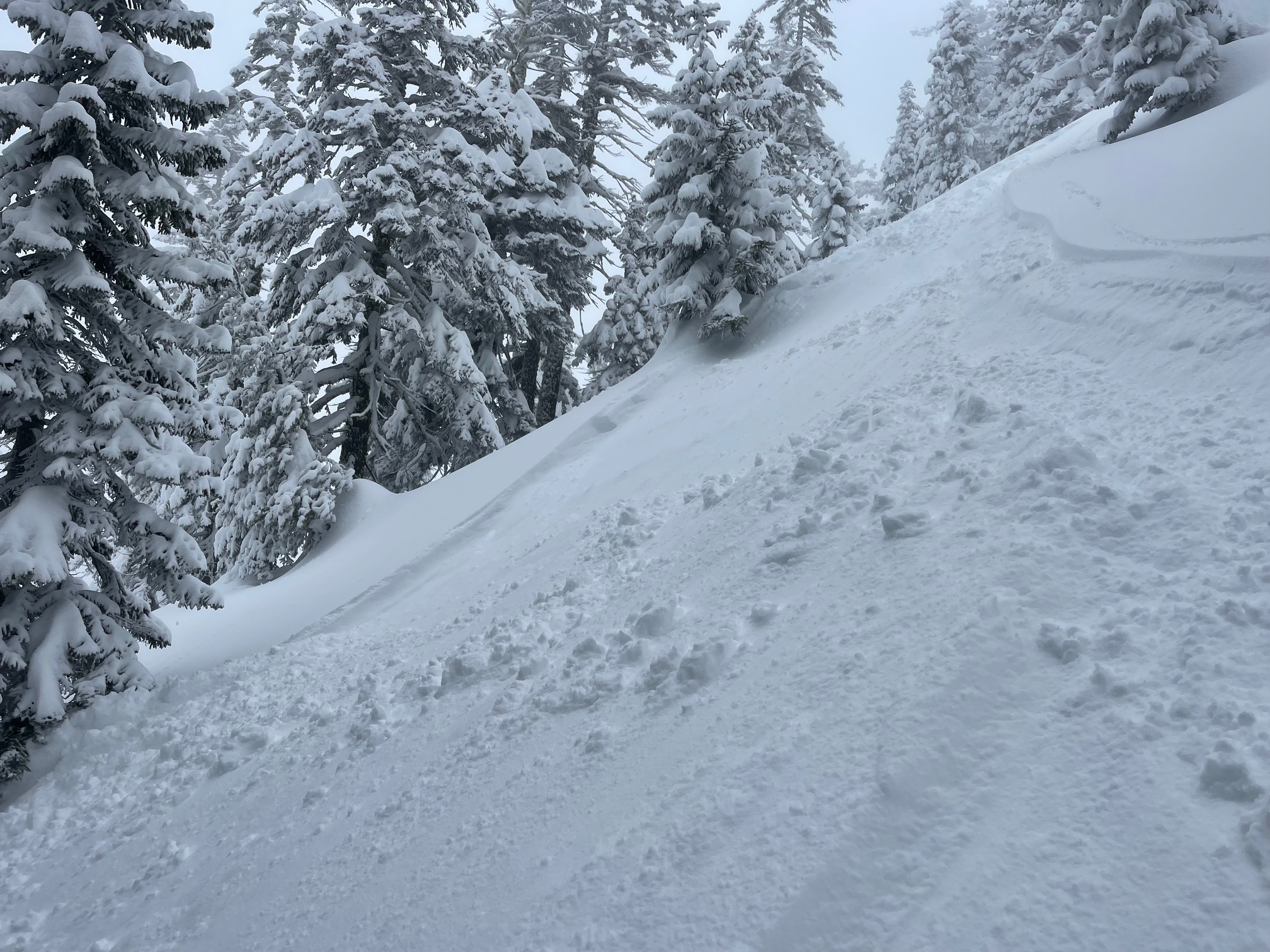
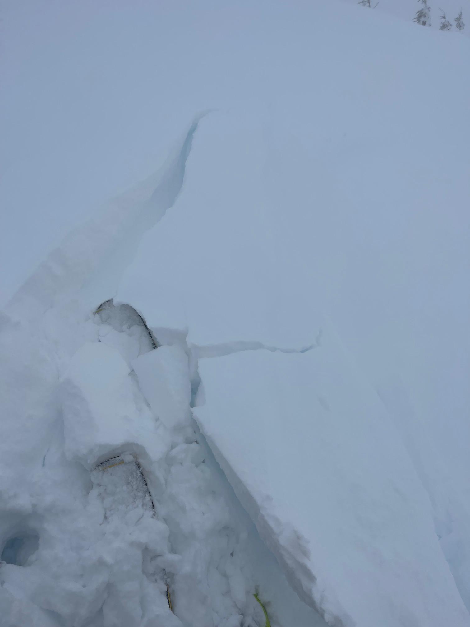
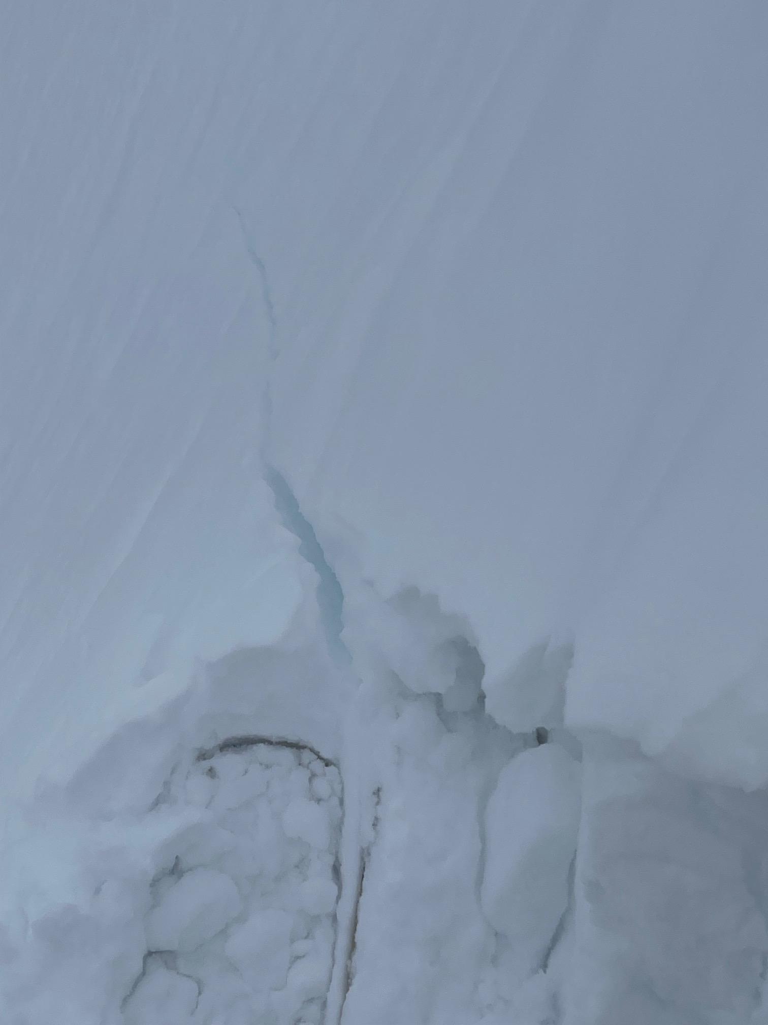
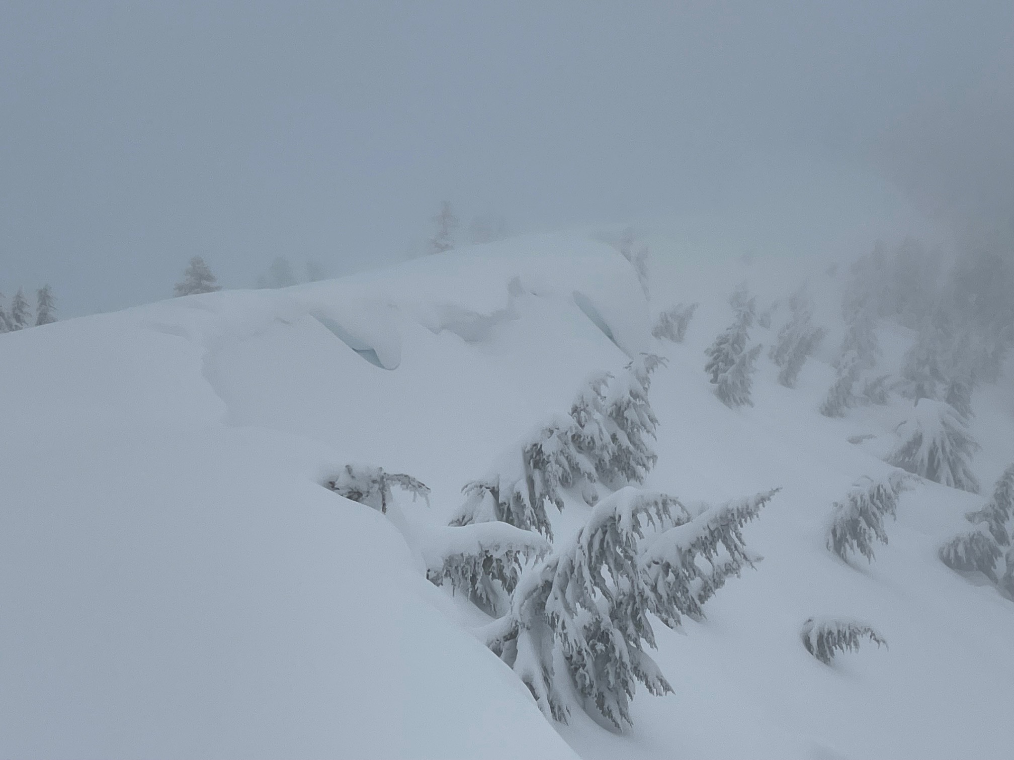
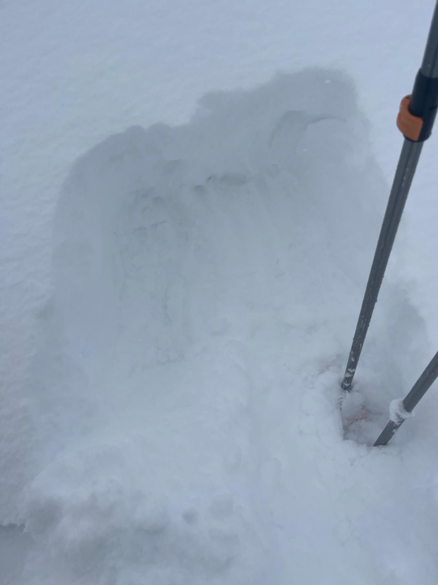
On top of Gray Butte, the south wind was effectively blowing snow around, loading west, north and east aspects. Small wind slabs and cornices were touchy. Leeward ridgelines held wind slabs up to 2.5 feet thick. Fresh cornices were very touchy, but small and inconsequential. Remaining cornices are large and unreactive.
With poor visibility and flat light, our observations were limited to our surroundings. We were unable to view any of Mount Shasta or the surrounding area.
CLICK HERE FOR VIDEO